Tag Archives: water

Canalside Trail (Turner Falls, MA)

Date Visited: May 28, 2016

Location: Eleventh St, the village of Turner Falls in the town of Montague, MA

Parking: There is a small area by the shoulder of the road to park.  There is also off street parking available and most people seem to ride the bicycle or walk or run along the bridge and walkway.

Cost: Free

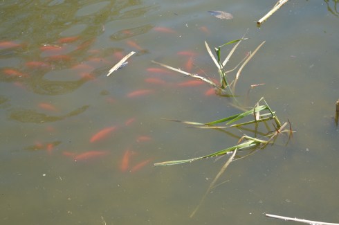
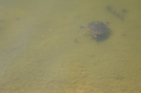
Highlights: Peaceful area (when it’s not rush hour), scenic, abundant wildlife, views of the Turner Falls Canal

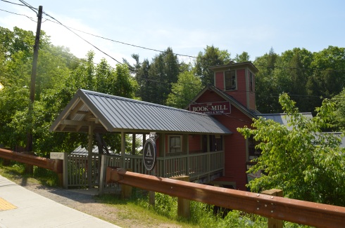
This may not be the bridge of Turner Falls but it is a bridge in Turner Falls.  The more popular bridges in Turner Falls are Gill-Montague and  the Turner Falls Roadway.  But, since I was in Montague visiting the Montague Bookmill, I thought I would make a quick stop here.

This 11th Street Bridge pictured below was built by the Turner Falls Company.  According to the Historic American Engineering Record, the bridge is a double-intersection Warren through truss, with a pair of trusses on either side of the roadway, and lateral bracing between each pair, but none over the roadway.

DSC_0401DSC_0514DSC_0510

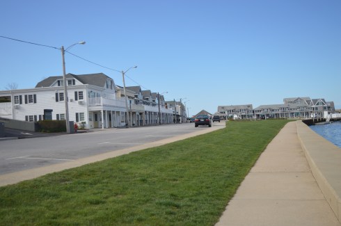
This 2.5 mile section of the Turner Falls Bikeway.  The bikeway, which people also use for jogging and walking, is wide enough to accommodate heavy traffic.  The walkway and bridge offer pretty views of the river and surrounding community.

This slideshow requires JavaScript.

There are additional bridges on the roadway.  Some, like the partially destructed bridge below, is no longer in use.  Out of service since the industrial shops closed some time ago, the foundations of the bridge still remain.  These remains are symbolic of the jobs and economic downturn the other otherwise idyllic neighborhood felt after many of the jobs left.

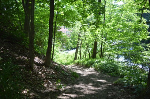
These steps led off the main trail  but didn’t seem to go anywhere as the street and residences were right next to the trail.  It may give walkers a closer look at some of the wildlife I heard rustling in the trees and underbrush.

DSC_0480

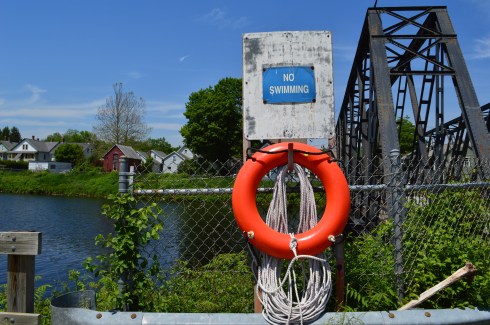
There’s no swimming allowed in the canal.  But, a life ring is there, just in case.

DSC_0560

Even though the Falls Turner Canal walkway is only a segment of the bikeway path, it is a great place for a peaceful stroll along a beautiful waterway.

Please connect with me on Facebook to see additional photos, videos and other posts that are not included in my blog posts: New England Nomad


Moswetuset Hummock (Quincy, MA)

Date Visited: April 21, 2016 & May 22, 2016

Location: East Squantum St, Squantum (Quincy), MA

Cost: Free

Parking: about 8 parking spots.  Parking is also available at the beach which is located about half a mile away on Quincy Shore Drive and is an easy walk to Moswetuset.

Highlights: great views, easy trail, secluded, not usually very busy, a lot of historical significance

Mosewtuset may seem much like all the other small parks that dot the Massachusetts shoreline.  But, its significance in the historical landscape of Massachusetts and all of the colonies and commonwealths should never be minimized.

Moswetuset is not only significant because the commonwealth of Massachusetts derived its name from Moswetuset but it is also the original trading place of Chickatawbot Sacamore and Myles Standish in 1621 that spurred the trade of the early settlers and the Native Americans. Moswetuset was also the area they used as their planting grounds.

What does a funky name like Moswetuset mean, you may ask.  Moswetuset has been translated into “shaped like an arrowhead” (the area does have a distinct arrowhead shape) and “site of the great house.”  The area is shielded by rows of trees and growth.

DSC_0090

The trail is an easy loop with a very minor incline.

Only underscoring how small things can be very big in their place in history, Moswetuset is only a quarter of a mile loop, if that.  But, it does offer some pretty views and it is a nice place to take a short stroll or sit on one of the many rocks along the beach (Moswetuset is located next to Wollaston Beach).  It was low tide when I went so I was able to get out onto the rocks and get some decent views of the water and the surrounding neighborhood of Squantum (which is technically part of Quincy) which is in the background of the photos.

This slideshow requires JavaScript.

Of course, what would a park or attraction in Quincy be without graffiti? There were some interesting works of graffiti at Moswetuset.

Moswetuset is a popular place for dog walkers.  But, for some reason, there weren’t any dog walkers at Moswetuset when I visited.  I found Buddy, though, on my way to my car as I walked along the beach.

DSC_0040

DSC_0037


Montague Bookmill (Montague, MA)

Date Visited: March 28, 2016

Location: 440 Greenfield Rd, Montague, MA

Hours: Mon-Wed 10 a.m. -6 p.m., Thu-Sun 10 a.m. 8:00 p.m.

Parking:  there is lots of parking on the side and back of the book store.  There is also a lot across the street from the bookstore.

Montague Book Mill

DSC_0398DSC_0353

Do you like books?  How about mills?  Then I have just the place for you.  But, this is no ordinary book store.  A former gristmill now operating as a used book store, the Bookmill has gone through many changes throughout its history.  But, it still keeps true to its beginnings.  The structure is largely the very same one that operated as a mill so long ago and the brook that runs along the two floor book shop is the very same one they used to power the gristmill so long ago.

Upon arriving at the Bookmill, the first thing you notice is the brook fed by a waterfall adjacent to the shop.

A short easy to walk path takes you to the source of the stream of water.

DSC_0157

The short waterfall and stream can be pretty fast in some spots.  But, when I came to visit it slowed down after it plummeted down the waterfall.

This slideshow requires JavaScript.

After the short walk back up the trail, you can access the bookstore by a wooden walkway with some more views of the waterfall and stream.

Or, you can just walk straight across (the easier route, less scenic route).

The great thing about the Bookmill is that it has kept much of the original charm and design of the past.  Narrow stairwells and cozy corners are the hallmark of the shop.  Memorabilia, such as old style typewriters, are scattered throughout the store.  The staff doesn’t rush you nor do you feel a sense that profit is their main driver.  Service and a respect for books seems to be the most important thing t the staff.  It’s a great place for any book lover and anyone who loves to lounge around historic places.

This slideshow requires JavaScript.

They even have newspaper clippings and memorabilia along the walls in the more private areas.

The Bookmill is not the only shop in the area.  In the shopping area there is also a cafe, The Lady Killigrew Cafe, located next to the book store and The Alvah Stone, a restaurant. There are also two art studios and an entertainment/media store called Turn It Up.  Turn It Up specializes in selling cd’s, dvd’s, vinyl and even cassette tapes.  They also sell other memorabilia.  It’s a unique store in a very unique shopping area.

The owner of Turn It Up let me photograph his 10 year old  dog and part owner, Daisy.

DSC_0363DSC_0355DSC_0357

Below is a video of the waterfall and stream next to the Bookmill.

Please stop by and connect with me on my Facebook page: New England Nomad


Borderland State Park (North Easton, MA)

Date Visited: May 21, 2016

Location: 259 Massapoag Ave, North Easton, MA

508-238-6566

Hours: Open 365 days a year, 8 a.m. to 6 p.m.  A sign at the front gate of the parking area states cars still parked in the lot after 7 p.m. will be fined $25.

Costs: According to the website it is $5 for MA residents and $6 for non-MA residents.  There is a parking payment station located at the front of the parking area.  I have a parking pass which allows me to park in all state run parks so I do not know exactly how the parking stations work or how they charge each patron.

Parking:  The parking lot is pretty big.  It looks like there are easily 200 spaces.  When we left, on a busy day at peak hours, there were still plenty of parking spots available, albeit far from the entrance to the trails.   There is also an alternate parking area before the main parking area for people with special passes.

Highlights: mansion, 6 ponds, quarry, 20 miles of hiking trails, large field for frisbee golf and other activities.  Fishing, canoeing and horseback riding are allowed.  Leashed dogs are permitted. Easy to moderate trails, teeming with wildlife.  Peaceful feeling, even when the park is packed.

*Please note, some of the slideshows take some time to load, unfortunately (especially on tablets and cellphones).  You may have to refresh but they may take a few minutes to load*

Created during the early 1900’s by artist and suffragist Blanche Ames and her husband Oakes Ames, Borderland State Park has been a state park since it was purchased by the state in 1971.  The Ames’ home, a three-story stone mansion built in 1910 still stands on the grounds.

DSC_0146DSC_0151DSC_0142DSC_0158

The grounds of the mansion are manicured impeccably.  They even take care of those pesky witches (or whatever that is on the lawn) .

This slideshow requires JavaScript.

Bordering on the towns of Sharon and Easton in Southern MA, Borderland has a variety of trails for runners, walkers, cyclists and even horseback riders.  The trails are easy to moderate and I saw many runners on the trail.

Located about 45 minutes south of Boston and half an hour north of Providence, Rhode Island, Borderland State Park is a popular destination for people from all sections of New England.  It is easy to see why so many people flock to the park when you see the views.

This slideshow requires JavaScript.

Sometimes it’s the little things that make the park so much fun.  Whether it’s the frisbee golf course on the lawn in front of the mansion (I can only imagine what the Ames’s would have thought of that) or the benches that are liberally scattered throughout the park  or the always full bowls of water thoughtfully left out for the thirsty dogs, the park really does think of everything.

here was also an abandoned building along one of the trails.

There are always pleasant surprises when you go to visit the different parks in New England.  One of those surprises was a mother bird feeding her babies in the nest on the beams of the roof of the abandoned building pictured above.  I did my best to seem as unobtrusive and I used my telephoto lens from a distance while I took these photos.  I love how the mother looks so protective and is surveying the area for potential threats.

DSC_0402DSC_0399DSC_0421DSC_0429DSC_0433

Then, as I was taking photos of the pond, I saw these little critters.  Look at how the frogs almost perfectly camouflage themselves.  It’s almost the perfect disguise.  Man, I love nature!

DSC_0463DSC_0465DSC_0481

DSC_0471DSC_0459

Ok, the snake isn’t so “little.”  But, I wasn’t about to get closer to see just how big he was.

And the animals didn’t stop there.

There were dogs a plenty also at Borderland State Park.

DSC_0245DSC_0244DSC_0242

Beef is a 6 year old  American Bullweiler (American Bulldog and Rottweiler mix).  He was being trained by his dad.  I thought the last photo showed just how much affection he has for his guardian.

Mason, a chocolate Labrador, took advantage of the warm weather to go for a swim.

DSC_0377DSC_0376

Romeo, an English Chocolate Labrador, celebrated his 10 month birthday at the park!

DSC_0513DSC_0516DSC_0509

Balto, a 7 month German Shepherd, wants attentively for the rest of the family to show up.

DSC_0531DSC_0528DSC_0527

Thank you for stopping by and reading and please consider connecting with me on Facebook and check out my future trips around New England:  New England Nomad


River Works Park (Greenfield, MA)

Date Visited: May 13th 2016

Location: 250 Deerfield Street, Greenfield, MA

Hours: Open 24 hours a day, 365 days a year

Cost: Free

Parking:  There is a lot that can accommodate about 30 or so cars behind the waterfall off Meridian St (a side road off Deerfield  St where the bridge is) or you can park in one of the lots of the local establishments and walk to the park, after patronizing them of course.  You can’t park on Deerfield St.

It’s not often that you see a silver fish on a pole while you’re driving down the main streets of a busy suburb.  So, when I saw Brookie, the mascot of River Works Park, I had to stop and check it out.

DSC_0175

The River Works Park is a quiet place (if you can ignore the passing traffic on Deerfield Rd) where residents and visitors can sit on the benches or walk along the sidewalk or bridge and admire the Green River below.

For a roadside attraction, the River Works Park is full of surprises and beauty.  One of these surprises is the walk way along the sidewalk that is blocked off by a fence.  Of course, there was an opening in the wire fence.  The views from the walk way weren’t so great though and I only managed to get a few scratches when I walked along it.

The walkway, which was dedicated in November of 1999, has several memorials and plaques along the sidewalk.  This bench was dedicated to Barbara Tillmanns, Greenfield’s “#1 cheerleader.”  Tillmanns was a town councilor for Greenfield and very active in the community.  She passed away in 2014 at the age of 72.  One of her endeavors was to begin an initiative to establish a series of commemorative benches throughout Greenfield.  Here’s one:

DSC_0159

A sign remains where the J. Russell Co once stood.  The company made Green River Knives.  Greenfield Tap & Die also stood there once upon a time.  The J. Russell Co and Greenfield Tap & Die were the main employers of the area for much of the 1800’s and the J. Russell Co made the highly touted Green River Knife.

DSC_0221

If you look closely at Brookie, the mascot of River Works Park, you can see the forks, spoons, cutlery and other utensils collected from the residents of Greenfield and Franklin County that make up the shape of the fish as a tribute to the J. Russell Cutlery Co. (you may have to zoom into the photo).

DSC_0181DSC_0179DSC_0176

The aptly named Green River, runs through the park.  There were some modest waves and ripples in the river.  The reason for this will soon be evident.

I thought made for a pretty backdrop.

However, just beyond the bridge, we found this pretty waterfall.

This slideshow requires JavaScript.

There is no sidewalk on the side of the road where the best views of the waterfalls are so I had to keep the video short since I shot it during a red light.

There is a lot of interesting historical information about the J. Russell Co and the area which you can access in the links below

J. Russell Co

John Russell Manufacturing Co

Please check out and like my Facebook page: New England Nomad


Hammonasset Beach State Park (Madison, CT)

Date Visited: May 7, 2016

Location:1288 Boston Post Road, Madison, CT

Cost: I paid $15 (the weekday fee) to get in (I went on a Saturday).  But, the prices on their web site show the cost as being $13 for CT residents and $22 for non CT residents on weekends and holidays (it’s worth every penny) and $9 for CT residents and $15 for non CT residents.  Also, if you enter at 4 or later it costs $6 for CT residents and $6 for non CT residents to enter the park (bear in mind the park’s gates close at 8 pm when it is in season).  There are also additional fees for camping there.

One workaround to paying a fee is to park at 1288 Boston Post Road instead of driving down the access road to the payment booths and walk (almost 2 miles) to the beach.  I would recommend this option when it is nice out or if you are bicycling.  However, since the park is so big it may be hard to see everything on foot.  So, riding your bike from 1288 Boston post Road may be a best option.

Hours:  The beach is still accessible, by foot or bike, in the off season without any staff.

DSC_0700

Connecticut’s largest public beach, Hammonasset Beach is split into different areas for camping and for people who want to visit the more than 2 miles of beach.

Meaning “where we dig holes in the ground”, Hammonasset is actually part of Long Island Sound.  

The campground at Hammonasset has 556 campsites and 8 rustic cabins for reservation during camping season which runs from mid-May until October 8.  Hammonasset also has a nature center at Meigs Point and acres of wetlands.

After paying the entrance fee, we asked the helpful woman at the booth where the best place to go for photography is and she suggested Meigs Point.

Meigs Point runs along the shoreline of the beach.  There are lots of ducks, birds and lots of other wildlife on the beach and on the trails behind the beach.

This slideshow requires JavaScript.

The beach has some pretty views.  There are also restrooms with showers and changing rooms at Meigs Point if you decide to go for a swim.  During my visit it was overcast and chilly.  The lack of sun didn’t take away from the beauty of the beach.

This slideshow requires JavaScript.

There is also a jetty.  It went out quite a way.  Since the rocks were pretty slippery, I made it about half way out before turning back.

Hammonasset is a beautiful beach, although it can get crowded as many beaches do during the summer months.  If you live nearby it may be best to get a seasonal pass rather than paying the somewhat hefty fee each time you visit.

Leashed dogs are allowed on the beach during the off season (from November until April).  They are still allowed on the trails but not on the beach from April until the end of October.

I met Summer, a golden retriever, on the trail Meigs Point.  Especially after this unseasonably cold winter, we all could use a little more summer in our lives!

DSC_0768DSC_0767DSC_0769

Jessie, a chocolate Labrador, had a great time on the trail.

DSC_0744DSC_0749DSC_0748


Please check out and like my Facebook page!

New England Nomad On Facebook


Wilcox Park (Westerly, RI)

Date Visited: April 30, 2016

Location: 44 Broad St, Westerly, RI

Cost: Free

Hours: Open from dawn to 9 p.m., 365 days a year

Parking:  There is not a designated parking lot for Wilcox Park.  But, you should be able to find off street parking.

DSC_0226

Wilcox Park is not your average park.  In fact,  it is unique in many different ways.  One thing that makes Wilcox Park unique is that it is not part of the DCR or any other city or governmental body.  Wilcox Park is privately operated by the Westerly Public Library’s Board of Trustees.  The library, located on the grounds of the park, and a group of volunteers help keep the grounds clean and orderly.  They rely on donations and fundraisers.

Westerly Library is attached to the park at the entrance.  The library’s beautiful architecture of the building is both artful yet modest.  It complements the beauty of the park and seems right in place.  There are also benches for visitors to unwind and perhaps read a book from the library’s collection.

There are also a number of statues in the grounds of the library.


As you entered the park, one of the first statues you will see is the statue of Christopher Columbus sculpted by Ciriaco (or “Charles” as he was commonly known as) Pizzano in 1949.  Originally from Avellino, Italy, Pizzano was living in Medford, Massachusetts, when he decided to sculpt this statue, appropriately, out of Westerly granite.

DSC_0230DSC_0239DSC_0238


The inscription reads:


CRISTOFORO COLOMBO
INTREPID ITALIAN EXPLORER
WHO LINKED THE OLD WORLD OF
OUR FATHERS TO THE NEW WORLD
OF OUR SONS

On the back of the pedestal:

DEDICATED
BY
THE CITIZENS
OF
WESTERLY AND PAWCATUCK
A.D. 1949

Somewhere Leif Erikson is rolling around in his grave.

Down the staircase from the entrance to the park is a fountain (which was not running when I went to visit due to the still cold temperatures).  The Wilcox Memorial Fountain was designed by John Francis Paramino in 1898 and was dedicated in honor of Harriet and Stephen Wilcox who had donated the land for the park.

There are a variety of beautiful trees, plants, bridges and statues at Wilcox Park.

This slideshow requires JavaScript.

There is also a pond along the trails at Wilcox Park.  It is populated with Koi fish

DSC_0323

ducks

DSC_0303DSC_0296

There’s room for two on this thing, right?

DSC_0310

and baby turtles.  I couldn’t find his mommy but I am sure she was nearby.

DSC_0411DSC_0410

and rabbits

The bronze Runaway Bunny statue was dedicated in 1998 by Connecticut sculptor Joan Binney Ross.  it is based on the book of the same name by Margaret Wise Brown.  Unfortunately, the bunny has been the target of vandalism, predictably.  But, it has been restored after each attack.  Cameras are now installed liberally around the park to deter vandalism or catch the vandals.

This fella just wanted to play with the ducks

DSC_0404DSC_0405

This sculpture sort of looked like a face to me.  A very ugly face.

DSC_0388

Dogs are allowed at Wilcox Park.  Bandit, a Siberian Husky, had fun playing in the park.  Apparently, Bandit earned his nickname because he “takes things”.  What a beautiful dog.  He caught my eye because of his handsome markings and his very cute smile. You can tell he’s a “bandit” based on his playful grin.

DSC_0352DSC_0353


Watch Hill Lighthouse (Westerly, RI)

DSC_0596

Date Visited: April 30, 2016

Location: Lighthouse Rd, Westerly, RI

Cost: Free

Parking: Vehicles are not allowed on Lighthouse Rd, unless you area senior citizen or if you have a physical impairment which may prevent you from walking or biking or running down.

The jewel of Westerly, Rhode island, Watch Hill Lighthouse is a stone’s throw away from Napatree Conservation Point.  The walk down Lighthouse Rd is about half a mile and the views are worth the walk.  Watch Hill is a swanky village in the town of Westerly that offers views of the southern most coast of the state (besides Block Island).

To get a sense of just how beautiful the area is, this is the view from someone’s driveway.  Not a bad view to wake up to every morning.

There are more stunning views as you walk down the road.

This slideshow requires JavaScript.

There is also a “cliff walk” along the road which is basically a walkway along the sidewalk which allows you to walk on a “cliff” type access way next to the road.  Besides being a fun way to travel, the cliff walk also offers some beautiful views.

Since it is somewhat isolated and not too active this time of the year, birds tend to congregate at Watch Hill.  I found a few Double Crested Cormorants.

Watch Hill Lighthouse is the second oldest lighthouse in Rhode Island (Beavertail Light is the oldest lighthouse in RI).  Originally built in 1808, Watch Hill Lighthouse has been destroyed or damaged by various storms over the years.  The current lighthouse that stands there was built in 1856.  It was automated in 1986 and it is still active today.

DSC_0646DSC_0645

The best part of my trip to Watch Hill was watching the waves from the rocks.  It is considered one of the more beautiful and romantic of Rhode Island (sans Newport).  In fact, just before I arrived there I had missed a man proposing to a woman at the location.  When I got there they were drinking champagne and cuddling as they watched the waves.

This slideshow requires JavaScript.

Cute little Louis (pronounced Louie) is a 3 year old toy poodle.  I love how the wind blew his fur and ears back but he still wanted to see the lighthouse!

DSC_0649DSC_0648

Below are two videos of the waves at Watch Hill to give a better sense of the power of the waves there (and this was just on a regular day)

Please connect with me and like my Facebook page to see extra photos and videos I don’t post on my blog!

New England Nomad


Napatree Point Conservation Area (Westerly, RI)

DSC_0599

Date Visited: April 30, 2016

Location: Fort Rd, Westerly, RI

Parking: Parking was a breeze in the early morning hours in April.  I found off street parking with a 3 hour limit.  There were several parking spaces available.  This will change when the weather begins to warm up (at this rate, sometime  in mid-August).  One thing I found interesting and somewhat vexing is that according to signs, the parking lot next to Napatree is not supposed to be used for going to the beach.  I assume the parking is meant for shoppers and people patronizing the restaurants in the area.  For an area that has limited parking this seems highly unusual.  If you go in the summer, be aware parking will be very limited.

First, I’d like to thank everyone for reading and being so supportive as I post my 100th blog post.   One hundred posts in just under one year.   What better place to write about than Napatree!

A peninsula-like shaped area, Napatree is actually a sandy spit.  It has been shaped through a process called longshore drift which is basically a process by which sediments such as clay, silt, sand and shingle are transported along the coast creating its unique shape.

You wouldn’t know it by looking at it now but Napatree used to be densely wooded.  Trees lined the area until the Great September Gale of 1815 hit the area and the trees were destroyed.  In fact, the name Napatree comes from the term nap or nape of trees.

The views from the entrance of Napatree are beautiful.  In some of the photos, you can see a brown tint to the otherwise deep blue water.  In fact, the colors seemed to change depending on where and when I took the photos.  The tides, shallowness of the water and other factors can affect the way the water looks.  I had never noticed it as distinctly as I did at Napatree.  The waves and movement of the water may have played a part as well.  Despite how calm the water seems in these photos this was not the case everywhere at Napatree.

This slideshow requires JavaScript.

If you look close, you can see the Amtrak train in the distance that services the Westerly area in one of the photos.

The dunes and the sand were also very pretty.

DSC_0719

DSC_0878

DSC_0860

At first glance, Napatree seems like a long stretch of beach on only one side.  But, I kept hearing noises over the dune.  At first, I brushed it off as traffic or some other noise.  Eventually, curiosity got the better of me and I decided to climb one of the dunes and check it out.  What I found was pure paradise.

The calm waves and plain waterscape were replaced with crashing waves, foamy water, beautiful homes (the homes on both sides weren’t pretty shabby actually), the Watch Hill Lighthouse and marine activity.

This slideshow requires JavaScript.

When I arrived, the village was pretty desolate.  This was partly due to the early time of the morning that I arrived and partly because the vacation season hasn’t began yet.  Westerly did have a Cape Cod feel to it.  From the quaint shops, the folksy, slowed down pace, the beautiful beaches and the mansions that dot the landscape (blog to follow soon about one of those lighthouses), I couldn’t help but think back to my childhood vacations at the Cape.

DSC_0572

In due time, these empty streets will be bustling with activity.  But, for now, it is a tourist/photographer’s dream having the area to one self!

There were several dogs at Napatree during my visit.  Dogs are allowed on the beach but only until May 2nd.  So, you’ll have to wait until next year to take Fido!

DSC_0659

DSC_0657

Daisy is a beautiful Golden Retriever.  What a gorgeous smile.

DSC_0796DSC_0797

DSC_0822DSC_0819

Caesar is an aquatic pitbull

Below are videos of the different sides of Napatree.  The first video is of the more calm waters that I saw when I first arrived.  The second video is from the other side over the dunes to the more active side of Napatree.


Wiggly Bridge (York, ME)

Date Visited: April 23, 2016

Location: Lilac Lane, York, ME

Cost: Free

Hours: Open 24 hours a day, 365 days a year.

Parking: There are about a half dozen parking spots on the side of the road across from the bridge on Lilac Lane (a very busy road so be careful parking and crossing there).  There is also additional parking on side streets and farther along the road on Lilac Lane.


There are many bridges in New England.  But, only few have the name, reputation and appearance of a bridge that could collapse any moment.  The Wiggly Bridge is a mini-suspension bridge built in the 1930’s which crosses over a tidal flow from Barrel Mill Pond to the York River.  If you’re not careful, you may end up in the York River!

Ok, Wiggly Bridge really isn’t that dangerous.  But, it can give you the willies as you walk across it.  Even though it is safe to walk across, the bridge does wiggle and make noises as you traverse it. I made it across the bridge without much trouble and took some photos of the bridge as I made my way across.

The short walk across the bridge leads to Steedman Woods, a tiny peninsula with a mile long loop.  Dogs are allowed on the beach and on Steedman Woods.  The vieews from the island and bridge are stunning.

This slideshow requires JavaScript.

Wiggly Bridge is also within walking distance, or a short drive from York Harbor.  So, you can take in both of these cool attractions in one day.

Cooper is a 7 year old rescue dog and a resident of Maine.  He also likes the bridge.

The videos below shows how unstable the bridge seems when you’re walking on it.

Please connect with me on Facebook here