Category Archives: views

Demarest Lloyd State Park

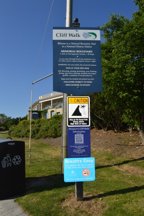
Date Of Visit: April 23, 2017

Location: Barney’s Joy Road, Dartmouth, MA (about 1.5 hours south of Boston and 45 minutes southeast of Providence, RI)

Hours: The park is generally open from Memorial Day to Labor Day. Park hours in season are 10 am to 6 pm weekdays and 8 am to 6 pm weekends and holidays.  You can park at the entrance (a gate prevents access in the off season) and walk the roughly half a mile to the beach

Cost: $12 MA Vehicle, $14 non-MA Vehicle, see website for additional fees for boating

Parking: there is ample parking near the beach after you pay at the entrance.

Handicapped Accessible: Yes

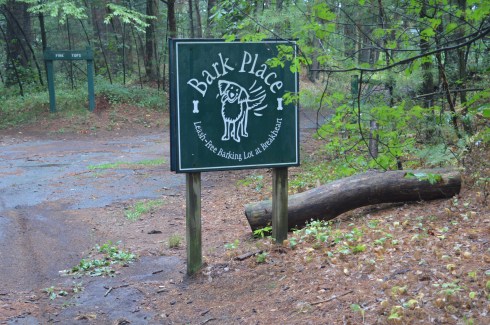
Dog Friendly: Yes, but they are not allowed on the beach from April 1st to September 15th, unless they are service pets

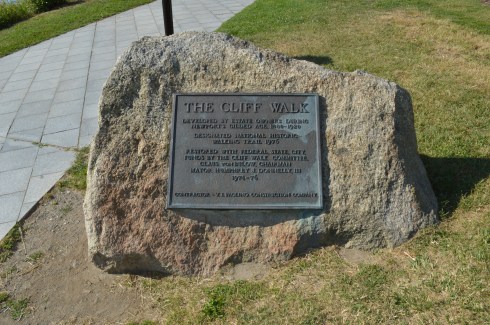
Website: Demarest Lloyd State Memorial Park

IMG_3223

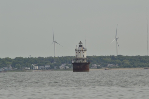
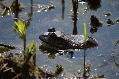
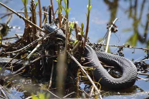
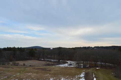
Located along the southern coast of Massachusetts,  Demarest Lloyd State Park has some of the prettiest views of any state park I have visited.  Its abundant bird population, scenic views and sandbars make Demarest one of the truly special places to visit and get away from it all.

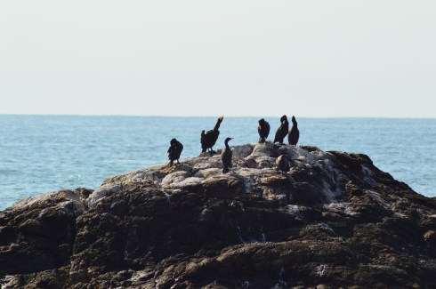
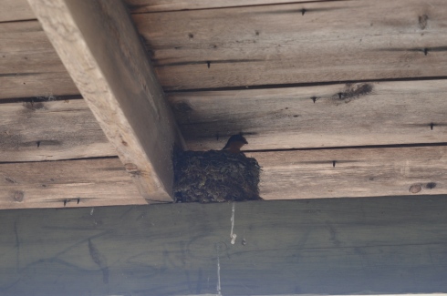
Demarest is a bird lovers paradise, especially during the off season when there are less people, cars and other disturbances to scare them away.

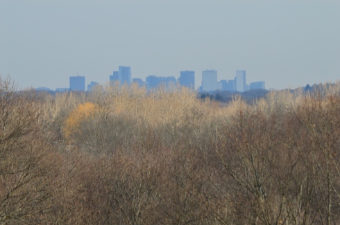
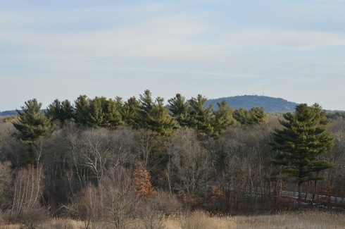
The views at Demarest are truly breath taking.

I kept thinking to myself, sometimes the world is indeed a very beautiful place.  It’s important to have places like this treasure to observe and appreciate pure beauty.  Demarest was easy to photograph.  The hardest part was deciding which photos to post.  All I had to do was check my settings and point and click.  The beauty was already there, all courtesy of Mother Nature.

It was low tide during my visit.  So, I was able to walk out onto some of the sandbars and get up close to some of the gulls at the park.

There were also several lobster pots and other cage-like devices that had washed up along the shore or were being stored there for safe keeping

If you do walk past the beach area, as I did, you should remember to pack or wear an extra pair of walking shoes (flip flops and sandals won’t be adequate) because the path turns from sand to pebbles and seashells.  It is worth the walk, though.

One of the few creepy things at the park were these spiders.  And they were everywhere.  I must have seen dozens of them.  So, if you do lie out there on a  beach blanket, I’m just saying…but they have a purpose and place here as well.

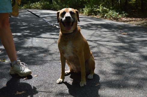
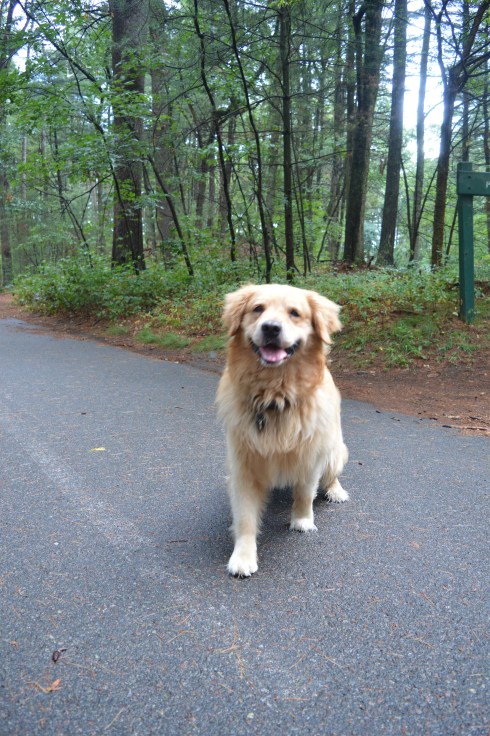
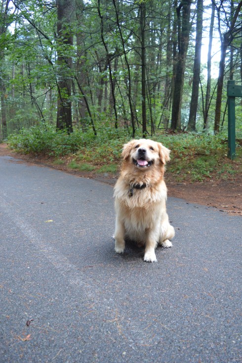
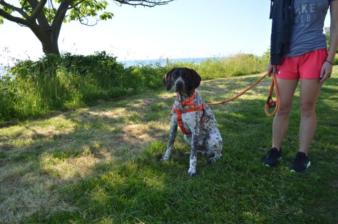
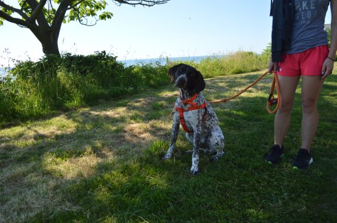
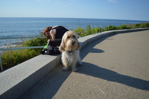
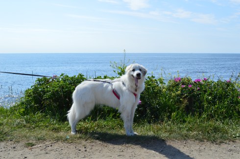
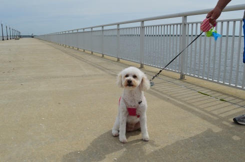
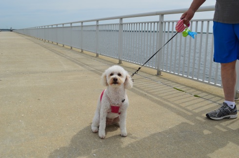
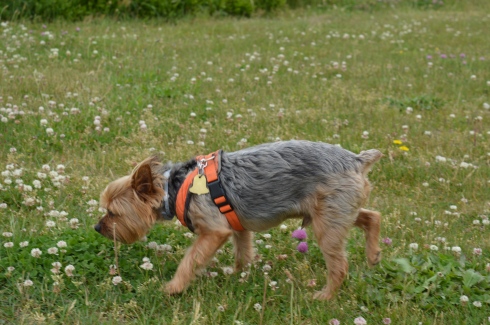
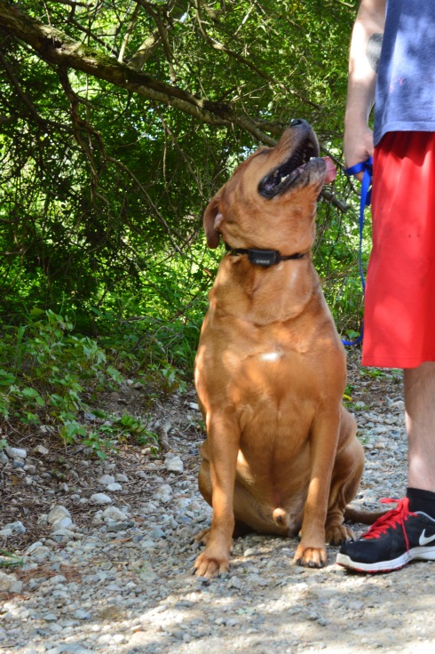
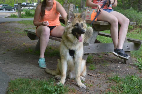
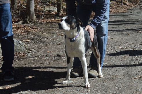
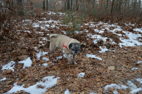
Dogs like Demarest as well.

Bartley is a 2 year old German Shepherd.

Ranger is a 5 or 6 year old mixed breed dog.

Sadie is an 8 year old Lab.


Breakheart Reservation (Saugus, MA)

Date Of Visit: August 14, 2016

Location: 177 Forest St, Saugus, MA 781-223-0834

Parking:  There are about 30 parking spots at the entrance to the park.  There is also off street parking and parking available down the street at Kasabuski Arena (201 Forest St).

Cost: Free

Hours: Open everyday sunrise to sunset

Size: 640 acres

Time To Allot For Visit: At least 1 to 3 hours

Trail difficulty: Easy to Moderate in some areas

Dog Friendly: Yes

Fun For One: Yes

Highlights: scenic views – especially from Eagle Rock, beach, play area for children, trails for cycling and running, fishing is allowed

Lowlights: side trails end without warning, some rocky terrain

Trail Map: Breakheart Reservation Trail Map

Website: Breakheart Reservation

DSC_0200

Once a hunting ground and camp area for Paleo Indians as far back as the Archaic and Woodland eras (roughly 1000 – 2000 BCE),  Breakheart Reservation boasts two grand lakes, scenic vistas, a beach, a play area for children and miles of trails.

The trails are mostly easy with some moderately difficult trails and inclines.  The side trails can be challenging more because of the rocky and narrow terrain rather than the inclines.  The one downside to taking the side trails is that some of the side trails end without warning, such was the case with the Saugus River Trail which is one of the first side trails you will see when you enter the park.  The Cedar Glen Golf Course abuts the park.  So, you’ll hear and see golfers whacking their golf balls around.  Also, one side trail leads to the children’s camping site which you’re not supposed to access and yet another trail just ends near a store’s parking lot.  So, you end up walking long distances only to have to turn around.  If you want to avoid walking on trails that end suddenly, it’s best to stay on the main trail and the trails that loop around the lake.

The two lakes at Breakheart Reservation, Pearce Lake and Silver Lake, have trails that loop around the bodies of water.

Pearce Lake (considered the lower pond) has a beach and some very pretty views.  It runs along the main trail and along some of the side trails.  It is the larger of the two lakes and it is where the beach is loacted.

Although Lake Pearce is the larger of the two lakes, I found Lake Silver (the upper pond) to be more intriguing than Lake Pearce.

Lake Pearce has two smaller islands in the lake.  One of the islands is accessible via a makeshift walking bridge of branches, sticks and anything else that you can walk on to get to the island.  Except for some pretty views there wasn’t much on the island.

At an elevation of 206 feet, Eagle Rock offers scenic views of the Boston skyline and surrounding areas.  One suggestion I would make if you do try to climb up to Eagle Rock (it’s a moderate climb) is to use the “back” way to the vista (aptly names Eagle Rock Trail).  I went straight up along the rocky edge along the Pearce Lake Trail and it was more challenging than it would have been if I had gone up via the trail on Eagle Rock Trail.  There are other points of higher elevation on other trails such as Castle Rock and Crow Hill.

There are many other beautiful and interesting things along the trails at Breakheart Reservation.

This slideshow requires JavaScript.

Breakheart has a paved main trail which is usually packed with runner, cyclists and people walking their dogs, especially at the Bark Place where dogs are allowed off leash for a section of the trail.

DSC_0327

Breakheart Reservation stopped allowing vehicles on the trails some time ago.  It was great not having to look over your shoulder or carefully turn a corner worrying if a car or other vehicle might be coming your way.  It also allows lots of room for all the walkers, runners and, of course, the dogs that frequent the park.

These dogs had a great time at Breakheart Reservation during my visit…

DSC_0707DSC_0702DSC_0704DSC_0705

Bailey is a 6 year old Black Mouth Cur

DSC_0337DSC_0336DSC_0335DSC_0334

Cooper is a 7 year old Golden Retriever.

DSC_0217DSC_0235DSC_0250

DSC_0211

Free is an 8 year old Bichon and Shih Tzu mix.

Follow Me on Twitter:

New England Nomad – Twitter

and like me on Facebook:

New England Nomad – Facebook

or follow me on Instagram:

New England Nomad – Instagram

Similar Places In New England I Have Visited:

dsc_0237 (2)

Dorrs Pond, Manchester, NH

dsc_03413

Ipswich River Wildlife Sanctuary

rutland

Rutland State Park

Below is a video of the view from Eagle Rock.


Cliff Walk (Newport, RI)

Dates Visited: June 25 & June 26, 2016

Location: 117 Memorial Blvd, Newport, RI (by Easton’s Beach)

Hours: open everyday dawn until dusk

Cost: Free

Parking: 3 hour metered parking is available at Easton Bank (but limited).  You can also park at other entry/exit points along the trail off Bellevue Ave (such as The Breakers mansion at 44 Ochre Point Ave which is free for a limited parking time and Narrangasett Ave.)

Distance: 3.5 miles each way

Time To Allot For Walk: The website suggests 2.5 hours.  I would allot 3-4 hours if you’re walking the entire trail (and back)

Dog Friendly: Yes

Highlights: scenic, free, always open, good for people of all ages, popular with joggers

DSC_0788DSC_0791

The Cliff Walk in Newport, Rhode Island, is not only a historically important attraction, it is also a great way to burn some extra calories or stroll along the shore, depending on your energy level.

Construction of the Cliff Walk began in 1880.  Since then, the trail has been extended and designed over a series of redevelopment projects.

The Cliff Walk, which begins at Memorial Blvd or Bellevue Ave (depending on where you start) takes you on a series of breath taking views and, at times, challenging trails.  Most people begin the trail at Memorial Blvd next to Easton’s beach (also known as First Beach).  This trail ends at Bailey Beach.  There is one “comfort station” on the walk at Narragansett Rd.

Rather than backtracking on the trail to get back, which you can do, it is easier to take the first right at Bailey Beach which leads onto Bellevue Ave.  You can follow Bellevue Ave all the way back to Memorial Blvd or one of the many access points along  the trail since it runs parallel to the cliff.  It is easier because it is a straight and more direct route.  I used this path to get back and it cut my walking time in half.

The views of Rhode Island Sound and First Beach from the Cliff Walk are astounding.

This slideshow requires JavaScript.

The first two thirds of the 3.5 mile trek (starting from Memorial Blvd) is easy and well defined.  However, the terrain gets rocky, challenging and more scenic after the first 2 and a quarter miles.  The steps and paths go from being well defined and wide.

to rugged, rocky and narrow

Other than the challenging terrain, the Cliff Walk is an easy, fun trail  (it’s best to stop and turn around at the Breakers mansion or Webster Street if you’re starting from Memorial Blvd to avoid the more rocky terrain).

The Cliff Walk is also a good place for birding.  There were lots of birds flying here and there, calling out to each other and even a few relaxing on the rocks.  They look like they’re conspiring.

DSC_0792

Perhaps the most well known part of the trail is the 40 Steps.  In addition to providing you with an up close look of the shoreline, the 40 Steps also provides a little bit of history to the trail.  The 40 steps is where the servants and workers of the mansions used to congregate during the Gilded Age.

One of my favorite parts of the walk was watching the people on the various water crafts and other flotation devices.

Another great thing about the Cliff Walk are the unusual features of the trail.  Tunnels, makeshift trails, colorful flowers, even a memorial attached to a rock and other decorative items are scattered throughout the Cliff Walk.  The memorial on the rock is dedicated to former surfer pro Ryan Patrick Roberts, nicknamed “Gazoo”. Roberts, a Newport native, passed away February 5, 2000.  One wonders how they got the plaque on there and made it stay there.

This slideshow requires JavaScript.

The Cliff Walk also offers many great views of the mansions and other buildings built along the shore.

Some of the visitors at the Cliff Walk weren’t contend to stay on the trail.

There were a lot of dogs on the trail during my visits.  It is a great place to take your pup for a walk.  But, you may want to avoid the rockier terrain when you take your dog to the Cliff Walk.

Remy is a 10 month German Short Hair Pointer and a loyal Red Sox fan I presume.

DSC_0811DSC_0813

Winston, a 4 year old Maltese from Seattle, WA, took the easy way around the Cliff Walk

DSC_0913DSC_0920

Fion is an 8 year old Petit Basset Griffon Vendeen.  Her breed is named after the area of France where that breed originated from (Vendeen).

DSC_0587DSC_0588

Believe it or not, Penny, a Great Pyrenees,  is only one year old.

DSC_0978DSC_0973

Connect with me on Facebook to see additional photos, videos and other posts I do post on this blog.  Thank you!

New England Nomad On Facebook


Fort Taber/Fort Rodman Park (New Bedford, MA)

Date Visited: June 11, 2016

Location: 1000 Rodney French Blvd, New Bedford, MA

Parking: There are about 70-100 spots or so in the park itself but plenty of off street parking as well.

Cost: Free

Hours: Dawn until dusk
Dog Friendly: It sure is!

Highlights: forts, lighthouse, jetty, beach, war memorials, walking trails, playground with slides and swings for children (or adults if you’re so inclined), military museum, war reenactments, pretty views

DSC_0696

The highlight of the park for most visitors has to be the jetty.  Fishing off the jetty, or anywhere else at the park is allowed.  But, they have a strict “catch and release” policy because most of the fish are contaminated with PCB (poly-chlorinated bipenyls).  So, they would not be safe to eat.  PCB’s are known cancer causing toxins.  The New Bedford Harbor is lined with these cancer-causing toxins that were released into the harbor between 1938 and 1973 by factories such as the electrical component manufacturer Aerovox.  The harbor is in the process of being cleaned.  But, it could take many more years before the job is complete.

Seashells and seaweed were scattered along the bridge, evidence of some recent stormy seas.

There are so many beautiful views and interesting things at Fort Taber Park.  The lighthouse in the photos is the

Since New Bedford has been known for its whaling and seafaring history, the park (and all of New Bedford) is also known for its lighthouses.  In the background of  the fort in the photo below you can see Clarks Point Lighthouse, first originally built in 1797 (it was replaced with a stone tower in 1804).

DSC_0819

The lighthouse below is the Butler Flats Lighthouse, originally built in 1898.

DSC_0699

There are several war memorials dedicated to the men and women of Fall River who have served their country, with a specific emphasis on those who were killed in action.

The memorial below is a Vietnam War Memorial that really stood out to me.  If you look closely at the board in the final photo, you can see photos of the service people from New Bedford who were killed in the war.   Everything about this memorial has meaning.  The 43 stars on the memorial represent all of the 43 people from New Bedford who died in Vietnam.  The outline of Vietnam is in orange as a reference to Agent Orange who died from Agent Orange.  Even the service ribbons on the memorial have meaning.  The blue ribbon represents the National Defense Ribbon which is representative of everyone who served in Vietnam.  The other two ribbons represent in country veterans.  The two plants at the memorial signify life.

This slideshow requires JavaScript.

There are also several memorials to all of the 20th century wars America has been in, although I did not notice any memorials for the Iraq and Afghanistan wars.  I am assuming this may be because those actions are still not officially over even if we have pulled out most of our military presence in those places.

A tribute does stand for Army Staff Sargent Joseph Camara of New Bedford, MA, who was killed in action on September 1, 2003 while serving during Operation Iraqi Freedom  when the humvee he was traveling in hit a land mine.  He was serving with the 115th Military Police Company as a member of the Rhode Island National Guard in the Iraq War.  He was 40 years old when he died.  He was also a member of the New Bedford Police Department.  His memorial is located at the bottom of the gallery below.

There is also a replica of a Sherman tank stands as a tribute to the LST amphibious force T-4 who lost their lives in training for the invasion on D-Day.  During the training exercises, sadly, many men lost their lives training for the invasion.

While I was visiting it was 17th century drill day.  Reenactors from the Dartmouth militia, in full 17th century garb, showed how weapons were used, described the different types of warfare of the day and answered any questions the public had.

The staff also allowed visitors inside Fort Taber.  The guide explained they stopped using this Civil War fort once the ballistics that were used became too effective against the barricades of the fort.

Grass and rust had overtaken what was once a formidable fortification.

One of the best parts of my visit – on the way to my car, I saw this man and woman playing their instruments.


One of the great things I noticed about the New Bedford area as I walked around taking photos and from the crowd at Fort Taber is the diversity of the cultures and people of the area.  The photographs above illustrate this.  The music sounded like it had an up tempo flamenco influence.  It sounded beautiful.  And I love their attire.

Fort Taber/Fort Rodman is a dog friendly park.  The park is a great place for dogs.  There are miles of trails for your dog to wander.

DSC_0787DSC_0786

Sadie is a miniature poodle.  She will be 5 in August!  Early happy birthday wishes, Sadie!

DSC_0906DSC_0918DSC_0911

I also met Yoda, a 10 year old Yorkie.

Below is a video of the inside of one of the forts at Fort Taber.   It’s kind of spooky!

This video is a video of the military reenactors firing their weapons.

Please connect with me on Facebook!

New England Nomad


Borderland State Park (North Easton, MA)

Date Visited: May 21, 2016

Location: 259 Massapoag Ave, North Easton, MA

508-238-6566

Hours: Open 365 days a year, 8 a.m. to 6 p.m.  A sign at the front gate of the parking area states cars still parked in the lot after 7 p.m. will be fined $25.

Costs: According to the website it is $5 for MA residents and $6 for non-MA residents.  There is a parking payment station located at the front of the parking area.  I have a parking pass which allows me to park in all state run parks so I do not know exactly how the parking stations work or how they charge each patron.

Parking:  The parking lot is pretty big.  It looks like there are easily 200 spaces.  When we left, on a busy day at peak hours, there were still plenty of parking spots available, albeit far from the entrance to the trails.   There is also an alternate parking area before the main parking area for people with special passes.

Highlights: mansion, 6 ponds, quarry, 20 miles of hiking trails, large field for frisbee golf and other activities.  Fishing, canoeing and horseback riding are allowed.  Leashed dogs are permitted. Easy to moderate trails, teeming with wildlife.  Peaceful feeling, even when the park is packed.

*Please note, some of the slideshows take some time to load, unfortunately (especially on tablets and cellphones).  You may have to refresh but they may take a few minutes to load*

Created during the early 1900’s by artist and suffragist Blanche Ames and her husband Oakes Ames, Borderland State Park has been a state park since it was purchased by the state in 1971.  The Ames’ home, a three-story stone mansion built in 1910 still stands on the grounds.

DSC_0146DSC_0151DSC_0142DSC_0158

The grounds of the mansion are manicured impeccably.  They even take care of those pesky witches (or whatever that is on the lawn) .

This slideshow requires JavaScript.

Bordering on the towns of Sharon and Easton in Southern MA, Borderland has a variety of trails for runners, walkers, cyclists and even horseback riders.  The trails are easy to moderate and I saw many runners on the trail.

Located about 45 minutes south of Boston and half an hour north of Providence, Rhode Island, Borderland State Park is a popular destination for people from all sections of New England.  It is easy to see why so many people flock to the park when you see the views.

This slideshow requires JavaScript.

Sometimes it’s the little things that make the park so much fun.  Whether it’s the frisbee golf course on the lawn in front of the mansion (I can only imagine what the Ames’s would have thought of that) or the benches that are liberally scattered throughout the park  or the always full bowls of water thoughtfully left out for the thirsty dogs, the park really does think of everything.

here was also an abandoned building along one of the trails.

There are always pleasant surprises when you go to visit the different parks in New England.  One of those surprises was a mother bird feeding her babies in the nest on the beams of the roof of the abandoned building pictured above.  I did my best to seem as unobtrusive and I used my telephoto lens from a distance while I took these photos.  I love how the mother looks so protective and is surveying the area for potential threats.

DSC_0402DSC_0399DSC_0421DSC_0429DSC_0433

Then, as I was taking photos of the pond, I saw these little critters.  Look at how the frogs almost perfectly camouflage themselves.  It’s almost the perfect disguise.  Man, I love nature!

DSC_0463DSC_0465DSC_0481

DSC_0471DSC_0459

Ok, the snake isn’t so “little.”  But, I wasn’t about to get closer to see just how big he was.

And the animals didn’t stop there.

There were dogs a plenty also at Borderland State Park.

DSC_0245DSC_0244DSC_0242

Beef is a 6 year old  American Bullweiler (American Bulldog and Rottweiler mix).  He was being trained by his dad.  I thought the last photo showed just how much affection he has for his guardian.

Mason, a chocolate Labrador, took advantage of the warm weather to go for a swim.

DSC_0377DSC_0376

Romeo, an English Chocolate Labrador, celebrated his 10 month birthday at the park!

DSC_0513DSC_0516DSC_0509

Balto, a 7 month German Shepherd, wants attentively for the rest of the family to show up.

DSC_0531DSC_0528DSC_0527

Thank you for stopping by and reading and please consider connecting with me on Facebook and check out my future trips around New England:  New England Nomad


Poet Seat’s Tower (Greenfield, MA)

Date Visited: May 13, 2016

Location:  Mountain Rd, Greenfield, MA

Parking: There are about half a dozen parking spots next to the tower and they fill up quickly.(and they were all filled at 8 o’clock on a Friday morning).  There is also parking at the gate of the entrance on Mountain Road for about another half a dozen vehicles.  The walk to the tower from the main entrance is about a mile.

Cost: Free

Hours: Open 365 days a year from sunrise to sunset

DSC_0095

Perhaps it’s the unobstructed, sweeping views of the landscapes or maybe it’s the solitude of being in such an isolated tall structure.  Whatever the reason, poets seemed to flock to this observation tower.  It has since been known as the “poets seat tower” because of the long tradition of poets that have been attracted to the location.  Frederick Goddard Tuckerman, a local poet at the time, is credited with bestowing this name on the structure in 1850.  The tower, which was built in 1912, now attracts people of all walks of life, not just poets.   Prior to the construction of the sandstone tower, a wooden observation tower had been built on the edge of the lookout in 1879.  A plaque at the tower acknowledges Tuckerman’s role in the history of the tower.

DSC_0981


Even before you reach the top of the tower, if you dare, there are some impressive views of the Greenfield (MA), Connecticut, Deerfield (MA) and Green River valleys.  The ledge of the road where the tower is bult has a rocky ledge from where you can get some views of the Greenfield area below.  It’s a long way down!

The highest point of Greenfield, the tower is 4 floors (counting the ground floor and top floor).  The views from each floor are pretty stunning.  After all the rain in the area, the greens were very vivid.

This slideshow requires JavaScript.

As I stood looking over the land below I couldn’t help but think of how the landscape has changed over the years.  Many years ago people looked over farmlands and valleys.  Now, we look over schools, houses, parks and businesses.  I also thought about all of the people who came here to rid their mind and soul of their worries by taking in the beautiful views.  It really can make you take a step back (and hopefully not forward) when you’re up so high and appreciating the nature around us.

The journey to the top is not difficult.  A trip up one stairwell and one spiral staircase take you to the top.

The arches and architecture of the tower rival the beauty of the views from the top of the tower.

This slideshow requires JavaScript.

And what would a historic structure be without graffiti?  As seems to be customary, particularly in Western Mass, there was graffiti on the walls of the sandstone structure.  It did seem fitting that poetry lined the walls of “Poet’s Seat Tower”

DSC_0075

“Jump off the cliff and build your wings on the way down”

DSC_0011DSC_0009

DSC_0039DSC_0052

The are also benches along the road to the tower which offer views of the area.  There are also hiking trails that branch off from the road to the tower.  The trails look easy to moderate but I could not walk on them because of time constraints.  I did hear a lot of presumably animal activity in the woods.

Below is a video of the view from the top of Poet’s Seat Tower

Please stop by my Facebook page and like me!  New England Nomad On Facebook


Bancroft Tower (Worcester, MA)

Date Visited: March 19, 2016

Cost: Free

Location: Bancroft Tower Road, Salisbury Park,Worcester, MA

Open: Daily from sunrise until 6 p.m.

Bancroft Tower


DSC_0783

In 1900, Stephen Salisbury II built a tower on what is now known as Salisbury Park as a tribute to his friend, historian and jack of all trades, George Bancroft.   And to think, my friends only usually give me gift cards, wine and books for my birthday.

The park is has a wide variety of bird life.

As I was reviewing the photos, I couldn’t help feeling the tower was purposefully constructed to look as though it was  incomplete.  The sides are not rounded and seem almost as though they were cut off from the facade or the builder gave up half way through.  But, as the photos show it was indeed constructed this way by design.

This slideshow requires JavaScript.

My favorite view from the tower was at the arched entrance.

The 56 foot tower is made  of natural stone and granite.  It was designed by Stephen C. Earle and Clellann W. Fisher.

The plaque at the memorial states:

BANCROFT TOWER
THIS TOWER WAS BUILT IN 1900
TO HONOR THE MEMORY OF

GEORGE BANCROFT
1800-1891

BORN AT THE FOOT OF THIS HILL
HE ROSE TO THE POSTS OF
SECRETARY OF THE NAVY
FOUNDER OF THE U.S. NAVAL ACADEMY
ANNAPOLIS, MARYLAND
U.S. MINISTER TO GREAT BRITAIN
AND GERMANY

THIS MEMORIAL WAS BUILT BY HIS
FRIEND AND ADMIRER
STEPHEN SALISBURY III

Jacks wasn’t impressed by the tower.

There were some views of the city from the parking lot.

During my visit and in my research after the shoot, I found out they let visitors inside the tower during October of each year.  The views at the top are said to give 360 degree views of the area.  The sorority and fraternity at the local college also holds a Halloween party for the kids in the area at the tower with mild scares.  So, it looks like a visit in October is on my list!

A walking tour of the Bancroft Tower:

Please stop by my Facebook page and like my page for extra photos, videos and other fun stuff!

New England Nomad’s Facebook Page


Bash Bish Falls (Mount Washington, MA)

Date Visited: March 12, 2016

Hours: Open everyday from sunrise to half an hour after sunset.

Cost: access to the trails and waterfalls is free. It may cost if you rent one of the Bash Bish cabins at nearby  Taconic Falls.

Bash Bish Falls

DSC_0540

Located in the most southwestern part of Massachusetts, Bash Bish Falls is considered one of the most dangerous waterfalls in not only Massachusetts but the entire United States.  It is also one of the most beautiful.

DSC_0672DSC_0658DSC_0656DSC_0664DSC_0644

DSC_0619DSC_0662

According to legend, Bash Bish was the name of a Mohican Native American woman who was accused of adultery which was punishable by death..  Bash Bish was pushed over the falls while tied up in a canoe.

The shape of the falls is said to resemble a woman falling to her death. Another theory claims the segmented characteristic of the falls resembled the reuniting of Bash Bish and her daughter White Swan who had also disappeared over the falls according to the Mohican legend.  If the rapids of the stream leading from the waterfall and the speed of the water falling from the waterfall are any indication, the restless spirits may still be there.  It is also a good reason why swimming is not allowed as the rapids can be very strong and it is easy to hit a rock.

This slideshow requires JavaScript.

Bash Bish Falls is located in Massachusetts, just past New York/Massachusetts border.

DSC_0613

There are several entrances for Bash Bish.  One of the entrances, at the top of the hill from the Massachusetts entrance on Falls Rd, gives ample evidence as to why Bash Bish may be considered such a dangerous waterfall.  The stairs, which are a generous description, and walkway, also a generous description, are rocky and treacherous.  There is a railing to hold on to.  But, it’s still a tricky path.

I would recommend using the first parking spot on Falls Rd, if you’re traveling from Massachusetts.  The trails are easy to moderate with a few slight inclines from the first parking lot.  It is a 3/4 mile walk to the waterfall from the parking area.

There are many interesting rock formations along the trail. Little known factoid: I learned a new word recently for the strange piles of rocks stacked creatively that we often see along trails and at beaches like the rocks in the first two photos in the top row of photos below.  They are called cairns, unless you ask a conservationist or geologist in which case they will condescendingly call them just rock piles since real cairns are nature made and not man made.

Bash Bish Falls is a popular spot for dog walkers.  I met the following dogs during my hike.

Charlie

DSC_0610DSC_0608

Juno, a Rottweiler and Shepherd mix

DSC_0688

Cassie, a Bernese Mountain Dog.

DSC_0684

DSC_0685

Murphy, a beautiful Golden retriever

DSC_0680DSC_0678

To get a better perspective of the waterfall and the stream leading from the waterfall, I have attached the following videos.


Coolidge Reservation (Manchester-By-The-Sea, MA)

Date visited: February 20, 2016

Cost: Free

Hours: 8 a.m. to sunset

Address: 15 Coolidge Point, Manchester By-The-Sea, MA

Coolidge Reservation

Parking: about 8-10 parking spaces, small lot.

DSC_0312

How could you not want to visit an area with the name “by the sea” in its name?  It sounds like the name of an idyllic setting from a novel.  And the town lives up to that description.  I passed by several fruit, vegetable and flower stands as well as signs to watch out for people riding horses.  The houses and town also had a very Norman Rockwell feel.

I wasn’t sure how the footing and appearance of the park would be given the recent snowy weather and icy conditions on many of the trails at other parks.  As it turned out, most of the ice and snow on the trails had melted and I only had to manage some small patches of ice and mud from the melted snow.

The trails are clearly marked and easy to walk.  There are no steep inclines and the paths are wide enough to accommodate the throng of visitors.

There are a few trails that meander slightly off the trail.  But one trail simply leads to the street and is behind a bunch of cattails so you really can’t view much of the pond.  The other stupid trail goes to a thorny, rocky dead end.

As you walk on the main trail, you will pass Clarke Pond on your left.  It was partially frozen and there were some ducks and geese milling around.  I also got a few shots off them dunking for lunch.  The gulls in the first photo looked like big blocks of snow at first glance.  I especially like how the mom and dad duck kept the baby duckling close to them.

This slideshow requires JavaScript.

There were many breath taking views of the pond.  I especially like how the frozen parts of the pond break with the unfrozen sections.

This slideshow requires JavaScript.

To the right of the main trail, I found a side road with a pond that channels into Clarke Pond. There were a variety of ducks and geese in this pond.

This slideshow requires JavaScript.

I met a lot of friendly and cool people at Coolidge.  Shapoo was one of the cool and friendly folks I met (the name is a mix of shih tzu and poodle) .

DSC_0373

Much to my consternation, I was unable to find the Ocean Lawn which offers views of the Boston skyline and Cape Cod as well as scenic views of the water.  I totally missed the boat on that one as there are some great views and opportunities for some great shots from there.  But, to the left of the trail, Magnolia Beach more than made up for it which I will post about very soon…click here to read about my visit to Magnolia Beach.


Signal Hill (Canton, MA)

Date visited: January 31, 2016

There are about a dozen parking spaces in the main parking lot.  If needed, you can also park on the side of the road by the parking lot.

Cost: Free

Hours: open daily, sunrise to sunset

DSC_0346

Before you even begin climbing the ascent to Signal Hill, the views from the parking lot are astounding.

Besides the historical significance (it used to be the home to the Paleo-Americans who settled on what would become the Neponset River) and the active wildlife (hawks are said to nest there and many amphibians inhabit the area by the river), Signal Hill also offers grand views of the Boston Skyline, Blue Hills and the Neponset River Valley.

The hill to the scenic outlook at Signal Hill is modest at best.  It should only take 10 minutes to go from the parking lot to the outlook.

DSC_0175

The views are worth the short hike.

DSC_0208DSC_0238DSC_0209DSC_0194DSC_0183DSC_0186DSC_0196DSC_0195DSC_0282DSC_0284DSC_0250DSC_0251

The scenic overlook has some pretty trees and rocks.

One of the charming features of Signal Hill is the short loop (1.6 miles) at the base of the hill.  After climbing and trudging along so many long and steep hills, it’s refreshing to be able to take a leisurely stroll along the clearly defined trail.  There are also trails that veer off a little.

Off the main trail there is a canoe launch site on the Neponset River.  The upstream launch site goes to Norwood (MA) while the downstream site leads to Milton (MA).

Since there is little traffic on the road, the road to Signal Hill is popular with joggers and cyclists.

I met Charley during my visit.  He was having fun playing in what remained of the snow on the trail.

DSC_0171

A 360 degree video of the overlook at Signal Hill

Connect with me on Facebook New England Nomad