Category Archives: skyline

Sunrise At Wollaston Beach (Quincy, MA)

Date Of Visit: December 4, 2016

Location: Quincy Shore Drive, Quincy, MA

Hours: Accessible everyday, 24 hours a day

Cost: Free

Parking: Free parking is located at the beach and in nearby lots.

Handicapped Accessible: Yes

Dog Friendly: Yes, although dogs are not supposed to be on the beach from May to September 30, although they are allowed to walk on the sidewalk along the beach year round.

Highlights: Views of the Boston skyline, pretty, long beach, great place to view sunrises and sunsets.

December isn’t usually considered beach weather.  At least, it’s not in New England.  But, some of the best sunrises and sunsets can happen any time of the year.

dsc_0514

For this shoot, I chose to focus (no pun intended) on the clouds.  You never know what you’ll get at the beach, especially during sunrises and sunsets.  My neighborhood could be cloudless and clear.  But, when I arrive at the beach, a five minute drive from my place, it could be dark and cloudy.  Not only that but it could be bright and clear on one side of the beach, it could be quite the opposite on the other side (something I noticed during this visit).

While the clouds on this particular morning looked foreboding and the sun itself was not visible, the colors in the sky were incredible.  Often times, less is more.  Sure, the sun itself is virtually nonexistent in most of these shots but that seems to add more by letting in pink, orange and blues.   The clouds seem to be layered with rays of light poking out threw each layer.

It was a typical December day with temperatures in the 30’s.  But the wind made it feel at least 10 degrees colder.  The steel blue water rippled with the power of the wind.

The most obvious features of the beach have got to be the jetty and, of course, the Boston skyline.

Bandit, a Japanese Chin, enjoyed his morning stroll along the beach.


World’s End (Hingham, MA)

Date Visited: August 28, 2016

Location: 250 Martin’s Lane, Hingham, MA

Hours: open everyday, 8:00 a.m. until sunset

Cost: $6 for adults, annual memberships which include free admission are available for $47

Size: 4.5  miles of continuous trails, 251 acres

Parking: there are three parking areas with roughly 20 spots each.  When I left at 1:00 p.m. the lot was full and there was a line of about half a dozen cars waiting to get into the park.

Time To Allot For Visit: 2 hours

Dog Friendly: Yes

Trail Difficulty: Easy to Moderate

Highlights: scenic views of the Boston skyline and surrounding area, wildlife, occasionally they display exhibits at the park, benches to sit along the trail, pretty trees and flowers, perfect for walkers, joggers, runners, cyclists and even horseback riders and anowshoeing during the winter

Lowlights: limited parking (if you follow the reservation Twitter they post alerts when the lot is full)

Website: World’s End

World’s End Trail Map

DSC_0988

I “misunderestimated” World’s End.  I figured it would be an “easy” quick jaunt (I usually save my easier treks for Sundays).  So, I slipped on my Chuck Taylor All-Stars and figured I would be home in a few hours.  Not the best choice of footwear in retrospect.  The trails can be rocky (particularly if you go off trail) and deceivingly steep in some areas.

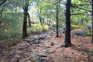
There are a lot of side trails and it’s easy to get confused and cover the same area twice (or more) which can add quite a bit of time to your journey.  In fact, for a while, I thought World’s End would never end. It’s a good idea to take a map of the trails with you.  But, the trails are clearly marked and easy to negotiate with some slight inclines.

Undoubtedly, the main attraction for many visitors at World’s End are the views of the Boston skyline.  World’s End affords several views of the skyline and surrounding areas.  From the shoreline views to the views atop the highest point on the top of one of the many views of the rolling, hilly trails, the views are majestic.

World’s End is teeming with wildlife, particularly birds.  They’re very good at camouflaging themselves so you might have to squint to see a few of them.

But, the real gem of my visit was this deer I spotted on my way to Rocky Neck, one of the more secluded areas.  We stood mere feet away from each other staring, until she finally took off.

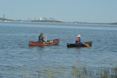
There are not just an abundant of bird life in the water.  Being a picture perfect summer day with low humidity and a slight breeze and calm waters, it was ideal for many of the boaters, paddlers and other seafaring folks.

This boater wanted some privacy, apparently.

World’s End has many other charming features such as this huge rock and an elevated viewing area for bird watching.

Of course, sometimes the more simpler things can be the prettiest features of the park.  These flowers, tress and views off the water caught my eye.

Some people took advantage of the shore to skim some stones.

DSC_0508

DSC_0622


If there is one photo that sums up a trip to World’s End it is this photograph of a hammock with a bicycle next to it.  World’s End is the perfect place to lie out in a hammock with only the sounds of nature to keep you occupied and maybe a good book or your Itunes collection.

DSC_0999

There is also an art exhibit on display until Oct. 31, 2017.  The display was created by Jeppe Hein, an artist based out of Copenhagen and Berlin.  He is known worldwide for his interactive exhibits.  The exhibit is called, “A New End”.  According to the website for the exhibit, Hein wants to invite visitors to reflect and to transform how we view a familiar place like World’s End.

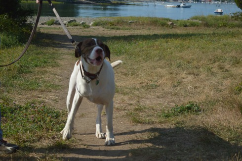
There were dogs-a-plenty at World’s End during my visit.  World’s End is a great place for dogs to play around in since there are many open, grassy areas and, of course, water to frolic around in.
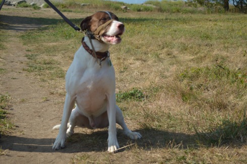
DSC_0474DSC_0483DSC_0488DSC_0478

Casey is a happy, 8 year old English Pointer mix.  He is a rescue.

DSC_0949DSC_0950

Gus is a 2 year old Ridgeback mix.  He was very excited to be at the park!
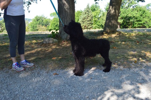
DSC_0651DSC_0650DSC_0643DSC_0647

Tande is an 8 month old Portuguese Water Dog.  If Tande looks familiar, you may have seen a similarly looking dog on the news.  The President also has the same breed of dog. Tande came all the way from the Odysea Portuguese Water Dogs breeder in Colorado.

DSC_0701DSC_0702DSC_0706

One of my easiest subjects to photograph ever, Bella is a gentle 7 year old Shetland Sheepdog.

I also saw a variety of other dogs playing in the water and running around.

viewsofanemergencyrn was kind enough to nominate me for the One Lovely Blog Award.  Thank you!  I usually don’t post about these awards but I figured I would play along since she was so nice to mention me and I wanted to acknowledge her.  She is a sweet, strong person and a survivor (read her post to see what I mean).

So, the rues are I have to mention 7 random things about me.

  1. I didn’t take up photography seriously until last year
  2. I  love dogs and all animals (big surprise there) but they also seem to love me – the key is to not show fear and be confident and friendly around them (they can sense fear)
  3. I am a pescatarian (I only eat seafood and do not eat meat, primarily)
  4. People often say I bear a strong resemblance to Donnie Wahlberg (but I can’t sing like him)
  5. Although I love dogs, I don’t have one (I have a cat instead)
  6. Until my work schedule got too busy, I had been an active literacy tutor at my local library
  7. I run (and/or walk) 3 miles (at least) a day everyday

The rules say to nominate other bloggers to participate.  But, I’m going to skip that part.  In my experience, people have usually already posted a blog like this in the past and don’t want to do it again, or they don’t participate or they seem to be too busy.  But, thank you, once again for the mention, viewsofanemergencyrn!  I do appreciate you and I look forward to reading more of your posts.  You all should also!

Similar Places I have Visited In New England:

111

Webb Memorial State Park (Weymouth, MA)

222

Blue Hills Reservation (Milton, MA)


Breakheart Reservation (Saugus, MA)

Date Of Visit: August 14, 2016

Location: 177 Forest St, Saugus, MA 781-223-0834

Parking:  There are about 30 parking spots at the entrance to the park.  There is also off street parking and parking available down the street at Kasabuski Arena (201 Forest St).

Cost: Free

Hours: Open everyday sunrise to sunset

Size: 640 acres

Time To Allot For Visit: At least 1 to 3 hours

Trail difficulty: Easy to Moderate in some areas

Dog Friendly: Yes

Fun For One: Yes

Highlights: scenic views – especially from Eagle Rock, beach, play area for children, trails for cycling and running, fishing is allowed

Lowlights: side trails end without warning, some rocky terrain

Trail Map: Breakheart Reservation Trail Map

Website: Breakheart Reservation

DSC_0200

Once a hunting ground and camp area for Paleo Indians as far back as the Archaic and Woodland eras (roughly 1000 – 2000 BCE),  Breakheart Reservation boasts two grand lakes, scenic vistas, a beach, a play area for children and miles of trails.

The trails are mostly easy with some moderately difficult trails and inclines.  The side trails can be challenging more because of the rocky and narrow terrain rather than the inclines.  The one downside to taking the side trails is that some of the side trails end without warning, such was the case with the Saugus River Trail which is one of the first side trails you will see when you enter the park.  The Cedar Glen Golf Course abuts the park.  So, you’ll hear and see golfers whacking their golf balls around.  Also, one side trail leads to the children’s camping site which you’re not supposed to access and yet another trail just ends near a store’s parking lot.  So, you end up walking long distances only to have to turn around.  If you want to avoid walking on trails that end suddenly, it’s best to stay on the main trail and the trails that loop around the lake.

The two lakes at Breakheart Reservation, Pearce Lake and Silver Lake, have trails that loop around the bodies of water.

Pearce Lake (considered the lower pond) has a beach and some very pretty views.  It runs along the main trail and along some of the side trails.  It is the larger of the two lakes and it is where the beach is loacted.

Although Lake Pearce is the larger of the two lakes, I found Lake Silver (the upper pond) to be more intriguing than Lake Pearce.

Lake Pearce has two smaller islands in the lake.  One of the islands is accessible via a makeshift walking bridge of branches, sticks and anything else that you can walk on to get to the island.  Except for some pretty views there wasn’t much on the island.

At an elevation of 206 feet, Eagle Rock offers scenic views of the Boston skyline and surrounding areas.  One suggestion I would make if you do try to climb up to Eagle Rock (it’s a moderate climb) is to use the “back” way to the vista (aptly names Eagle Rock Trail).  I went straight up along the rocky edge along the Pearce Lake Trail and it was more challenging than it would have been if I had gone up via the trail on Eagle Rock Trail.  There are other points of higher elevation on other trails such as Castle Rock and Crow Hill.

There are many other beautiful and interesting things along the trails at Breakheart Reservation.

This slideshow requires JavaScript.

Breakheart has a paved main trail which is usually packed with runner, cyclists and people walking their dogs, especially at the Bark Place where dogs are allowed off leash for a section of the trail.

DSC_0327

Breakheart Reservation stopped allowing vehicles on the trails some time ago.  It was great not having to look over your shoulder or carefully turn a corner worrying if a car or other vehicle might be coming your way.  It also allows lots of room for all the walkers, runners and, of course, the dogs that frequent the park.

These dogs had a great time at Breakheart Reservation during my visit…

DSC_0707DSC_0702DSC_0704DSC_0705

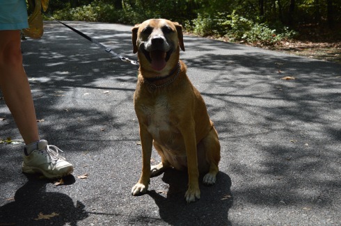
Bailey is a 6 year old Black Mouth Cur

DSC_0337DSC_0336DSC_0335DSC_0334

Cooper is a 7 year old Golden Retriever.

DSC_0217DSC_0235DSC_0250

DSC_0211

Free is an 8 year old Bichon and Shih Tzu mix.

Follow Me on Twitter:

New England Nomad – Twitter

and like me on Facebook:

New England Nomad – Facebook

or follow me on Instagram:

New England Nomad – Instagram

Similar Places In New England I Have Visited:

dsc_0237 (2)

Dorrs Pond, Manchester, NH

dsc_03413

Ipswich River Wildlife Sanctuary

rutland

Rutland State Park

Below is a video of the view from Eagle Rock.


Signal Hill (Canton, MA)

Date visited: January 31, 2016

There are about a dozen parking spaces in the main parking lot.  If needed, you can also park on the side of the road by the parking lot.

Cost: Free

Hours: open daily, sunrise to sunset

DSC_0346

Before you even begin climbing the ascent to Signal Hill, the views from the parking lot are astounding.

Besides the historical significance (it used to be the home to the Paleo-Americans who settled on what would become the Neponset River) and the active wildlife (hawks are said to nest there and many amphibians inhabit the area by the river), Signal Hill also offers grand views of the Boston Skyline, Blue Hills and the Neponset River Valley.

The hill to the scenic outlook at Signal Hill is modest at best.  It should only take 10 minutes to go from the parking lot to the outlook.

DSC_0175

The views are worth the short hike.

DSC_0208DSC_0238DSC_0209DSC_0194DSC_0183DSC_0186DSC_0196DSC_0195DSC_0282DSC_0284DSC_0250DSC_0251

The scenic overlook has some pretty trees and rocks.

One of the charming features of Signal Hill is the short loop (1.6 miles) at the base of the hill.  After climbing and trudging along so many long and steep hills, it’s refreshing to be able to take a leisurely stroll along the clearly defined trail.  There are also trails that veer off a little.

Off the main trail there is a canoe launch site on the Neponset River.  The upstream launch site goes to Norwood (MA) while the downstream site leads to Milton (MA).

Since there is little traffic on the road, the road to Signal Hill is popular with joggers and cyclists.

I met Charley during my visit.  He was having fun playing in what remained of the snow on the trail.

DSC_0171

A 360 degree video of the overlook at Signal Hill

Connect with me on Facebook New England Nomad


Weir River Farm (Hingham, MA)

Last week, I posted about my visit to Whitney And Thayer Woods.  I wanted to break the post into two parts because it would have been too big to do as one post and there were quite a few photos I wanted to share.  So, without further ado, Weir River Farm…

As you emerge from the dense Whitney and Thayer Woods, you see a welcome scene: open space and scenic views.

DSC_0202 DSC_0243

One of the more endearing features of Weir River Farm are the trees

DSC_0710DSC_0295  DSC_0700    DSC_0740  DSC_0231  DSC_0222

DSC_0736 DSC_0737DSC_0676DSC_0729

There was also a fancy rock formation.

DSC_0242

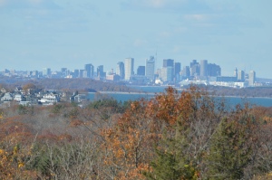
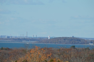
On a clear day, like the one from the day I visited, you can see Boston and other surrounding areas

DSC_0287DSC_0298

DSC_0289DSC_0292

DSC_0293DSC_0753

DSC_0801DSC_0786

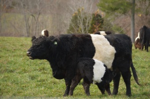
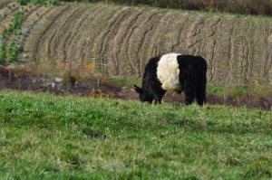
Holy Cow!  Weir River Farm had their cows grazing when I stopped by.

DSC_0762DSC_0784DSC_0806DSC_0790DSC_0778DSC_0798

I saw Hudson, a 6 year old Newfoundland at Weir River Farm

DSC_0238

and this cutie

DSC_0232