Category Archives: water
Pope John Paul II Park (Dorchester, MA)
Dates Of Visits: June 17 & 18, 2017
Location: There are several entrances at Gallivan Blvd. and Hallet St., Dorchester, MA
Cost: Free
Parking: There are multiple parking lots at the entrances
Hours: Open from sunrise til one hour before sunset
Trail Size/Difficulty: 2 miles, easy with moderate inclines
Handicapped Accessible: Yes
Dog Friendly: Yes
Highlights: wildlife, scenic, easy trails, ball fields
Website: Pope John Paul II Park
With its rolling hills, abundant wildlife, pretty trees and flowers and beautiful views, it’s hard to believe it once was the home to a drive in (remember those?) and a land fill.
Connected to Senator Joseph Finnegan Park, Pope John Paul II Park is part of the extensive Neponset River Greenway.
Pope John Paul Park is not only beautiful for it’s natural beauty, there are also two murals at the park.


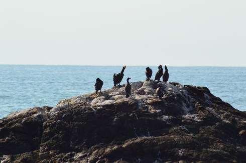
There are a variety of birds at Pope John Paul Park (but I didn’t see any cardinals which was unusual).


This bird had a meal for his or her babies,

There are many pretty trees, plants and rolling hills along the paths.


The paths at John Paul Park are easy with some moderate inclines.


The paths are perfect for running, riding your bicycle or rollerblading with your dog.

There are some wonderful views along the Neponset River which separates Dorchester from picturesque Quincy, MA.


People like to use the river to cruise along with their jet ski, boat or other aquatic vessel.


There is also a stream that flows under the bridge at the park.


There are also soccer and lacrosse fields as well as pavilions and benches for people to sit and watch the games.


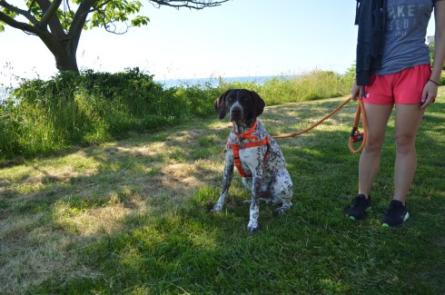
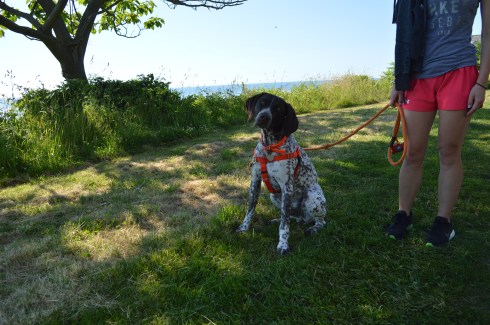
Pope John Paul Park is a great place to bring your dog. Zoey, a 5 year old mixed breed dog, brought her ball with her to the park.


Please follow me on Facebook for more New England related content!
Leverett Pond/Echo Lake (Leverett, MA)
Date Of Visit: May 27, 2017
Location: Depot Rd, Leverett, MA (about 40 minutes north of Springfield, MA)
Hours: Open everyday from sunrise to sunset
Cost: Free
Parking: There is free street parking available on the shoulder of the road across from the lake. There is room for about 5 cars.
Handicapped Accessible: Yes
Dog Friendly: Yes
Highlights: pond, poetry box, wildlife, boat launch
Website: Friends Of Leverett Pond

Located in the center of town inconspicuously on the side of the road, Leverett Pond (also known as Echo Lake) is a 100 plus acre pond with amazing views and abundant wildlife. In fact, the wildlife is so abundant it threatens the pond itself. Beavers, specifically, seem to be clogging the dam at the nothern end. It costs the organization $20,000 to fix this issue and they do not receive funding from the town. So, the organization relies solely on donations. But, still, the Friend of Leverett Pond are keep working to solve this problem.
Despite the ecological issues they may face, the pond still looks beautiful.


The pond is popular with boaters and fishing enthusiasts. I saw two boats in the pond during the short time I was there.


During the winter, the pond is used by skaters.
While there were signs of wildlife, I was only able to see some fish in the water and a bird.


While the lake is a gem itself, one of the hidden treasures is the poetry box located on a tree by the lake. If you weren’t looking for it you might just miss it. Just to the left of the boat launch, the box is attached to a tree.

Inside the box sits a binder with poems, stories and memories left behind by visitors. There are also a few pencils in the box for people to leave their thoughts and poems. Some of the poems dated back to 2012. It was not only nice to see this collection of art. It was also nice to see it has been preserved and no one has stolen or disturbed the poetry box.
Behind the tree is a table for people to sit and read the binder or write their own addition to the binder. The poems and other writings ranged from the comedic to the serious. Some were written by children. Others were written by older people. Sometimes you could not tell who wrote the poem or what age they were.


Whether you’re a fisherman or fisherwoman, a boater or a poet, Leverett Pond is the perfect to spend the day.
Castle Rock (Marblehead, MA)
Date Of Visit: October 9, 2016
Location: 377 Ocean Ave (it is also listed as Castle Rock Lane), Marblehead, MA
Cost: Free
Hours: Open daily, dawn until dusk
Parking: There is lots of of unmetered, 2 hour, off street parking available on Ocean St
Dog Friendly: Yes
Highlights: Views of the Atlantic Ocean, fishing, benches to watch the ocean

Once used as a lookout for arriving and departing fishing fleets as well as pirate and enemy ships, both British and French, Castle Rock is yet another hidden treasure along the North Shore of Massachusetts. Heck, it’s in my own backyard and I had not even heard of it until recently.
Also known as “Great Head”, Castle Rock gets its name for the castle-like looking home next to the lookout area. Now, it serves as a place to sit or stand and look out along the Atlantic Ocean and remember how small we really are in comparison.
It was a rainy, fall-like October morning (oddly enough during October) when I stopped by Castle Rock. It felt like the rain would never end and the water was very active. The entrance to Castle Rock is nestled between two homes, although I’m not sure if anyone resides in the castle-like home to the right of the lookout area.


The views were not diminished because of the inclement weather. I did, however, have to make a few trips to my car to dry off my equipment and try to keep my lens clear.


The 1.20 acre lookout is also known for its off-shore sailing, although there really isn’t a safe place to launch from Castle Rock. But, you get some great views of the boats that did dare to venture out in the choppy waters.


This brave fisherman made his way down the wet, slippery rocks and went fishing for stripers.


The rain didn’t stop the birds.


Castle Rock is another beautiful area in New England with some very pretty views. Below is a video of the area. You can hear the wind and the rain pelting down. It wasn’t a “beach day” by any means but it was still a great place to visit during any type of weather.
Similar Places In New England I Have Visited

Please connect with me on Facebook to view photos, videos, links and other content about New England not included in my blogs!
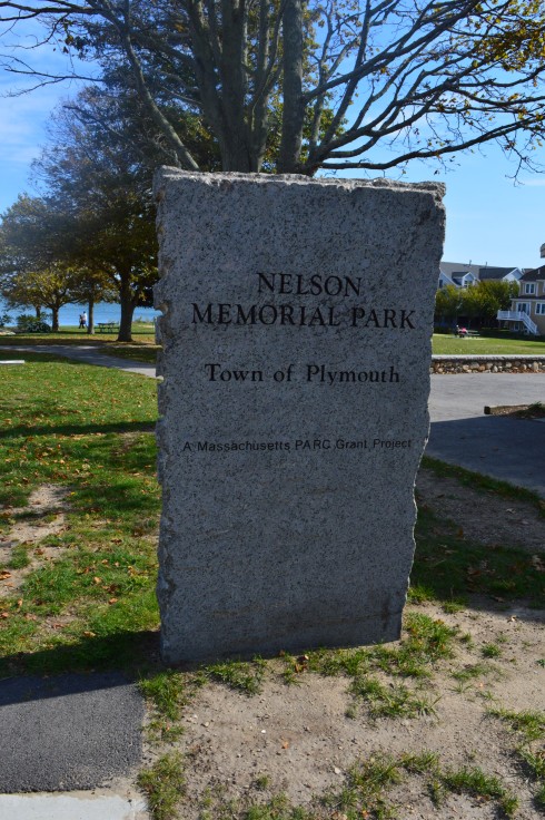
Nelson Memorial Park (Plymouth, MA)
Dates of Visit: October 8, 2016 & October 16, 2016
Location: Nelson St, Plymouth, MA
Hours: Open everyday, dawn until dusk
Cost: Free
Parking: There are about 50 parking spots
Dog Friendly: Yes
Highlights: Free parking, handicap-accessible, picnic benches and tables, playground area, beach area, restrooms, boat docking area, seasonal water play area, bike path
Web Site: Nelson Memorial Park
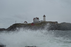
When people think of Plymouth Massachusetts certain places automatically come to mind; Plimoth Plantation, Plymouth Rock, Nelson Memorial Park. No, that’s not a typo. In fact, Nelson Memorial Park may be one of the best kept secrets in Plymouth (except may be the Grace Trail).
Located approximately a mile from the aforementioned rock, Nelson Memorial Park is a family friendly park with activities for children, pretty views and ample parking.


The water activity area, called a “splash pad” is an area that shoots out water for children, and probably even a few adults and dogs, to play in. A sign states that due to water restrictions the pad will be on only on days when the air temperature is above 80 degrees. There’s little threat of that happening for some time, although we have had some unseasonably warm weather lately.


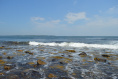
The park is relatively small but it still offers some very pretty scenery. I’ve always marveled at how clouds, even wispy clouds, can really accentuate the beauty of an area, especially by bodies of water.


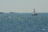
Some kayakers took advantage of the warm weather and calm water.


There is also a bike path from Nelson Memorial Park that goes all the way to North Plymouth (roughly 1.5 miles from Nelson Memorial Beach or over 2 miles if you start from Grace Trail which is located behind the park’s parking lot).
Although it is a small park, Nelson Memorial is a wonderful, peaceful area just minutes from the busy waterfront and downtown areas and a must-see if you’re in the Plymouth area.
A boy and his dog take in the views at Nelson Memorial. This is why dogs are so great. No matter how bad your day is or how lonely you might feel, you always have your dog.

There were many other dogs at Nelson Memorial Park and I was able to get some great shots of a few of them.
Remy is a 13 year old Lab, Boxer and Rottweiler. He had head and leg injuries when he was adopted. But, he looks fine right now!


Stella is a 7 year old Boston Terrier with a special talent. She likes to chase balls and hit them with her head, soccer style.


Below is a video of Stella playing.
Similar Places In New England I Have Visited:
Odiorne Point State Park (Rye, NH)
South Natick Dam Park (Natick, MA)
Date Visited: August 13, 2016
Location: 9 Pleasant Street South
Hours: Open daily, dawn til dusk
Cost: Free
Parking: There is free unmetered off street parking available but only a dozen or so cars can fit on the side street. You may be able to park somewhere else nearby and walk to the dam.
Time To Allot For Visit: half an hour to an hour
Dog Friendly: Yes
Web Site: South Natick Dam Park
Highlights: pretty waterfall, birds, pretty architecture, family friendly

Established in 1933 on the site of a former grist mill, the South Natick Dam Park attracts people far and wide for its pretty waterfall and scenic views. Construction of the South Natick Dam was completed on September 2, 1933. It replaced a timber dam that had been built at the site since 1760 by Matthew Hastings.


Millstones from the grist mill, which had served the area since colonial times, are embedded in the paved area of the area surrounding the dam.
There is also an island in the middle of the river, that you can see in some of the photos, which is named for Horace Holyoke, one of the characters from Harriet Beecher Stowe’s “Old Town Folks.” This character is based on her husband Calvin Stowe who was a South Natick native.
Since the water was at such a low level, I was able to walk down to the base of the dam and take some photos from where the water would normally be.


The South Natick Dam Park is adjacent to the Charles River’s dam, and is a popular spot for visitors, both human and animal.


A fun and unexpected stop on my way home from Broadmoor Wildlife Sanctuary, the South Natick Dam is a great place to take your dog for a walk, photograph or just sit at one of the benches and take in the beauty of the area.
World’s End (Hingham, MA)
Date Visited: August 28, 2016
Location: 250 Martin’s Lane, Hingham, MA
Hours: open everyday, 8:00 a.m. until sunset
Cost: $6 for adults, annual memberships which include free admission are available for $47
Size: 4.5 miles of continuous trails, 251 acres
Parking: there are three parking areas with roughly 20 spots each. When I left at 1:00 p.m. the lot was full and there was a line of about half a dozen cars waiting to get into the park.
Time To Allot For Visit: 2 hours
Dog Friendly: Yes
Trail Difficulty: Easy to Moderate
Highlights: scenic views of the Boston skyline and surrounding area, wildlife, occasionally they display exhibits at the park, benches to sit along the trail, pretty trees and flowers, perfect for walkers, joggers, runners, cyclists and even horseback riders and anowshoeing during the winter
Lowlights: limited parking (if you follow the reservation Twitter they post alerts when the lot is full)
Website: World’s End
I “misunderestimated” World’s End. I figured it would be an “easy” quick jaunt (I usually save my easier treks for Sundays). So, I slipped on my Chuck Taylor All-Stars and figured I would be home in a few hours. Not the best choice of footwear in retrospect. The trails can be rocky (particularly if you go off trail) and deceivingly steep in some areas.
There are a lot of side trails and it’s easy to get confused and cover the same area twice (or more) which can add quite a bit of time to your journey. In fact, for a while, I thought World’s End would never end. It’s a good idea to take a map of the trails with you. But, the trails are clearly marked and easy to negotiate with some slight inclines.


Undoubtedly, the main attraction for many visitors at World’s End are the views of the Boston skyline. World’s End affords several views of the skyline and surrounding areas. From the shoreline views to the views atop the highest point on the top of one of the many views of the rolling, hilly trails, the views are majestic.


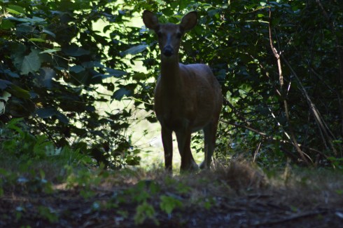
World’s End is teeming with wildlife, particularly birds. They’re very good at camouflaging themselves so you might have to squint to see a few of them.


But, the real gem of my visit was this deer I spotted on my way to Rocky Neck, one of the more secluded areas. We stood mere feet away from each other staring, until she finally took off.


There are not just an abundant of bird life in the water. Being a picture perfect summer day with low humidity and a slight breeze and calm waters, it was ideal for many of the boaters, paddlers and other seafaring folks.


This boater wanted some privacy, apparently.


World’s End has many other charming features such as this huge rock and an elevated viewing area for bird watching.


Of course, sometimes the more simpler things can be the prettiest features of the park. These flowers, tress and views off the water caught my eye.


Some people took advantage of the shore to skim some stones.


If there is one photo that sums up a trip to World’s End it is this photograph of a hammock with a bicycle next to it. World’s End is the perfect place to lie out in a hammock with only the sounds of nature to keep you occupied and maybe a good book or your Itunes collection.

There is also an art exhibit on display until Oct. 31, 2017. The display was created by Jeppe Hein, an artist based out of Copenhagen and Berlin. He is known worldwide for his interactive exhibits. The exhibit is called, “A New End”. According to the website for the exhibit, Hein wants to invite visitors to reflect and to transform how we view a familiar place like World’s End.


There were dogs-a-plenty at World’s End during my visit. World’s End is a great place for dogs to play around in since there are many open, grassy areas and, of course, water to frolic around in.


Casey is a happy, 8 year old English Pointer mix. He is a rescue.
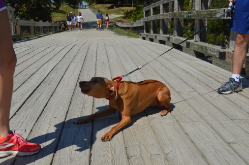

Gus is a 2 year old Ridgeback mix. He was very excited to be at the park!
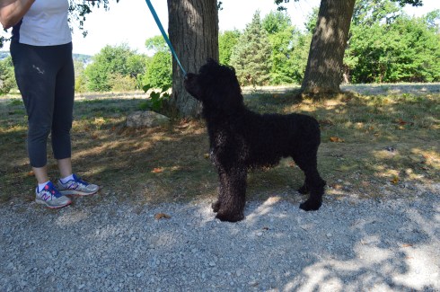


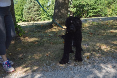
Tande is an 8 month old Portuguese Water Dog. If Tande looks familiar, you may have seen a similarly looking dog on the news. The President also has the same breed of dog. Tande came all the way from the Odysea Portuguese Water Dogs breeder in Colorado.


One of my easiest subjects to photograph ever, Bella is a gentle 7 year old Shetland Sheepdog.
I also saw a variety of other dogs playing in the water and running around.


viewsofanemergencyrn was kind enough to nominate me for the One Lovely Blog Award. Thank you! I usually don’t post about these awards but I figured I would play along since she was so nice to mention me and I wanted to acknowledge her. She is a sweet, strong person and a survivor (read her post to see what I mean).
So, the rues are I have to mention 7 random things about me.
- I didn’t take up photography seriously until last year
- I love dogs and all animals (big surprise there) but they also seem to love me – the key is to not show fear and be confident and friendly around them (they can sense fear)
- I am a pescatarian (I only eat seafood and do not eat meat, primarily)
- People often say I bear a strong resemblance to Donnie Wahlberg (but I can’t sing like him)
- Although I love dogs, I don’t have one (I have a cat instead)
- Until my work schedule got too busy, I had been an active literacy tutor at my local library
- I run (and/or walk) 3 miles (at least) a day everyday
The rules say to nominate other bloggers to participate. But, I’m going to skip that part. In my experience, people have usually already posted a blog like this in the past and don’t want to do it again, or they don’t participate or they seem to be too busy. But, thank you, once again for the mention, viewsofanemergencyrn! I do appreciate you and I look forward to reading more of your posts. You all should also!
Similar Places I have Visited In New England:

Webb Memorial State Park (Weymouth, MA)

Blue Hills Reservation (Milton, MA)
Breakheart Reservation (Saugus, MA)
Date Of Visit: August 14, 2016
Location: 177 Forest St, Saugus, MA 781-223-0834
Parking: There are about 30 parking spots at the entrance to the park. There is also off street parking and parking available down the street at Kasabuski Arena (201 Forest St).
Cost: Free
Hours: Open everyday sunrise to sunset
Size: 640 acres
Time To Allot For Visit: At least 1 to 3 hours
Trail difficulty: Easy to Moderate in some areas
Dog Friendly: Yes
Fun For One: Yes
Highlights: scenic views – especially from Eagle Rock, beach, play area for children, trails for cycling and running, fishing is allowed
Lowlights: side trails end without warning, some rocky terrain
Trail Map: Breakheart Reservation Trail Map
Website: Breakheart Reservation

Once a hunting ground and camp area for Paleo Indians as far back as the Archaic and Woodland eras (roughly 1000 – 2000 BCE), Breakheart Reservation boasts two grand lakes, scenic vistas, a beach, a play area for children and miles of trails.
The trails are mostly easy with some moderately difficult trails and inclines. The side trails can be challenging more because of the rocky and narrow terrain rather than the inclines. The one downside to taking the side trails is that some of the side trails end without warning, such was the case with the Saugus River Trail which is one of the first side trails you will see when you enter the park. The Cedar Glen Golf Course abuts the park. So, you’ll hear and see golfers whacking their golf balls around. Also, one side trail leads to the children’s camping site which you’re not supposed to access and yet another trail just ends near a store’s parking lot. So, you end up walking long distances only to have to turn around. If you want to avoid walking on trails that end suddenly, it’s best to stay on the main trail and the trails that loop around the lake.


The two lakes at Breakheart Reservation, Pearce Lake and Silver Lake, have trails that loop around the bodies of water.
Pearce Lake (considered the lower pond) has a beach and some very pretty views. It runs along the main trail and along some of the side trails. It is the larger of the two lakes and it is where the beach is loacted.


Although Lake Pearce is the larger of the two lakes, I found Lake Silver (the upper pond) to be more intriguing than Lake Pearce.


Lake Pearce has two smaller islands in the lake. One of the islands is accessible via a makeshift walking bridge of branches, sticks and anything else that you can walk on to get to the island. Except for some pretty views there wasn’t much on the island.


At an elevation of 206 feet, Eagle Rock offers scenic views of the Boston skyline and surrounding areas. One suggestion I would make if you do try to climb up to Eagle Rock (it’s a moderate climb) is to use the “back” way to the vista (aptly names Eagle Rock Trail). I went straight up along the rocky edge along the Pearce Lake Trail and it was more challenging than it would have been if I had gone up via the trail on Eagle Rock Trail. There are other points of higher elevation on other trails such as Castle Rock and Crow Hill.


There are many other beautiful and interesting things along the trails at Breakheart Reservation.
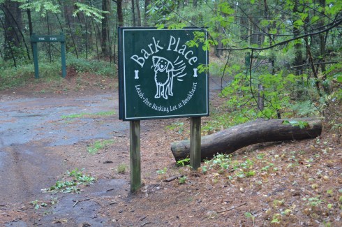
Breakheart has a paved main trail which is usually packed with runner, cyclists and people walking their dogs, especially at the Bark Place where dogs are allowed off leash for a section of the trail.
Breakheart Reservation stopped allowing vehicles on the trails some time ago. It was great not having to look over your shoulder or carefully turn a corner worrying if a car or other vehicle might be coming your way. It also allows lots of room for all the walkers, runners and, of course, the dogs that frequent the park.
These dogs had a great time at Breakheart Reservation during my visit…
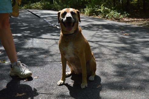


Bailey is a 6 year old Black Mouth Cur

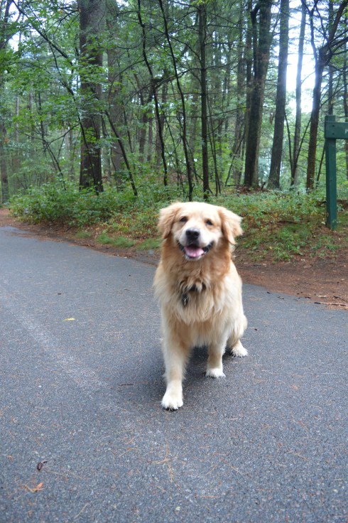
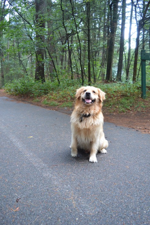

Cooper is a 7 year old Golden Retriever.


Free is an 8 year old Bichon and Shih Tzu mix.
Follow Me on Twitter:
and like me on Facebook:
or follow me on Instagram:
Similar Places In New England I Have Visited:


Ipswich River Wildlife Sanctuary

Below is a video of the view from Eagle Rock.
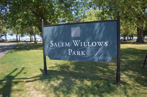
Salem Willows (Salem, MA)
Date Visited: July 23, 2016
Location: 167 Fort Ave, Salem, MA
Hours: The website for Salem Willows shows their hours as being daily from 11 a.m. to 11 p.m. but you can get in to the park before 11. We got their just before 10 and there was already some people there. I think the hours are the hours of operation for the restaurants and other businesses in that area.
Cost: Free
Parking: There are about 60 metered parking spots. The meters cost 25 cents an hour. There is also about 50 additional free parking spots in a nearby lot and off street parking is available.
Dog Friendly: Yes
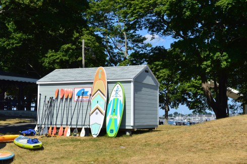
Highlights: Family friendly, arcades, restaurants, willow trees, harbor, scenic walking path, grassy areas to grill, relax and for kids to play, jetty, place to rent surfboards and other aquatic sporting goods
As I entered Salem Willows I couldn’t help but think of my childhood of carnivals and traveling shows. My friends and I would be so excited when the fair came to town. Now, the fair is always in town. In these days of sit down eateries and chain restaurants, it was refreshing. If you d go, try the slushies or get a cone at Cappy’s!
Salem Willows has changed so much since its original opening in 1880. Willows Pavilion which featured a skating rink and restaurant dominated the landscape. Now, the area where the takeout food vendors are located still keeps the name of “on the line”. But, the restaurants are much different. In place of the sit down, grand restaurants stand take out vendors and ice cream shops.


There is also a stage for bands and other entertainers to perform. Named after former Salem resident and veteran, the Robert F Hayes Band Stand holds a summer concert series every year as well as holding other events.

But, there is so much more to Salem Willows than nostalgic stroll past the smell of flour dough and the buzzing and ringing from the vendors and arcades. Salem Willows is also, as the name would suggest, known for all of the willow trees planted to offer shade and beauty to the area.


The mostly shady loop around the bay and back too the parking area is an easy half mile walk. Along the way there are benches to sit on and a jetty to fish off or just enjoy the views. The views from the bay were very pretty. A variety of flowers and scenic views frame the busy blue waterway.


There was a lot of activity on and in the water at Salem Willows. That is a man swimming in the last photos


There is also a place to rent surf/paddle/body boards and other watercraft and flotation devices.
Salem’s love of art is evident even in the most unlikely places. These trash cans and rocks displayed some of the street art of Salem. I especially like the art on the rocks. Each block has a different symbol of the area painted on them.
Salem Willows is a great place to bring your dog for a short walk. Dixie, a 4 year old Maltese, was enjoying the seasonal weather and cool breeze when she stopped to pose for photos for me.


Video of “on the line” from Salem Willows
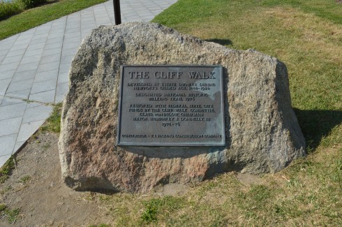
Cliff Walk (Newport, RI)
Dates Visited: June 25 & June 26, 2016
Location: 117 Memorial Blvd, Newport, RI (by Easton’s Beach)
Hours: open everyday dawn until dusk
Cost: Free
Parking: 3 hour metered parking is available at Easton Bank (but limited). You can also park at other entry/exit points along the trail off Bellevue Ave (such as The Breakers mansion at 44 Ochre Point Ave which is free for a limited parking time and Narrangasett Ave.)
Distance: 3.5 miles each way
Time To Allot For Walk: The website suggests 2.5 hours. I would allot 3-4 hours if you’re walking the entire trail (and back)
Dog Friendly: Yes
Highlights: scenic, free, always open, good for people of all ages, popular with joggers
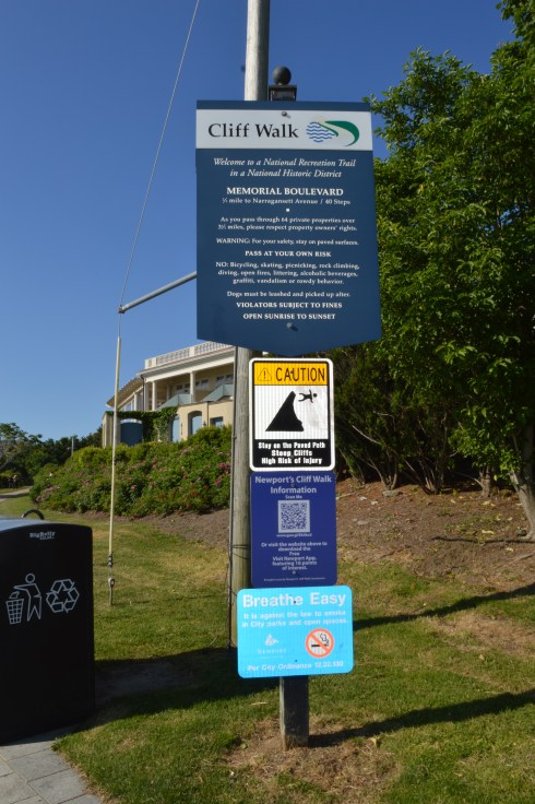
The Cliff Walk in Newport, Rhode Island, is not only a historically important attraction, it is also a great way to burn some extra calories or stroll along the shore, depending on your energy level.
Construction of the Cliff Walk began in 1880. Since then, the trail has been extended and designed over a series of redevelopment projects.
The Cliff Walk, which begins at Memorial Blvd or Bellevue Ave (depending on where you start) takes you on a series of breath taking views and, at times, challenging trails. Most people begin the trail at Memorial Blvd next to Easton’s beach (also known as First Beach). This trail ends at Bailey Beach. There is one “comfort station” on the walk at Narragansett Rd.
Rather than backtracking on the trail to get back, which you can do, it is easier to take the first right at Bailey Beach which leads onto Bellevue Ave. You can follow Bellevue Ave all the way back to Memorial Blvd or one of the many access points along the trail since it runs parallel to the cliff. It is easier because it is a straight and more direct route. I used this path to get back and it cut my walking time in half.
The views of Rhode Island Sound and First Beach from the Cliff Walk are astounding.
The first two thirds of the 3.5 mile trek (starting from Memorial Blvd) is easy and well defined. However, the terrain gets rocky, challenging and more scenic after the first 2 and a quarter miles. The steps and paths go from being well defined and wide.


to rugged, rocky and narrow


Other than the challenging terrain, the Cliff Walk is an easy, fun trail (it’s best to stop and turn around at the Breakers mansion or Webster Street if you’re starting from Memorial Blvd to avoid the more rocky terrain).
The Cliff Walk is also a good place for birding. There were lots of birds flying here and there, calling out to each other and even a few relaxing on the rocks. They look like they’re conspiring.
Perhaps the most well known part of the trail is the 40 Steps. In addition to providing you with an up close look of the shoreline, the 40 Steps also provides a little bit of history to the trail. The 40 steps is where the servants and workers of the mansions used to congregate during the Gilded Age.


One of my favorite parts of the walk was watching the people on the various water crafts and other flotation devices.


Another great thing about the Cliff Walk are the unusual features of the trail. Tunnels, makeshift trails, colorful flowers, even a memorial attached to a rock and other decorative items are scattered throughout the Cliff Walk. The memorial on the rock is dedicated to former surfer pro Ryan Patrick Roberts, nicknamed “Gazoo”. Roberts, a Newport native, passed away February 5, 2000. One wonders how they got the plaque on there and made it stay there.
The Cliff Walk also offers many great views of the mansions and other buildings built along the shore.


Some of the visitors at the Cliff Walk weren’t contend to stay on the trail.


There were a lot of dogs on the trail during my visits. It is a great place to take your pup for a walk. But, you may want to avoid the rockier terrain when you take your dog to the Cliff Walk.
Remy is a 10 month German Short Hair Pointer and a loyal Red Sox fan I presume.
Winston, a 4 year old Maltese from Seattle, WA, took the easy way around the Cliff Walk


Fion is an 8 year old Petit Basset Griffon Vendeen. Her breed is named after the area of France where that breed originated from (Vendeen).


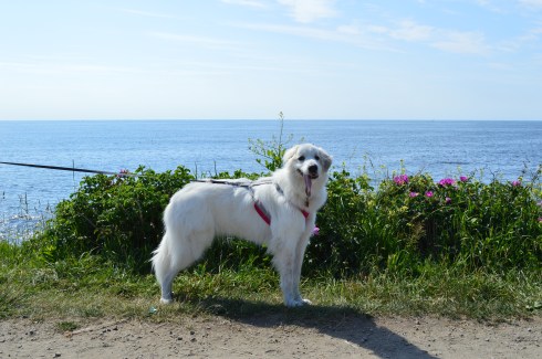
Believe it or not, Penny, a Great Pyrenees, is only one year old.

Connect with me on Facebook to see additional photos, videos and other posts I do post on this blog. Thank you!
