Category Archives: trail

Heublein Tower (Simsbury, CT)

Date Of Visit: September 9, 2017

Location: Talcott Mountain State Park, Route 185, Simsbury, CT

Cost: Free

Hours: The trail to the tower is open daily from sunrise to sunset.

Hours for the museum in the tower are as follows:

Memorial Day Weekend through September 30th, the museum is open Thursday through Sunday only.
October 1 – October 31st the museum is open Tuesday through Sunday.
Museum hours are 10 am to 5 pm. Pets, food, drink, and walking sticks are not allowed in the museum.

Parking:

Handicapped Accessible: No

Dog Friendly: Yes

Trail Size/Difficulty: 2.5 miles round trip/moderate with some sharp inclines.

Website: Friends Of Heublein Tower

Talcott Mountain State Park

Highlights: tower, scenic views,

Tips:

  • There is no parking lot at the park.  Parking is allowed on the side of the road at and near the trail to the tower
  • Don’t forget to check out the scenic views on the way up to the tower by taking the trail closest to the ledge (the trail on the right after the trail splits
  • The trail has a steep incline at the beginning but evens out and becomes easier about halfway to the tower
  • If using a GPS: Parking is located on Summit Ridge Dr. Simsbury, CT 06070

IMG_1752

Once the home of Gilbert Heublein (pronounced “High-Bline”), Heublein Tower offers some of the most pretty views in the Connecticut River Valley.

As legend has it, during a hike of Talcott Mountain with his fiance Louise M. Gundlach, he promised her that one day he would build her a castle there.  He would make good on his promise in 1914 with the Heublein Tower.

Heublein manufactured such delicacies as A1 Steak Sauce and Smirnoff Vodka.  Anyone else hungry for some steak and vodka? A barbecue, perhaps?

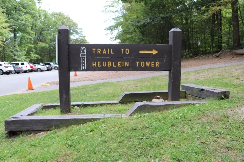
Heublein Tower is located along a trail that begins at Talcott Mountain State Park.  Parking is available along the sides of the road to the tower.

Along the trail to the tower, you can take the trail on the right to see some pretty views of the Farmington River Valley.  As you can also see by some of the photos, the trail does have some inclines.  There are also some benches along the trail at the beginning of the trail.

During certain days you can enter the tower and view the rooms in the tower.  The at times arduous hike is worth it for the views of the tower and the self guided tower of the inside of the tower.

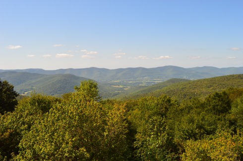
The views from Heublein Tower are stunning.

The trails are not too hard for man nor beast.  Dogs of a variety of sizes and breeds were on the trail during my visit.

Hiro is a 7 month old Cobberdog

Monte is a 2 year old Tibetan Terrier.

Kaiser is a 2 year old Airedale.

IMG_1961

Roscoe (on the left) is a 3 year old Rottweiler.   Love his bandanna!

Onyx (on the right) is a 2 year old boxer.


Attleboro Springs Wildlife Sanctuary (Attleboro, MA)

Dates Of Visits: May 20 & June 19, 2017

Location: Park St, Attleboro, MA (behind the La Salette Shrine at 947 Park St) (45 minutes southwest of Boston, MA, and 15 minutes northeast of Providence, RI)

Hours: Open daily sunrise to sunset

Cost: Free but donations are appreciated

Parking: There is room for about 10 cars in the lot next to the trail.  You may also be able to park at the Lasallette Shrine in front of the trail.

Trail Size/Difficulty: 3 miles total (.5 handicapped accessible), easy with a few gentle inclines

Handicapped Accessible: Yes, .5 miles of the trail are handicapped accessible with boardwalks, along the pond and vernal pool.  The rest of the trails are dirt, narrow and rocky and not handicapped accessible.

Dog Friendly: Dogs are not usually allowed on the Audubon trail but they are allowed in certain sections of the trail at Attleboro Springs (on the reflection trail I believe)

Website: Attleboro Springs

Trail Map: Attleboro Springs Trail Map

Highlights: wildlife, vernal pool,

Fitbit Stats: 2,712 steps, 242 calories, 1.19 miles

DSC_0076

Often overshadowed by the more well known cities and towns  south of Boston, Attleboro, MA, is one of the more underrated sections of Massachusetts.  It is also the site of two beautiful Audubon sanctuaries (Attleboro Springs and Oak Knoll) .  I decided to visit Attleboro Springs first.

Attleboro Springs is a little hard to find.  Basically, look for the La Salette Shrine on Park St.  The path to the trail is the very next turn after the shrine.

From the entrance to the park, one word comes to mind – charming.  A pavilion and map of the trail are located on the trail at the entrance.

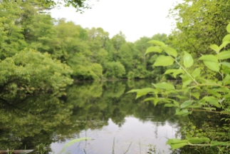
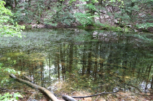
The main trail at Attleboro Springs is the Reflection Trail.  The Reflection Trail encircles a pond.  A vernal pool with a vernal pool are also on the trail.  It is the easiest trail to take, although there are additional side trails.

Birds, frogs, tadpoles and other kinds of wildlife are abundant along the trail, particularly at the pond and vernal pool.

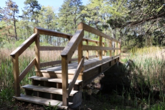
I love side trails and going off the beaten path.  So, of course I tried them.  There wasn’t much to see except a brook and a cool bridge on the side trail.

The Reflection Trail is very easy with few inclines or rocky terrain which makes it ideal for jogging on or taking walks on, particularly since it is a short trail (about 3/4 of a mile).

I know I write this often.  But, what the heck.  I could spend all day here.  The trails are easy.  The pond is a popular spot for birds and aquatic life (naturally).  And there are seats to watch all the life around you.  As an added bonus, it’s free to visit.  It’s usually the smaller, charming places that stick with me.  In fact, I liked it so much I visited it twice.

The Nomad’s link of the day is a blog post by WordPress blogger and fellow New Englander  Kristen.  Kristen’s blogs are peppered with book reviews, pretty photos and interesting observations.  Kristen posted about  place that is very close to this trail and is one of the more popular places in Attleboro,    La Salette is a popular place to visit year round.  But, it is especially busy during the winter each year when they host a holiday light display.  You can find Kristen’s wonderful blog post here.


Rattlesnake Gutter (Leverett, MA)


Dates of Visits: May 27 & 29, 2017

Location: 16 Rattlesnake Gutter Rd, Leverett, MA

Hours: Open daily, sunrise to sunset

Cost: Free

Parking: There is not a designated parking area.  But, there is an area to park by the front gate on the side of the road on Guttersnake Rd

Trail Size/Difficulty: 1.93 miles (Rattlesnake Gutter trail) with connecting loops and other trails that can add a significant amount of distance to your hike.  Easy too moderate trails.

Handicapped Accessible: No.  The terrain is rocky with some steep inclines

Dog Friendly: Yes

Fitbit Stats: 3.45 miles, 711 calories, 8,027 steps

Highlights: chasm, wildlife, easy to moderate trails, art, unique rock formations, ponds

Website: Rattlesnake Gutter Trust

Trail Map: Rattlesnake Gutter Trail Map

IMG_7093

Don’t let the name scare you.  There really aren’t any, or at least not many, rattlesnakes at Rattlesnake Gutter Trail.  Legend has it rattlesnakes once did populate the area.  But, due mostly to a concerted effort to rid the area of these snakes, you’e rarely see a rattlesnake there.

I actually had to make two visits to this trail because some of the photos on one of memory cards were not saved.  Yeah, okay, twist my arm.  I’ll go again, I figured to myself.

Before you even reach the trail, there is an interesting find in a field at the entrance of Rattlesnake Gutter Rd.  A group of bee hives sat under a tree in a pretty field while what looked like a falcon soared high above.

The trail is known more for the chasm that runs through most of the main trail from the Rattlesnake Gutter Rd entrance.  The trail is described as a boulder that runs 3/4 mile long and 1/8 mile wide.  It produces a lot of pool-like streams between the rocky edges.

There are also several pools of water along the trail with some frogs and other aquatic animals.

Between the rocky sides there is a roughly mile trail with several mini waterfall-like streams and a very long way down if you’re not careful.

The dirt trails are easy to moderate in some areas due to the somewhat strenuous inclines in some areas.  At least they were strenuous to a middle aged hiking novice.

The origins of the chasm are unclear.  Some theories include a sub glacial melt water channel or a tear at the site of an old geologic fault.  Another theory suggests it was caused by a spillway for a temporary pro glacial lake.  I would go with the last one.  Just because I like to say “pro glacial.”  In any event, the rocks show the aftermath of some major event.

Unexpectedly, we found some art along the rocks.

It’s not known who created this art or why.  But, it is pretty cool.  You know how if you look at a photo or rock long enough, you can see other images?  Well, to the right of the tree in the photo below just above the greenery and boulder in the right hand corner of the photo, there appears to be possibly the outline of a cat’s face (you may have to tilt your head to see it). Or, maybe I’ve just drank too much caffeine and I’m seeing things.   It could just be the way the rocks appear from the weather and erosion.

IMG_7079

We took the main guttersnake trail to the connector loop to Whitney Rd.  The connecting loop is hard to find.  It is actually a trail made into the side of the hill on the trail that was made into a zig zag design. I wouldn’t have probably found it if I hadn’t noticed someone walking down what looked like the side of a hill.

The Whitney Trail looks a little confusing at first (make sure to follow the red marked trees).  But, after a short distance, there will be signs and maps that will help you stay on the trail.  That is one of the unusual things about this trail.  There are several maps posted throughout the trail.  There are alternate routes you can take if you have the time and curiosity.  While I am always curious, I didn’t the time.  So, I stayed on the Whitney Rd trail.  This intersection of trails can take you farther into different sections of the trail system.  But, as time was a factor, I was unable to explore more.

IMG_7134

Whitney Rd is just that, a road.  There are some pretty houses, cute decor and signs as well as beautiful landscapes along this part of the trail.

There were also some interesting rock formations and pretty trees along the way.

Along Whitney Rd, on the left of the trail we saw am empty area with tall trees and what looked like an overlook.  To our surprise, we found what looked like an area for parties or other events.  A van with speakers and what looked like an audio system was parked in the area.  There was also a table with chairs and jug of some kind of adult concoction and some other artistic designs.

Rattlesnake Gutter is the perfect place to take your dog.  Although, I would only recommend it for a “fit” dog, as I would recommend it for a “fit” person since the inclines can be deceivingly steep in some places.

These dogs had no problem with the trail.

Huckleberry is a rescue from Mississippi.

Luna is a 3 year old rescue.

Below are two videos of the streams at Rattlesnake Gutter Trail.


Eastern Marsh Trail (Salisbury, MA)

Date Of Visit: May 21, 2017

Location: Friedenfels St, Salisbury, MA

Hours: accessible everyday

Cost: Free

Parking: There are 15 total parking spots designated for the rail trail.  There are 5 spots in the main parking lot on Friedenfels St at the entrance to the trail.  There are also 10 parking spots across the street from the main parking lot.  There is a larger parking lot in front of the main parking area that is a private lot.  Don’t park there as your car could be towed.


Trail Size/Difficulty: 1.4 miles, flat, easy trail.

Handicapped Accessible: Yes, the main trail is handicapped accessible.  The side trails are not accessible due to the rocky trails and steep inclines.  There is ramp to the right of the staircase to the trail at the parking area.

Dog Friendly: Yes

Highlights: scenic views, wide and easy trail, side trail, dog friendly, family friendly, benches to sit at, wildlife

Fitbit Stats: 1.8 miles, 502 calories, 4,504 steps (one way)

Website: Eastern Marsh Trail

Once the site of a grand railroad that ran from Boston to sections of Boston’s North Shore and New Hampshire, the Eastern Marsh Rail Trail is a true gem of the coastal section of the north shore (cities and towns north of Boston).

The railroad, which would be extended over time, began operating from Boston to Salem in 1838.  It would later be extended to Salisbury and other territories in Massachusetts and New Hampshire in 1840.

Alas, the last train crossed the Merrimack River in 1965, leaving behind abandoned rail lines.  Eventually, it was proposed that the rail lines should be converted to rail trails.  Now, many decades later, instead of being used by noisy engines often carrying dangerous cargo, the rail lines are being used for exercise, dog walking and just enjoying nature.

The 1.4 mile Eastern Marsh Trail connects to the Clipper City Rail Trail  to the south and the Ghost Trail to the north.

The Eastern Marsh Trail, which is part of a system of trails along the coastal north shore which includes Newburyport and Salisbury.

The trails at Eastern Marsh Trail are flat with no significant inclines.

The Stevens Trail is a short trail (about .4 mile) that hooks up back to the main trail.  There are some views and a cute bridge along the trail.  You may see a few chipmunks along the way.  It has some minor inclines but I would classify it as easy.  This trail is not handicapped accessible due to the rocky terrain and a bridge that only has steps and no ramp.

The views along the trail are beautiful.

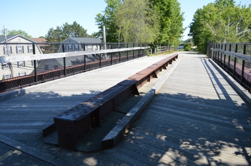
There are still remnants from the original railroad at the beginning of the trail.  Maybe some day they will revive the rail!

This mural from the Salisbury Art Stroll held on May 13 was still remaining along the trail.  I just missed it by a week.  But, I may have to drop by next year to check out the art on display.  This mural was a collaborative effort worked on by a group of artists.

IMG_5985

There were lots of little critters on and off the trail.  I would hear rustling in the trees or bushes in one direction only to be distracted by some other sound of activity in another direction.

Birds

turtles

and chipmunks

DSC_0098

are just a few of the animals you may see on the trail.

But, birds, chipmunks and turtles aren’t the only animals who frequent the trail.

The trail is a popular with dogs and their walkers.

I love the “side eye” Peter, a 14 year old Golden Retriever, was giving his human walker in the first photo.  All he wanted to do was greet me and say hi.

I love how May’s white fur looked against the background.  May is a 6 year old Golden Doodle.

Look at the big smiles on Mako (on the right) and Murphy (on the left)!  Mako is 6.5 years old and Murphy is 7 years old.  They are both Labradors.


Grace Trail (Plymouth, MA)

Date Of Visit: October 16, 2016

Location Nelson Memorial Park

Hours: Open everyday, dawn until dusk

Cost: Free

Highlights: biking and walking trail, flowers, scenic views, stones with words and phrases of encouragement on them

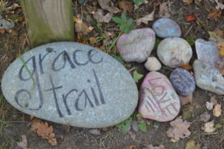
The G.R.A.C.E. Trail in Plymouth, MA, is not your average walking or biking trail.  Standing for Gratitude, Release, Acceptance, Challenge and Embrace, the idea for this trail is the creation of author, life coach and TED X speaker and Plymouth, MA, resident Anne Jolles.  The trail is designed to help people reflect on and overcome their struggles.  According to Ann Jolles’ website, the trail is meant to get people from, “a state of confusion and overwhelm to one of hope and possibility.” Now, inspired by Jolle’s trail, GRACE trails are appearing all over the country.

There may be many grace trails but this one in Plymouth, MA, is where it all started.

dsc_0144

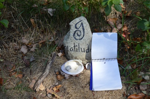
Located next to Nelson Memorial Park, GRACE trail appears like any other trail.  However, upon closer inspection, it is very different.  Rocks and stones with words of encourage and placed along the side of the trail. At the entrance of the trail, there are rocks with words of encouragement (these rocks have gratitude and “just breath” written on them) and a notepad to write your own words of encouragement.  The person who left a message on the notepad about how he or she left someone who was abusive and “free” is written underneath the message.  It’s very inspiring and for the cynics out there who think that may have been a “faked” message (I know you may be out there), who cares?  It’s something people could still draw inspiration and maybe a nudge to do the same thing.  And that is what this trail is all about; inspiring others and grace.

Along the trail, you’ll find other signs of inspiration and grace.

I love how one of the rocks says to “accept…or not.”  You don’t have to and should not accept certain things in your life.

dsc_0969

dsc_0970

These rocks encourage you to embrace the possibilities and “hang on” to hope.

There are messages of hope and inspiration everywhere

I know I could really use a place like this with all of its positivity and inspiration.  I would go everyday if I lived closer to the trail.

The trail are very easy and level along at Grace Trail.

In addition to the pretty stones and encouraging words, there are scenic views and trails that go off into other areas like the trail below that leads to the beach.  The views are very pretty along the trail.

The beach offers views of Plymouth Harbor and the surrounding area.

Since it was such an unseasonably warm autumnn day, there were an assortment of boats (motor powered and otherwise) in the water.

There is also remnants of a railroad that used to go by the area.  Flowers and grass now grow where the train used to run.

The Grace Trail is also dog friendly.  Lilly, a 9 year old Palmarin, enjoyed walking along the trail.

Similar Places I Have Visited In New England:

dsc_09423

Clipper City Rail Trail (Newburyport, MA)

dsc_0448

Canalside Trail (Turner Falls, MA)


Clipper City Rail Trail (Newburyport, MA)

Date Visited: June 18, 2016

Location: Off Low St, Newburyport, Massachusetts

Parking: I entered the trail from Low St and free parking is available at Cushing Park on Kent St (2 blocks away from the entrance to the park) and parking was ample there.  There are several other trailheads and depending upon where you join the trail there are various parking areas.  You can find parking at the local MBTA station on Parker St and some other designated places.  it is best to check their website for specific parking areas.  You may also find off street parking.

Hours: open everyday, dawn until dusk

Cost: Free

Dog Friendly:  Yes

Distance: 1.1 miles each way

Time To Allot:  Half an hour to an hour

Highlights: bridges, trails for cycling, running and walking, art, artifacts, flowers, trees, historical and other surprises along the trail.

The Clipper City Rail Trail is not just your ordinary run of the mill paved trail.  The 10 foot wide trail which eventually spills out on the Newburyport Harborwalk, is lined with various works of art and other surprises.  The great thing about the art and items on the trail is that they have special meaning and represent the people and times of the area.
DSC_0767DSC_0770

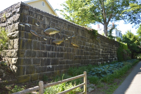
“Native Fish” by Bob Kimball (2010).  The sculpture consists of eleven stainless steel fish mounted on a large granite block wall on the edge of the Rail Trail.  The group of fish consist of half a dozen foot-long herring, two three-foot tuna, a five-foot cod and striped bass, and a seven-foot bluefin tuna.  The artist, Bob Kimball, is a brick and stone mason who specializes in working with copper, brass, glass and stainless steel.  He is based in the state of Washington.

DSC_0772DSC_0774

The “Great Blue Heron” piece was also created by Bob Kimball in 2010.  It was commissioned in memory of John Soward by his family and friends.  According to the plaque placed on the wall the work of art was dedicated to John Soward who lived on the other side of the wall where it is so prominently displayed.  The sculpture is based on John’s painting of the great blue heron.  John’s painting is below.  It’s a pretty accurate rendition.
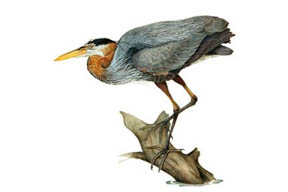
soward watercolor

Around every corner and stretch of trail there is something interesting or fun to keep your interest peaked.  In fact, waiting to see what is next on the trail is enough to keep you going along the trail.
DSC_0784

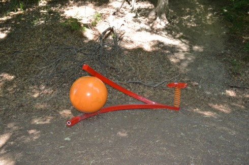
“Wishbone” by James Irving (2010) is an interactive statue crafted by the Vermont based artist.  And, yes, you can sit on the seat there!

DSC_0796

DSC_0802

DSC_0792

“Steam Loco” by Scott Kessel and Matt Niland (2010).  Kessel and Niland, both from Middletown, CT, created this play locomotive train to resemble the locomotives of the time.  It is a magnetic interactive destination for young children and their families.

The 19th century granite blocks pictured above once supported the Old Railroad Bridge Embankment at the Merrimack River (a mile or so from their current location).  The blocks were relocated during the building of the rail trail.  They are purposefully displayed in a star pattern.

There also a couple of bridges along the trail.

DSC_0808DSC_0811

Unfortunately, some of the works of art have either been vandalized or disturbed by nature.  As I often say, this is why we can’t have nice things.This work of art “Will He” by Simon LaRochelle, based out of Quebec, is supposed to have a bicycle wheel in between the two slabs of limestone.  See the actual sculpture below.
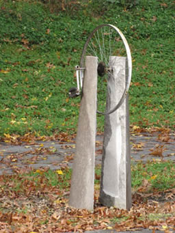
Will He

Some surprises along the trail are less artistic than others.

DSC_0819

DSC_0838DSC_0836DSC_0835

“Torrential Flight” an aluminum sculpture by Brian Russell (2010) from Tennessee.

“Eclipse” by Rob Lorenson (2010) is a stainless steel.  Rob is based in Middleborough, Massachusetts.

Rob has two sculptures on the trail.  Closer to the harborwalk at the end of the trail stands his sculpture “Brushstrokes” a  red powder coated aluminum
DSC_0909

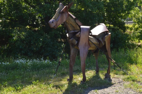
Newburyport purchased a horse sculpture called “Clyde” from artist Jamie Burnes based out of Weston, Massachusetts and Santa Fe, Mexico. Jamie specializes in making sculptures of horses, bulls and other land based animals.  Originally displayed on the waterfront as part of the sculpture park, Clyde is made of corten weathering steel and black locust wood and was made specifically for the trail.

DSC_0928

“Sparrows” by Dale Rodgers (2011) based in Haverhill, Massachusetts.  “Sparrows” is a 16-foot corten weathering steel sculpture of two sparrows, naturally.

“G-Swirl” by Dale Rogers (his second sculpture on the trail) (2010) is a scaled up stainless steel abstract sculpture.

DSC_1024

“Peace Offering” (2012) is not just a bronze sculpture.  It is actually a bench by Michael Alfano of Hopkinton, Massachusetts.  The bench acts as  a functional bench featuring a dove, in which the tail becomes the head of a hawk and the wings become hands that invite two people to sit down and discuss their differences.  The sculpture, which now sits at the harborwalk, down a flight of stairs from the rail trail, was purchased by Newburyport for the Rail Trail, in bronze.  There are also additional castings of the sculptures.  One of the additional castings was a gift of the 2012 Hopkinton High School graduates and is still at the high school.


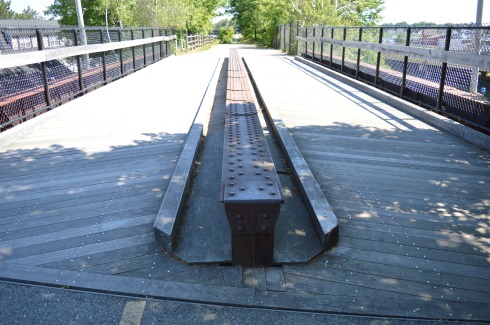
Many of the models and structures are relevant to the history of the area like this rail.  The rail on the bridge is from the original rail trail that was in place during the train wreck on May 23, 1873.  The accident was due to a misplaced switch that forced a freight train onto a dead end side track.  Interestingly, no one was injured during the accident (the two passengers- a fireman and an engineer – jumped out of the train before it crashed) and the train was back on the track two days later.  But, it became famous, in part because many of the onlookers and the aforementioned engineer and fireman requested their photo be taken at the wreck.  The trail is also popular with skate and long boarders as you can see in the final photo.
DSC_0994DSC_1000DSC_1027

At the end of the southern most side of the trail is “Archway”by Mark Richey Woodworking.  The archway, made of white oak, leads to the commuter train, fittingly, at the end of the rail trail.

DSC_0942

There are also several well manicured and cared for plants, trees, graffiti and grassy areas on the trail.

This slideshow requires JavaScript.

As an added bonus (I know some of you who will really appreciate this), there is a pathway cut through the trees and brush to an ice cream shop with a handy sign to point the way.

There was also a PanMass Challenge when I was visiting.  The bike ride is actually a 5 mile loop that ends at the harborwalk.

With its long, wide trails and grassy areas, the Clipper Rail Trail is a great place to walk your dog.  Rufus, a 5 year old sheepdoodle, enjoyed the cloudless, sunny day on the trail.

DSC_0936DSC_0931

And Savannah, a 4 year old Lab mix, took a break to pose for me.

DSC_0887DSC_0879


The Nature Trail and Cranberry Bog at Patriot Place (Foxborough, MA)

Date visited: January 9, 2016

Although the area is mostly known for being the home of the New England Patriots and its adjacent marketplace, Patriot Place has another impressive attraction – The Nature Trail and Cranberry Bog.  Admission to the trail and bog is free and the parking is ample evident by the photo below.  You can also park in the lots in front of the store and walk down to the trail.

DSC_0906

From the entrance the Nature Trail and Cranberry Bog greets you with a charming sitting area and pretty trees.

This slideshow requires JavaScript.

Although most of the vegetation is dead (save for a few stubborn blueberries and cranberries), a thin layer of ice covered most  of the pond and the trees are bare this time of the year, the Nature Trail and Cranberry Bog at Patriot Place in Foxboro, MA, is just as beautiful in the winter as it is during the summertime.

This slideshow requires JavaScript.

Located directly behind the expansive Bass Pro Shop, the Nature Trail and Cranberry Bog is a .5 mile loop with a 3 percent grade and some inclines as much as 12 percent.

It is a mostly dirty trail with a few boardwalks and bridges.  There are two benches in the middle of the first walking bridge.  Overall, it is an easy to semi-moderate trail.  I saw people of all age groups handle the trail, inclines and all, with little difficulty.

I found this strange, creepy looking branch or alien arm protruding from the ice.

DSC_0836DSC_0837


An extra bonus for any Patriots fan is you can see Gillette Stadium (the stadium the Patriots play in) from the main road on the way to the Nature Trail and Cranberry Bog.  You can also catch a quick glimpse of some of the stadium from the entrance to trail and bog.

DSC_0899

After finishing the loop, I met Chandler, a beautiful 6 year old tri-colored English Setter (thank you for the clarification, Adam).

DSC_0833 Thank you for reading and please like my Facebook page to view videos, photos and more that I do not post on this blog:

http://www.facebook.com/newenglandnomad

Please check out my other WordPress blog:

https://mrwayne.wordpress.com/


Mount Greylock (Lanesborough, MA)

If you want to feel on top of the world, or at least on top of Massachusetts, there’s no place like Mount Greylock.

DSC_0912

Clocking in at 3,491 feet and about an hour and a half west of Springfield, MA, Mount Greylock is the highest point in Massachusetts.  With its miles of hiking trails and scenic views, Mount Greylock is the perfect destination for hikers and nature lovers.  There is also a paved road to the summit with places to pull over to view the scenic beauty.

DSC_0718  DSC_0721 DSC_0724  DSC_0728   DSC_0735      DSC_0742 DSC_0746       DSC_0751       DSC_0737 DSC_0738    DSC_0722  DSC_0717

There are also some cute and pretty attractions off the main trails.

DSC_0904 DSC_0792 DSC_0712 DSC_0687   DSC_0681

Even the views and flowers at the Visitor Center were captivating.

DSC_0657 DSC_0660 DSC_0661 DSC_0665 DSC_0664 DSC_0656

Along the trails

But, the pinnacle of Mount Greylock is the tower that sits atop the summit.  First built as a tribute to the veterans of the first World War, the tower now serves as a memorial to all service members who have served the country.  When it is lit each night, the tower is said to be able to be seen from 70 miles.  The granite from which the tower was came from my hown city, Quincy (pronounced kwin-zee), Massachusetts.

DSC_0781 DSC_0779 DSC_0885 DSC_0884 DSC_0883 DSC_0891 DSC_0900

Mount Greylock State Reservation is a dog friendly park.  During my visit there were many dogs out enjoying the views.  DSC_0649

Izzy was patiently waiting for his mom outside the visitor’s center.

DSC_0670

Peanut was getting ready for his big hike.

DSC_0753

Max was tired from hiking the trails at Greylock.

DSC_0879

This fella was enjoying some rays.

Most of the wildlife at Mount Greylock was hidden during the day.  But, I did see this grasshopper.

DSC_0676

Mount Greylock is also a popular spot for paragliders.  In fact, several paragliders took off from Mount Greylock during the day.

DSC_0834 DSC_0829 DSC_0827 DSC_0778  DSC_0860

DSC_0861       DSC_0812   DSC_0766

Mount Greylock is also a stop on the Appalachian Trail.  It’s a long way to Georgia.  Maybe I’ll try it sometime.

DSC_0780 DSC_0902