Category Archives: lighthouse

Old Scituate Light (Scituate, MA)

Date Of Visit: April 10, 2021

Location: 100 Lighthouse Rd, Scituate, MA (about 40 mins southwest of Boston, MA or 1 hour northwest of Providence, RI)

Parking: There is a small parking area for about half a dozen cars and an overflow lot across the street

Hours: Open daily dawn until dusk

Cost: Free

Universally Accessible: Yes, the lighthouse is universally accessible but the jetty may not be universally accessible
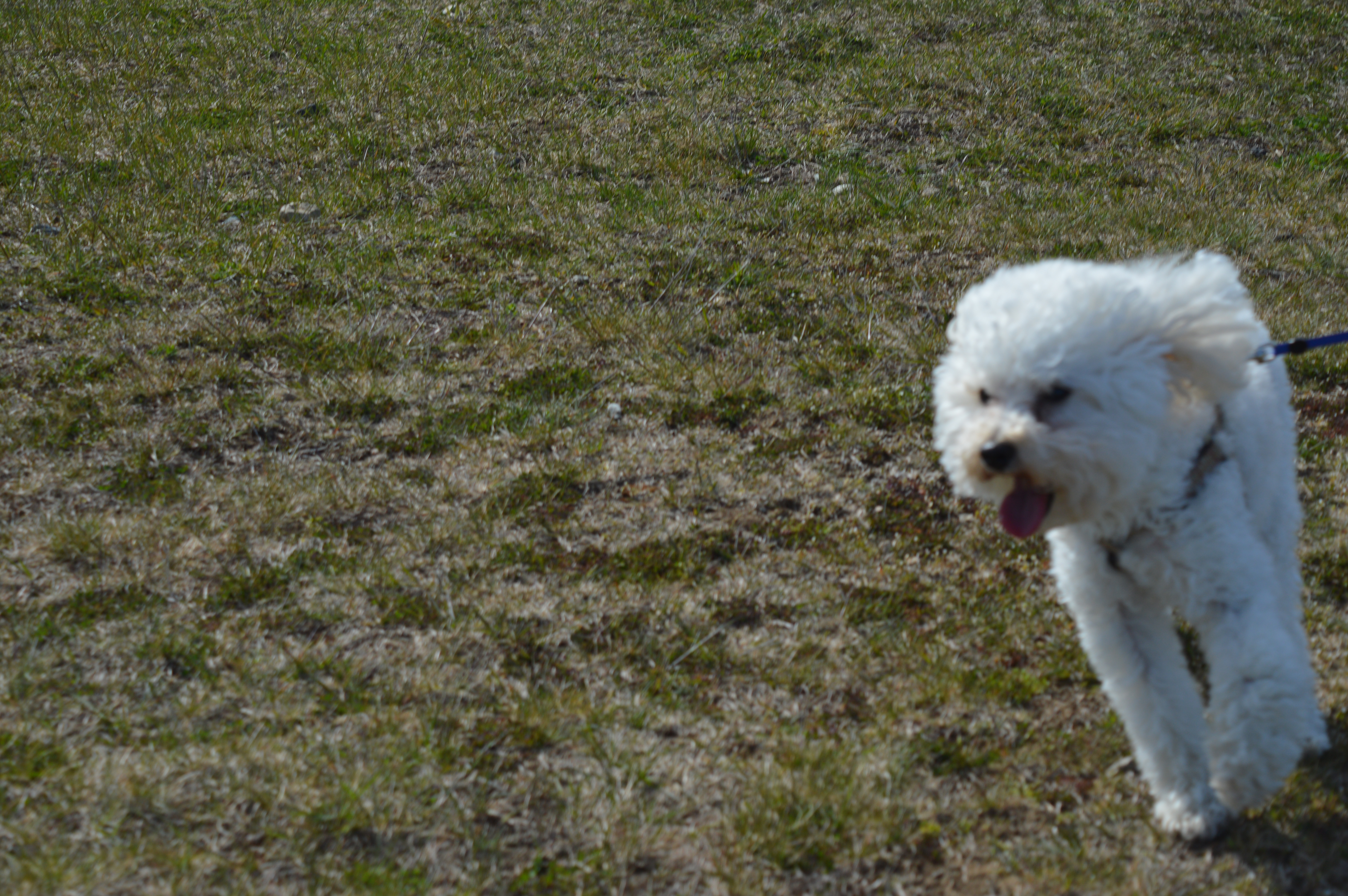
Dog Friendly: Yes

Website: http://scituatehistoricalsociety.org/light/

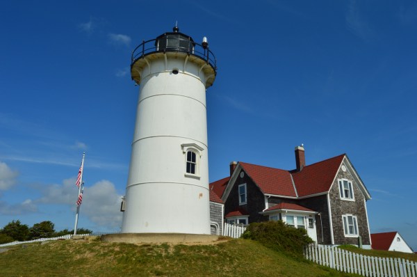
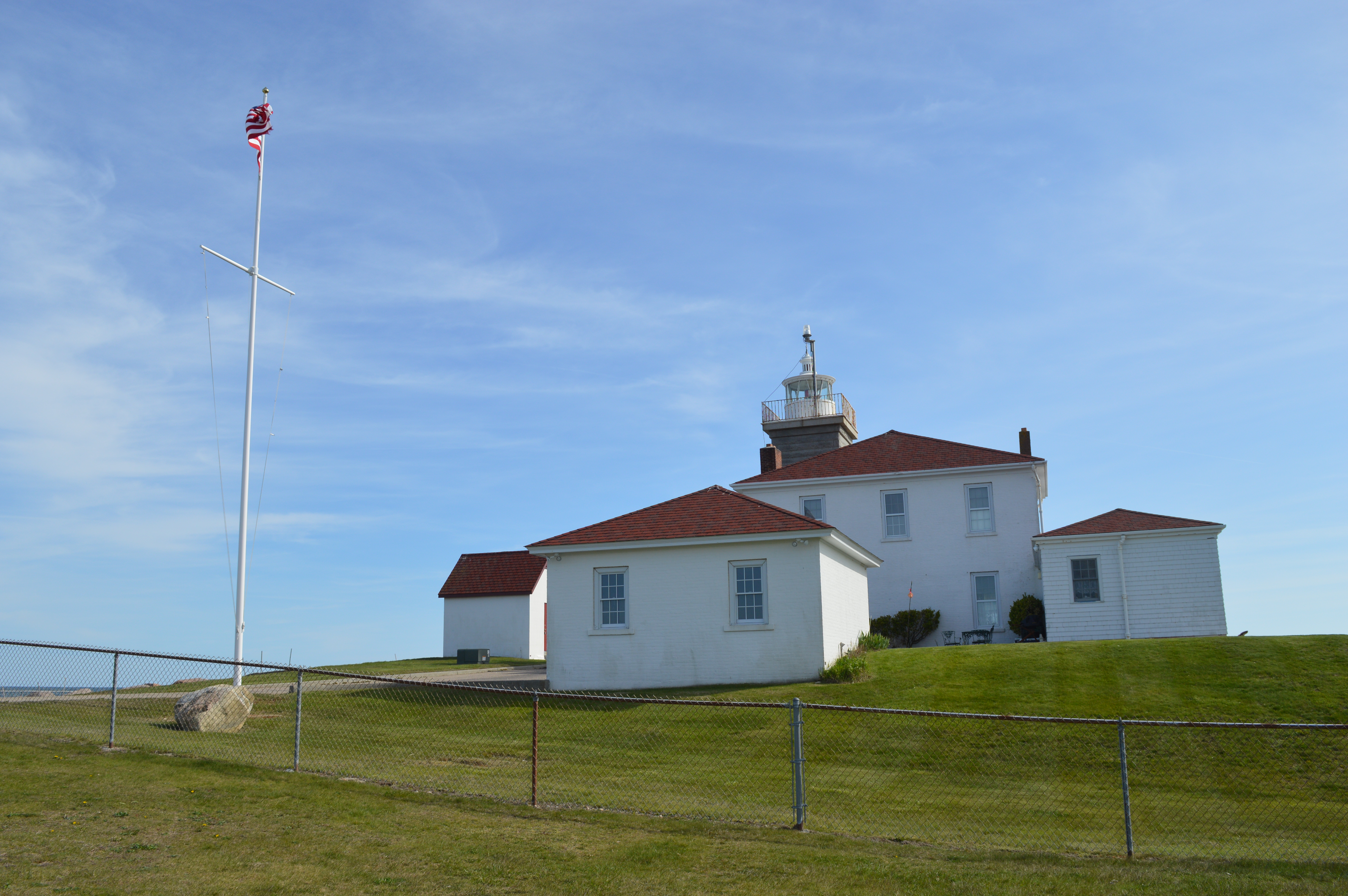
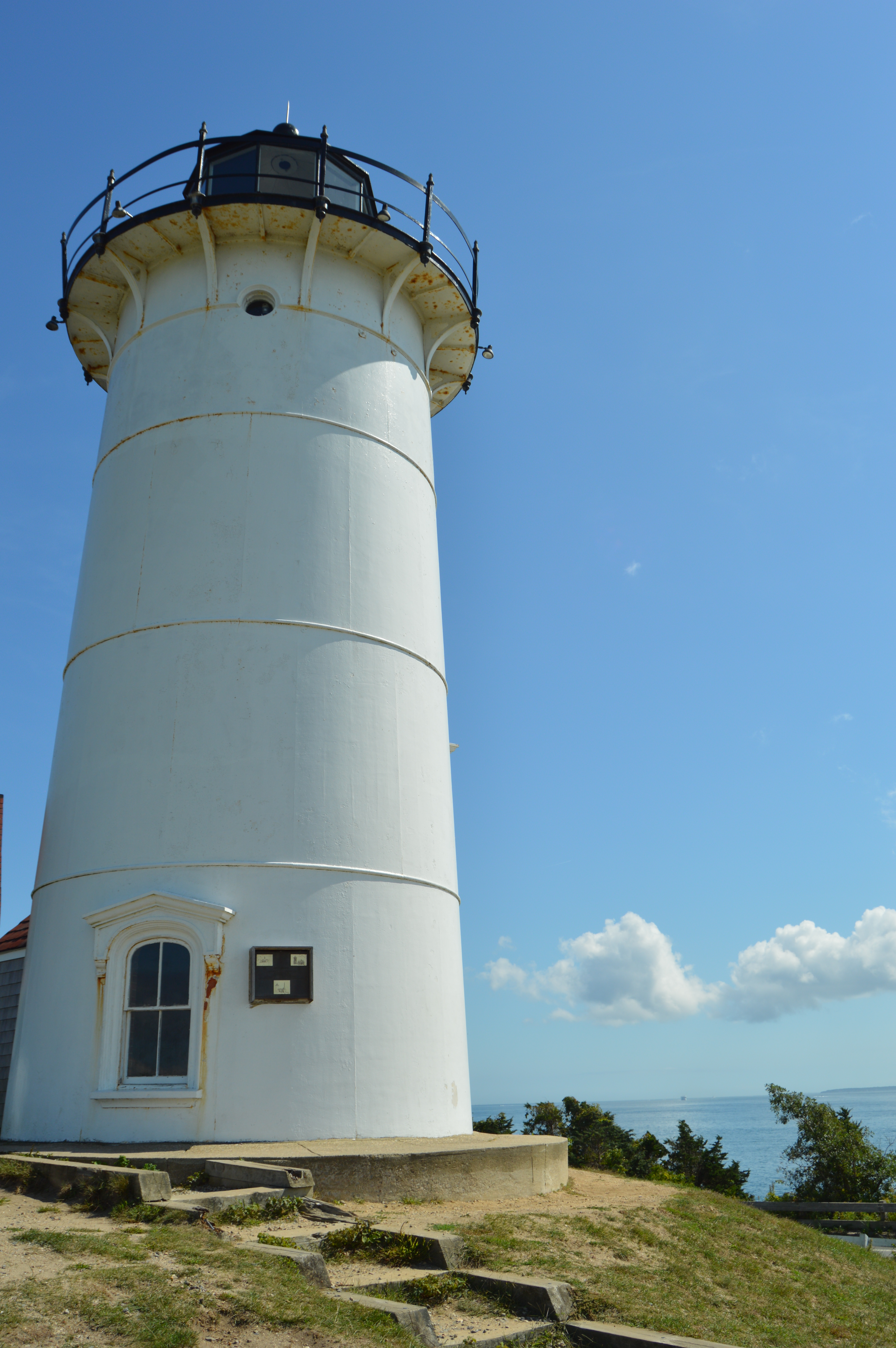
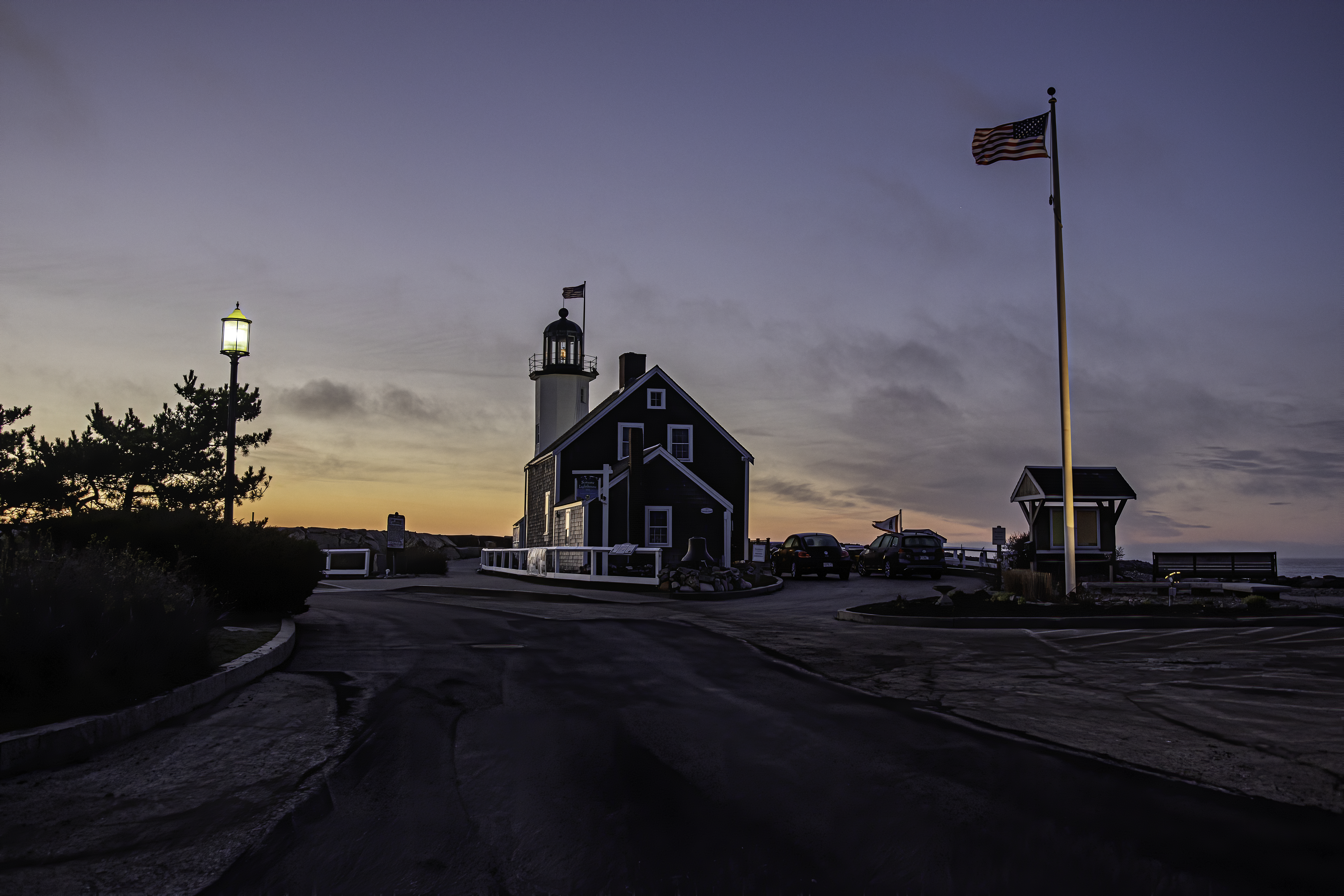
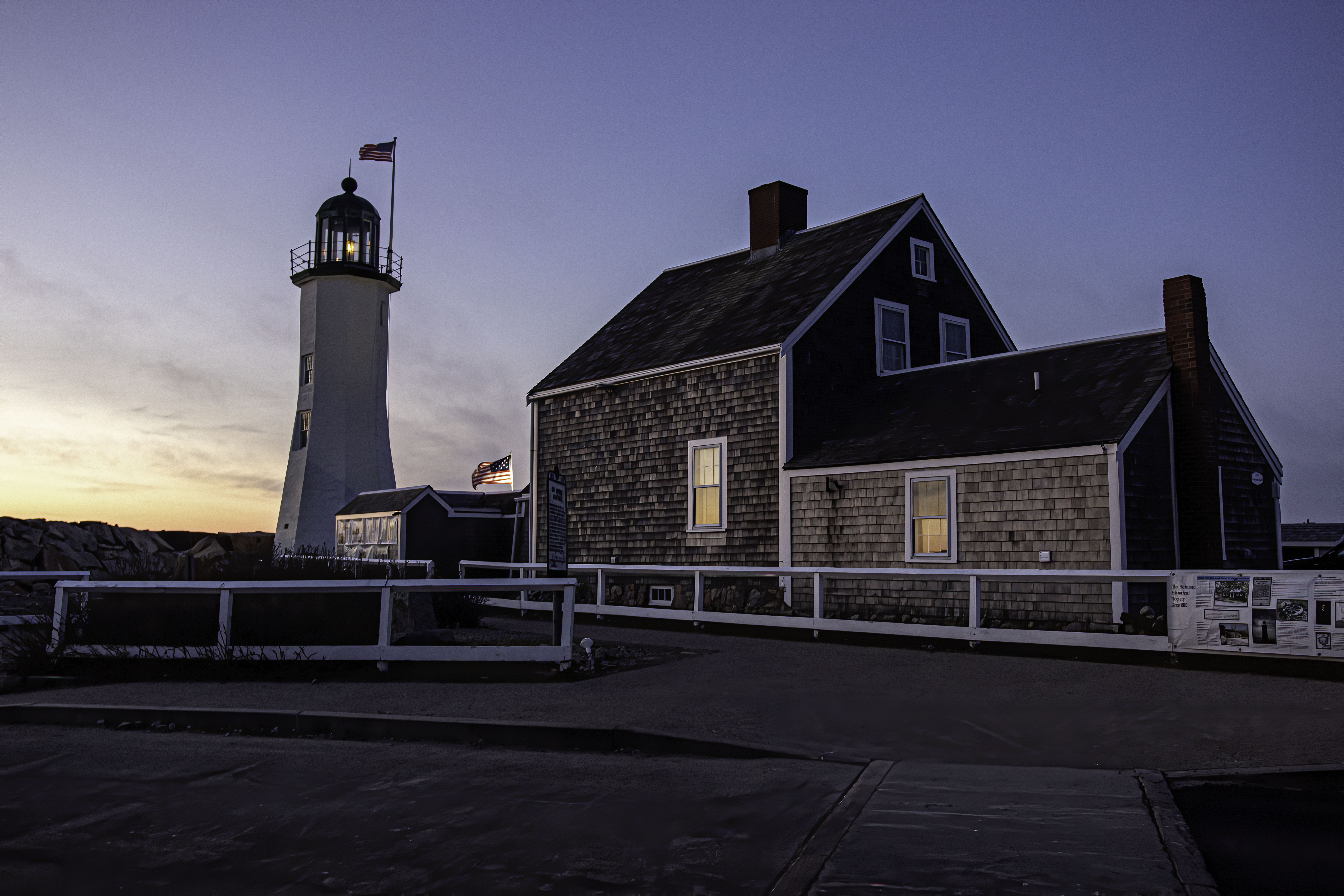
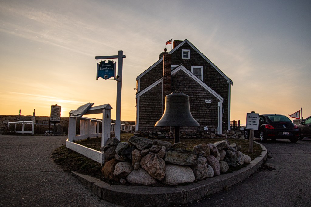
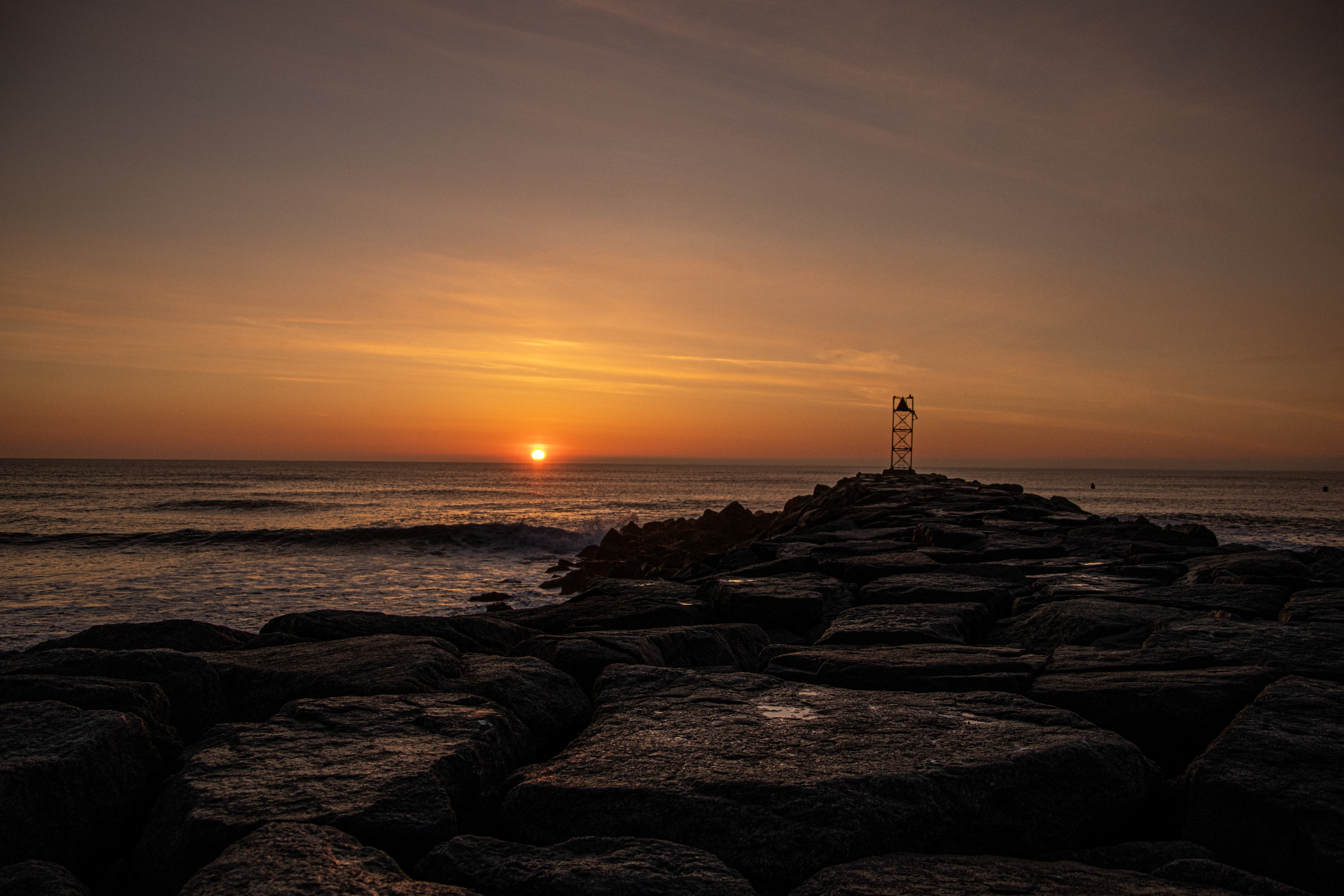
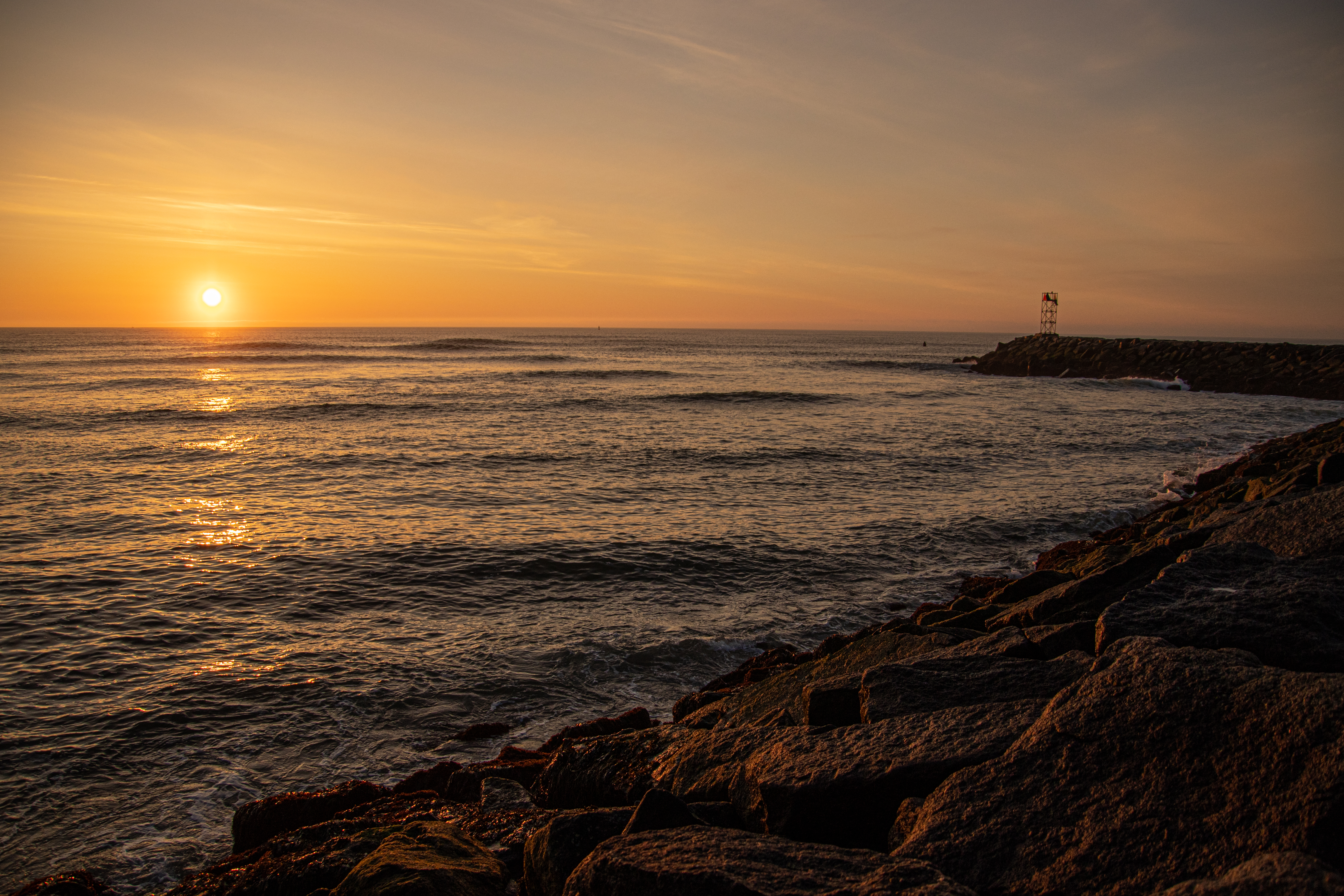
Summary: Built in 1810, Old Scituate Light is the 11th lighthouse lit in Massachusetts. The lighthouse is on the registry of historic landmarks in Massachusetts and is reportedly open for tours during certain periods of time during the year (see link above for more info). A rock jetty and rocky beachhead is a popular spot for sunrise watchers and tourists. The lighthouse has a rich history dating back to the early 1800s.

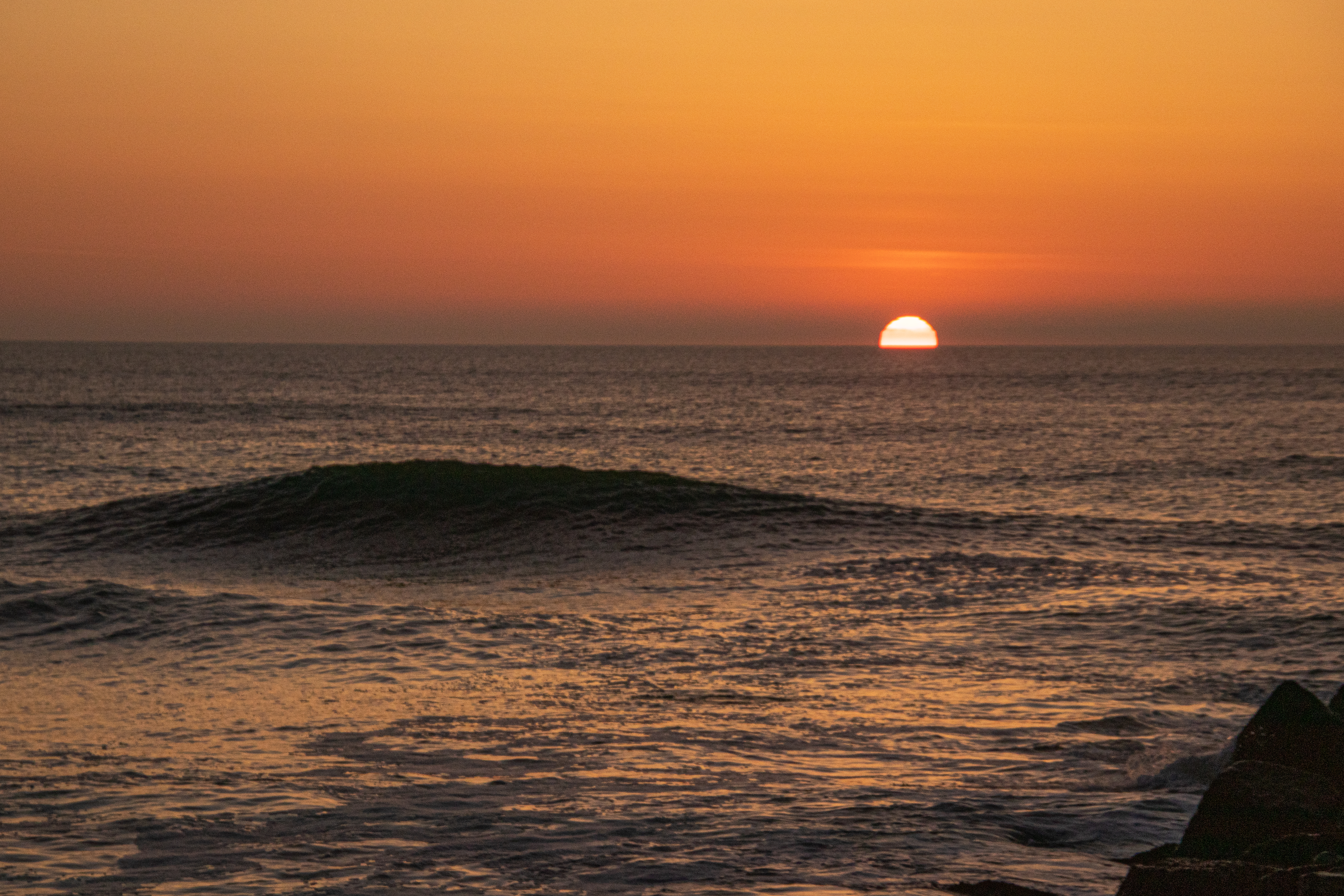
New England has no shortage of lighthouses and breath taking views of seascapes. In fact, due to the plethora of beautiful destinations along the water, some destinations seem to get overlooked. Old Lighthouse in Scituate, MA, is one of these overlooked destinations.

Built in 1810 for $4,000, Old Scituate Light played an important, but little known, role in the War Of 1812. After observing two British barges approaching the Scituate harbor, Abigail and Rebecca Bates, the daughters of the original keeper of the lighthouse (Simeon Bates) hid among a cluster of cedar trees which were once prominent in the area and played their fife and drum in an attempt to ward off the would be attackers. The two girls created such a loud din the barges were said to have retreated fearing an army was preparing for their attack. Their efforts are said to have saved Scituate from being sacked as there was, in reality, no standing army ready for a British attack. The girls went on to become known as the “American Army of Two.”

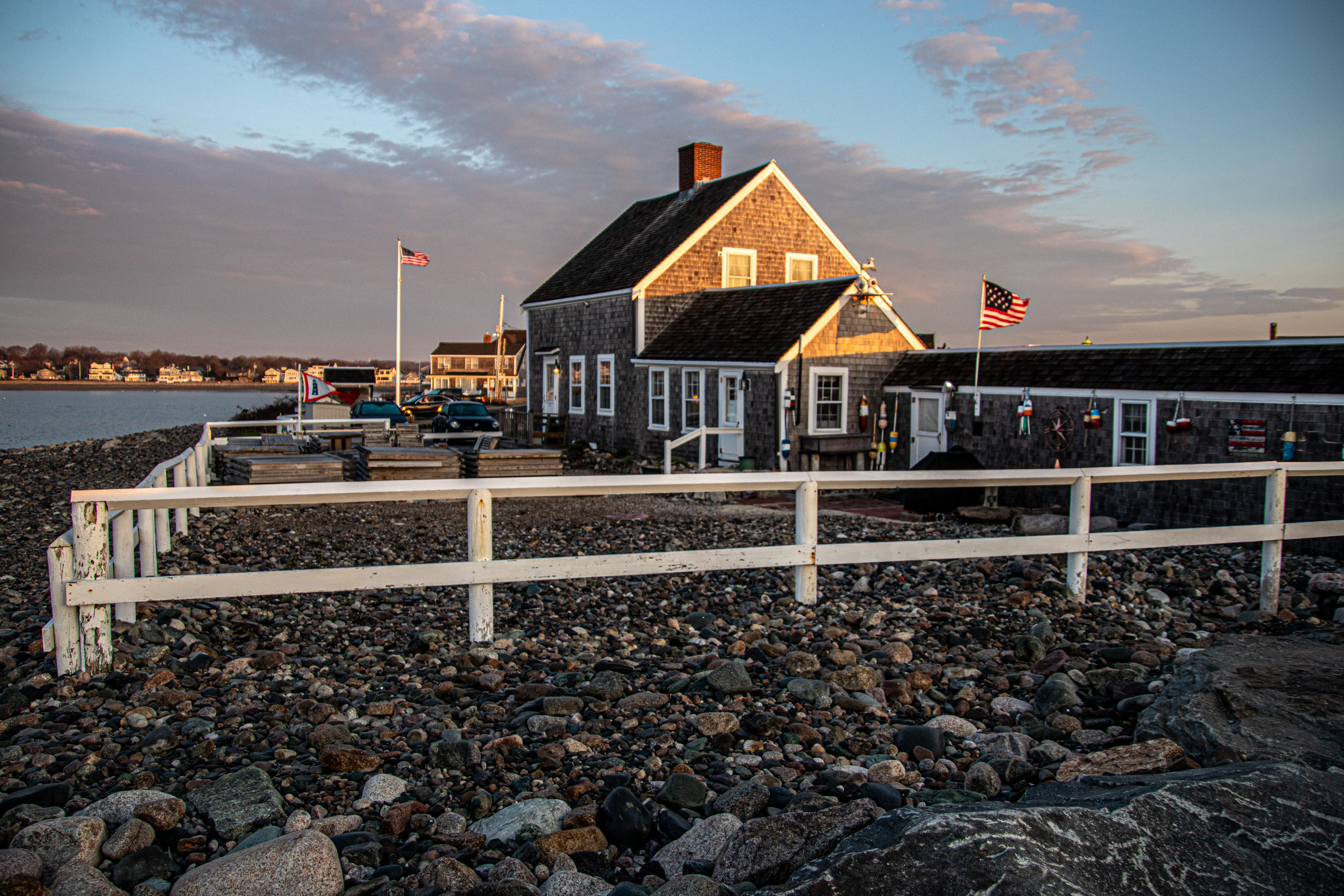
The 25 foot lighthouse (70 feet above sea level) has a natural/emplaced foundation. The light is a replicated lantern and the keeper does stay in the attached home. A bell, perhaps more for decor than function, stands outside the housekeeper’s residence. The lighthouse keeper is a teacher at nearby Marshfield High School.

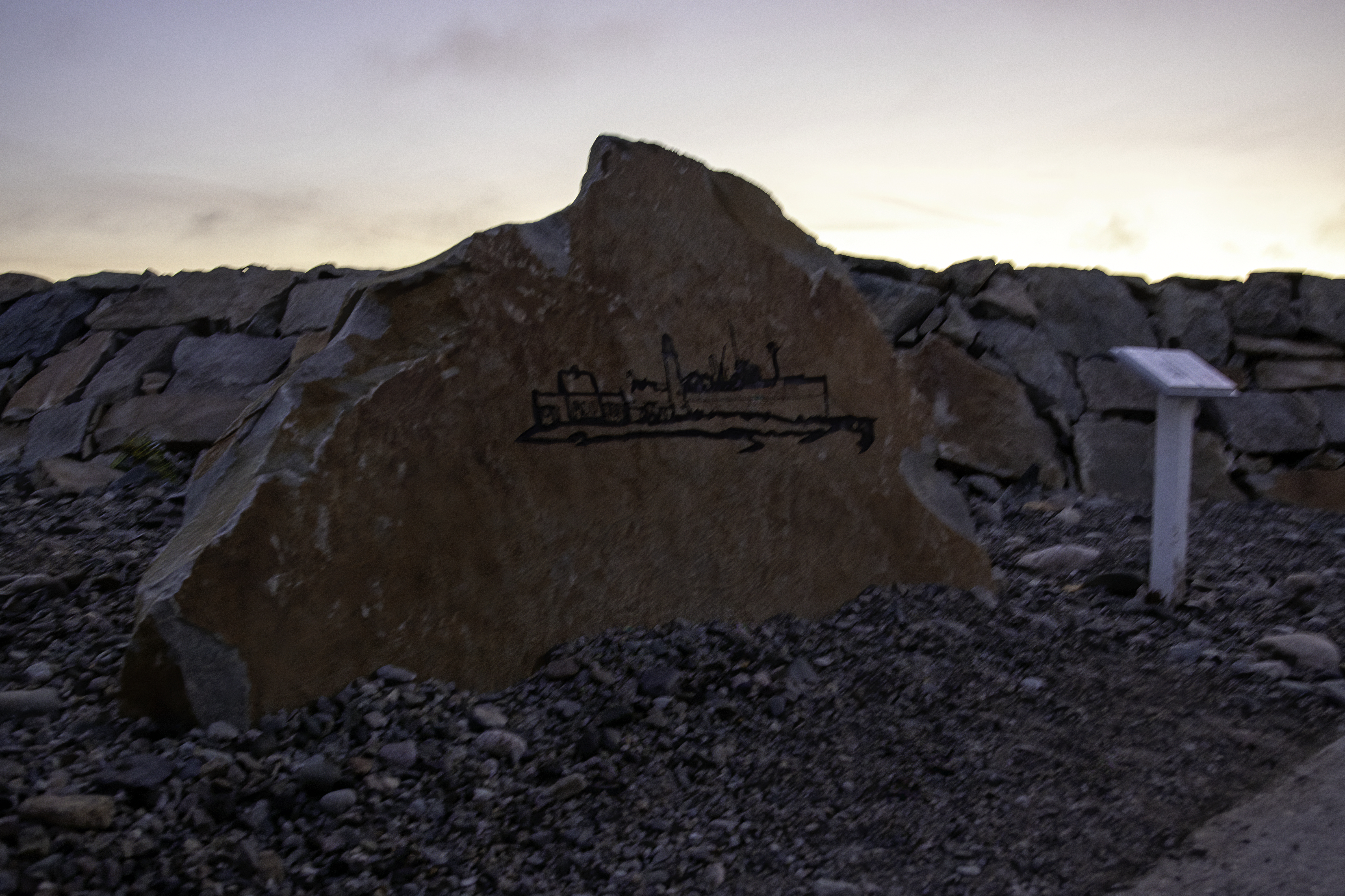
There is also a memorial dedicated to the grounding of the Etrusco and the rescue efforts from that accident. On March 16, 1956, the ship came aground at Cedar Point during the St. Patrick’s Day Blizzard (it is New England after all). After the grounding of the freighter, five Scituate residents (all members of Scituate’s Civil Defense Communications Team) sprang into action and, despite blizzard conditions, kept in communication with the Coast Guard, providing key details and information to the Coast Guard. The Coast Guard would eventually rescue all 30 men from the grounded ship.

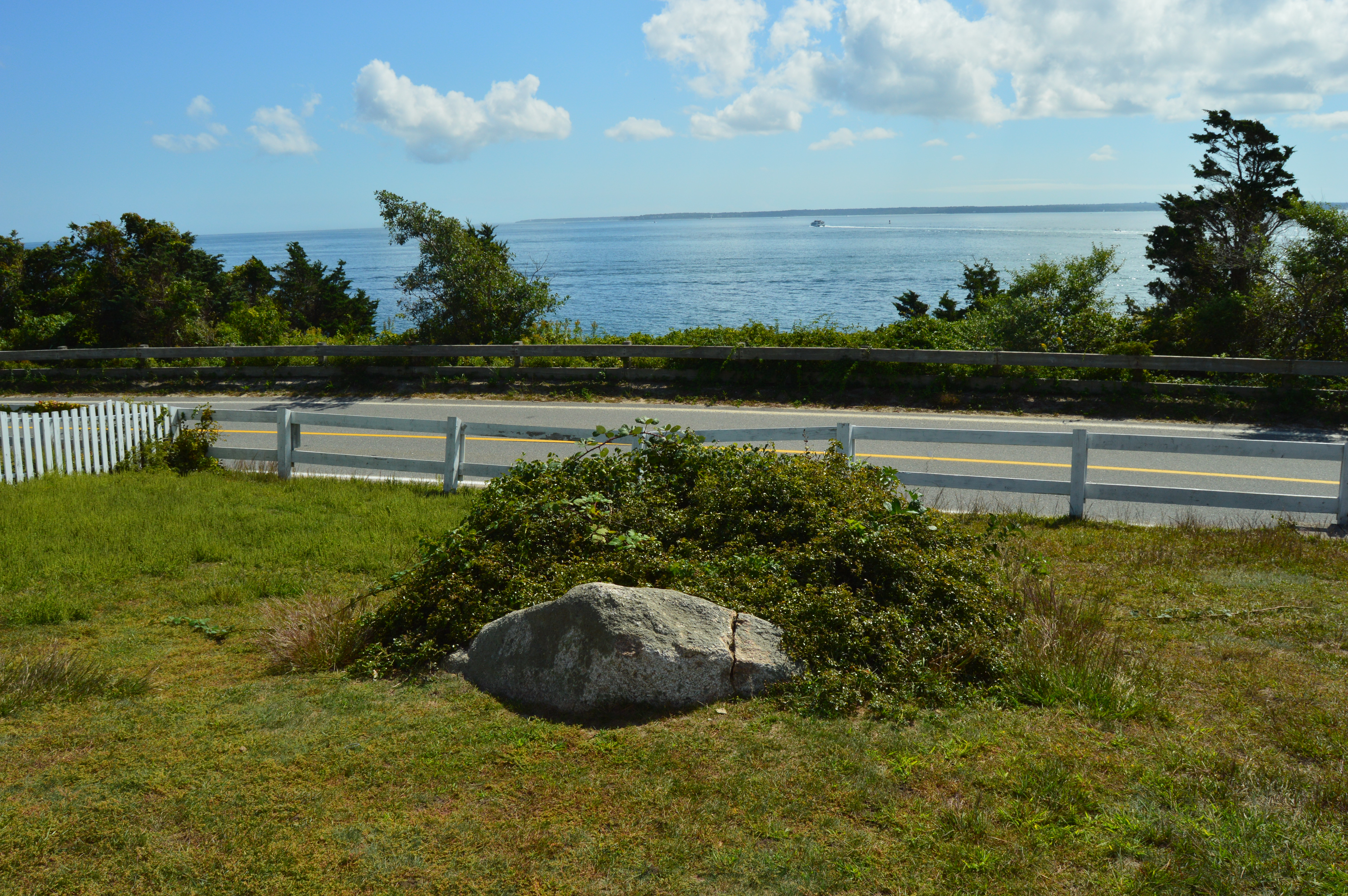
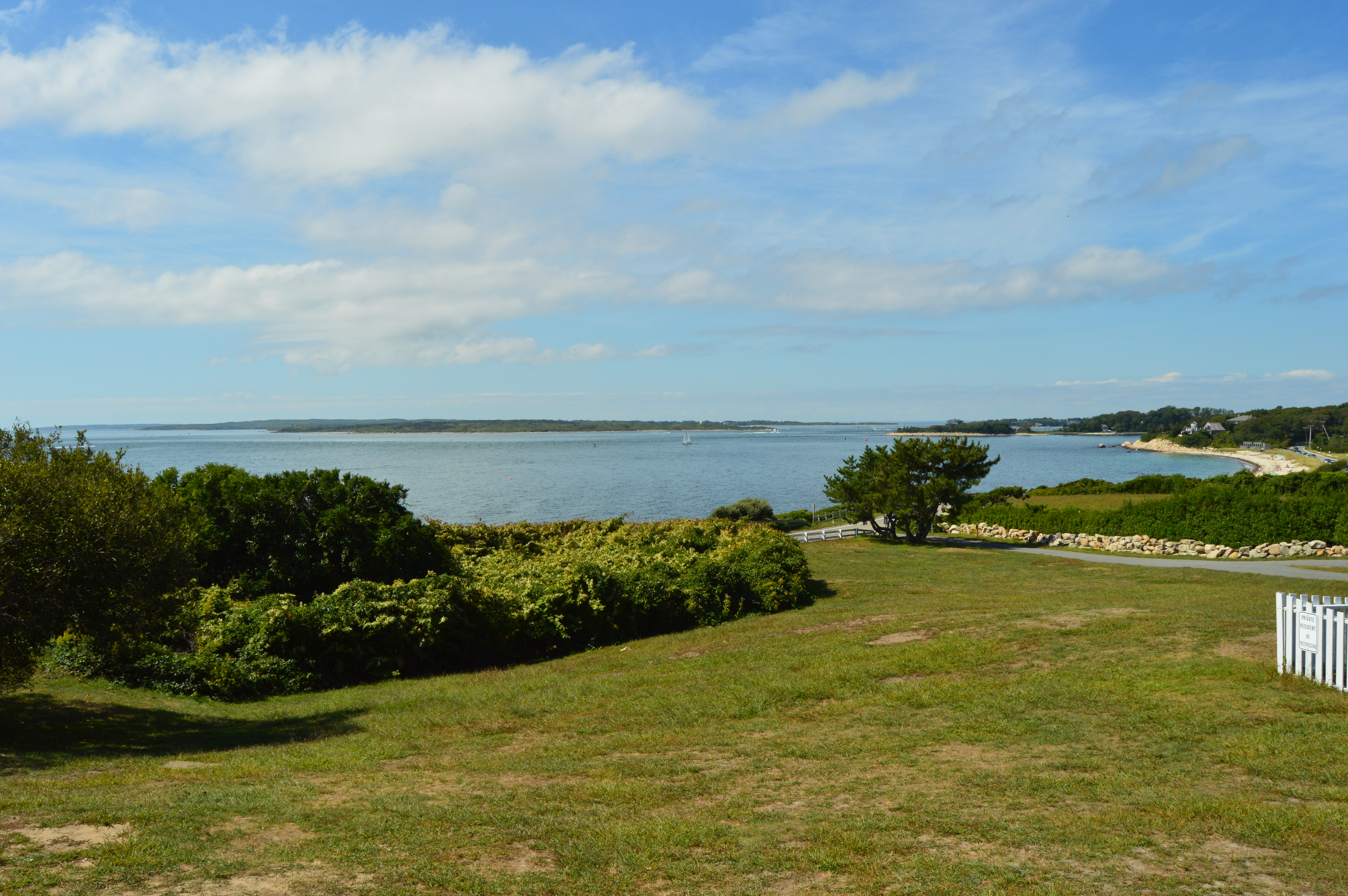
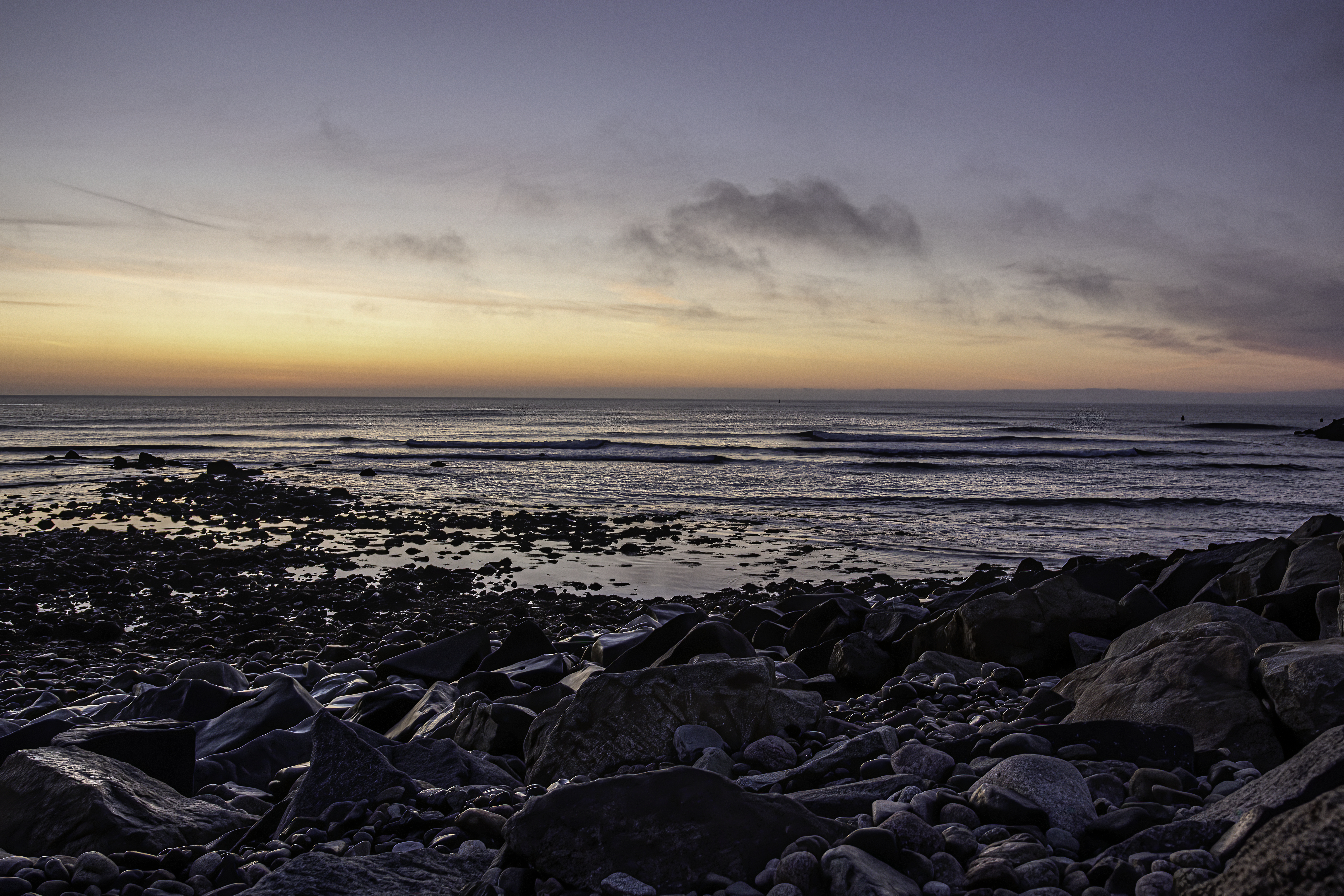
The surrounding grounds of the lighthouse provide for great photo opportunities.

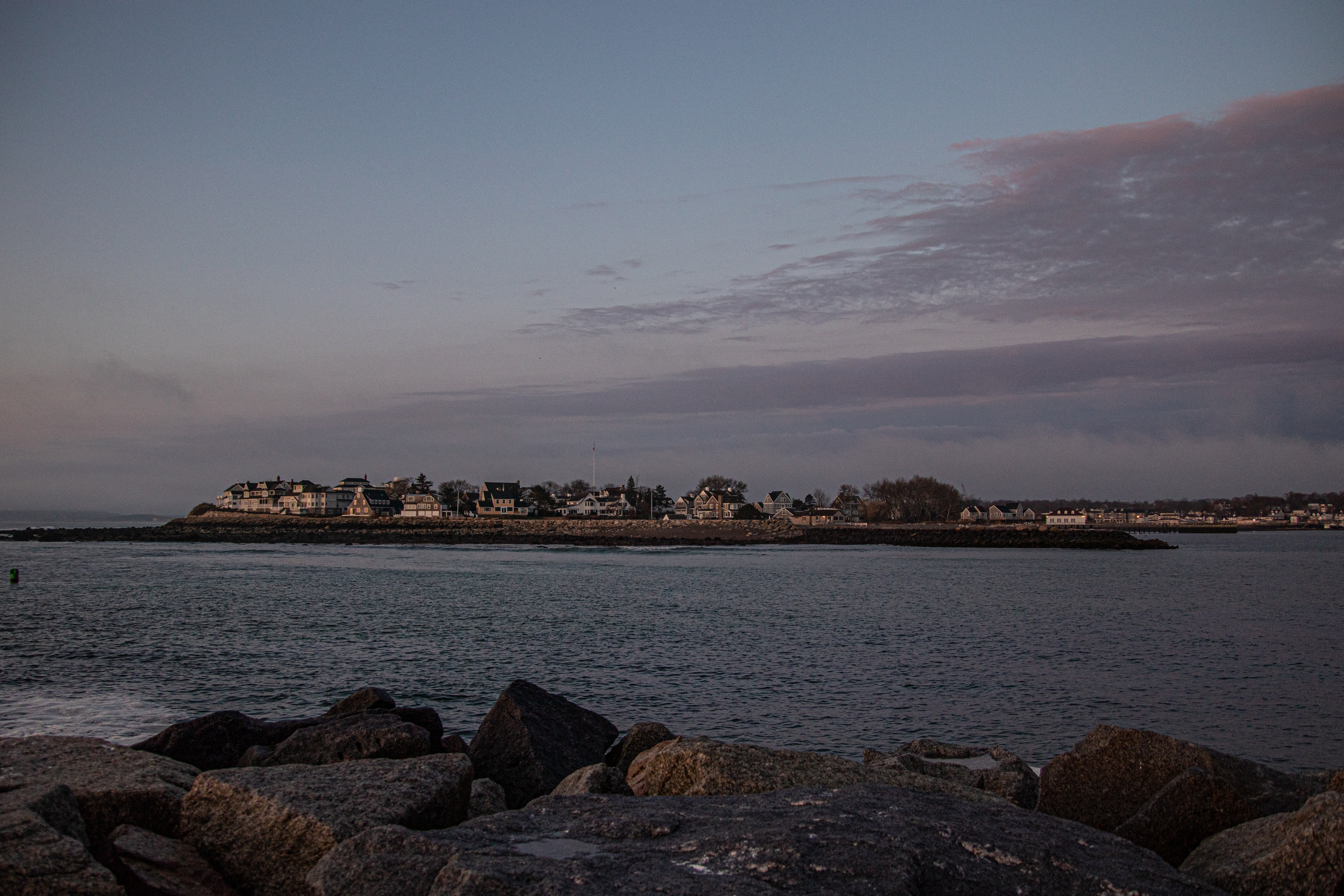
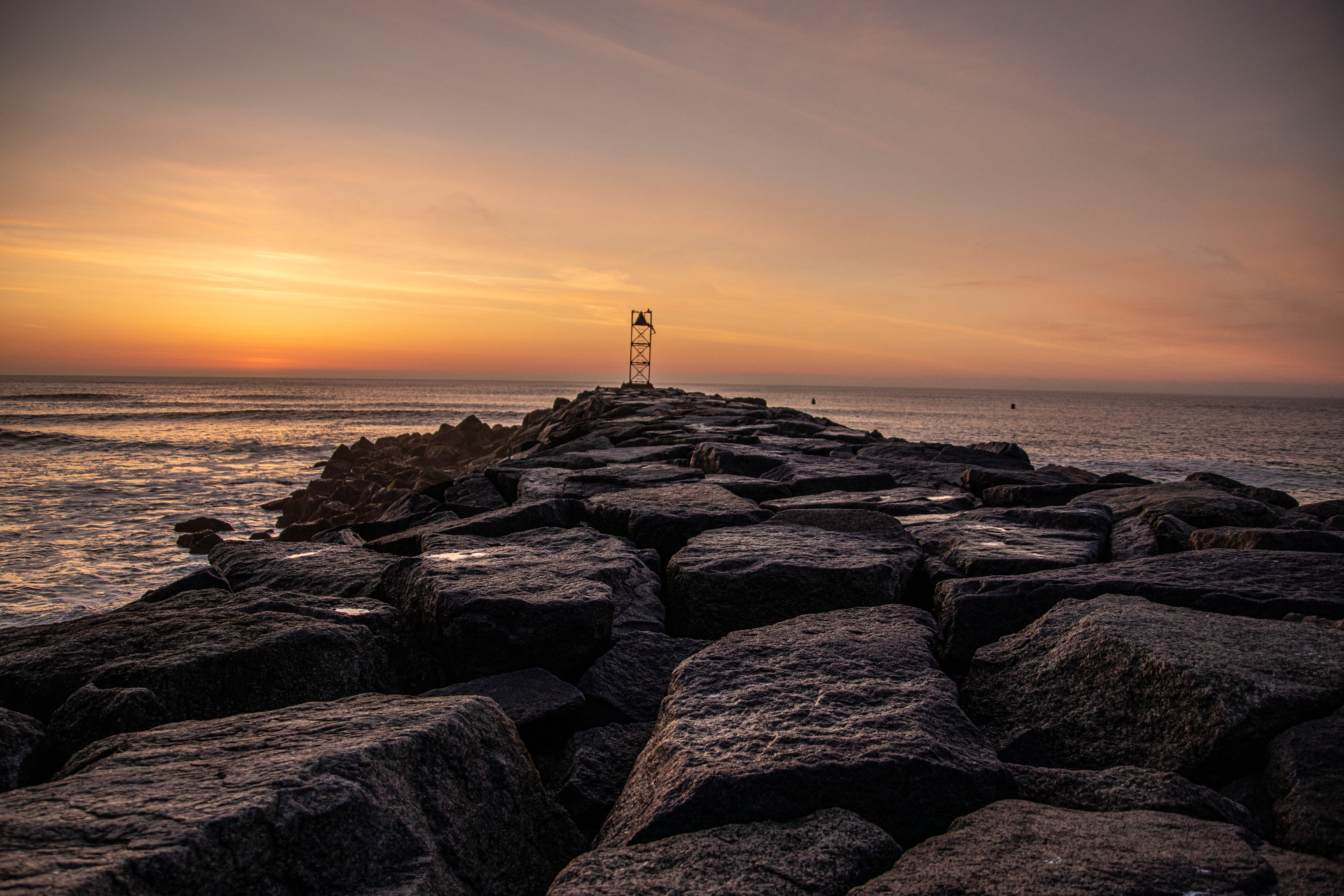
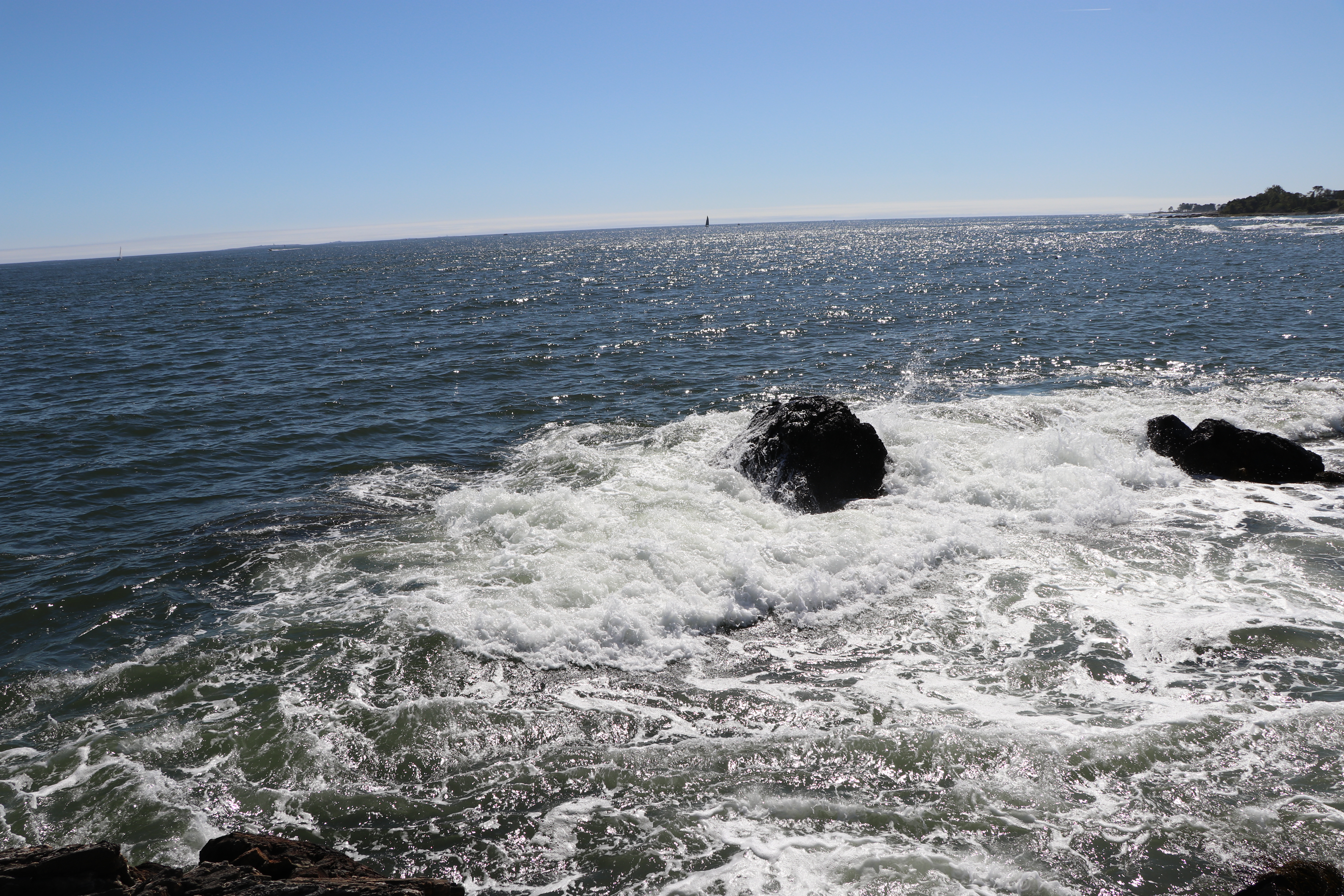
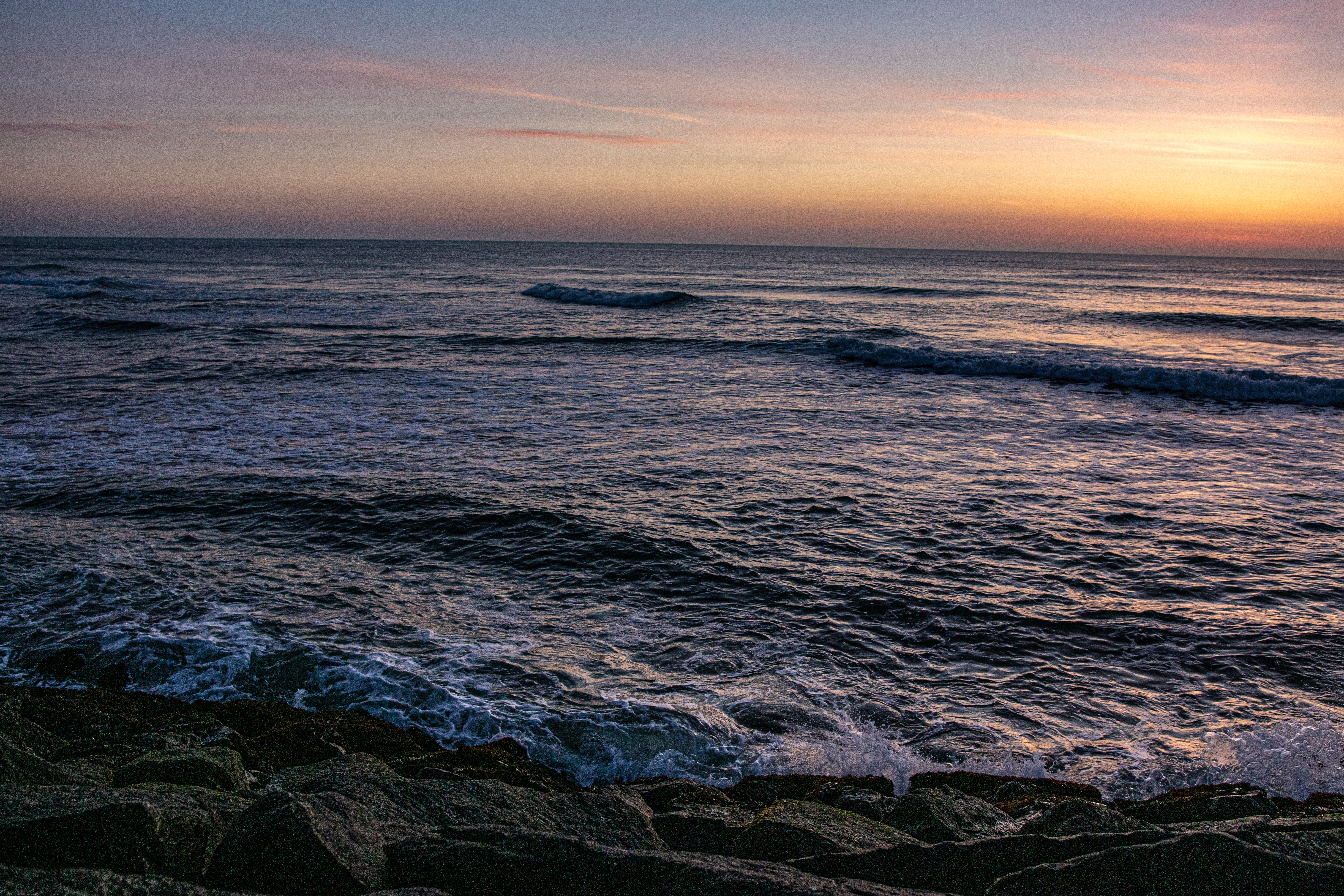
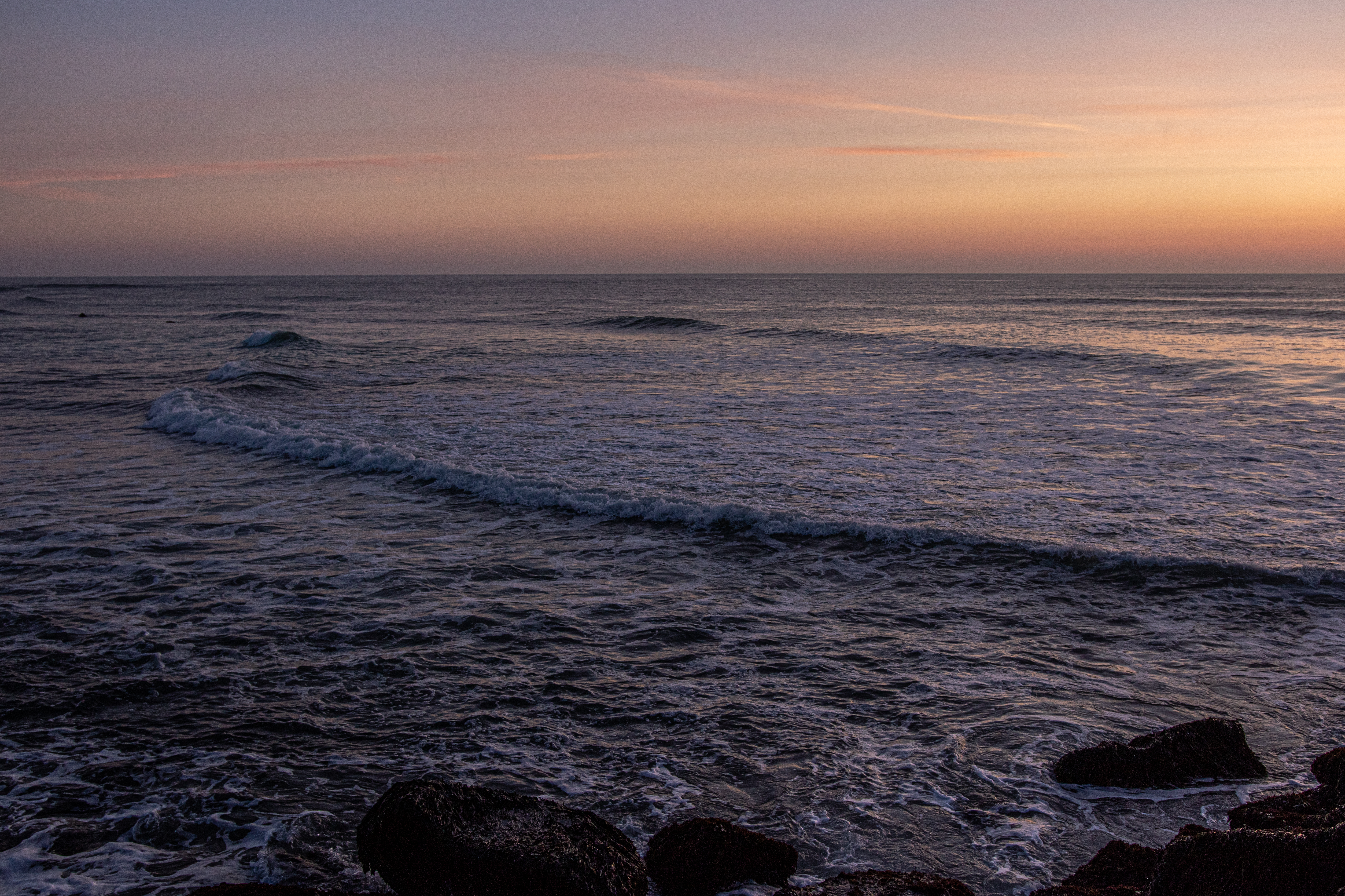
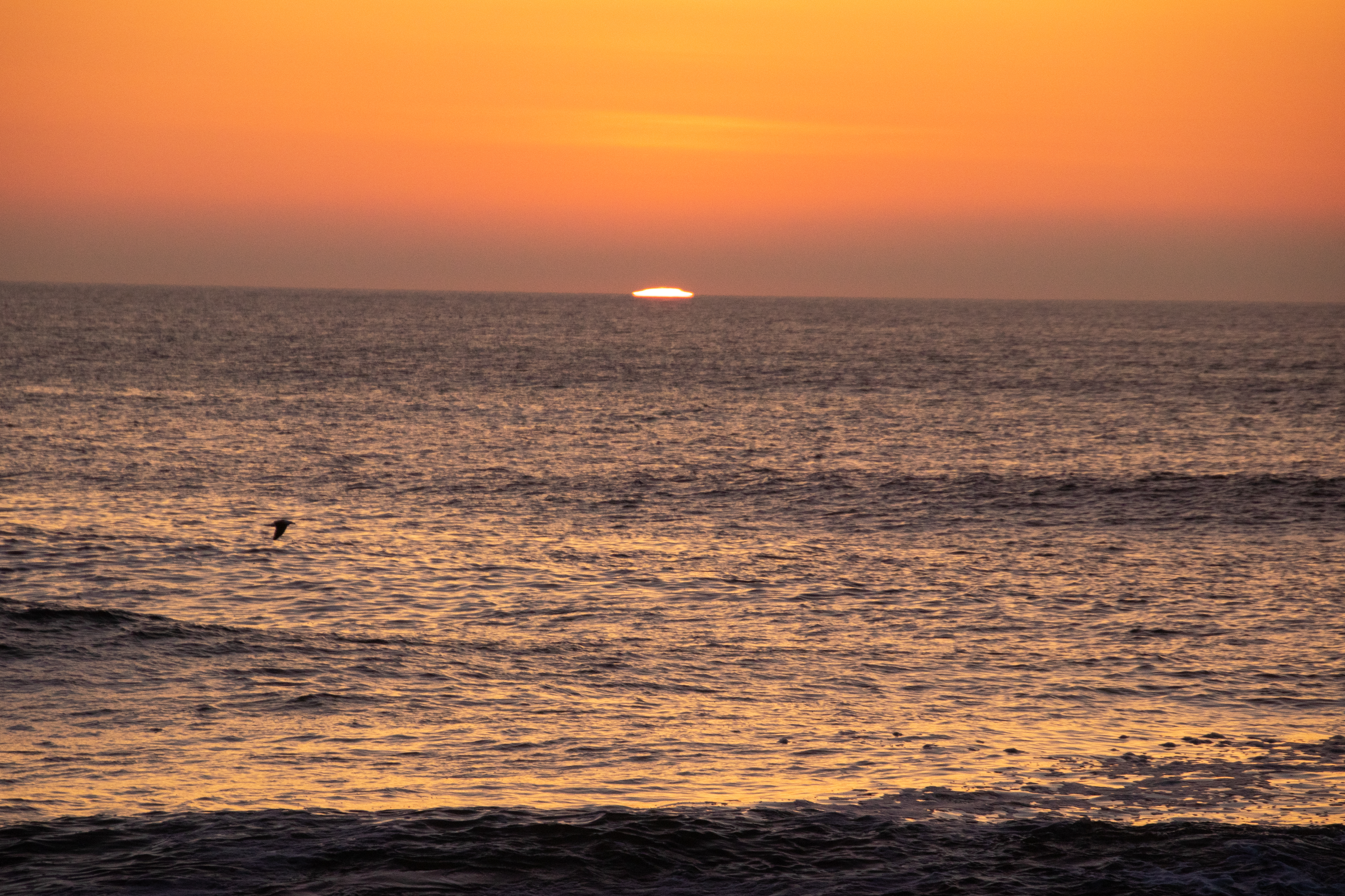
The highlight of the lighthouse and the surrounding area is the beautiful views it offers which are especially spectacular during sunrise and sunset

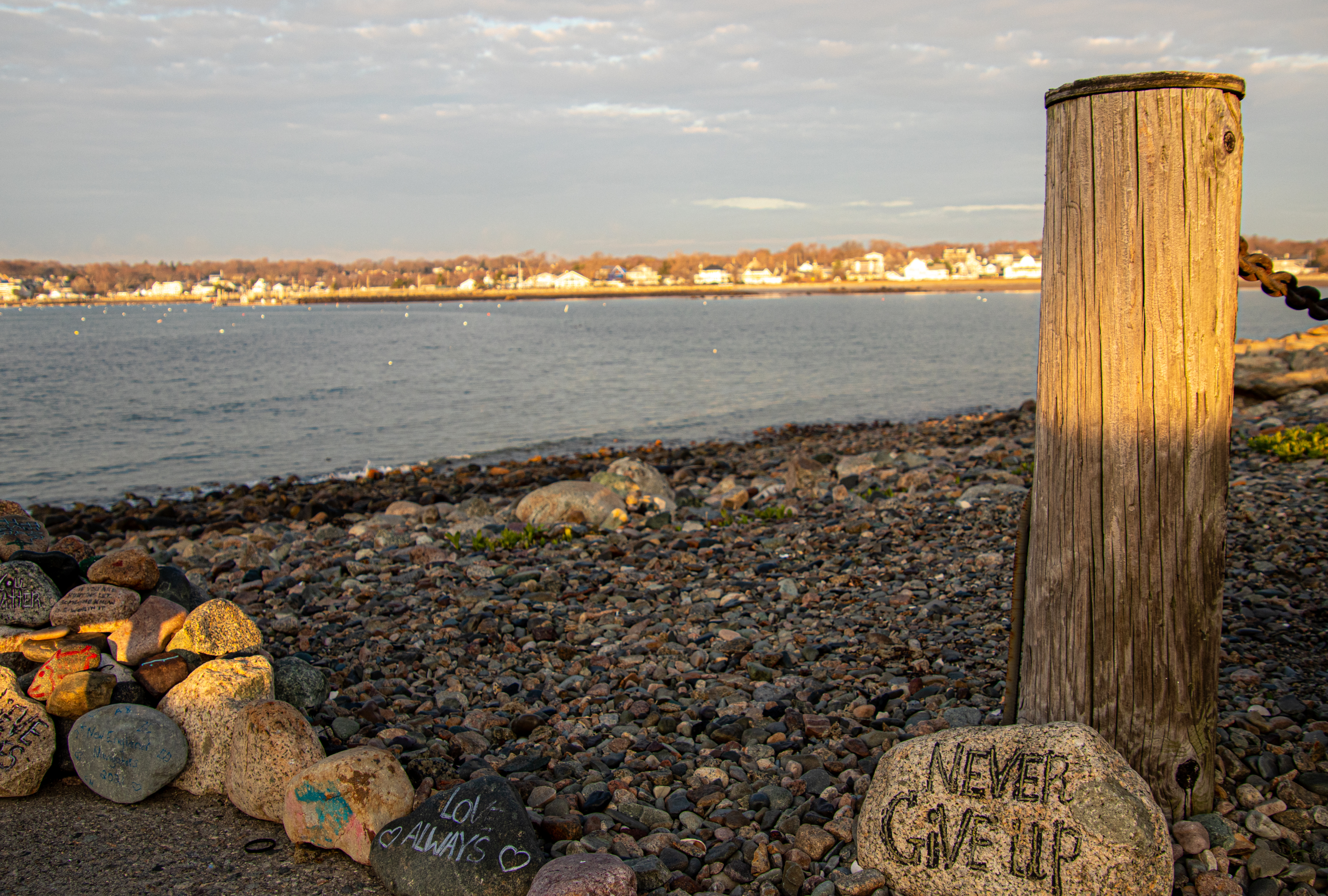
As I was about to pack up and head to my next destination, I noticed this group of painted rocks with hopeful messages. Many of them seemed to have a special personal meaning. But, I think we call can derive some inspiration from their messages.

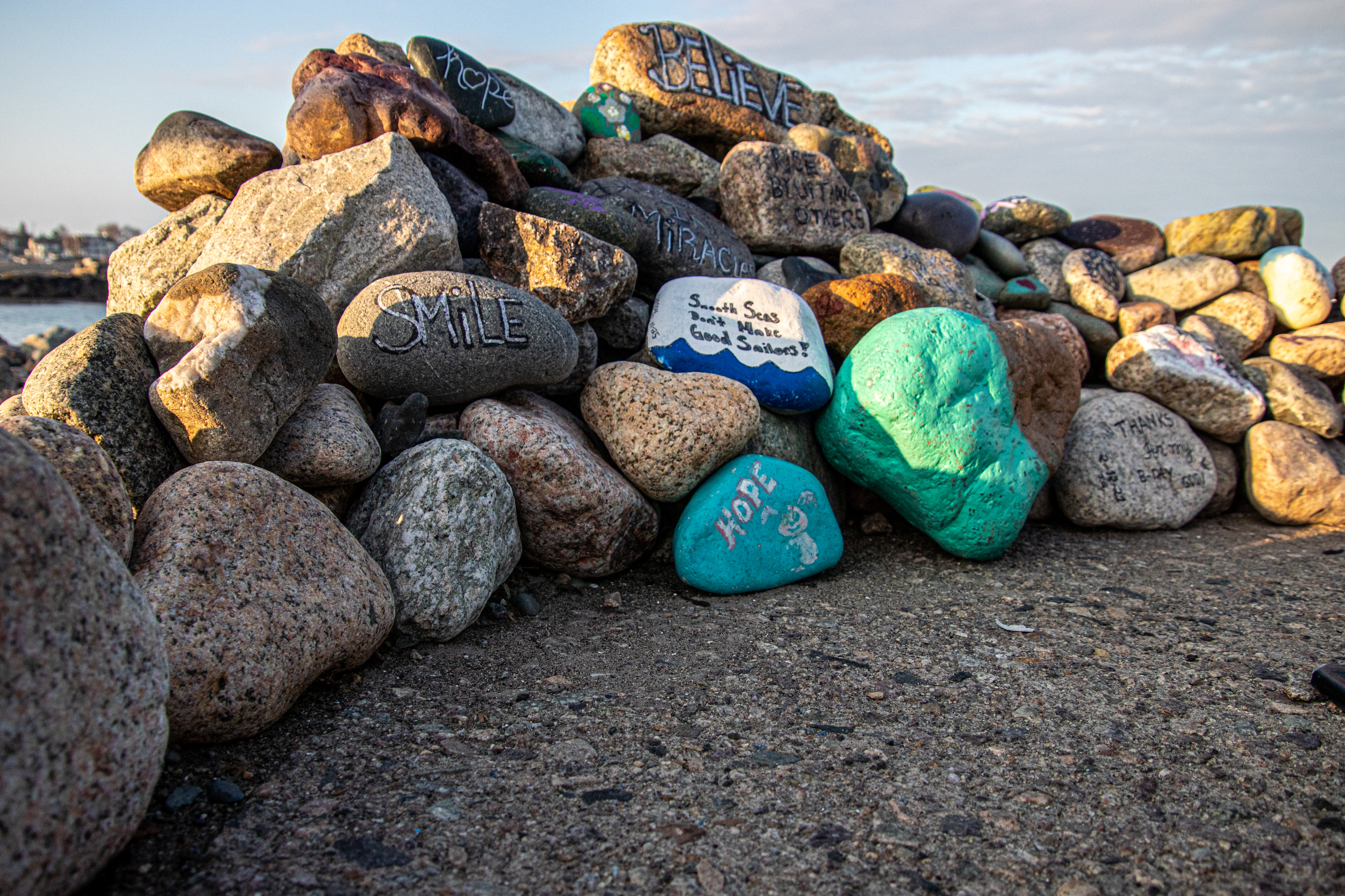
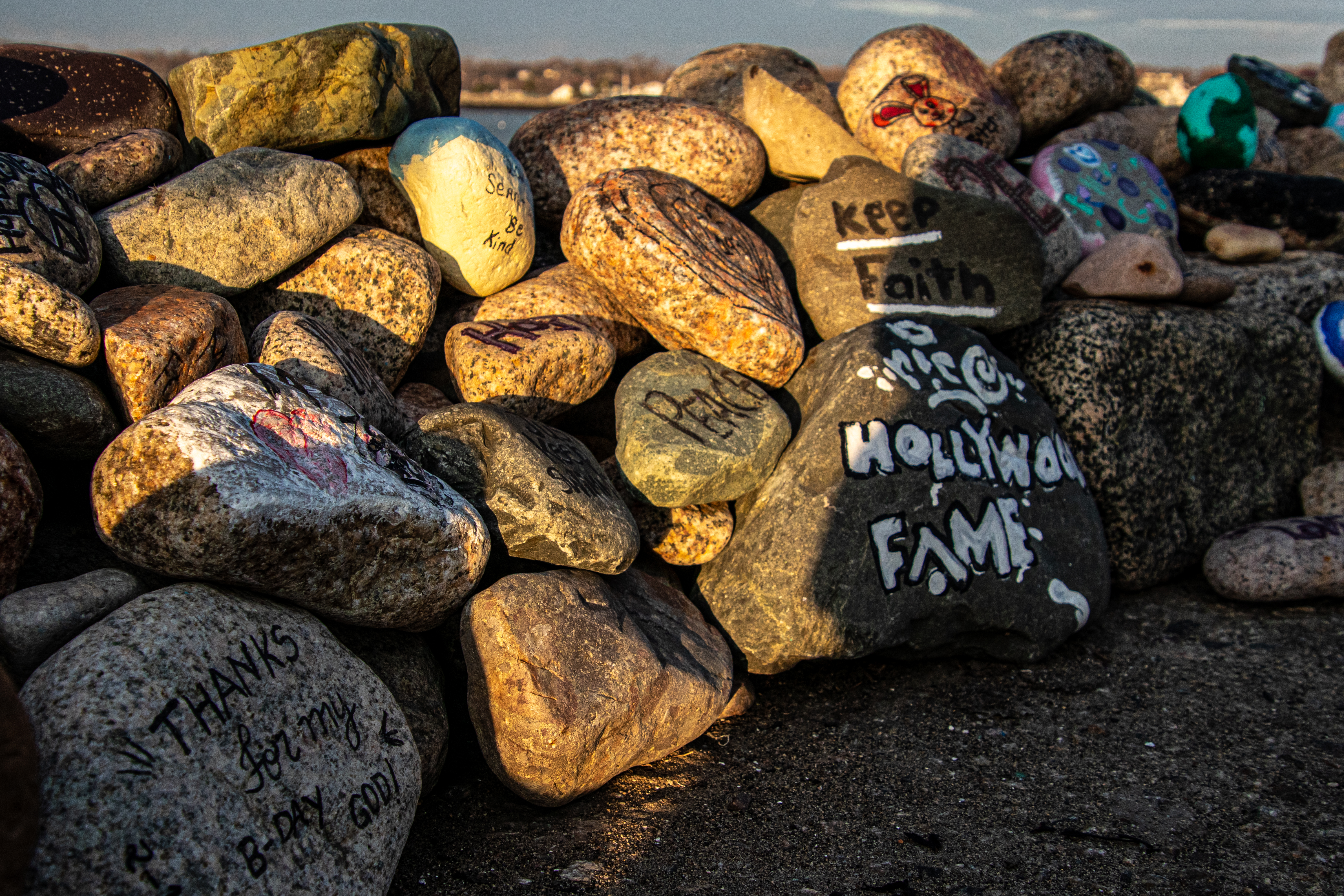
And, of course, my favorite message


Derby Wharf (Salem, MA)

Dates Of Visits: October 1 & 22, 2017

Location: 174 Derby St, Salem, MA

Hours: open daily, sunrise to sunset

Parking: there is some metered street parking available (good luck this time of the year) and two main parking garages on Congress St. and Church St.  Parking this time of the year is $20 for the day, regardless of how long you stay there if you park in most of the garages and lots in Salem during the month of October.  After Halloween it is much more affordable.

Handicapped Accessible: Yes

Dog Friendly: Yes

Highlights: historical wharf, pretty views, great place for dogs and  children to play

Tips:

  • great place to catch sunrises and sunsets if you can plan it
  • don’t forget to look along the side of the trail to the lighthouse for signs with historical info about the wharf
  • don’t forget to visit the cute shops and dining establishments at nearby Pickering Wharf

DSC_0577

Once the site of an active trade port and a thriving market area that included warehouses with goods from around the world, Derby Wharf is just as busy and thriving but not because of its imports and trade.

Built during the 1760’s by Richard Derby, Derby Wharf, the wharf attracts tens of  thousands of visitors each year (if not more), each year to learn about its rich history, get some exercise and, mostly, enjoy the views from the wharf.

The first thing you’ll notice at Derby Wharf, after the marker signalling the Salem Maritime National Historic site, is the  Pedrick Store House.  The Pedrick Store House is a three-story building, constructed around 1770, is a historic rigging and sail loft, which was relocated to the Salem Maritime National Historic Site from Marblehead, MA in 2007.  They don’t allow visitors inside.  At least they didn’t during my visits to the area.


The ship The Frienship is usually docked next to Pedrick House.  But, now, for some reason, it was anchored a little farther away from the wharf.

IMG_5992

Perhaps the highlight (no pun intended) of the wharf is Derby Wharf Light.


Built in 1871, Derby Wharf Light was meant to “mark the main channel leading into this anchorage, with the view to its becoming a harbor of refuge which may be safely entered at any time,”  The lighthouse is about twelve feet square and about 20 feet high to the top of the cupola.

Derby Light originally used an oil lamp shining through a Fresnel lens (a lens with a large aperture and short focal length).  The lighthouse is now solar powered and the light flashes red every six seconds.

During my second visit to the lighthouse this month (I always make a trip there whenever I visit Salem), some of the workers were painting the door of the lighthouse and they were kind enough to let me shoot a photo of the inside from the outside of the lighthouse (visitors are not allowed inside).

IMG_9467

Recent archaeological research has shed some light on how the wharf was built.  in 1992, the archaeological dig revealed that Derby Wharf was built by laying timbers on the mud flats at low tide, and then filling between the timber walls with dirt and stones. Later in the 19th century, the wharf was encased with large granite blocks.

The main goods which were imported to Salem, often arriving at Derby Wharf, are indigo, textiles (mainly silk), spices (particularly cinnamon), ceramics and decorative arts and artificial flowers.

The pier at Derby Wharf includes a roughly half mile walk to the lighthouse along a flat, wide dirt trail.


Along the path to the lighthouse, there are signs and displays with various fun facts about the history of the wharf and Salem.


Because of its storied past, all of the people who died at sea or on the wharf and the role it played in the slave trade, the Wharf is said to be haunted.

However, Derby Wharf mainly serves as a peaceful place to go for walks, run or ride your bike.  It is also a nice place to sit and look out at the views.


Derby Wharf is a great place to take the dog and let him and her play.  We have been fortunate to have some really nice weather fecently.  So, there have been dogs everywhere these past few weekends in Salem!


Tiro is a 5 year old mixed breed dog.  I had a lot of fun photographing him.  He was very playful!


Cody is a 9 year old Tri-Color Collie.  Look at those colors!

I also saw several dogs while I was walking to and from the wharf.


Bradley is a 4 and a half year old mixed breed. I was so very impressed with how Bradley and all of the other dogs posed for me.  There are a lot of distractions in Salem, especially this time of the year.  Yet, they all posed wonderfully.


Luna (on the left) is a 6 year old Sato from Puerto Rico.  I am very glad Sato is here and not caught up in the aftermath of the hurricane.  Grimm (on the right) is a 2 year old American Bulldog.


Great Island Common (New Castle, NH)

Date Of Visit: September 23, 2017

Location: 301 Wentworth Rd. (Route 1B), New Castle, NH,  (1 hour northeast of Boston, MA, 1 hour southeast of Concord, NH)

Hours: Open daily 9 a.m. until 9 p.m.

Cost:

New Castle Residents:
– No admission charge if vehicle has current resident sticker.
– Residents may invite up to 25 guests at no charge – Over 25 guests, admission fees apply.
– Resident must be present for all guests.
Non-Residents:
– Admission charged from May to the end of September.
General Admission Fees
– Individuals:
0-5 yrs old free
6 to 65 years old $4.00
65 and older $2.00
Handicapped $1.00

Parking: There are about 50 or more parking spots available in the parking area

Handicapped Accessible: Yes

Dog Friendly: Yes, seasonally (pets are not allowed in the park or on the beach from May 15 to September 15)

Website: Great Island Common

Highlights: lighthouses, beach, places to grill, pavilions

Tips:

  • When you enter the park, you must turn right.  The parking area is at the end of the circular paved road
  • If you want to use a pavilion, you may have to call ahead and reserve the area


IMG_5100

No other name than Great Common Island may be more apt for this park.  Except it’s not really an island.  But, it is great.

The park, with attached beach, sits on the shore of New Castle ( a small town of 968 according to their 2010 census) just outside of Portsmouth, NH).  The park and beach area are only 32 acres.  But what it lacks in area it makes up for in beauty and charm.

The park offers some great views of the water.  It is a good place to watch the waves crash against the rocks, although the waves weren’t too strong during my visit.

Great Island Common is popular with fishing enthusiasts, boaters and the occasional bird.

You can view two lighthouses from Great Island Common.

Whaleback Lighthouse was established in 1830.  The granite lighthouse that stands there now was built in 1872 and it was automated in 1963.

DSC_0926

Portsmouth Harbor Lighthouse, just down the road from the park, is also visible from Great Island Common.  During the summer, there are open houses at the lighthouse on Sundays from mid May to late October from 1-5.  Since I was visiting on a Saturday I was not able to attend the open house.  Next to the lighthouse (to the left of the lighthouse in the photo above) is Coast Guard Station Portsmouth Harbor and Fort Constitution.  In the distance, past the lighthouse, you can see the foliage has just started to begin.

Wood Island Life Saving Station in Kittery, Maine, is also visible from the park. In 1827, Wood Island was given to the federal government so the U.S. Navy could build barracks.  However, it would eventually be used to quarantine Spanish-American War prisoners who had Yellow Fever.  It is presently not in use.

DSC_0904

One of the biggest attractions at the park is a sculpture of a painter by an easel working on the scenic skyline.

IMG_5175

Pretty good painting of me.  It looks so life-like.

21761519_10214661291553875_2668283864827767945_n

Great Island Common is not just a park.  A beach is also attached to the park.

The park is spacious for kids to play in with lots of big trees for shade.

Erected in 1984, the memorial honors all of the people of New Castle who have served the country in all wars and conflicts.  Two benches sit next to the memorial, one on each side of it.

IMG_5192

Great Island Common is dog friendly except from May 15 to September 15.  Luckily, I was able to visit the week after ban ended.  It was a picture perfect day with a calm breeze.  So, it was a great day to bring your dog out!

Miley is a 8 year old Yorkie Poodle.

Tuck is a 6 month Cocka Poo (Cocker Spaniel & Poodle mix)

IMG_5203

Remy (on the left) is a 10 year old Puggle and Phoebe (On the right) is a 1 and a half year old Puggle.

IMG_5216

Jaelo (pronounced “J Lo”)is a 10 year old Puggle.

Below is a video by the shore of Great Island Common.

Posted below is a drone video of the Great Island Common area on Paul Moore’s YouTube page


Fort Foster State Park (Kittery Point, ME)


Date Of Visit: January 21, 2017

Location: Pocahontas Rd, Gerrish Island, Kittery Point, ME

Cost: $10 per vehicle; pedestrians or bicyclists $5 adults/$1 under 12 (free during the off season)

Hours: Dawn to dusk for pedestrians; gates open 10 a.m.-8 p.m. (presently closed for the season, opens in May)

Parking: The gate was up during my visit so everyone parked along the road in front of the entrance.  When the parking is officially open, there are parking areas available.

Park Size/Trail Difficulty: 88 acres, easy trail difficulty

Handicapped Accessible: Yes

Dog Friendly: Yes

Highlights: fort, trails, family friendly, play area for children, jetty, views of Kittery, lighthouse

Web Site: Fort Foster State Park

dsc_0414

As a disclaimer, since it had previously snowed in Maine and the weather turned much warmer, the trails were slushy and muddy and I didn’t have my boots on.  So, I wasn’t able to walk the entire trail system at the park.  However, the trails I did walk were pretty even and easy to navigate with a few slight inclines.

Named after John Gray Foster, a Major-General in the United States Army, Fort Foster Park has so much to offer the entire family.  Kids (and a few adults) will love plating at the playground area, especially the playhouse with the tree growing out of it.

Or, if you’re a military history buff,you will enjoy the various military installations.  This is one of the forts at the park.

The trees at Fort Foster State Park are particularly majestic.

The southernmost park in Maine, Foster Park also has a pier with wonderful views of the Piscataqua River and the Whaleback Lighthouse.  To the right of the lighthouse isWood Island Life Saving Station on Wood Island.  It looks like a bridge or perhaps another pier in the water to the left of the pier on the way to Eood Island.  I loved how the clouds played with the landscape and gaave an ominous yet beautiful backdrop to the river.   .

The tide was low and the sand was surprisingly firm,.  So I was able to walk out pretty far and get some shots of the water and the landscape across the water.  The Portsmouth Harbor Lighthouse can be viewed across the river in the final photo.

The Piscataqua River, which flows into Portsmouth (NH), is a busy waterway for birds and boats.  I saw quite a few of both in or above the river.

It’s funny how you see so many funny things on the trails at parks.  Anyone lose a shoe or croc?

dsc_0393

Fort Foster State Park is a dog friendly park.  I saw many cute dogs at the park during my visit.  But, as one visitor told me, during the spring and summer the park is packed with dogs.  Since it was an unseasonably mild January day, I ran into a fair share of them.

While I was walking the path to the park, I saw a man throwing a ball to a cute dog.  So, of course, I had to ask for a photo.  Charlie, a 1 and a half year old Feist, is looking so intently at his dad because he wanted him to throw the ball to him.

dsc_0053

As I walked along the park, I saw another beautiful dog in a beautiful setting.  Omar, an 8 year old Greyhound, is a rescue who used to race.  He is now retired but he still likes to run and play.  And, as you can see by the photos, he loves his mom.

Missy, a Golden Retriever, and Ruby, a Flatcoat Retriever, (from left to right) both 6 months, are sisters.  Because of the sharp, dark color of Ruby’s fur and the shadows from the sun, it was hard to pick up her features.  But, trust me she is beautiful.

Java The Pup is an 8 year old (almost 9) Poodle.  Not only is he cute, he also does tricks!

Below is a video (360 degrees no less) of the low tide at Fort Foster.

Please connect with me on Facebook


Nubble Lighthouse Holiday Lights (York, ME)


Dates Of Event: November 26, 2016 – January 1, 2017 (photos are from my visit on December 10, 2016)

Location: 11 Sohier Pard Rd, York, ME

Hours: from dusk (roughly 4:30 EST) until midnight

Cost: Free

Parking: There is a parking area for about 20-30 vehicles and adeparate parking lot for about 10 cars nearby

Handicapped Accessible: Yes

Dog Friendly: Yes

Highlights: Nubble Lighthouse decorated and lit up for the holidays.

Each year the Nubble Lighthouse (also known as Cape Neddick Lighthouse) is lit up

The annual lighting of the Nubble Lighthouse is a big event.  The annual lighting begins each holiday season on the Saturday after Thanksgiving.  Santa makes a visit, the fire department stops by to let the children check out their trucks and a bus shuttles people back and forth from Ellis Park to Sohier Park.  Yes, they take their lighthouse lightings pretty seriously in York.

Interestingly, this isn’t the only time of the year the lighthouse is decorated with lights.  In July of each year the lighthouse is lit up as part of their “Christmas In July” celebration.  So, if you miss this viewing you only have to wait 7 more months.

We started the viewing of the lighthouse with the last stages of yet another beautiful Maine sunset.

It was a bitterly cold night at Sohier Park with temperatures in the teens and 20’s and a wind chill making it feel about 10 degrees colder.  So, in between visits to the car to thaw out, I was able to take photos of the lighthouse at various stages.  If you look closely, you may see a drone that a visitor was flying by the lighthouse, presumably for video footage.  Also, you can see a Christmas tree through one of the windows in some of the photos.

Below is a video of the lighthouse lit up.  I had only been there about an hour when I videotaped the lighthouse.  But, darkness comes quickly in this part of New England.  So, the video doesn’t look great.  It actually looks kind of spooky.


Nubble Lighthouse (York, ME)

Date Visited: October 1, 2016

Location: 11 Sohier Park Rd, York, ME

Hours: Open everyday, 9 a.m. to 5 p.m.

Cost: Free

Parking: There is a designated parking area with about 30 to 40 parking spots.  There are also additional parking spots on the other side of the main parking area on the side of the road as you exit the main parking area

Highlights: lighthouse, scenic, views of the ocean, bird life

Lowlights: Parking can be difficult since it is such a popular spot (there was a line of cars waiting to park when I left and that was on a rainy day)

Web Site: Nubble Light

dsc_0218

Also known as Nubble Light, Cape Neddick Lighthouse is an 41 foot (88 feet above sea level) cylindrical lighthouse on the edge of Cape Neddick, a community in York, Maine.

The lighthouse is actually on Nubble Island, hence the name Nubble Light.  People like to call it Nubble and it sounds like a cuter name.  So, yeah, I’ll go with that.

Originally constructed in 1879 for $15,000 (roughly $342,000.00 in today’s money), Nubble Light is located about 100 yards off Cape Neddick Point.  The light was automated in 1986.

Nubble Light is one of the easiest lighthouses to photograph.  From Cape Neddick, you have wonderful views of the lighthouse.

There is also a rocky area you can climb down to get closer to the water and get some sweet views of the lighthouse.  Uhm, yes.

As you can see in some of the photos, it was a very windy day and the waves were crashing pretty hard against the rocks.  Between the rain and the water from the surf it was almost impossible to keep a dry lens, although I tried.

Since people feed them, birds seem to flock by the area.

The weather conditions didn’t deter this hardy Maine fisherman.  He did catch and release.

As you leave the parking area on the other side of the lighthouse, there are some pretty views.

Cape Neddick is a dog friendly area.  Logan, a 2 year old Red Hound and Coon Hound mix, likes to look out at the lighthouse also.

Video of Nubble Lighthouse:

Similar Places I Have Visited In New England:

dsc_0596

Watch Hill Lighthouse (Westerly, RI)

dsc_08071

Nobska Lighthouse (Woods Hole, MA)


Watch Hill Lighthouse (Westerly, RI)

DSC_0596

Date Visited: April 30, 2016

Location: Lighthouse Rd, Westerly, RI

Cost: Free

Parking: Vehicles are not allowed on Lighthouse Rd, unless you area senior citizen or if you have a physical impairment which may prevent you from walking or biking or running down.

The jewel of Westerly, Rhode island, Watch Hill Lighthouse is a stone’s throw away from Napatree Conservation Point.  The walk down Lighthouse Rd is about half a mile and the views are worth the walk.  Watch Hill is a swanky village in the town of Westerly that offers views of the southern most coast of the state (besides Block Island).

To get a sense of just how beautiful the area is, this is the view from someone’s driveway.  Not a bad view to wake up to every morning.

There are more stunning views as you walk down the road.

This slideshow requires JavaScript.

There is also a “cliff walk” along the road which is basically a walkway along the sidewalk which allows you to walk on a “cliff” type access way next to the road.  Besides being a fun way to travel, the cliff walk also offers some beautiful views.

Since it is somewhat isolated and not too active this time of the year, birds tend to congregate at Watch Hill.  I found a few Double Crested Cormorants.

Watch Hill Lighthouse is the second oldest lighthouse in Rhode Island (Beavertail Light is the oldest lighthouse in RI).  Originally built in 1808, Watch Hill Lighthouse has been destroyed or damaged by various storms over the years.  The current lighthouse that stands there was built in 1856.  It was automated in 1986 and it is still active today.

DSC_0646DSC_0645

The best part of my trip to Watch Hill was watching the waves from the rocks.  It is considered one of the more beautiful and romantic of Rhode Island (sans Newport).  In fact, just before I arrived there I had missed a man proposing to a woman at the location.  When I got there they were drinking champagne and cuddling as they watched the waves.

This slideshow requires JavaScript.

Cute little Louis (pronounced Louie) is a 3 year old toy poodle.  I love how the wind blew his fur and ears back but he still wanted to see the lighthouse!

DSC_0649DSC_0648

Below are two videos of the waves at Watch Hill to give a better sense of the power of the waves there (and this was just on a regular day)

Please connect with me and like my Facebook page to see extra photos and videos I don’t post on my blog!

New England Nomad


Winter Wildlife Cruise (Boston Harbor, MA)

Date visited: January 23, 20016

Price: $20 for adults, $10 for children (ages 3-11) and seniors (over 65)

This was a special cruise and is not something they do regularly in the winter.  During the spring, summer and fall they have cruises scheduled regularly.

Twenty degree weather and an impending winter storm; what better conditions for a harbor cruise.  Ironically, that statement could not be more accurate.

We were greeted by gulls and rough seas when we arrived at the wharf.

DSC_0084

As we made our way on to the boat for and they announced the cruise would be a three hour tour (in retrospect, that Gilligan’s Island reference should have been a bad omen), I was surprised by how roomy, comfortable and modern it was.  The three story boat had booths on the sides of the cabin area and ample seating.

Even before we left the wharf I took some shots of the bay.  You can see Logan Airport in the distance in some of the photos.

This slideshow requires JavaScript.

As the boat left the bay, I took some obligatory photos of the skyline.

DSC_0197DSC_0189DSC_0231DSC_0227DSC_0249

I had to bundle up (and hold on tight to the railing) for the shoot.  I was surprised at how well I handled the overly active ocean.  I’ve never been particularly fond of roller coasters, wavy oceans or anything that moves to and fro quickly.  But, I did fine.  The only time I felt a tinge of sickness was when a fellow traveler described his own feelings of sea sickness (gee, thanks random stranger).  But, that quickly passed.

DSC_0277

There was a variety of sea life, although the choppy waters made it difficult to photograph all of them.  DCR (Department of Conservation and Recreation) officials were on the boat with binoculars on the lookout for wildlife and other points of interest and announcements were made whenever a bird or other animal was sighted.

I did photograph this Eider as he swam with friends.

DSC_0328

and a few other elusive birds.

This slideshow requires JavaScript.

Even though it was a cruise for wildlife viewing some of the best views were of the harbor and the islands.

This is Spectacle Island.  Spectacle Island was made entirely from the dirt from the huge construction project known as the “Big Dig”.   it is much prettier during the summer.

These are some photos of Boston Light.  Boston Light is the first Lighthouse in America.  It is still working today.

This slideshow requires JavaScript.

The Deer Island Waste Water Treatment Plant began operations in 1995.  It is clearly the jewel of Boston Harbor.  Prior to the construction of the sewage plant, sewage from Boston’s treatment facilities had contaminated shellfish after the sewage had been released.  Lunch, anyone?

DSC_0466

These structures are what is left of the bridge to Long Island (not the one in NY – we didn’t go out that far).  It was dismantled recently.  Personally, I think they should keep them.  They make for a good background for photography.

Below is a slideshow of some of the other shots from my cruise.  It was very windy and the sea was pretty choppy.  I tried to capture this in the photos.

This slideshow requires JavaScript.

Finally, I found a cute furry animal named Bailey to photograph when I disembarked from the boat.

DSC_0630

See below for videos of the cruise to get a better idea of just how windy it was.

Winter Wildlife Cruise – Long Wharf

Winter Wildlife Cruise

Winter Wildlife Cruise II


Nobska Lighthouse (Woods Hole, MA)

Located across from Nobska Beach, the Nobska Lighthouse is a popular stop for tourists.

DSC_0807 DSC_0812  The present tower was built in 1876.  It stands 40 feet and has a focal plane view of 87 feet.

DSC_0826 DSC_0825

The keeper’s house next to the light house serves as the home for the commander of Coast Guard Sector Southeastern New England.

DSC_0828

A busy paved roadway separates the two places.  You will often cyclists and even runners on the road.  So, it can be a tricky road to navigate.  But, across the road are some good views of the water.  The islands (Nantucket and Martha’s Vineyard) can be seen in the distance.

DSC_0804   DSC_0806

There are also some pretty views of the grounds of the light house and the beach

DSC_0833 DSC_0834

The Nobska lighthouse was  a nice break from the crowded beach, although the lighthouse also gets its fair share of visitors.  But, before long, it was time for the next and final leg of our Farewell to Summer Cape Cod trip…