Category Archives: lake

Winnekenni Park (Haverhill, MA)

Date Of Visit:July 15, 2018

Location: 347 Kenoza Ave, Haverhill, MA (about 45 minutes north of Boston, MA or 50 minutes southeast of Concord, NH)

Hours: open daily sunrise to sunset

Cost: Free

Parking: There are about 20 parking spaces at the main entrance. Parking is also allowed on the side of the road past the main entrance. There are also additional parking lots throughout the park and trail (see attached map)

Trail Size/Difficulty: 700 acres of roughly 10 miles of trails/easy to moderate

Handicapped Accessible: Some areas of the park and playground are. But the trails are not.
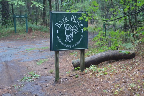
Dog Friendly: Yes

Highlights: castle, lake, wildlife, trails, playground, scenic

Fun Facts:

  • Winnekenni (pronounced “winnie kinny”)is an Algonquian Native American term for “Very Beautiful”
  • The castle was built between 1873-1875
  • they host several events throughout the year at the castle or at the park
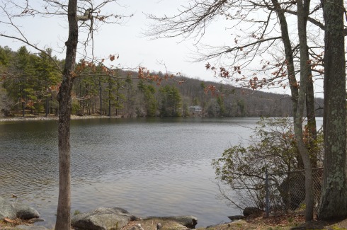
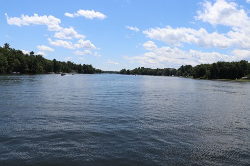
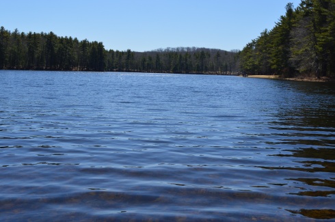
  • Kenoza Lake, which is encircled by the main trail, was originally known as “Great Pond.” It was later renamed in 1859 by John Greenleaf Whittier as “Kenoza Lake”, which means “Lake of the Pickerel”
  • Winnekenni Park became Haverhill’s first public park during the early 1800’s

Tips:

  • check out plug pond and the basin (see map) for scenic views off the beaten path
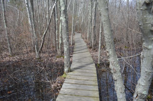
  • some of the side trails are tricky
  • they usually dissuade people from parking at the castle unless you have a function there
  • take the castle trail to go to…the castle

Website: Winnekenni Park

Winnekenni Park (2)

Trail Map: Winnekenni Trail Map

IMG_5671

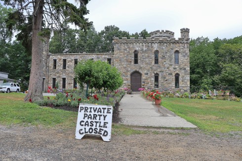
Formerly the home to Dr James Nichols, who used the area to test his experiments with chemical fertlizers, Winnekenni Park offers a variety of scenic views and difficulty levels of hiking or running.

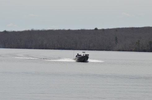
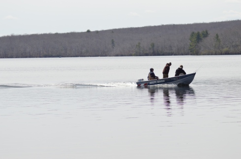
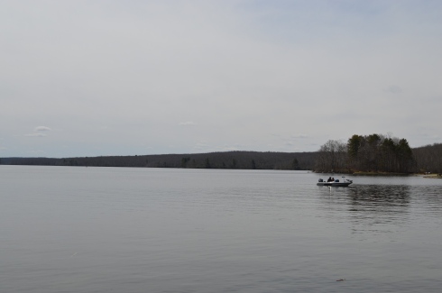
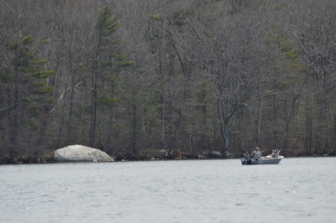
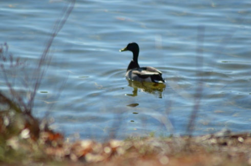
The main trail which goes around Kenoza Lake (Dudley Porter Trail) offers some pretty views and active wildlife.

The trail to the castle was fairly easy and quick. I found myself at the castle within 15 minutes after entering the park. In fact, I was a bit disappointed that it was so easy to find. I would later wish everything was this easy to get to.

The castle, which was built between 1873 to 1875 is still used today for weddings, reunions and other social events. The day I visited it was being used. So I was unable to gain access.

There are a couple of memorials, of the many at the park, at the castle. This memorial is dedicated to Dorothy M. McClennan, a Haverhill native and benefactor to the castle.

According to his obituary, Nicholas Jay Morani, of Methuen, MA, died unexpectedly at the age of 25 in March, 2017. It’s always sad to see lives cut short at such a young age.

If you came to see just see the castle, which I had originally planned, your visit could be a very short one. You could hike or walk up to the castle and back to your car in an hour and most likely 30 to 45 minutes. Of course, I wanted to see more.

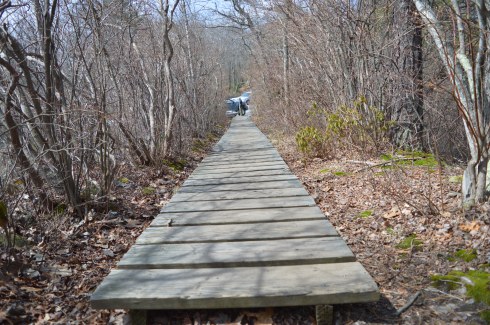
The trails at Winnekenni Park are mostly easy and wide.

I am always looking for treasures. One of the secrets to most visitors too the park are the trails off the main trail. Take the Plug Pond Trail foe some scenic views, pretty flowers and tall trees.

I must admit I got a little lost going on the side trails and the map I had didn’t seem to help much on the side trails. In any case, somehow I found myself in this clearing. It offered some pretty views but I don’t think i was supposed to be there. Eventually, I got out of there and made my way back to the main trail.

As you walk along the trails you will see a few more memorials, beautiful views and some other interesting things. Do be careful, especially if you travel some of the side trails or lesser used trails. Horses are apparently frequent visitors to the park.

This memorial was another one of the monuments I noticed along the trail. It appears it was recently visited based on the items left on the bench.

This memorial is dedicated to Ralph J Potter Jr.

Another memorial along the trail is this bench which is dedicated to Dudley Porter, who the main trail is named after. Porter was a successful business man. His wife dedicated the memorial to him after he passed away in 1905. It was actually built as a fountain and bench. But, the fountain no longer works as the main water connection has been disabled.

This memorial is located near the main entrance. it is dedicated to Christopher J Laubner. The garden and short walkway is called “Christopher’s Corner,” Originally from Lawrence, MA, Christopher moved to Haverhill where he lived until his death. He was only 31 when he passed away in 2014.

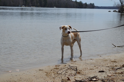
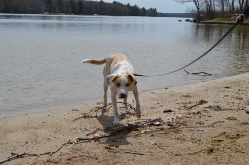
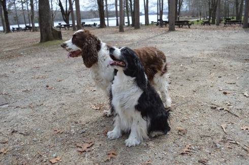
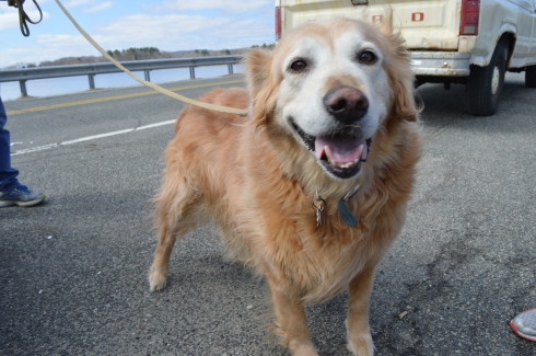
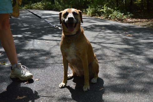
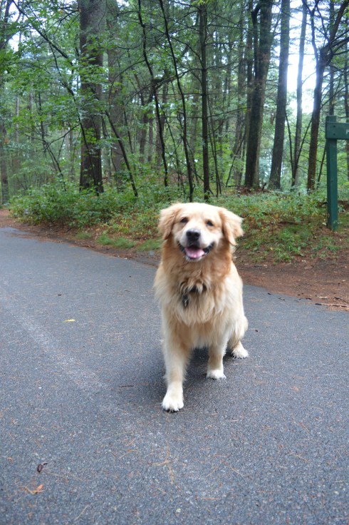
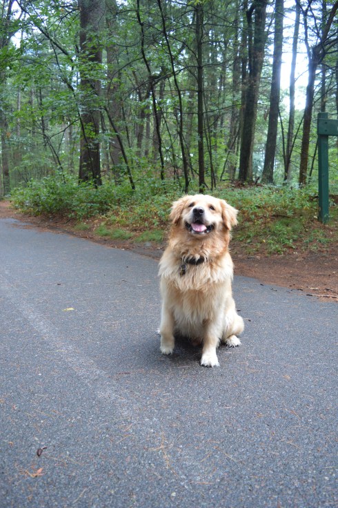
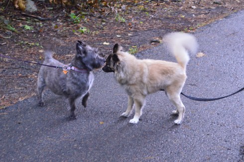
Winnekenni Park is a dog friendly park and I saw many cute dogs during my hike there.

Ziya is a 13 month old German Shepherd.

IMG_5953

Luna is a 2 year old pitbull.

IMG_6046

Not only is she adorable. She also loves to fetch!

Lily (or Lilly – her mom and dad spell it differently) is a 3 year old mixed breed.

IMG_5753

Mira is a 2 year old German Short Haired Pointer.

IMG_5692

Princess is a 1 and a half year old pitbull mix.
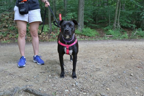
IMG_5574


Congamond Lakes (Southwick, MA)

Date Of Visit: July 4, 2017

Location: 93 Point Grove Rd, Southwick, MA

Hours: the ramps are open around the clock

Cost: $5 boat launch fee

Parking: there is parking available in the parking lot of the boat launch and there is limited parking on Point Grove Rd.,

Handicapped Accessible: Yes

Dog Friendly: Yes

Highlights: boat launch, fishing, scenic

IMG_9482

What better way to spend July 4th than at one of the busier lakes in Western MA?

Lake Congamond in Southwick, MA, seemed like the perfect place to spend the summer morning hours before our barbecue.  But, mostly because I like to say and write Lake Congamond.  What a fun name to say and what a fun lake to visit.

As  the name suggests, Congamond Lakes is not one lake but, rather, a group of lakes at the border of Massachusetts and Connecticut.  There are various boat launches.  We stopped off at the boat launch in Southwick (MA).


With a maximum depth level of 35 feet, the Congamond Lakes are a popular place for boating or taking some other aquatic vehicle.


Ducks are common at the lake and they are so used to being fed they will sometimes eat from your own hand.


Congamond roughly translates to “long fishing place” and we saw quite a few people fishing.


The pier offers spots for fishing, places to view the water and the boats or a place to sit with a friend.


Dogs are allowed at Congamond Lakes.  I’m just not sure they’re supposed to navigate the boats.


IMG_9319

Some dogs prefer land to being on boats.  Samurai is a Belgian Malinois.


Today’s featured link is Paul Samson’s Kayaking Blog.    People on boats, or in this case a kayak, can get to places those on land can’t get to and Paul found some gems during his kayaking adventure.  Paul’s blog post about Congamond Lakes can be found here.


Windsor Lake (North Adams, MA)


Oak Knoll Wildlife Sanctuary (Attleboro, MA)

Dates Of Visits: May 20 & June 19, 2017

Location: 1417 Park Street, Attleboro, MA

Hours: Trails are open daily dawn to dusk.  Office hours are:

Summer:
Mon-Fri, 9:30 am-4:30 pm
Closed Sat & Sun

Spring, Fall, Winter:
Tues-Sat, 9:30 am-4:30 pm
Sun, 10 am-4 pm
Closed Mon

Cost: Free but a $2 donation is suggested for visitors who aren’t members of the Mass. Audubon Society

Parking: There is ample parking inthe main parking lot for about 40 to 50 vehicles.

Trail Size/Difficulty: 1.5 miles, easy

Handicapped Accessible: The nature center and rest rooms are handicapped accessible.  The trails at Oak Knoll are not.

Dog friendly: No, most Audubon trails are not pet friendly

Highlights: wildlife, pond, easy trails, geo-caching, summer camp for children, nature center

Website: Oak Knoll Wildlife Sanctuary

Trail Map: Oak Knoll Wildlife Sanctuary Trail Map

Located about a mile and  a half from Attleboro Springs Wildlife Sanctuary, Oak Knoll is a fun trail with with scenic views, abundant wildlife and a few other surprises along he way.

Spring was in the air and a rebirth of sorts was happening on the trails.  During my first visit, I found these two Northern Water Snakes getting friendly.  To be honest, I wasn’t really sure what I was looking at.  But, I did think at the time I did hear the faint sounds of Al Green in the air.  The naturalist at the nature center told me you could tell they were mating by their interlocked tails.

The Northern Water Snake can be dangerous.  Although they usually tend to avoid confrontations, if they feel threatened the snake can bite their predator or perceived predator and their bites can require medical attention.  This is why I always tend to keep my distance (these photos were taken with my telephoto lens) and from behind in most of the shots I took except for the one front facing photo.

During my second visit in June, I noticed this turtle on the trail.  Since it is unusual for a turtle to be in the trail and its even more unusual for a turtle to not flee when they see a human (I could have pet the turtle I was so close although of course I never would at least not int he wild), I notified the naturalist since I thought maybe the turtle might be injured.  The naturalist told me the turtle was most likely laying her eggs as they often do this away away from the water and it was that time of the year when turtles will lay their eggs.

The naturalist also informed me that turtles also tend to lay their eggs on warm areas, such as the side of paved roads.  This is one of the reasons why turtles often get hit by cars on the side of the road.  So, be careful while your driving this time of the year!


The trails at Oak Knoll are easy with some boardwalks that pass over red maple swamps and freshwater marshes.  There are a few very slight inclines.  But the trails are primarily very easy.

The main trail at Oak Knoll is a loop that leads to and circles around Lake Talaquega (say that 5 times fast).  There are some pretty views of the lake along the way.

I also spotted this geocache off the trail.  Apparently, a regular visitor at the sanctuary installs these geocaches from time to time.

There are a wide variety of birds and other critters at the sanctuary.  This colorful insect is a six pointed tiger beetle.  I think they call him Ringo.

DSC_0780

There was also butterflies, garter snakes and a variety of birds.

The nature center at the entrance to the trails has amphibians in tanks that are being taken care of while they are rehabbed or are there for educational purposes, particularly for the children who are attending the summer camp they host.  They also have some pretty flowers and trees on their grounds.

Today’s Nomad link of the day is the North Attleboro Fish Hatchery by Trails And Walks In Rhode Island.  Trails And Walks offers informative and detailed summaries of different trails in and around the Rhode Island area.  I appreciate the short but sweet synopsis of each trail and the posts always include one pretty photograph of the area.  I may have also used the website to find some places to visit!


Leverett Pond/Echo Lake (Leverett, MA)

Date Of Visit: May 27, 2017

Location: Depot Rd, Leverett, MA (about 40 minutes north of Springfield, MA)

Hours: Open everyday from sunrise to sunset

Cost: Free

Parking: There is free street parking available on the shoulder of the road across from the lake.  There is room for about 5 cars.

Handicapped Accessible: Yes

Dog Friendly: Yes

Highlights: pond, poetry box, wildlife, boat launch

Website: Friends Of Leverett Pond

IMG_7285

Located in the center of town inconspicuously on the side of the road, Leverett Pond (also known as Echo Lake) is a 100 plus acre pond with amazing views and abundant wildlife.  In fact, the wildlife is so abundant it threatens the pond itself.  Beavers, specifically, seem to be clogging the dam at the nothern end.  It costs the organization $20,000 to fix this issue and they do not receive funding from the town.  So, the organization relies solely on donations.  But, still, the Friend of Leverett Pond are keep working to solve this problem.

Despite the ecological issues they may face, the pond still looks beautiful.

The pond is popular with boaters and fishing enthusiasts.  I saw two boats in the pond during the short time I was there.

During the winter, the pond is used by skaters.

While there were signs of wildlife, I was only able to see some fish in the water and a bird.

While the lake is a gem itself, one of the hidden treasures is the poetry box located on a tree by the lake.  If you weren’t looking for it you might just miss it.  Just to the left of the boat launch, the box is attached to a tree.

IMG_7214

Inside the box sits a binder with poems, stories and memories left behind by visitors. There are also a few pencils in the box for people to leave their thoughts and poems.   Some of the poems dated back to 2012.  It was not only nice to see this collection of art.  It was also nice to see it has been preserved and no one has stolen or disturbed the poetry box.

Behind the tree is a table for people to sit and read the binder or write their own addition to the binder.  The poems and other writings ranged from the comedic to the serious.  Some were written by children.  Others were written by older people.  Sometimes you could not tell who wrote the poem or what age they were.

Whether you’re a fisherman or fisherwoman, a boater or a poet, Leverett Pond is the perfect to spend the day.


Breakheart Reservation (Saugus, MA)

Date Of Visit: August 14, 2016

Location: 177 Forest St, Saugus, MA 781-223-0834

Parking:  There are about 30 parking spots at the entrance to the park.  There is also off street parking and parking available down the street at Kasabuski Arena (201 Forest St).

Cost: Free

Hours: Open everyday sunrise to sunset

Size: 640 acres

Time To Allot For Visit: At least 1 to 3 hours

Trail difficulty: Easy to Moderate in some areas

Dog Friendly: Yes

Fun For One: Yes

Highlights: scenic views – especially from Eagle Rock, beach, play area for children, trails for cycling and running, fishing is allowed

Lowlights: side trails end without warning, some rocky terrain

Trail Map: Breakheart Reservation Trail Map

Website: Breakheart Reservation

DSC_0200

Once a hunting ground and camp area for Paleo Indians as far back as the Archaic and Woodland eras (roughly 1000 – 2000 BCE),  Breakheart Reservation boasts two grand lakes, scenic vistas, a beach, a play area for children and miles of trails.

The trails are mostly easy with some moderately difficult trails and inclines.  The side trails can be challenging more because of the rocky and narrow terrain rather than the inclines.  The one downside to taking the side trails is that some of the side trails end without warning, such was the case with the Saugus River Trail which is one of the first side trails you will see when you enter the park.  The Cedar Glen Golf Course abuts the park.  So, you’ll hear and see golfers whacking their golf balls around.  Also, one side trail leads to the children’s camping site which you’re not supposed to access and yet another trail just ends near a store’s parking lot.  So, you end up walking long distances only to have to turn around.  If you want to avoid walking on trails that end suddenly, it’s best to stay on the main trail and the trails that loop around the lake.

The two lakes at Breakheart Reservation, Pearce Lake and Silver Lake, have trails that loop around the bodies of water.

Pearce Lake (considered the lower pond) has a beach and some very pretty views.  It runs along the main trail and along some of the side trails.  It is the larger of the two lakes and it is where the beach is loacted.

Although Lake Pearce is the larger of the two lakes, I found Lake Silver (the upper pond) to be more intriguing than Lake Pearce.

Lake Pearce has two smaller islands in the lake.  One of the islands is accessible via a makeshift walking bridge of branches, sticks and anything else that you can walk on to get to the island.  Except for some pretty views there wasn’t much on the island.

At an elevation of 206 feet, Eagle Rock offers scenic views of the Boston skyline and surrounding areas.  One suggestion I would make if you do try to climb up to Eagle Rock (it’s a moderate climb) is to use the “back” way to the vista (aptly names Eagle Rock Trail).  I went straight up along the rocky edge along the Pearce Lake Trail and it was more challenging than it would have been if I had gone up via the trail on Eagle Rock Trail.  There are other points of higher elevation on other trails such as Castle Rock and Crow Hill.

There are many other beautiful and interesting things along the trails at Breakheart Reservation.

This slideshow requires JavaScript.

Breakheart has a paved main trail which is usually packed with runner, cyclists and people walking their dogs, especially at the Bark Place where dogs are allowed off leash for a section of the trail.

DSC_0327

Breakheart Reservation stopped allowing vehicles on the trails some time ago.  It was great not having to look over your shoulder or carefully turn a corner worrying if a car or other vehicle might be coming your way.  It also allows lots of room for all the walkers, runners and, of course, the dogs that frequent the park.

These dogs had a great time at Breakheart Reservation during my visit…

DSC_0707DSC_0702DSC_0704DSC_0705

Bailey is a 6 year old Black Mouth Cur

DSC_0337DSC_0336DSC_0335DSC_0334

Cooper is a 7 year old Golden Retriever.

DSC_0217DSC_0235DSC_0250

DSC_0211

Free is an 8 year old Bichon and Shih Tzu mix.

Follow Me on Twitter:

New England Nomad – Twitter

and like me on Facebook:

New England Nomad – Facebook

or follow me on Instagram:

New England Nomad – Instagram

Similar Places In New England I Have Visited:

dsc_0237 (2)

Dorrs Pond, Manchester, NH

dsc_03413

Ipswich River Wildlife Sanctuary

rutland

Rutland State Park

Below is a video of the view from Eagle Rock.


Lake Char­gogg­a­gogg­man­chaugg­a­gogg­chau­bun­a­gung­a­maugg (Webster, MA)

Date Visited: April 9, 2016

Location: Webster, MA

Parking:  Parking is available at the entrance, before the gate and there is a big parking lot where you can also launch your watercraft at the head of the beach.

Cost: There are a variety of different fees established for visitors to Lake Char­gogg­a­gogg­man­chaugg­a­gogg­chau­bun­a­gung­a­maugg.  For instance, if you walk in or ride your bicycle to the lake and you are 17 or younger it is free.  If you walk to the lake or ride your bike and you are 18 or older it is $1 to get in.  A resident (of Webster) motor vehicle costs $5 for entry.  A resident motor vehicle with a water craft is $25, etc.  See the link below for all of the fees and regulations.

Lake Webster Rules and Fees

DSC_0086

Lake Char­gogg­a­gogg­man­chaugg­a­gogg­chau­bun­a­gung­a­maugg.  Try saying that 5 times fast.  I dare you!

Originally named Lake Chaubunagungamaugg or “Fishing Place at the Boundary”, Lake Char­gogg­a­gogg­man­chaugg­a­gogg­chau­bun­a­gung­a­maugg (meaning, “Englishmen at Manchaug at the Fishing Place at the Boundary”) is actually broken into two parts; a lake (Lake Char­gogg­a­gogg­man­chaugg­a­gogg­chau­bun­a­gung­a­maugg) and beach (Memorial Beach).

For the purposes of this post, I will call Lake Char­gogg­a­gogg­man­chaugg­a­gogg­chau­bun­a­gung­a­maugg Lake Webster as it is now more commonly called.

At the main entrance ofWebster Lake, there is a memorial to our veterans.  It is a fitting tribute for those who have gave so much.

Upon arriving at Webster Lake, you will see the lake.

Memorial Beach is dedicated to the veterans of all of our wars.

As beautiful as the lake is, I found the beach, located just beyond the lake to be even more beautiful.  To me, it’s basically one large body of water and I am not sure why they have separate names.

This slideshow requires JavaScript.

Webster Lake and Memorial Beach are a boaters/kayakers/fisher person’s dream.

Lake Webster also has a variety of bird life.

DSC_0455DSC_0450DSC_0336DSC_0354DSC_0360DSC_0208DSC_0194DSC_0223

Dogs are not allowed at the lake or beach.

There is also a basketball court and play area.

The beauty of the beach and the sound of the water could only be captured in a video

Please check out my Facebook Page and like my page by clicking on the link below!

New England Nomad


Rutland State Park (Rutland, MA)

Date Visited: April 10, 2016

Location: White Hall Rd, Rutland, Massachusetts

Cost: Free since I visited during the off season.  It costs $8 for MA vehicles and $10 for out of state vehicles once the main season begins (around early May)

Parking is limited.  Since it was not the peak of the season, I found a spot without any trouble.  But, there are only 20 or so spots in the main parking areas. There are some additional parking areas off the main trail to the lake.

Boats are not allowed in the water, although fishing is allowed.  Trout and bass are the most common fish in the water.

DSC_0731

I had been interested in visitng Rutland State ever since I heard about the remnants of the state prison camp  and the views of the water.

DSC_0973

There was a strong wind, evident by the ripples in the water.

This slideshow requires JavaScript.

The gates at the entrances to some of the trails prevented some vehicles from entering the trails.  This is because during this time of the year it rains a lot and bikes and other vehicles can get stuck on the trails.  So, it was a pretty empty trail when I went.  Which was just fine by me.  Miles of near solitude in nature with a cloudless, cold blue sky on a bright New England morning….yes please!

The main trail I stayed on was easy with some moderate includes.  The only thing you may find annoying is the long stretches of nothing but trees and water on each side of the trail.  This was heaven for me, though.  I was also pleased to see a dirt trail rather than gravel or, gasp, paved road.

As I continued on the main trail, I began to see signs of ruins of structures frozen in time.  A stairwell and frame of a building, now adorned with graffiti (get used to it as it is a constant theme), stood on the outskirts of the trail.

At around the 2 mile mark of the trail there are remnants of a prison camp.  The camp was constructed in 1903 for housing petty criminals.  It would later be converted into a farm.  The first structure, again riddled with graffiti, was used for solitary confinement.

When you consider just how small and confining the spaces in the building are you can only imagine the distress it caused some of the prisoners.

Something happened when I visited the remnants of the prison camp.  What I had once considered “cool” and interesting, seemed dank and sad.  In fact, it wasn’t until after I left the structure and cave that it really sunk in.  It seems like a grim existence at the least. When you realize people lived in these conditions and suffered, largely for committing petty crimes (such as drunkeness), it makes you think we should be more cognizant of the history of the building and area.  If it wasn’t so tragic it would be more interesting.  Rather than being “cool”, it just made me depressed.

Farther along the trail is an arch that appears to be a root-like cellar.  I am not sure what it was used for but my gut tells me nothing good.

There are also some interesting tunnels and holes in the ground at the old prison site.  I decided to investigate.

Given the architecture of the structures and the history of the area, it is easy to see why the park is considered haunted.  Disembodied voices and apparitions are said to have been witnessed by visitors. There are even claims the area was once used for satanic worship. The area was the subject of the book The Soul Collector, written by Joni Mayhan.

On a brighter note, I saw lots of four legged friends at Rutland State Park.

DSC_0757DSC_0753

(left to right) Grayson, 7, an American Pit Bull Terrier and Gamble, 6, a Pit Bull and Boxer mix.

DSC_0789DSC_0788 Blackie, 4 years old, a part husky.

I also saw some other four legged friends.

DSC_0823DSC_0822

Panda, in front, is a training horse.  Calvin is the horse on the right and the horse in the back left (who is difficult to see) is Jack.

There were also a few kids playing on their motor bikes and ATV’s.

The videos below are some videos from my visit.  Thank you for reading!

Please check out my Facebook page: New England Nomad ‘s Facebook Page


Douglas State Forest (Douglas, MA)

Date Visited: April 9, 2016

Cost:  Since I visited during the off season, it was free.  The web site states it costs $9 for MA vehicles and $11 for out of state vehicles.  Prices may vary if you bring your boat.

Location: 107 Wallum Lake Rd. Douglas, MA

Parking:  Parking is limited at the main entrance.  It probably fills up quickly during the summer weekends.  There is also additional parking for boaters farther down the road to the entrance.  There is also additional areas to park near the forest.

Douglas State Forest

DSC_0544

I wasn’t sure what to expect when I arrived at Douglas State Forest.  It just happened to be in the area of another attraction I was visiting.  But, I’m a firm believer in spontaneity, no I really am, so I decided to give it a whirl.  I’m glad I did.

Douglas State Forest has a few different entrances besides the main entrance at Wallum Lake Drive.  I passed some of them on the way to the main entrance.  It may be a good option to try these entrances (off Webster and Wallis Streets respectively).  After viewing the map for Douglas State Forest, I have determined I only walked a fraction of the  5,525 acres of the park.

There are many hidden trails and long trails in the park. In fact,  the Midstate Trail, a 95 mile hiking trail that extends through central Massachusetts to Mt. Watatic in the north, runs through the forest.  I saw a group of walkers/hikers at one of the other entrances during my drive.  I suspect they may have been gearing up to hike a section of this trail.  There is also some rare Atlantic White Cedar swampland at Douglas State Forest.  Boards are laid down to allow walking over these areas.

DSC_0538DSC_0614DSC_0615

After arriving at Douglas State Forest, I walked the easy, half mile or so trail trail to Wallum Lake (the trail continues on much farther but I only walked to the boat launch and fishing area).  A sure sign that spring is begrudgingly, well, springing was abundant.  The trails are mainly like the one pictured below.  I would describe the trails I took as being easy to moderate but the trail may get harder the farther you walk.

There were several people fishing and an assortment of boats in the lake.  Boaters always seem to want to show off and speed around when they see someone with a camera!

DSC_0518DSC_0514DSC_0516DSC_0524DSC_0593

Douglas Forest is a year-round attraction.  Swimming, fishing and boating are allowed in the lake.  In the winter snow shoeing and snowmobiling are popular activities at the forest.  Horses and dogs are also allowed at the forest.

The views from the lake were beautiful.

This slideshow requires JavaScript.

What started as a gloomy, chilly, overcast day, typical of a true New England spring day, turned into a sunny, warm day.  It was the perfect day to take your pooch out for a walk and they were in abundance at Douglas Forest.

DSC_0568DSC_0565

Lloyd is a 3 year old husky and lab mix.  He was adopted by his pet parent from a shelter and he loves to play in the water.

DSC_0639

Delilah is a 5 year old Staffy (Staffordshire Bull Terrier).  She was rescued one day before she was slated to be put down.  She is also from England and loves to play with sticks.  Welcome to America, Delilah!

DSC_0642

Dixie and Monty, Irish Spring Setters, posed perfectly for their dad.

Central Massachusetts (where Douglas is located) had always been a place to drive through to get to Western Massachusetts and its plethora of mountains, forests and waterfalls.  But, I have been spending a lot of time in Central Massachusetts. After my last few visits I have fallen in love with the area.  I will have many more posts coming from my travels in the Central Massachusetts area.  Stay tuned and thank you for reading!

Please check out my Facebook Page and “like” it for additional photos, posts and videos.  Thank you!

New England Nomad on Facebook


Lake Onota (Pittsfield, MA)

Date Visited: March 26, 2016

DSC_0925

Driving home from Balance Rock State Park, I happened upon Lake Onota   This is what is so great about New England, and really any area of the country.  You can find the most beautiful places at the most unexpected moments.

A popular fishing spot, Lake Onota is a 617 acre pond located in Pittsfield, Massachusetts.  It flows into the Housatonic River which eventually drains into Long Island Sound.  Fishermen and women and boaters flock to Lake Onota for the bass, trout, walleye and crappie (yes they even fish for crappie fish).  

A roadway bisects the lake.  Of course, typical of New England weather, while it was very cloudy on one side, the other side had nary a cloud.

This slideshow requires JavaScript.

Dogs like Lake Onota as well.  I met Becca, a happy 9 year old golden retriever,there.

DSC_0924