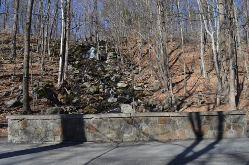
The Keystone Arches Bridge Trail is full of surprises. One of these surprises is a waterfall which is only a short jaunt down the main trail (about quarter of a mile from the entrance).
This slideshow requires JavaScript.
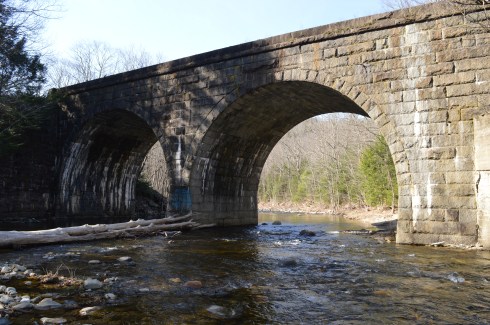
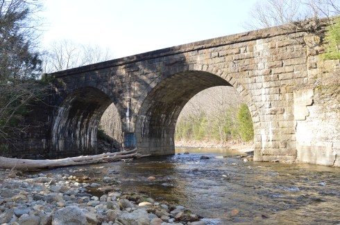
Another short walk brings you to the main attraction, the Keystone Arch Bridge.
The bridge was made from local Chester blue granite and reach up to 70 feet. There is a weathered, crumbling stairway up the side of the bridge. Bear in mind, the stairs are a little tricky if you do take this route. I took this stairway as far as I could. The views were very pretty.
There is a train railroad that continues on to the bridge
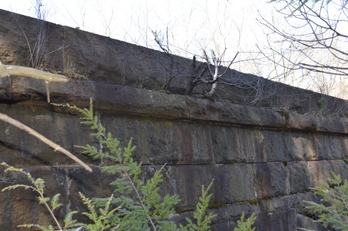
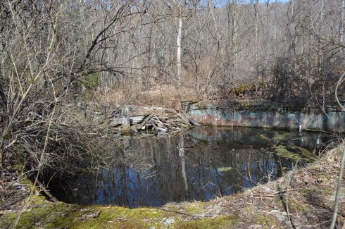
The Keystone Arches Bridge Trail encompasses area that used to be an artist colony. There are remnants of the colony present off the main trail
There was a clock tower
and the remnants of what used to be a swimming pool. Anyone want to take a quick dip?
and some other foundations of what were once buildings
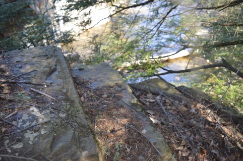
Along the trail there are many pretty trees, plants, waterfalls and other interesting structures and rocks.
The Keystone Arches Bridge Trail boasts a variety of wildlife such as moose, bobcats, fox and a variety of other animals. I found this critter during my travels.
The 5 mile loop at Keystone Arches Bridge Trail are dirt trails with some jutting rocks and holes which often form puddles and dirt which must make it challenging for the cyclists who frequent the trail. The trails are easy to moderate with some challenging inclines. The website cautions the trail is not suitable for novice cyclists.
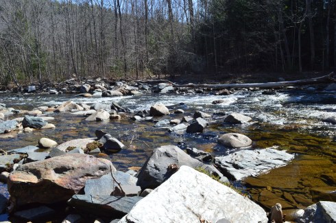
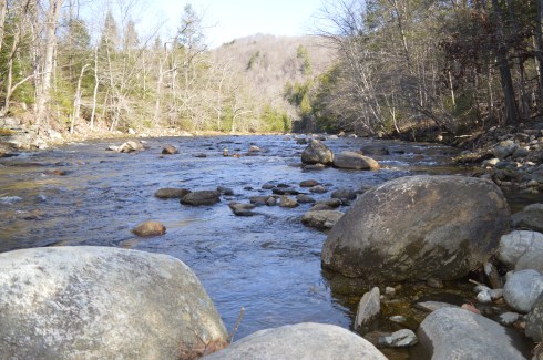
There are other arches and bridges at the Keystone Arches Bridge Trail and it is not unusual to see people climbing up some of the arches. However, we only went about a couple miles before turning back because of time constraints (see future blog post). The kayakers who frequent the stream at the Keystone Arches Trail, were absent due a white water race that particular day. But, normally they are present in large numbers.
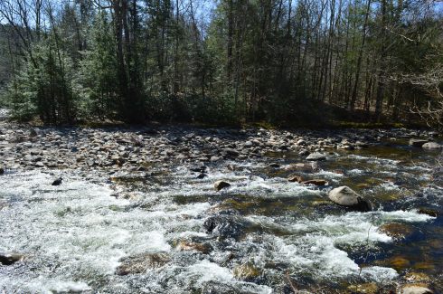
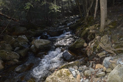
Along the trail are some impressive rapids.
I couldn’t help notice how the rapids mirror our own lives: rapid and frenzied activity one moment, calm, serene the next.
The video below gives a glimpse of the power, beauty and serenity of the rapids.
Durango, a 12 year old Australian Sheepdog, is the mascot of the Chester Railway Station And Museum and he’s a great tour guide. The Chester Railway Station Museum had organized a tour of the trail and Durango went along with them.
In 1900, Stephen Salisbury II built a tower on what is now known as Salisbury Park as a tribute to his friend, historian and jack of all trades, George Bancroft. And to think, my friends only usually give me gift cards, wine and books for my birthday.
The park is has a wide variety of bird life.
As I was reviewing the photos, I couldn’t help feeling the tower was purposefully constructed to look as though it was incomplete. The sides are not rounded and seem almost as though they were cut off from the facade or the builder gave up half way through. But, as the photos show it was indeed constructed this way by design.
This slideshow requires JavaScript.
My favorite view from the tower was at the arched entrance.
The 56 foot tower is made of natural stone and granite. It was designed by Stephen C. Earle and Clellann W. Fisher.
The plaque at the memorial states:
BANCROFT TOWER
THIS TOWER WAS BUILT IN 1900
TO HONOR THE MEMORY OF
GEORGE BANCROFT
1800-1891
BORN AT THE FOOT OF THIS HILL
HE ROSE TO THE POSTS OF
SECRETARY OF THE NAVY
FOUNDER OF THE U.S. NAVAL ACADEMY
ANNAPOLIS, MARYLAND
U.S. MINISTER TO GREAT BRITAIN
AND GERMANY
THIS MEMORIAL WAS BUILT BY HIS
FRIEND AND ADMIRER
STEPHEN SALISBURY III
Jacks wasn’t impressed by the tower.
There were some views of the city from the parking lot.
During my visit and in my research after the shoot, I found out they let visitors inside the tower during October of each year. The views at the top are said to give 360 degree views of the area. The sorority and fraternity at the local college also holds a Halloween party for the kids in the area at the tower with mild scares. So, it looks like a visit in October is on my list!
A walking tour of the Bancroft Tower:
Please stop by my Facebook page and like my page for extra photos, videos and other fun stuff!
Driving home from Balance Rock State Park, I happened upon Lake Onota This is what is so great about New England, and really any area of the country. You can find the most beautiful places at the most unexpected moments.
A popular fishing spot, Lake Onota is a 617 acre pond located in Pittsfield, Massachusetts. It flows into the Housatonic River which eventually drains into Long Island Sound. Fishermen and women and boaters flock to Lake Onota for the bass, trout, walleye and crappie (yes they even fish for crappie fish).
A roadway bisects the lake. Of course, typical of New England weather, while it was very cloudy on one side, the other side had nary a cloud.
This slideshow requires JavaScript.
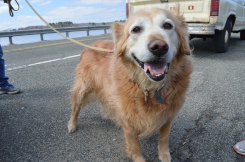
Dogs like Lake Onota as well. I met Becca, a happy 9 year old golden retriever,there.
Parking: There are several parking lots at the Greater Worcester Land Trust which the Cascading Waters is part of. The closest lot to the Cascading Waters is small with only room for about half a dozen cars. You can also drive up to Cascading Waters via Cataract St and park on the dirt road there.
One of the great things about Worcester (pronounced “Woo-stah”) is its diversity of people and places. One moment you could be in the heart of the city and only ten minutes later you could be at a grand waterfall. It remind me a lot of Boston in this regard.
I found myself at one of the natural wonders of Worcester, Cascading Falls, Saturday.
Located about an hour west of Boston, Cascading Falls is known for its beauty and trails. There are both hiking and biking trails at the main parking area. I chose the most direct hiking route to the falls. The trail is pretty flat and straight with some pretty views. I also noticed some greenery sprouting on the eve of the first day of Spring. it’s about half a mile to the Cascading Waters from the parking area.
There is a trail to the right of the falls with a fairly steep incline. The trail leads to the top of the falls. You can go to the top of the waters. The views are pretty sweet.
This slideshow requires JavaScript.
There are also interesting rocks, pools of water and streams at the top of Cascading Waters.
This slideshow requires JavaScript.
Although the sun was out and the temperatures did increase, it was still relatively cold as this branch shows.
The waterfall leads to a stream just under and behind the trail.
Cascading Waters is a great place to take your dog for a walk. I met two golden retrievers; Wilson (on the left ) and Tucker, while I was there.
Below are two videos of Cascading Waters from the trail view and view from the top of the falls.
New Hampshire isn’t known as the “Live Free Or Die” state for no reason. The quote, which is said to have French origins and adorns license plates and other kitschy souvenirs, is directly attributed to General, and former New Hampshire resident, John Stark. It was at John Stark Park in Manchester, NH, that I found this historical tribute to the revolutionary warrior.
The remaining of the “live free or die…”quote is lesser known, yet just as poignant.
For someone who is so heroic and brave, General Stark is not someone who many of us are familiar with. But, heroic he is. As the plaque in front of his statue explains, after being kidnapped by a Native American tribe and eventually ransomed, Stark joined the American Revolution and became a general. His most notable achievement was in 1777 when he commanded his troops to prevent British troops and supplies from connecting with the main army in Saratoga, New York, which was considered a key point which led to the American victory in the war.
Crisp blue skies awaited me at the park. It almost felt fall-like. What struck me most about the park was how peaceful it was. The gazebo is a nice touch also. The statue of General Stark was sculpted by Richard Recchia in 1948. The park is one of the older parks in New Hampshire, dating back to 1893 (it is the second oldest park in Manchester).
This slideshow requires JavaScript.
General Stark his, wife and a few of their children are buried at the bottom of the hill from the entrance.
One of the interesting things about Stark Park is the loop behind the park. It’s only about a quarter of mile and it is a great place to take your dog for a walk. But, there is a trail that branches off to a bridge and some other trails which eventually lead to the Heritage Trail. But, apart from some interesting trees and some wildlife, there isn’t much on the trails. Most of them lead to residential areas. I walked most of the narrow trails as far as I could go before they ended, rather disappointingly, at roadways and residential areas.
The big payoff to walking the loop behind the park was meeting Bennie. Bennie is a Chinook which is the state dog of New Hampshire.
A hidden gem of the Coolidge Reservation, Magnolia Beach is located a short walk from the main entrance (about a half mile walk). From Coolidge Reservation, just take a left by the bridge off the main trail and you’ll find this sandy paradise. Or, you can access the beach more directly from a lot at the main entrance in the nearby city of Gloucester. Magnolia Beach is a fairly small beach so if you do plan on going, I would plan on getting there early as it must get packed during the summer days.
It was the perfect day for a walk along the beach – low tide, 50 degree weather and the waves were swelling.
This slideshow requires JavaScript.
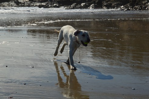
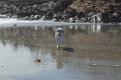
Magnolia Beach is a perfect for dogs and humans. Gigi had fun playing catch.
The sea shells on the beach are very unique.
This house on the hill above the beach must have some great views.
One of the beach goers took advantage of the windy conditions to fly his or her kite.
Attached below is a video of the sights and sounds of the beach during my visit.
There are about a dozen parking spaces in the main parking lot. If needed, you can also park on the side of the road by the parking lot.
Cost: Free
Hours: open daily, sunrise to sunset
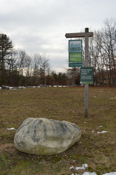
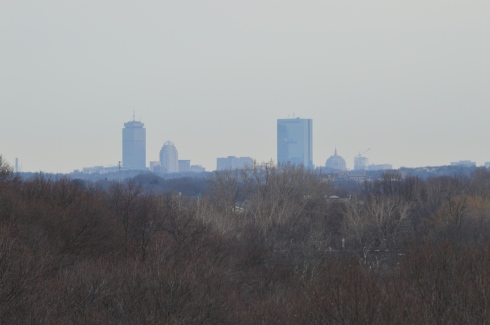
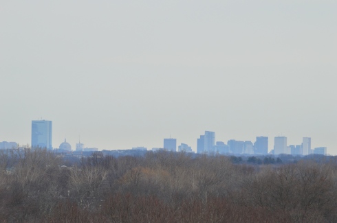
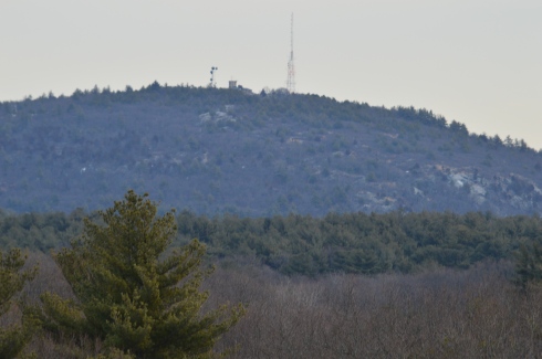
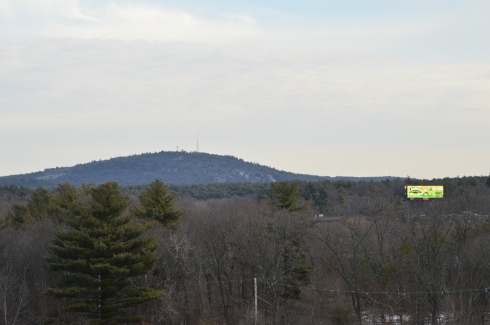
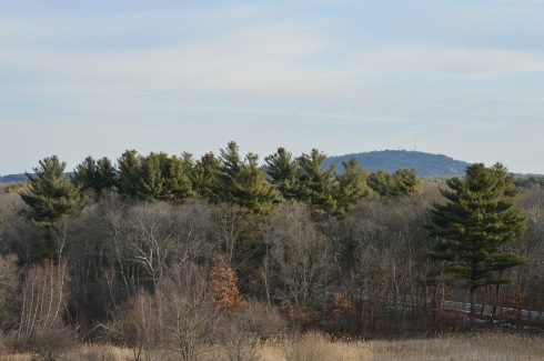
Before you even begin climbing the ascent to Signal Hill, the views from the parking lot are astounding.
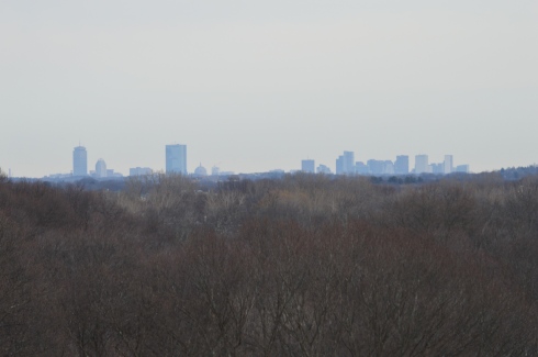
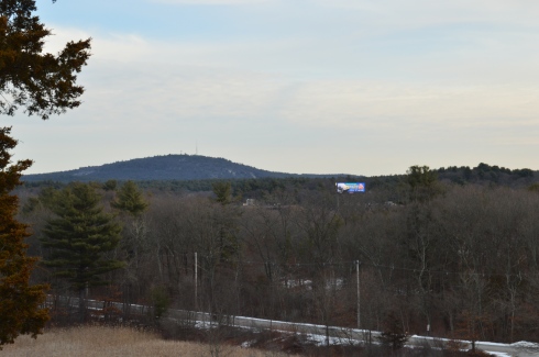
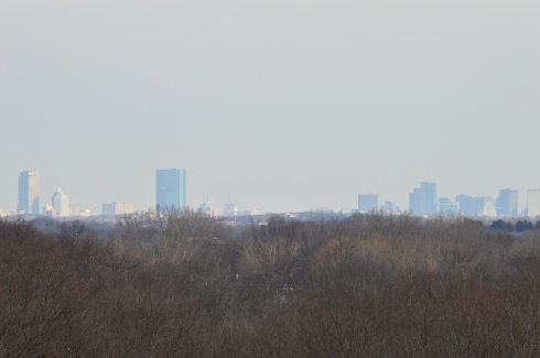
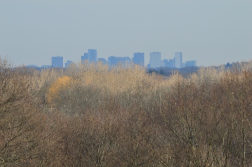
Besides the historical significance (it used to be the home to the Paleo-Americans who settled on what would become the Neponset River) and the active wildlife (hawks are said to nest there and many amphibians inhabit the area by the river), Signal Hill also offers grand views of the Boston Skyline, Blue Hills and the Neponset River Valley.
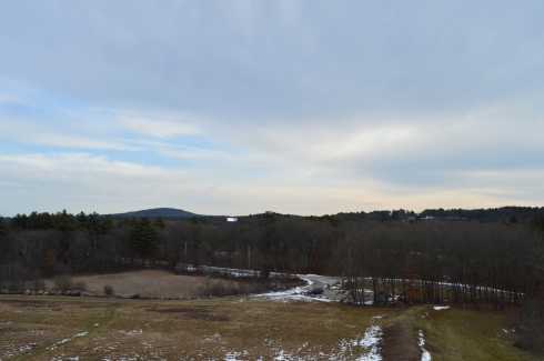
The hill to the scenic outlook at Signal Hill is modest at best. It should only take 10 minutes to go from the parking lot to the outlook.
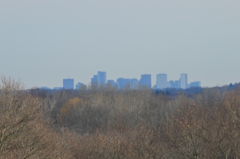
The views are worth the short hike.
The scenic overlook has some pretty trees and rocks.
One of the charming features of Signal Hill is the short loop (1.6 miles) at the base of the hill. After climbing and trudging along so many long and steep hills, it’s refreshing to be able to take a leisurely stroll along the clearly defined trail. There are also trails that veer off a little.
Off the main trail there is a canoe launch site on the Neponset River. The upstream launch site goes to Norwood (MA) while the downstream site leads to Milton (MA).
Since there is little traffic on the road, the road to Signal Hill is popular with joggers and cyclists.
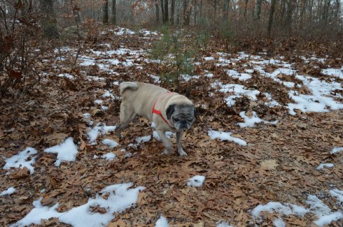
I met Charley during my visit. He was having fun playing in what remained of the snow on the trail.
Hours 8 a.m. – 8 p..m. (during the regular season, open without staff during the off season)
There are about 10-20 parking spots by the main entrance but there is a parking lot across the street for overflow traffic (watch out for the holes and bumps in the lot)
Cost: Free but it may cost to put a boat or other watercraft in the lake
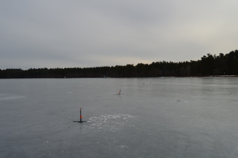
“Massabesic” (pronounced Mass-A-Bee-Sick) is a Native American word for “place of much water” or “near the great brook”. True to its translation, Massabesic Lake Watershed is definitely a place where you will find much water, albeit frozen. Manchester Airport is nearby so it is not uncommon to see a plane fly by as is evident in one of the photos in the slideshow below.
This slideshow requires JavaScript.
Normally, I would consider visiting a lake, pond or any body of water during the winter something of a waste. Little did I realize though, lakes can be as much fun in the winter as they are during the summer.
A sign on the trail in Massabesic Lake warns you to stay on the trail. This is partly because the houses are so close to the trail. Also, you have to cross busy roadways at some points to continue on the trail.
There were people ice fishing (the orange flags on the poles in the water stick up when they get a bite). Since Lake Massabesic is used as a watershed, people are not allowed to swim or put their bodies in the water. But, you can fish, sail and canoe on the lake.
There were people sailing on their ice boats. You can hear the gentleman talking to me in the video below. Are there any friendlier people on this planet than the people of New Hampshire?
or relaxing in their favorite chair
The Massabesic Lake is home to a trail that leads to Portsmouth, NH as part of the Rockingham Recreational Trail. As much as I love Portsmouth, I wasn’t up for hiking that far (The Rockingham Recreational Trail is 26 miles total). It is called a “Rail Trail” because it used to be part of the railway system and was converted over to a trail. It is very popular with cyclists. The cyclist pictured below had wide tires, presumably to deal with all off the ice as it was very icy. He is a braver man than I. There is also a 4 mile loop at the lake.
Overall, I would rate the trails I hiked easy to moderate in some parts. The only hard part was dealing with the ice on the trails. It went from being very easy to manage to downright dangerous due to the icy conditions. As the snow melted in the morning it turned to mud, then iced over again. During the morning hours, the ice was melting at a rapid pace. Then, a few hours later, you could walk on the lake again because the temperatures dropped so much. While the weather was warmish (by New Hampshire standards), you could hear the ice making noises as it melted. You may be able to hear the “groaning” noises in the video below.
I did manage to walk out on the ice myself, after seeing everyone else out there first of course.
Meet Jackson, a Siberian husky. Jackson has one blue eye and one brown eye. I tried to photograph his eyes but he was blinking when the photo was taken. You may be able to see his different colored eyes if you zoom in on the first photo. He was very playful and friendly and what about that smile in the second photo!
Please like my Facebook page for photos not included in my blogs, videos and other fun stuff! Thank you.
Price: $20 for adults, $10 for children (ages 3-11) and seniors (over 65)
This was a special cruise and is not something they do regularly in the winter. During the spring, summer and fall they have cruises scheduled regularly.
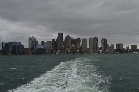
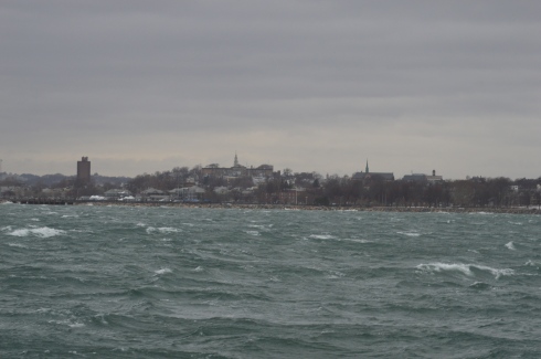
Twenty degree weather and an impending winter storm; what better conditions for a harbor cruise. Ironically, that statement could not be more accurate.
We were greeted by gulls and rough seas when we arrived at the wharf.
As we made our way on to the boat for and they announced the cruise would be a three hour tour (in retrospect, that Gilligan’s Island reference should have been a bad omen), I was surprised by how roomy, comfortable and modern it was. The three story boat had booths on the sides of the cabin area and ample seating.
Even before we left the wharf I took some shots of the bay. You can see Logan Airport in the distance in some of the photos.
This slideshow requires JavaScript.
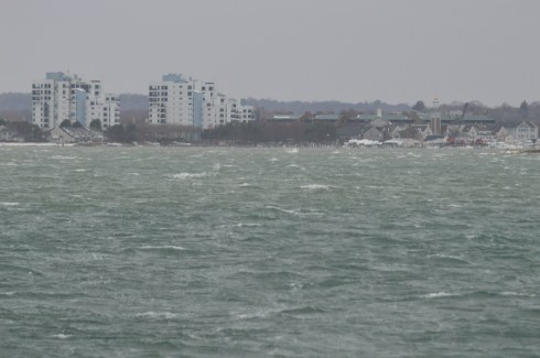
As the boat left the bay, I took some obligatory photos of the skyline.
I had to bundle up (and hold on tight to the railing) for the shoot. I was surprised at how well I handled the overly active ocean. I’ve never been particularly fond of roller coasters, wavy oceans or anything that moves to and fro quickly. But, I did fine. The only time I felt a tinge of sickness was when a fellow traveler described his own feelings of sea sickness (gee, thanks random stranger). But, that quickly passed.
There was a variety of sea life, although the choppy waters made it difficult to photograph all of them. DCR (Department of Conservation and Recreation) officials were on the boat with binoculars on the lookout for wildlife and other points of interest and announcements were made whenever a bird or other animal was sighted.
I did photograph this Eider as he swam with friends.
and a few other elusive birds.
This slideshow requires JavaScript.
Even though it was a cruise for wildlife viewing some of the best views were of the harbor and the islands.
This is Spectacle Island. Spectacle Island was made entirely from the dirt from the huge construction project known as the “Big Dig”. it is much prettier during the summer.
These are some photos of Boston Light. Boston Light is the first Lighthouse in America. It is still working today.
This slideshow requires JavaScript.
The Deer Island Waste Water Treatment Plant began operations in 1995. It is clearly the jewel of Boston Harbor. Prior to the construction of the sewage plant, sewage from Boston’s treatment facilities had contaminated shellfish after the sewage had been released. Lunch, anyone?
These structures are what is left of the bridge to Long Island (not the one in NY – we didn’t go out that far). It was dismantled recently. Personally, I think they should keep them. They make for a good background for photography.
Below is a slideshow of some of the other shots from my cruise. It was very windy and the sea was pretty choppy. I tried to capture this in the photos.
This slideshow requires JavaScript.
Finally, I found a cute furry animal named Bailey to photograph when I disembarked from the boat.
See below for videos of the cruise to get a better idea of just how windy it was.
Although the area is mostly known for being the home of the New England Patriots and its adjacent marketplace, Patriot Place has another impressive attraction – The Nature Trail and Cranberry Bog. Admission to the trail and bog is free and the parking is ample evident by the photo below. You can also park in the lots in front of the store and walk down to the trail.
From the entrance the Nature Trail and Cranberry Bog greets you with a charming sitting area and pretty trees.
This slideshow requires JavaScript.
Although most of the vegetation is dead (save for a few stubborn blueberries and cranberries), a thin layer of ice covered most of the pond and the trees are bare this time of the year, the Nature Trail and Cranberry Bog at Patriot Place in Foxboro, MA, is just as beautiful in the winter as it is during the summertime.
This slideshow requires JavaScript.
Located directly behind the expansive Bass Pro Shop, the Nature Trail and Cranberry Bog is a .5 mile loop with a 3 percent grade and some inclines as much as 12 percent.
It is a mostly dirty trail with a few boardwalks and bridges. There are two benches in the middle of the first walking bridge. Overall, it is an easy to semi-moderate trail. I saw people of all age groups handle the trail, inclines and all, with little difficulty.
I found this strange, creepy looking branch or alien arm protruding from the ice.
An extra bonus for any Patriots fan is you can see Gillette Stadium (the stadium the Patriots play in) from the main road on the way to the Nature Trail and Cranberry Bog. You can also catch a quick glimpse of some of the stadium from the entrance to trail and bog.
After finishing the loop, I met Chandler, a beautiful 6 year old tri-colored English Setter (thank you for the clarification, Adam).
Thank you for reading and please like my Facebook page to view videos, photos and more that I do not post on this blog:


 Thank you for reading and please like my Facebook page to view videos, photos and more that I do not post on this blog: