Location: 33 Lothrop St, Beverly, MA (about 30 minutes northeast of Boston, MA)
Hours: Open daily sunrise to sunset
Parking: On street parking is available but limited. I did not see a parking lot at or near the beach.
Handicapped Accessible: Yes, certain areas are handicapped accessible. The beach is accessible through a paved walkway to the right of the beach.
Dog Friendly: Yes
Highlights: scenic, boating and other water activities, historical memorials, fishing, wildlife
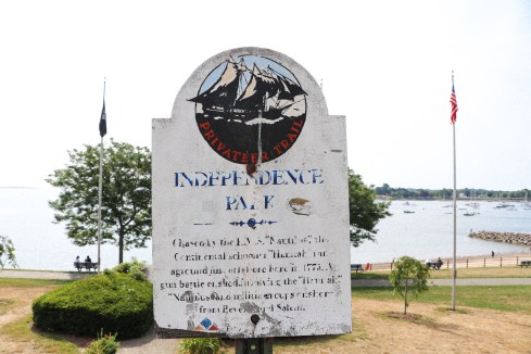
History, beauty and recreation await you at Independence Park.
The picturesque park offers scenic views and benches to sit.
Although the bench and path at the park are pretty and provide beautiful views, they do not lead to the beach.
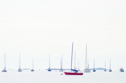
I don’t usually take artistic license with the photos I take. But as I was editing this photo, I noticed how the red really stood out in the boat at the front of the group of boats.
Although it may be possible to get to the beach from the path by the benches, a fence and rocky area prevent easy access to the beach.
There are entrances to beach are a short jaunt to the right and left of the monuments at the park. And, to the right of the park is a paved walkway to the beach.
The beach offers beautiful views, a clean beach area and a jetty to fish off. Rumor has it striped bass (“stripers”) are abundant in the area.
There are a lot of birds and other wildlife at the beach.
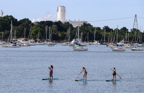
The beach is a popular spot for paddle boarders, surfers and boaters.
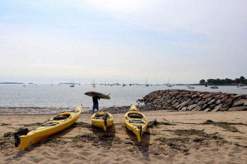
If you’re in the area and you want to try paddle boarding, kayaking or even winter paddling or snow shoeing during the winter, try Coast To Coast Paddle. Aaron, seen in the photo below, was getting ready to take a few paddlers out while I was taking photographs.
As the name would suggest, Independence Park is more than just a haven for sun seekers and paddle boarders. It also has a rich history.
One of the plaques at the park states that in 1775 the first authorized armed ship, The Hanna, set sail in those waters to capture British vessels. Just standing in an area that played such a pivotal role in our history is pretty freegin cool when you think about it.
There are also cannons, monuments and flags on the grounds of the park.
The park is dog friendly and there were quite a few dogs at the beach while I was there.
Below are just a few of the cute dogs I saw during my visit.
Koa (on the left) is a 3 month old mixed breed dog. Frank (on the right) is a Golden Retriever.
Polly is a 13 year old mixed breed dog.
Willow is a 4 month old Englisg Cream Golden Retriever.
(Oliver) Twist is a 5 year old Schnauzer Cairn Terrier mix (aka Carnauzer).
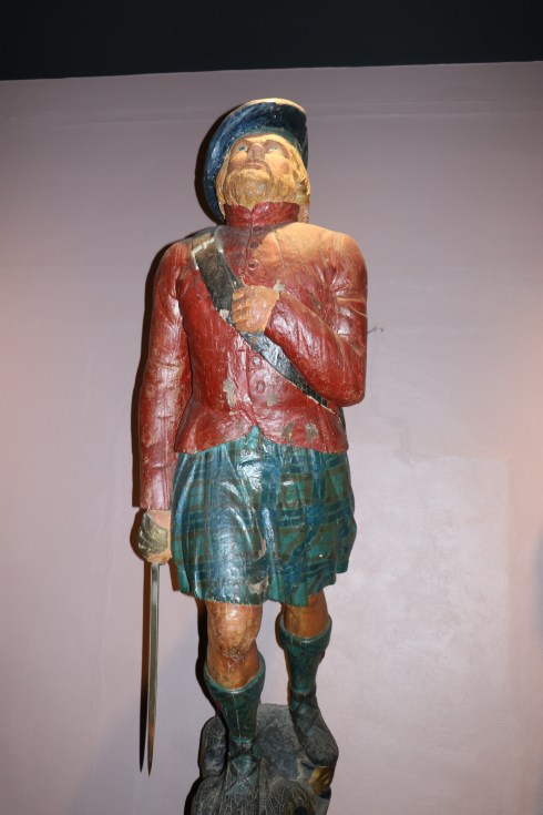
Highlights: Items and people in costume from various eras
Hello fellow bloggers and readers, I have been out of commission for a while due to a back injury. But, I am recovering and I should be back to my normal blogging schedule soon. Thank you for your support and I look forward to posting more of my adventures!
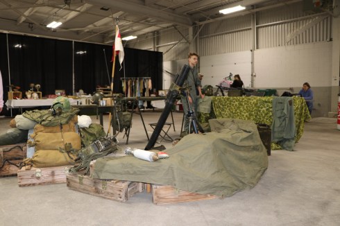
The Eastern State Exposition Center in West Springfield. MA, was in a time warp the last weekend of February.
The Northeast Reenactors (formerly the New England Reenactors) descended upon the Big E to show off their attire, sell their era-appropriate merchandise and celebrate the days of yore.
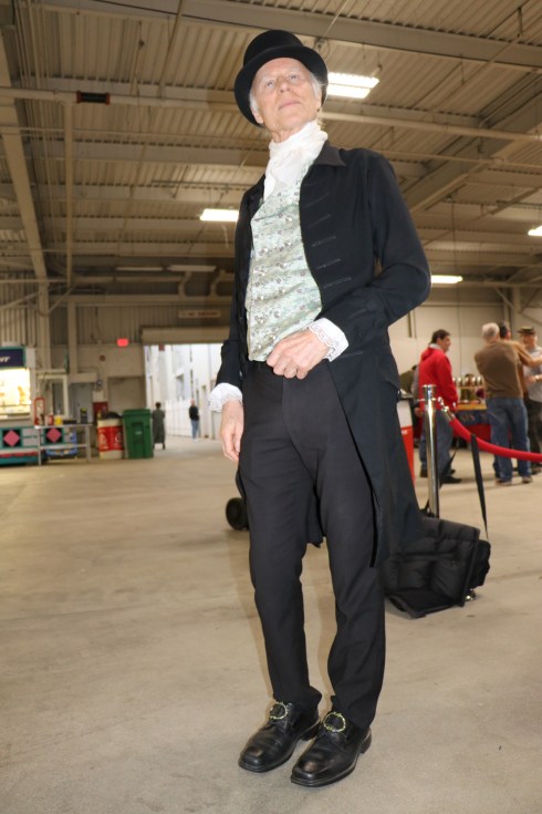
There were reenactors of every era in costume at the fair.
While there were reenactors from every time period, there were quite a lot of Vietnam War era reenactors.
The weapon in this photo, an M29 Mortar, is still used today, with some slight modifications. If you never thought you would ever use geometry, think again. The trajectory of the projectiles use a lot of geometry and other mathematical formulas to direct the mortars accurately. Also, it took five people, yes five people, to operator (the squad leader, the gunner, the assistant gunner, first ammunition bear and the second ammunition bearer). One of the projectiles can be seen to the right of the M 29.
There were also vendors selling their wares. Many of the products being sold were home made replicas of the items of previous eras.
There were also various displays of the popular attire, books and other items from the various eras.
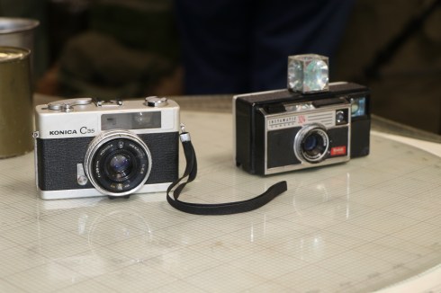
Check out the cameras used during the Vietnam era. Maybe I should consider trading in for one.
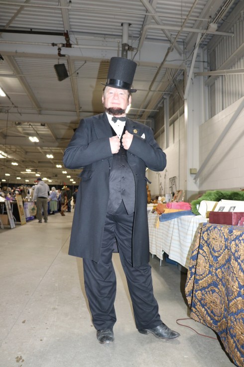
It was such a big event, even two presidents showed up.
President Madison
And, of course, President Lincoln.
If all that wasn’t enough, there was also entertainment at the reenactors fair. Singers performed a variety of songs from the past.
Below is a video of one of the talented performers.
Please follow me on Facebook to view photos, video and other content not included on my blog.
Handicapped Accessible:The museum is wheelchair accessible and guests may request a wheelchair at the front desk (a photo ID must be left). Wheelchairs are available on a first-come, first-served basis.
Highlights: historical items, photos and videos from John F Kennedy’s life. There is also a special Kennedy 100 Milestones And Mementos exhibit which is scheduled to be on display until May, 2018.
“What could have been?” is probably the most common phrase people come away with after their visit to the John F Kennedy Presidential Library And Museum
You can’t help but feel inspired while walking through the museum. Even if you’re not an admirer of the man or his family, just looking at the historical items of the era and seeing how much he accomplished at such a young age is bound to make you feel motivated. By the time he died at the age of 46, he had been a senator, war hero and President. I’m approaching that age and I’m not quite there in my career accomplishments. Yet.
The first room you enter after paying your admission is a room with many of the items from JFK’s younger school days. I actually used to use JFK’s less than stellar grades in his early education as an excuse when I didn’t always do well on my report card…it didn’t work out well for me, though.
There is also a photo of JFK with hsi favorite boat, the Victura, and his U.S. Navy dog tag. During the summer, the Victura can be found on the lawn of the Kennedy Library. However, during the winter months, and when I was visiting, it is kept at the Crosby Yacht yard in Osterville, Massachusetts where she was built.
Next to the first room of the museum is an auditorium where you can watch a quick film (about 20 minutes) about the life of President Kennedy.
After the film ends, visitors follow a stairwell into the heart of the museum where many of the historical items from Kennedy’s Presidency can be found.
The museum displays historical memorabilia and videos and photos in chronological order. In the beginning of the museum you can view videos of the senator and presidential candidate Kennedy.
I especially liked the examples of shops and other memorabilia from that era.
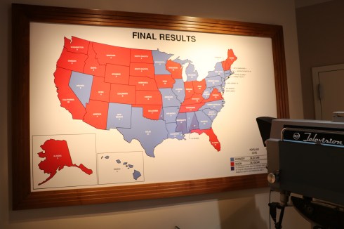
Looking at the electoral map from the night of the election shows a sharp contrast to what it would look like these days.
The states in red show states the Republican candidate (Richard Nixon) won. The blue states are states Kennedy won. The chief reason behind this, besides the changing political landscape, is that Nixon was the senator from California which would explain in part why he did so well on the west coast. Kennedy’s running mate, Lyndon Baines Johnson (who was from Texas), helped Kennedy carry many of the southern states. In fact, the whole Kennedy/Johnson relationship is full of dichotomy and complexities. It has been believed, and essentially proven, the two men did not like each other very much before the election (and not the first time a president and vice president didn’t like each other). But, Kennedy and his people thought they needed Baines on the ticket to help deliver the south.
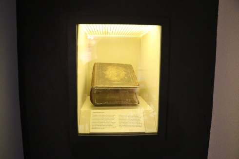
The book shown below, an 1850 edition of the Douay English translation, is the Kennedy family bible that was brought over from Ireland by his forebears. It is the bible JFK was sworn in on during his inauguration.
After viewing the historical items from his campaign and early days of his presidency, there is a larger area with memorabilia from his presidency can be found. There are also letters, memorabilia and other items from the Kennedy’s and not just John Kennedy. There are also historical items from Robert Kennedy and Sargent Shriver, John’s brother-in-law. The historical displays include an exact replica of the Oval Office while Kennedy was president.
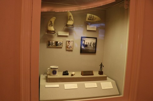
In the photo below are two whale teeth etched with portraits of King Christian VI of Norway and Frederick William, the Great Elector of Brandenburg. These whale teeth were used as book ends in the Oval Office.
Next to the whale teeth, to the right, is a whale tooth scrimshaw inscribed with a full rigged ship. This was a gift from his close friend and class mate at Choate School, Lem Billings. Kennedy kept this on his desk. So much for saving the whales.
The section with Jacqueline’s personal items is wonderful also.
One of the more interesting things I found at the museum were gifts other world leaders had given Kennedy and Jacqueline Kennedy, the first lady.
This stucco head of Buddha (circa 2nd century A.D.) was given to the president and his wife by the king of Afghanistan, Mohammed Zaher Shah.
This gilded metal kris and sheath, decorated with ivory and precious stones, was given to the president by President Achmed Sukarno of Indonesia on April 24, 1961.
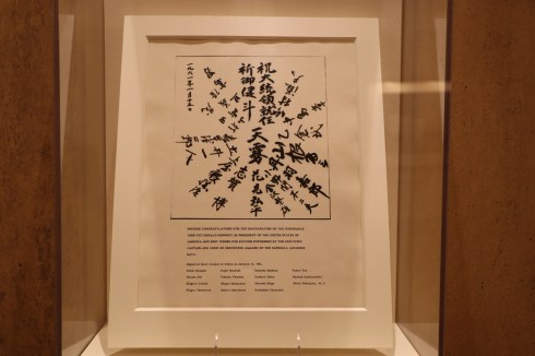
This congratulatory message was sent to President Kennedy on his inauguration in 1961 from the surviving crew and captain of the Amagiri. What makes that so interesting? The Amagiri was the Japanese destroyer that on August 2, 1943, rammed PT 109, the boat Kennedy and his men were on during World War II.
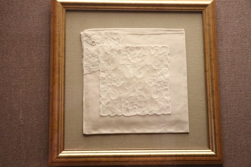
This Carrickmacross lace napkin was presented to President Kennedy by Prime Minister Sean Lemass of the Irish Fianna Fail party.
While President Kennedy’s assassination is acknowledged, there is not much on exhibit about the assassination. Rather, they focus on how the world responded to the tragedy. Fittingly, a darkened hallway leads to an area with photos of memorials dedicated to the slain president from all over the world.
There is also an area dedicated to the Kennedy family after President Kennedy’s death. There are books written about John Kennedy, mementos that were made in his honor (such as the half dollar piece that was issued after his death) and the rest of the Kennedy family. There are also historical artifacts such as a piece of the Berlin Wall which signify way the world has changed and how John Kennedy and other members of his family, specifically Ted, had possibly helped shape these changes.
There are also short films that play in small cinemas throughout the day at various locations in the museum.
The biggest attraction at the museum, however, is a special exhibit called JFK 100 Milestones and Mementos.
This exhibit is on display to celebrate what would have been the 100th birthday (his birthday was May 29, 1917). Everything from the hat and gloves he wore on his inauguration day, his first baby photo to hiss iconic Rayban sunglasses that he popularized are on display in chronological order of his life. The exhibit is planned to be on display until May, 2018.
There are far too many items to post photos of. Below are a few of the items that stood out to me.
Pictured below is the Profile In Courage Award that has been awarded annually since 1990. Past recipients include John McCain and Russell Feingold (co-winners in 1999), Gerald Ford and John Lewis (co-winners in 2001), Gabrielle “Gabby” Giffords (2013) and former President Barack Obama (2017)
Behind the museum there is a path used by joggers and people just going for a walk. There are some pretty views of the Boston skyline and the water. There is also a pier you can walk out onto and look out at the bay. It is a quiet place to ponder all that you have seen at the museum.
Sadly, we will be observing the death of this notable president later this month. But, rather than focusing on his tragic death, it is much better to focus on his life and not his death. This museum is a powerful reminder of his life and legacy.
While driving along Derby St in historic Salem, MA, you might drive past the nondescript, white building with shuttered looking windows and think it”s just another building. You would be wrong, though.
Two popular candies are said to have been popularized by people associated with the company.
The story of this historic company dates back to the early 1800’s when John Pepper, who is considered by some to be responsible for creating “The Black Jack” candy according to the company’s web site, began selling his candies in Salem and the nearby communities. Although there is some debate over who is responsible for creating this candy, it would go on to be considered the flagship candy of the store.
The other story holds that the Spencer family from North Salem were left destitute after a shipwreck. In an effort to help the family, neighbors and friends donated supplies to help them in their time of need. Mrs. Spencer used this sugar to create what would become known as “Salem Gilbratars” which are sold in the store to this day.
The company has come a long away from these simpler days. The companie sells a variety of candies. From the divisive candy corn, which people seem to hate or love but has become a staple of the Halloween season nonetheless, to the wide varieties of fudge and chocolate,
The companie remains one of the most popular spots to visit in Salem (MA) particularly during Halloween. This photo was taken the weekend before Halloween (Oct. 28).
The line would grow even longer during the day. Good thing it wasn’t too cold out, not that it would have deterred the shoppers.
It’s funny how the exterior of the building seems to scream dull and boring but the inside of the store, particularly during the various holidays (they also hold candy cane making demonstrations during the Christmas season) and Halloween has so much character and decor.
This woman who was working at the shop during my visits even got dressed up for the season. Rumor has it, she may be the original Mrs. Spencer. And people say Salem doesn’t have ghosts.
If you’re in the Salem area, or you just get a sweet tooth for some historic candy, stop by! Ask for Mrs. Spencer.
Location: 310 1/2 Essex Street, Salem, MA (about 10 minutes north of Boston, MA)
Hours: Open March 15-November 15, daily 10am-5pm
Call for Winter Hours / Extended Hours in October
Cost:
Guided House Tour
Adult $10.25 Senior $ 8.25 Child (7-14) $ 6.25 Self-guided House Tour
Adult $8.25 Senior$6.25 Child (6-14) $4.25 Children Under 6 are free
Parking: there is street parking (75 cents for a maximum of 4 hours) if you get there early. Otherwise, there are several parking lots and garages that charge $20 for the entire day of parking. Generally, I park at the Museum Place Mall at Church St since it is closest to all of the attractions in Salem and within walking distance to the Witch House
Handicapped Accessible: No
Dog Friendly: No, although service dogs may be allowed
Highlights: historical artifacts, knowledgeable staff, actual home of “with hunter” Judge Johnathan Corwin
Tips:
The entrance is in the rear of the building (off North St)
“It’s October”, a passerby yelped to a disgruntled driver as he barely squeezed his sedan into the last available street parking spot.
Yup, it’s that time of the year again in Salem, Mass.
Although Salem has proven itself to be so much more than just an autumn destination, fall is still Salem’s biggest time of the year.
It’s unfortunate much of the draw to Salem is related t the witch hunt of 1692. However, it does provide a learning opportunity and it also gives us a chance to remember the past in the hopes it won’t happen again.
One of the best places to get a no frills education about the Salem Witch Trials is the Witch House on Essex St., just one mile away from the actual hanging spot of these accused witches.
The last standing building directly related to the Salem Witch Trials, the Witch House has a dark, storied history.
As I walked around the house I couldn’t help but think of the innocent people who had been tortured into confessing and the backdoor deals that were made to avoid being accused or convicted of being a witch. In this very room, John and Elizabeth’s (his wife) parlor or best room, people’s fates were sealed. In total, 24 people would either be hung (19 in total), 1 person was pressed to death and 4 people died in prison.
The home was bought in 1675 by Corwin, a local magistrate, and his wife Elizabeth (Gibbs). Elizabeth was a wealthy widow having been previously married to Robert Gibbs. They would have 10 children together. Six of their children would die before the age of 25. Only 2 children lived long enough to have families of their own.
The other room on the first floor showcases many of the tools and herbs used during that time. As you can see in some of the photos, each historical artifact has a sign or placard next to it with an explanation or story behind the piece being displayed.
The Witch House has six rooms (if you count the foyer areas on two floors. While not all of the items in the house are directly from that time, many of the items in the building closely mimic the items of that era.
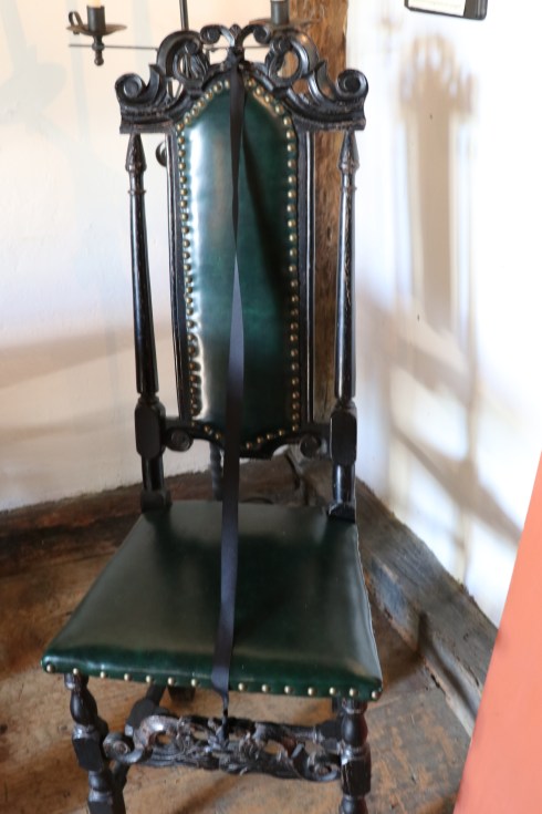
These chairs, for instance, are very similar to the chairs and tables used that time. In fact, the 5 chairs at this table are symbolic of the 5 judges (out of 9) needed to convict someone of being a witch at that time.
On the table are copies of the pages of journals, diaries and court records of the inquisitions and court proceedings.
Judge Johnathan Corwin, who resided here, was said to have questioned the accused at times using extreme measures such as tying people’s arms behind their backs to a chair similar to this one. It forced more than one innocent person to confess.
The windows and furniture featured in the house are very well crafted.
In the first room of the first floor there is a sealed off area that shows the inside of the walls. The architecture of that day may be outdated but it still holds up to this day.
Up a short, narrow, windy staircase, the second floor has two bedrooms.
In one of the rooms sits a machine for sewing or knitting.
This doll, also known as a poppet, which was found in the wall of Bridget Bishop’s home, was said to have been a voodoo doll. The catch is that most people at that time left these types of dolls in their walls as a sign of good luck. Instead, In Bridget’s case, it was said to have been used to curse others. Cute little fella, isn’t he?
Dogs are not allowed in the Witch House (exceptions may be made for service dogs). But, I met Abita, a 3 year old Lab mix, on my way to the house. Abita was adopted from the Northeast Animal Shelter in Salem, MA. What a cutie.
The video below comes courtesy of samuelaschak. It gives a more detailed historical background of the building and the historical highlights of the Corwin family and Salem.
Hours: Open daily, 9:00 – 5:00 (hours may vary depending on the season)
Cost:
Adult – $28.95
Senior (ages 65+) – $26.95
Youth (ages 4-14) – $18.95
Children (3 and younger) – Free
Parking: there is a free parking lot across the street from the Seaport Museum. There is also additional parking across the street from the parking lot for overflow
Handicapped Accessible: Yes, but not all of the buildings are accessible to the handicapped. Approximately one-third of our buildings have wheelchair-accessible entrances; interior access varies. The village’s unpaved roads are generally firm and stable suitable for wheelchairs and strollers. All roads are basically level with a few slight inclines located near the Children’s Museum, Treworgy Planetarium and Membership Building. (see link below for more info)
Highlights: living museum with character actors, boats, replicas of historic homes, figureheads, lighthouse replica, play area for children
Tips:
For an after museum viewing treat, Mystik Village, an open area shopping mall is a mere.9 miles away on Coogan Blvd
the museum’s main parking lot can fill up quickly if you don’t get there early. Additional parking can be found in the lots off Rossie St on the other side of the main parking lot
Once a major seaport, Mystic Seaport no longer functions as the busy hub of commerce and fishing or transportation. But, they have preserved some of the historical atmosphere while still incorporating modern technology.
Since Mystic Seaport is such a big attraction, I am posting my blog posts in three or possibly four installments. My first installment deals with the Viking ship display which was being featured at the museum as well as the figureheads, decorations and other sculptures at the museum.
During my visit, there was a Viking ship docked at the museum. Tours were being provided for a small charge.
By far, my favorite part of the museum is the figurehead museum. The dimly lit room, which made photography challenging, in the Wendel Building added to the mystique of these treasured works of art.
This scroll billethead figurehead is the oldest one in the museum. Many ships used these billetheads in lieu of figureheads because they were easier to carve and less expensive than the full sized figureheads.
There are several other figureheads in the museum which stood out to me.
This scary cat timber was used while lifting the anchor and keep it away from the ship so it would not damage the vessel.
Most of the figureheads are of people, though.
This figure titles Woman With A Comb. Although it’s hard to tell when some of these figureheads were made, it appears this figurehead was made during the 1820’s. This figurehead shows a hairstyle and clothing style that was popular during the 1820’s. Unlike some of the figureheads you may have seen previously where the figurehead leans forward and under the bowspirit, this figurehead stands upright, which was common until the 1840’s when they changed to the design that leans forward.
Woman With Roses has an interesting historical background. This figureheads, which resembles a portrait more than an actual figurehead, was originally called Belva Lockwood when it first came to the seaport museum. Belva Ann Bennet Lockwood, who this figurehead resembles, was a leader in the women’s suffrage movement during the late 1800’s. She was nominated for President of the United States in 1884 and 1888. Despite her historical significance and the likelihood that a ship would have been named after her, there are no records that show her name on any vessel.
Donald McKay is a figurehead made for the 1855 clipper ship Donald McKay. Named and designed after the famous ship builder and designer Donald McKay, this figurehead was broken off its vessel and stood unprotected, outdoors in the Cape Verdes islands off the coast of Africa. It was restored and repainted but it still shows the effects of being exposed to the conditions. The first figurehead for the vessel was lost at sea and this figurehead which replaced the original one was believed to have been carved by the ship’s carpenter while the ship was out at sea.
Seminole decorated the ship vessel of the same name for over 40 years. The figurehead, which was built by Maxon Fish & Co in 1865 in Mystic, CT, is believed to have been carved by James N. Colby and James Campbell. Colby and Campbell were prominent ship and sign carvers and decorators in the Mystic area from the 1850’s until 1877. Seminole, an offshoot of the Creek Confederation, means “separatist” or “runaway.”
Seminole carried cargo from New York to San Francisco and vice versa for over 20 years. It was captained by another Mystic, CT, native Joseph Warren Holmes. Holmes would go on to make 84 passes by Cape Horn, a record among captains at that time. Eventually, the Seminole ended up in the west coast lumber trade and was finally broken up at Port Adelaide, Australia, in 1904. The figurehead was salvaged and, 50 years later, Mystic Seaport acquired it.
Magdalena is the largest figure of the collection. Magdalena once adorned the bow of the 421 feet long British Royal Mail steam packet Magdalena which launched in 1889 in Glasgow, Scotland.
Iolanda is considered the second figurehead for the steam yacht of the same name. The industrialist Morton F. Plant of New York and Groton, Connecticut, had this figurehead adorned to his yacht when he made his 33,000 mile voyage to India, China, Japan and the Mediterranean.
After Plant, the figurehead had many more owners including a Russian Princess and the British Navy where she saw service in both World Wars.
The figured pictured above called Aleppo could not be identified since there are no records or photographs to match it to any vessel. I find this makes the figureheads even more mysterious and interesting.
This figurehead once adorned the Rhine shipping vessel which was built in Scotland in 1886. The harp and caduceus necklace are said to portray her as a classical figure rather than a portrait or national symbol. It is typical of the British sail and steam vessels of the late 19th century.
The Rhine transported laborers from India and China, jute from Calcutta and lumber from Boston. After being damaged by a fire after World War I, she was sold to a junk dealer for $925. Shen then became a barge in New York.
This ghost-like carving called White Lady is not a figurehead, despite its strikingly similarities to other figureheads. One of the reasons the museum was able to determine it is more likely a decoration or sign are because the posture is too erect. Figureheads were carved to fit the curving shape of the vessel’s bow. Another reason this was not a figurehead is that her outstretched arm would have been particularly vulnerable to damage at sea. Also, her elaborate scrollwork base is very unusual for a figurehead. Lastly, there is no evidence of the wooden or iron fastenings that would typically have held the carving to a ship’s bow. You know, the obvious reasons.
Cover your eyes! This unidentified figurehead which has been named Women With Goblet by the museum is said to have been the victim of well intentioned but overdone restoration. The flowers around the bae were reconstructed and the outstretched right arm with the goblet is not original. Typically, carvers made the arms close to the body because it reduced the possibility of damage by the sea.
This figured, The Great Admiral, was craved in the honor of and dedicated to Admiral David G. Farragut. Farragut was an Admiral in the United States Navy during the Civil War. In 1869, a new clipper ship, The Great Admiral, was commissioned in his honor with this figured on the bow.
The figurehead was eventually salvaged after the ship was wrecked off the coast of Oregon in 1906 and it eventually made its way all the way to Mystic.
Woman With Beads was carved in the classical British figurehead style. It is said to represent one of Victorian England’s literary or historic characters.
Abigail is believed to have been carved for the vessel of the same name which was named after the ship’s owner’s wide, Abigail Chandler. The figurehead was found after the ship crashed along the coast of Massachusetts in 1817.
Great Republic once adorned the largest American ship of its day, if only for a few weeks. This figurehead was once on Donald McKay’s clipper ship The Great Republic. Built in 1853, the 335 feet long The Great Republic is the largest cargo ship ever built in the United States.
The eagle, which was carved by S.W. Gleason & Sons of Boston, was on the ship for a few weeks when the ship was damaged by a fire. The eagle was then removed and kept by Captain Nathaniel Palmer of Stonington, CT. Captain Palmer had the burned out hull of The Great Republic removed and built into a smaller ship. A new bow carving was replaced on The Great Republic when it was repaired.
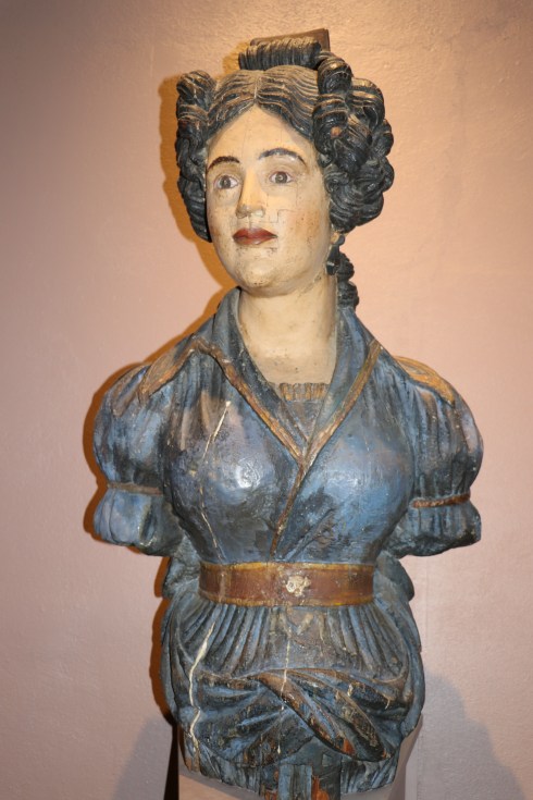
This bust of a woman is believed to be from the mid 19th century. Although it is not clear who the woman is portrayed in this bust, it is most likely a wife, girlfriend or relative of a captain or ship builder.
The Gray Man is a bust of a man from around the 1830’s. It really isn’t a bust. It was originally a figurehead on a ship. However, after it was removed from its original vessel, it was painted blue-gray and the base was altered which makes it look more like a marble statue than a figurehead
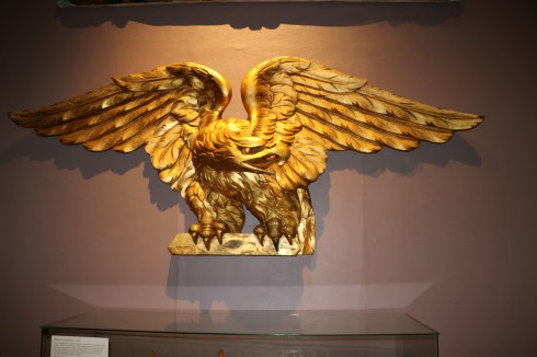
This carved gold leafed pine eagle pictured above is believed to be carved by William Rush but this claim has yet to be verified.
While this eagle with its arms extended may have been originally intended to be posted on the flat transom at the stern of the ship, it is also very similar to the décor on public buildings during the 1800’s. It is something that looks familiar to me as I have noticed decorations and sculptures like this on or inside older buildings while visiting the historic homes and area of New England.
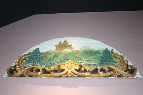
This carving of a mountain sunrise, Mt Washington Lunette once adorned the steamship The Mount Washington, a steamship on Lake Winnipesaukee in New Hampshire. This fan-shaped panel, called a lunette, was located at the center of one of the boxes that covered the steamboat’s paddle wheels. The half round paddle boxes served two purposes. They helped to protect the wheels from damage while shielding passengers from the turning wheels as well as the water that was thrown up by their blades.
There are other statues and decorations scattered through out the living museum.
These sculptures above, I believe of a sea mammal, were located outside one of the buildings.
This horsehead, located outside one of the historical homes, may have been used to tie the reigns of your horse.
This outdated statue was located outside a cigar and supply shop. It is displayed, I am sure, simply to give an accurate display of what the shops at that time looked like. The craftsmanship is impressive regardless.
The Carver’s Shop is one of the shops replicated to show how statues and other carvings were made and sold. The carving in the last photo (bottom right) may look similar to the cat carving at the figurehead museum.
These are two other cute decorations I noticed at the museum during my visit.
There were several dogs at the museum. Who knew dogs were so fond of the sea?
Since I am posting these blog posts as a series, I will post one set of photos for each dog or group of dogs I saw there.
I saw Brandi (On the left) and Colby (on the right) sitting by a bench with their guardian before I entered the museum. They are both 6 year old Chihuahua and Japanese Chin mix breeds.
See you soon with the next installment from my visit here!
Below is a short video of the figureheads and the restoration of figureheads from Mystic Seaport’s website.
Who knew Hampton had so much history? That is what many visitors think when they leave the Tuck Museum in Hampton, NH.
But, it really shouldn’t surprise anyone that so much history. After all, it is one of the oldest settled areas of New Hampshire having been settled in 1638.
It’s also surprising that a small museum can have so much historical items and stories. Upon entering the museum, you will most likely notice some of the historical articles from many years ago. One of the main features is are the items from the defunct railway that ran to Hampton.
There are also two mannequins dressed in old military clothing from an earlier era. This is a preview of an exhibit I will discuss later in this post.
The Tuck Museum is considered a “museum complex” because it has several structures and memorials on its land. Guided tours are given to all of these buildings by the very knowledgeable staff.
The first place our guide took us to was the fire fighter building which had older firefighting equipment and vehicles. It’s hard to believe , but true, that some of these vehicles were moved by humans, not horses, in the early days of the fire department in Hampton. It is fitting since the fire department still remains the same – physically go and save lives, despite all of the technological advancements they have made. It still boils down to the one constant – the brave men and women who work in that profession everyday.
You may notice the name Winnacunnet on the fire engine pictured above. That used to be the name of Hampton (more specifically it was called Plantation of Winnacunnet) because of the pine trees in the area (Winnacunnet translates to “beautiful place of pines”). A high school and street in the Hampton area still bear this name.
The next building we went to on the property of the Tuck Museum complex was the barn which contained many of the machines, tools and equipment the people used to farm the land and conduct the everyday chores of the settlers of Hampton. Everything from fishing equipment, agricultural devices to a shoe cobbler’s counter were housed in this barn. Each of these devices has a story and history behind it.
It would take too long and take up too much space to explain each one. But, if you do go on the tour at the museum the tour guide will keep you entertained with various anecdotes and fun facts about these machines and tools. One fun fact you can impress your friends and hot dates with at dinner parties is that when cobblers made shoes there was only one shape to them so you could wear any shoe on any foot. I was joking – please don’t tell anyone that on a date.
There is also a special military exhibit dedicated to the people connected to Hampton, NH. Included in this exhibit are letters from people serving that have been donated on a temporary basis from family and friends of those who served abroad during wartime. One of the storiees that stood out to me from my visit to this memorial was the story of Hampton residentof Lt. Rita Palmer and the Angels of Bataan.
The final room of the museum (I told you it was surprisingly big) was a room with household items and some of the luxuries of the early settlers of the area.
The framed work of art pictured above was made of human hair (does that make it a bona-fide “hair loom”?).
There are also some replicas of beach houses that used to dot the landscape of the Hampton area on the grounds. Since it was raining outside, I was unable to get to them without getting my camera equipment wet, unfortunately.
Hampton has a rather obscure dark side in the form of a witch, Eunice “Goody” Cole. Eunice Cole was the only woman convicted of witchcraft in Hampton, NH (although many others have been casually accused of being one I am sure).
After being released from indentured servitude, her husband and she settled in Mount Wollaston (now Quincy, MA) and they eventually made their way to Hampton, NH. Since they did not have children (they were both beyond child bearing age) and some other characteristics of her that were considered unusual at the time, she must have been a witch. Of course. She was actually accused of witchcraft several times. the first time she was convicted of witchcraft was in 1660. She served 2 years in prison and was sentenced again for a number of years in 1668. She was also found not guilty of witchcraft when she was tried in 1673. And I thought we were litigious these days.
Eventually, Goody Cole was absolved of her accused crime of witchcraft on March 8, 1938. The citizens passed a resolution restoring Eunice “Goody” Cole to her rightful place as a citizen of Hampton. The city went as far as to burn copies of all her court documents, The burned documenst were said to be mixed with soil from her last home and reputed resting place and buried. However, it was actually given to the Tuck Museum.
This brings me to the last few photos of the museum and its grounds. Inside the museum there are some replicas of Goody Cole.
On the grounds of the museum is a memorial without her name or any other marking. In fact, if you did not know the story about Eunice Cole you may just pass by it none the wiser. The marker was erected by Harold Fernald, a teacher and part time police officer from Hampton. The stone is said to be from the location of Eunice Cole’s property.
As an aside, the North Shore paranormal Group and some other paranormal groups have done ghost hunting on the premises with what they considered convincing results that some paranormal activity occurred. The fact the museum is located right across the street from a graveyard, mixed with the Goody Cole history, has added to the theories of paranormal activity. Admittedly, I saw some unusual things during my stay in hampton. But, it was mostly at the beach.
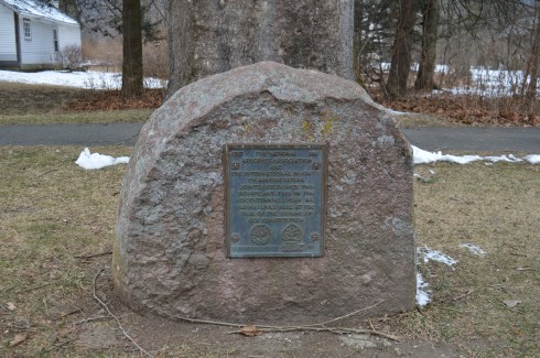
Another memorial on the grounds of Tuck Museum is dedicated to Thorvald, the brother of Viking explorer Leif Erickson and son of Erik the Red. However, this memorial has more of a controversial past as some believe it was just a rock put there by Judge Charles A. lamprey to increase the value of land that he was developing for beach cottages in 1902. Whatever the true story behind the rock, it has become a popular tourist attraction.
The grounds of the museum are well kept and worth strolling by even if you don’t venture into the museum.
marylizstyles is a fellow New England blogger who specializes in the fashion blogging genre. Read a post about her recent dude that’s so nautical fashion adventure in Hampton, NH.
Location: Norumbega Rd, Weston, MA (about 20 minutes west of Boston, MA)
Hours: Accessible every day, 24 hours a day
Cost: Free
Parking: Parking is difficult. There is no parking area and the road is pretty narrow. So, pulling over isn’t recommended. I found a parking lot around the corner from the tower on South St. There is also a parking garage on South St.
Handicapped Accessible: Yes
Dog Friendly: Yes
Highlights: 38 foot tower built as a tribute to the Norse
Once considered part of a Norse Village, Weston, MA, has a very special tribute lying just across from the winding Charles River. While the stone tribute still stands there to commemorate the suspected Norse village of Norumbega (a legendary Norse fort city), the name of the area is no longer. Weston must have been easier to pronounce. To preserve the Viking history of the area, the tower was built on that ground as a tribute to the Norse history.
Legend has it that Eben Norton Horsford, an American scientist best known for reformulating baking powder (thank goodness for that), was convinced Fort Norumbega. Horsford was convinced Leif Erikson had discovered America and this drove his interest in Norse history. He commissioned several works to commemorate the Norse explorer and the Norse people.
Erected in 1889 , Norumbega Tower is a hidden gem located just west of Boston, MA. The tower stands 38 foot tower and is made of mortared field stones with a stone spiral staircase.
A locked gate prevented access to the he tower, which has a spiral staircase inside the structure. I am not sure if it is open certain times of the year. There is also a bench near the tower and the path to the tower is paved. It is amazing how, after all of our extreme weather and other elements, the structure still stands. They just don’t make stone towers like this anymore.
The following is written in the inscription on the tower:
Parking: You can park on the side of the road at or near the tree. It’s a residential area so please be safe when viewing
Cost: Free
Hours: everyday, 24 hours a day
Handicapped Accessible: Yes
Dog Friendly: Yes
Highlights: “widest tree this side of the Mississippi”, biggest sycamore tree in Massachusetts, 300 plus year old tree
On a nondescript road in Sunderland, MA, stands a tree. A big tree. But, no, this is no ordinary “big tree.” This is the widest tree in the Eastern part of the United States.
The Buttonball tree, located on N Main St, is over 113′ high, with a girth of 24’7″ and has a spread of 140′. Pretty big, huh? The locals think so. Because of its size and its legendary status, locals have dubbed the Buttonball Tree, “The widest tree this side of the Mississippi.” It is also considered, wrongly, to be the “biggest” this side of the Mississippi.
In fact, another tree in Massachusetts may hold this claim. Or, at the least it may be the tallest this side of the Mississippi. The Eastern White Pine in the Mohawk State Forest in Charlemont, Massachusetts, is listed at 174 feet in height. And there are many others that are taller than the Buttonball.
For instance, the “Boogerman Pine” (186 feet tall) located in the Great Smoky Mountains in North Carolina, is considered by many as the tallest tree in the U.S. east of the Mississippi.
In addition to these trees, there could be some huge, crazy big tree in some forest or park somewhere that has yet to be recorded. As you can see, it is a hotly contested claim!
So, the claim of “largest tree east of the Mississippi” is a title that has been debated. But, the Buttonball still holds the title for widest tree this side of the Mississippi. OK, enough fun tree facts. For now.
Who knew it would be such a contentious subject! Who knew there was so many details about these trees? But, there’s more to the tree than it’s girth and height. Besides, it’s not the size…never mind.
While the title for largest tree east of the Mississippi may be up for debate, one thing is for: the Buttonball Tree is one big tree! It is the largest sycamore tree in Massachusetts and one of the largest trees of any kind in Massachusetts. Once part of the Sunderland forest, the tree now stands in a residential area. I bet the neighbors just love all the attention. (another) Fun fact: because of their longevity, during the 17th and 18th century sycamores were sometimes planted at the door of new house for newlyweds as “bride and groom” trees. The trees lasted much longer the marriages I am sure.
Not only is the Buttonball Tree big, it is historically significant. And old. I mean really, really old. The tree is estimated at being between 350 and 400 years old. And you thought you were getting long in the tooth.
Without further delay, ladies and gentlemen…the Buttonball Tree….
In 1987, to celebrate the 200th anniversary of signing of the Constitution, a plaque was engraved in a stone and placed in front of the tree. The plaque is engraved with the following:
1787 THE NATIONAL 1987 ARBORIST ASSOCIATION AND THE INTERNATIONAL SOCIETYOF ARBORICULTURE JOINTLY RECOGNIZE THIS SIGNIFICANT TREE IN THIS BICENTENNIAL YEAR AS HAVING LIVED HERE AT THE TIME OF THE SIGNING OF OUR CONSTITUTION
Don’t forget to Connect with me on Facebook (this isn’t part of the inscription)
As a youngster, I used to love the family trips to New Hampshire and other far flung parts of Massachusetts. One of the sharpest memories I have are visiting the local general store (I especially liked the old time “penny candy”, funny how somethings never change).
A recent search on Google retrieved 3 general stores in the Western Mass area (basically west of Springfield, MA). While their numbers are dwindling, these shops still exist and I was lucky enough to find one in my travels in Williamsburg, MA.
Since the weather has been cold and the trails icy, we nixed our plans to hike some of the trails in the area. Luckily, the Williamsburg General Store was located near the center of town.
The general store has been a staple of the town for over 140 years.
The general store, built in 1876, still has the original furnace that was used with the fireplace that once stood in the front part of the store. I couldn’t help to think of all of the famous, and not so famous, people who had walked through the store before me. It’s also survived the Depression, recessions and, not least of all, New England winters.
The general store seems custom built for tourists. Memories rushed over me as I walked past the stuffed animals, t shirts with quirky sayings and other tchotchkes you would only purchase when you’re on vacation for some reason. It is deceivingly long inside.
The ice cream parlor area used to be a post office years ago. There is a table and chairs to sit down at and enjoy your coffee, ice cream or other treats. And the bread, pastry and other bake goods are baked fresh everyday by one of the employees who travels at least half an hour each way to work there.
It’s not dumb luck this store has lasted so long. The nostalgia, homey feel and pleasant staff make this place a great shop to stop by on one of your journeys to Western Massachusetts.