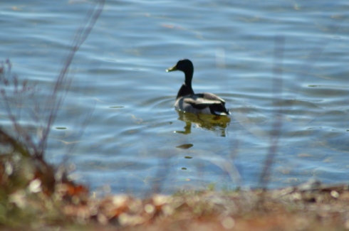
As the name suggests, there are lots of birds to watch at Francis William Bird Park. Either there are lots of robins at the park or I photographed the same one over and over.
There are more than birds at the park to catch your attention.
Such as trees and flowers
This slideshow requires JavaScript.
the ponds and streams
and the bridges (each bridge is made slightly differently)
The trails are easy and branch off to side trails. But, since it is all concentrated in one area it is hard to get lost there.
The tree below was planted in memory of Charles Sumner Bird, a paper manufacturer, candidate for governor of Massachusetts, resident of Walpole MA and the son of William Francis Bird.
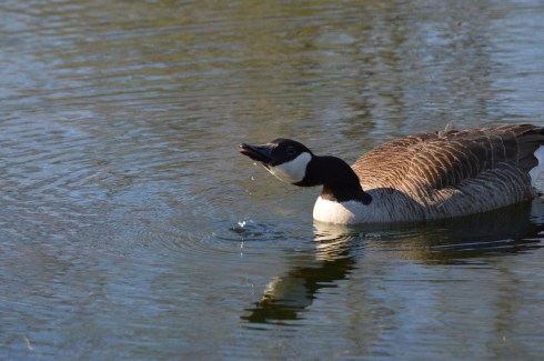
Tip of the day; don’t get too close to a goose and his or her Cheetos.
You’re not supposed to feed the birds at William Francis (and you’re especially not supposed to feed them Cheetos). It’s not good for them physically and it creates more messes on the trail. But, of course, people still do.
Along the trails, there are benches and places to enjoy the outdoors. Or, you can just chill on a rock or log. There is also a restroom (open seasonly)
Charlot (pronounced Char-lo) is a local (local to Walpole) artist, storyteller and cultural and historical expert. He specializes in Haitian art and culture. He likes to go to the park to paint and relax. He was kind enough to let me photograph him painting. He calls the first painting Silhouette Of The Drum. he was also touching up a painting he had finished previously.
Charlot is very talented. You can find out more about him here.
There are also a variety of attractions for sportsmen and sportswomen. The trails make for great running surfaces. There are four tennis courts as well as a basketball backboard (but not a court) . There are also musical and other types of events during the summer by the main field.
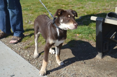
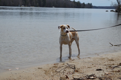
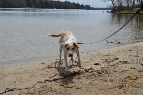
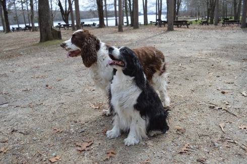
Birds aren’t the only animals you will find at Francis William Bird Park. The park is also popular spot for dogs. The trails and open spaces make it a great place to take your pooch.
Henry is a 3 year old Basset Hound. Cute freckles on his left front paw!
Sophia is a 5 year old Newfoundland. Sophia reminded me of a Newfoundland we had. Beautiful dog.
Buddha is a 3 month old Hound mix. I love the eyebrows!
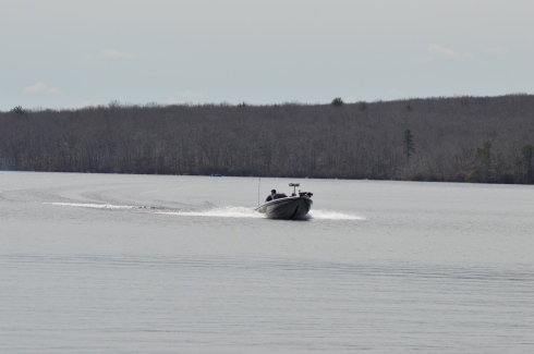
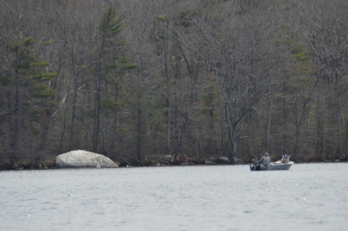
Each year hundreds of kayak and canoe racers come to the Western Massachusetts to test their mettle against the rapids of the Westfield River.
The Westfield River, one of the longer rivers in Western Massachusetts, runs 78.1 miles and has a 497 square miles drainage area consisting of several tributaries. It attracts enthusiasts, recreational competitors and people who just like to challenge themselves. It also attracts an array of boating fans.
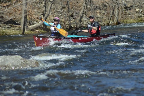
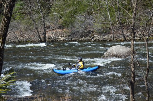
The Westfield River Whitewater Races, which have been held every year since 1953, are the oldest consecutively run canoe races in the US. People come from all over New England and farther to participate in the races. The races consist of novice and expert divisions. The novices race lasts 8 miles and the experts race for 12 miles. The participants race in two person canoes or one person kayaks. As if the rapids weren’t challenging enough, the race officials have the water behind the dam held for three days before the race to give more momentum to the current.
I never knew how popular kayaking, canoeing and boating was in Western Massachusetts. It was hard enough to find a good place to pull over or park along the route of the race. I was able to find a place on the side of the road to catch some of the novices who had already started.
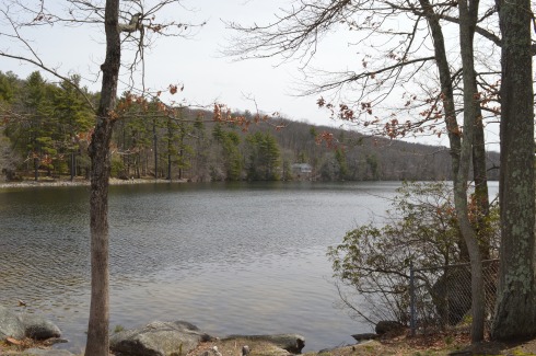
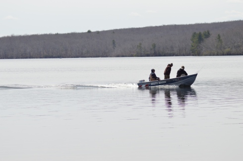
Since the river wasn’t very active here, we drove to the Knightville Dam, the launch point for the race. The area was very pretty and the river was more active here. I even caught some enthusiasts who weren’t participating in the race.
At the main parking area, one of the racers let me photograph his boat.
Still not happy with my location, I found a better spot along the side of the river past a precarious rocky decline. Watching the racers expressions was fascinating. Some were determined. Others looked focused and even a bit bewildered. Others just looked like they were having a grand time. Then, there were others who didn’t seem to be having fun at all.
This slideshow requires JavaScript.
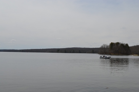
Not every racer made it to the end.
Eventually, they were able to wade across the river to the other side, no easy task given the strength of the rapids.
Monty, an 8 year old Siberian Husky, came along to watch the race.
Below is a video of a canoe racing tandem fighting the rapids. You can hear the strength of the tide. Rumor has it that it gets even rougher farther down the river.
Parking: Parking is available at the entrance, before the gate and there is a big parking lot where you can also launch your watercraft at the head of the beach.
Cost: There are a variety of different fees established for visitors to Lake Chargoggagoggmanchauggagoggchaubunagungamaugg. For instance, if you walk in or ride your bicycle to the lake and you are 17 or younger it is free. If you walk to the lake or ride your bike and you are 18 or older it is $1 to get in. A resident (of Webster) motor vehicle costs $5 for entry. A resident motor vehicle with a water craft is $25, etc. See the link below for all of the fees and regulations.
Lake Chargoggagoggmanchauggagoggchaubunagungamaugg. Try saying that 5 times fast. I dare you!
Originally named Lake Chaubunagungamaugg or “Fishing Place at the Boundary”, Lake Chargoggagoggmanchauggagoggchaubunagungamaugg (meaning, “Englishmen at Manchaug at the Fishing Place at the Boundary”) is actually broken into two parts; a lake (Lake Chargoggagoggmanchauggagoggchaubunagungamaugg) and beach (Memorial Beach).
For the purposes of this post, I will call Lake Chargoggagoggmanchauggagoggchaubunagungamaugg Lake Webster as it is now more commonly called.
At the main entrance ofWebster Lake, there is a memorial to our veterans. It is a fitting tribute for those who have gave so much.
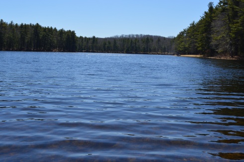
Upon arriving at Webster Lake, you will see the lake.
Memorial Beach is dedicated to the veterans of all of our wars.
As beautiful as the lake is, I found the beach, located just beyond the lake to be even more beautiful. To me, it’s basically one large body of water and I am not sure why they have separate names.
This slideshow requires JavaScript.
Webster Lake and Memorial Beach are a boaters/kayakers/fisher person’s dream.
Lake Webster also has a variety of bird life.
Dogs are not allowed at the lake or beach.
There is also a basketball court and play area.
The beauty of the beach and the sound of the water could only be captured in a video
Please check out my Facebook Page and like my page by clicking on the link below!
Cost: Free since I visited during the off season. It costs $8 for MA vehicles and $10 for out of state vehicles once the main season begins (around early May)
Parking is limited. Since it was not the peak of the season, I found a spot without any trouble. But, there are only 20 or so spots in the main parking areas. There are some additional parking areas off the main trail to the lake.
Boats are not allowed in the water, although fishing is allowed. Trout and bass are the most common fish in the water.
I had been interested in visitng Rutland State ever since I heard about the remnants of the state prison camp and the views of the water.
There was a strong wind, evident by the ripples in the water.
This slideshow requires JavaScript.
The gates at the entrances to some of the trails prevented some vehicles from entering the trails. This is because during this time of the year it rains a lot and bikes and other vehicles can get stuck on the trails. So, it was a pretty empty trail when I went. Which was just fine by me. Miles of near solitude in nature with a cloudless, cold blue sky on a bright New England morning….yes please!
The main trail I stayed on was easy with some moderate includes. The only thing you may find annoying is the long stretches of nothing but trees and water on each side of the trail. This was heaven for me, though. I was also pleased to see a dirt trail rather than gravel or, gasp, paved road.
As I continued on the main trail, I began to see signs of ruins of structures frozen in time. A stairwell and frame of a building, now adorned with graffiti (get used to it as it is a constant theme), stood on the outskirts of the trail.
At around the 2 mile mark of the trail there are remnants of a prison camp. The camp was constructed in 1903 for housing petty criminals. It would later be converted into a farm. The first structure, again riddled with graffiti, was used for solitary confinement.
When you consider just how small and confining the spaces in the building are you can only imagine the distress it caused some of the prisoners.
Something happened when I visited the remnants of the prison camp. What I had once considered “cool” and interesting, seemed dank and sad. In fact, it wasn’t until after I left the structure and cave that it really sunk in. It seems like a grim existence at the least. When you realize people lived in these conditions and suffered, largely for committing petty crimes (such as drunkeness), it makes you think we should be more cognizant of the history of the building and area. If it wasn’t so tragic it would be more interesting. Rather than being “cool”, it just made me depressed.
Farther along the trail is an arch that appears to be a root-like cellar. I am not sure what it was used for but my gut tells me nothing good.
There are also some interesting tunnels and holes in the ground at the old prison site. I decided to investigate.
Given the architecture of the structures and the history of the area, it is easy to see why the park is considered haunted. Disembodied voices and apparitions are said to have been witnessed by visitors. There are even claims the area was once used for satanic worship. The area was the subject of the book The Soul Collector, written by Joni Mayhan.
On a brighter note, I saw lots of four legged friends at Rutland State Park.
(left to right) Grayson, 7, an American Pit Bull Terrier and Gamble, 6, a Pit Bull and Boxer mix.
Blackie, 4 years old, a part husky.
I also saw some other four legged friends.
Panda, in front, is a training horse. Calvin is the horse on the right and the horse in the back left (who is difficult to see) is Jack.
There were also a few kids playing on their motor bikes and ATV’s.
The videos below are some videos from my visit. Thank you for reading!
Cost: Since I visited during the off season, it was free. The web site states it costs $9 for MA vehicles and $11 for out of state vehicles. Prices may vary if you bring your boat.
Location: 107 Wallum Lake Rd. Douglas, MA
Parking: Parking is limited at the main entrance. It probably fills up quickly during the summer weekends. There is also additional parking for boaters farther down the road to the entrance. There is also additional areas to park near the forest.
I wasn’t sure what to expect when I arrived at Douglas State Forest. It just happened to be in the area of another attraction I was visiting. But, I’m a firm believer in spontaneity, no I really am, so I decided to give it a whirl. I’m glad I did.
Douglas State Forest has a few different entrances besides the main entrance at Wallum Lake Drive. I passed some of them on the way to the main entrance. It may be a good option to try these entrances (off Webster and Wallis Streets respectively). After viewing the map for Douglas State Forest, I have determined I only walked a fraction of the 5,525 acres of the park.
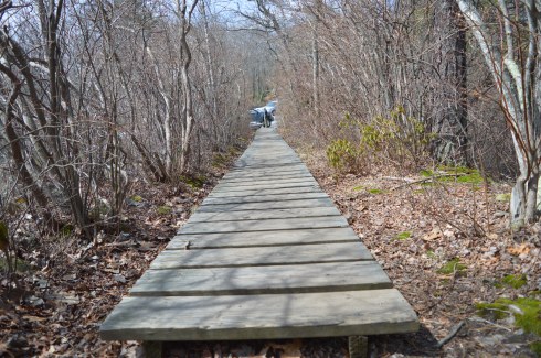
There are many hidden trails and long trails in the park. In fact, the Midstate Trail, a 95 mile hiking trail that extends through central Massachusetts to Mt. Watatic in the north, runs through the forest. I saw a group of walkers/hikers at one of the other entrances during my drive. I suspect they may have been gearing up to hike a section of this trail. There is also some rare Atlantic White Cedar swampland at Douglas State Forest. Boards are laid down to allow walking over these areas.
After arriving at Douglas State Forest, I walked the easy, half mile or so trail trail to Wallum Lake (the trail continues on much farther but I only walked to the boat launch and fishing area). A sure sign that spring is begrudgingly, well, springing was abundant. The trails are mainly like the one pictured below. I would describe the trails I took as being easy to moderate but the trail may get harder the farther you walk.
There were several people fishing and an assortment of boats in the lake. Boaters always seem to want to show off and speed around when they see someone with a camera!
Douglas Forest is a year-round attraction. Swimming, fishing and boating are allowed in the lake. In the winter snow shoeing and snowmobiling are popular activities at the forest. Horses and dogs are also allowed at the forest.
The views from the lake were beautiful.
This slideshow requires JavaScript.
What started as a gloomy, chilly, overcast day, typical of a true New England spring day, turned into a sunny, warm day. It was the perfect day to take your pooch out for a walk and they were in abundance at Douglas Forest.
Lloyd is a 3 year old husky and lab mix. He was adopted by his pet parent from a shelter and he loves to play in the water.
Delilah is a 5 year old Staffy (Staffordshire Bull Terrier). She was rescued one day before she was slated to be put down. She is also from England and loves to play with sticks. Welcome to America, Delilah!
Dixie and Monty, Irish Spring Setters, posed perfectly for their dad.
Central Massachusetts (where Douglas is located) had always been a place to drive through to get to Western Massachusetts and its plethora of mountains, forests and waterfalls. But, I have been spending a lot of time in Central Massachusetts. After my last few visits I have fallen in love with the area. I will have many more posts coming from my travels in the Central Massachusetts area. Stay tuned and thank you for reading!
Please check out my Facebook Page and “like” it for additional photos, posts and videos. Thank you!
Location: Balance Rock, Rd, Pittsfield, MA (about 2.5 hours west of Boston, MA or 1 hour east of Albany, NY)
Hours: Sunrise until 6 p.m.
Parking: There is parking for about up to 50 cars or so at the Balance Rock entrance.
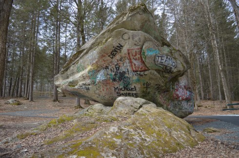
During the last ice age, some 12,000 to 100,000 years ago, rocks were haphazardly pushed to and fro, creating this unusual formation. Or, someone put one rock on top of another. Either the product of glacial movement or an elaborate hoax, the namesake of Balance Rock State Park is a huge attraction.
But, before you view the impressive rock, there are rocks and beauty aplenty at the entrance to Balance Rock Park.
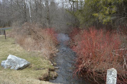
By the entrance, there is a stream that runs along the side of the park
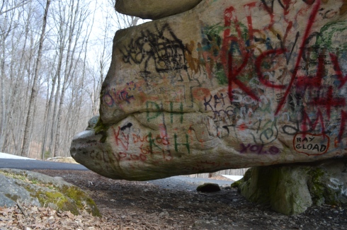
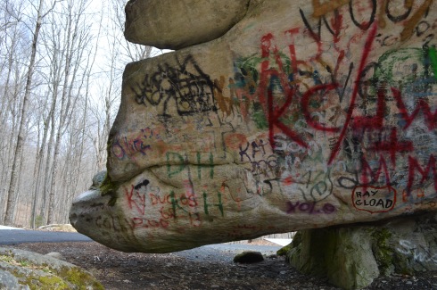
After a short drive up the main entrance road (about half a mile), you will reach Balance State Park’s main attraction; the rock. We were a bit disappointed to find the rock right there next to the parking lot. While it is convenient and easy for visitors to find, it would have been nice to have to hike to it. It would have built up the anticipation. Despite the journey being anticlimactic, the rock was impressive. As you can tell from the photos and attached video, the rock never touches the ground. Unfortunately, it has been vandalized which was very disappointing to see.
The rock is 30 feet long and 15 feet wide. It is resting on another much smaller rock. This, the story goes, is the product of the last glacial age. It also goes to show that no matter how big and seemingly powerful someone or something may be, the rock and we wouldn’t be the same without the help of a little friend.
I noticed how some of the rocks seem to have eyes and lips. I am not sure if this was due to nature, erosion or the work of mankind.
It turns out, there are many rocks in the area
The residents of Balance Rock State Park are very photogenic. He was shy at first. But, eventually, he came out and I was able to get some close ups of him.
Video of the stream at the entrance to Balance Rock State Park
Arms Park is a unique kind of park. In fact it’s not really a park at all. A stream, fed by the Amoskeag Fishways, runs parallel to the park. It is the perfect place for people who love the sound of water and watching waves (and based on my previous posts I know you’re out there). There’s not much to Arms Park. A parking lot takes up most of the area (which has led some to call it “Arms Parking”) and a few office buildings dot the landscape. It’s certainly not one of the most picturesque landscapes but the stream and walkway does have a certain charm. It is often used for observing important important days such as the annual Pearl Harbor Day observance event and the Fourth of July fireworks display.
The river is usually pretty rough and could consequently be dangerous if anyone got caught up it in.
This slideshow requires JavaScript.
It was still fairly cold when I went to visit, so the water which did splash on the railing quickly turned to ice.
A variety of birds like to seek refuge at Arms Park. I saw a bunch of gulls there during my visit.
Arms Park has a short walkway along the river with benches along the way.
The video below gives a better representation of the choppy water at Arms Park.
How could you not want to visit an area with the name “by the sea” in its name? It sounds like the name of an idyllic setting from a novel. And the town lives up to that description. I passed by several fruit, vegetable and flower stands as well as signs to watch out for people riding horses. The houses and town also had a very Norman Rockwell feel.
I wasn’t sure how the footing and appearance of the park would be given the recent snowy weather and icy conditions on many of the trails at other parks. As it turned out, most of the ice and snow on the trails had melted and I only had to manage some small patches of ice and mud from the melted snow.
The trails are clearly marked and easy to walk. There are no steep inclines and the paths are wide enough to accommodate the throng of visitors.
There are a few trails that meander slightly off the trail. But one trail simply leads to the street and is behind a bunch of cattails so you really can’t view much of the pond. The other stupid trail goes to a thorny, rocky dead end.
As you walk on the main trail, you will pass Clarke Pond on your left. It was partially frozen and there were some ducks and geese milling around. I also got a few shots off them dunking for lunch. The gulls in the first photo looked like big blocks of snow at first glance. I especially like how the mom and dad duck kept the baby duckling close to them.
This slideshow requires JavaScript.
There were many breath taking views of the pond. I especially like how the frozen parts of the pond break with the unfrozen sections.
This slideshow requires JavaScript.
To the right of the main trail, I found a side road with a pond that channels into Clarke Pond. There were a variety of ducks and geese in this pond.
This slideshow requires JavaScript.
I met a lot of friendly and cool people at Coolidge. Shapoo was one of the cool and friendly folks I met (the name is a mix of shih tzu and poodle) .
Much to my consternation, I was unable to find the Ocean Lawn which offers views of the Boston skyline and Cape Cod as well as scenic views of the water. I totally missed the boat on that one as there are some great views and opportunities for some great shots from there. But, to the left of the trail, Magnolia Beach more than made up for it which I will post about very soon…click here to read about my visit to Magnolia Beach.
Price: $20 for adults, $10 for children (ages 3-11) and seniors (over 65)
This was a special cruise and is not something they do regularly in the winter. During the spring, summer and fall they have cruises scheduled regularly.
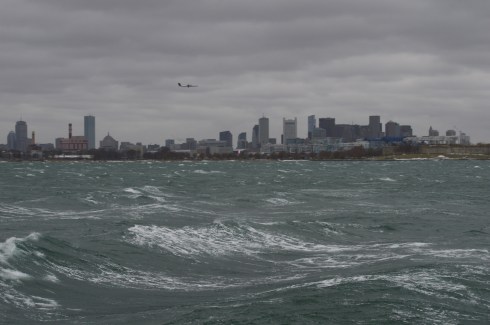
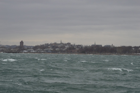
Twenty degree weather and an impending winter storm; what better conditions for a harbor cruise. Ironically, that statement could not be more accurate.
We were greeted by gulls and rough seas when we arrived at the wharf.
As we made our way on to the boat for and they announced the cruise would be a three hour tour (in retrospect, that Gilligan’s Island reference should have been a bad omen), I was surprised by how roomy, comfortable and modern it was. The three story boat had booths on the sides of the cabin area and ample seating.
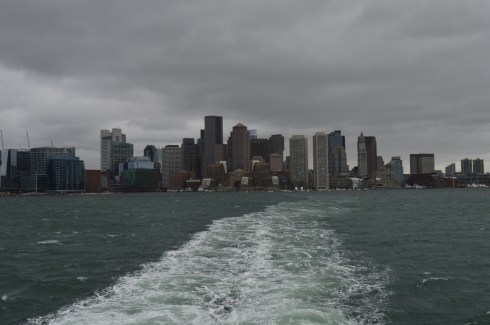
Even before we left the wharf I took some shots of the bay. You can see Logan Airport in the distance in some of the photos.
This slideshow requires JavaScript.
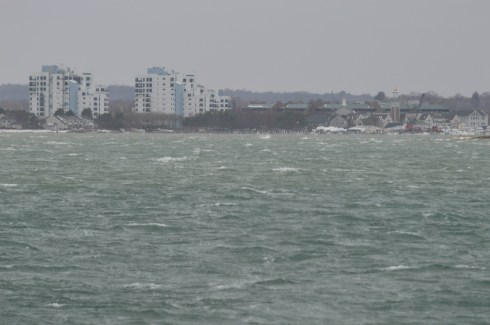
As the boat left the bay, I took some obligatory photos of the skyline.
I had to bundle up (and hold on tight to the railing) for the shoot. I was surprised at how well I handled the overly active ocean. I’ve never been particularly fond of roller coasters, wavy oceans or anything that moves to and fro quickly. But, I did fine. The only time I felt a tinge of sickness was when a fellow traveler described his own feelings of sea sickness (gee, thanks random stranger). But, that quickly passed.
There was a variety of sea life, although the choppy waters made it difficult to photograph all of them. DCR (Department of Conservation and Recreation) officials were on the boat with binoculars on the lookout for wildlife and other points of interest and announcements were made whenever a bird or other animal was sighted.
I did photograph this Eider as he swam with friends.
and a few other elusive birds.
This slideshow requires JavaScript.
Even though it was a cruise for wildlife viewing some of the best views were of the harbor and the islands.
This is Spectacle Island. Spectacle Island was made entirely from the dirt from the huge construction project known as the “Big Dig”. it is much prettier during the summer.
These are some photos of Boston Light. Boston Light is the first Lighthouse in America. It is still working today.
This slideshow requires JavaScript.
The Deer Island Waste Water Treatment Plant began operations in 1995. It is clearly the jewel of Boston Harbor. Prior to the construction of the sewage plant, sewage from Boston’s treatment facilities had contaminated shellfish after the sewage had been released. Lunch, anyone?
These structures are what is left of the bridge to Long Island (not the one in NY – we didn’t go out that far). It was dismantled recently. Personally, I think they should keep them. They make for a good background for photography.
Below is a slideshow of some of the other shots from my cruise. It was very windy and the sea was pretty choppy. I tried to capture this in the photos.
This slideshow requires JavaScript.
Finally, I found a cute furry animal named Bailey to photograph when I disembarked from the boat.
See below for videos of the cruise to get a better idea of just how windy it was.
Although the area is mostly known for being the home of the New England Patriots and its adjacent marketplace, Patriot Place has another impressive attraction – The Nature Trail and Cranberry Bog. Admission to the trail and bog is free and the parking is ample evident by the photo below. You can also park in the lots in front of the store and walk down to the trail.
From the entrance the Nature Trail and Cranberry Bog greets you with a charming sitting area and pretty trees.
This slideshow requires JavaScript.
Although most of the vegetation is dead (save for a few stubborn blueberries and cranberries), a thin layer of ice covered most of the pond and the trees are bare this time of the year, the Nature Trail and Cranberry Bog at Patriot Place in Foxboro, MA, is just as beautiful in the winter as it is during the summertime.
This slideshow requires JavaScript.
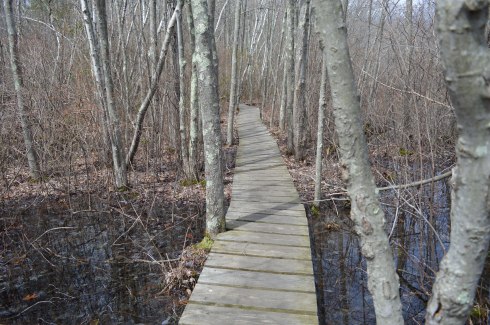
Located directly behind the expansive Bass Pro Shop, the Nature Trail and Cranberry Bog is a .5 mile loop with a 3 percent grade and some inclines as much as 12 percent.
It is a mostly dirty trail with a few boardwalks and bridges. There are two benches in the middle of the first walking bridge. Overall, it is an easy to semi-moderate trail. I saw people of all age groups handle the trail, inclines and all, with little difficulty.
I found this strange, creepy looking branch or alien arm protruding from the ice.
An extra bonus for any Patriots fan is you can see Gillette Stadium (the stadium the Patriots play in) from the main road on the way to the Nature Trail and Cranberry Bog. You can also catch a quick glimpse of some of the stadium from the entrance to trail and bog.
After finishing the loop, I met Chandler, a beautiful 6 year old tri-colored English Setter (thank you for the clarification, Adam).
Thank you for reading and please like my Facebook page to view videos, photos and more that I do not post on this blog:


 Blackie, 4 years old, a part husky.


 Thank you for reading and please like my Facebook page to view videos, photos and more that I do not post on this blog: