Hours: Open 24 hours a day, 365 days a year (may be closed on federal and/or state holidays)
It’s not very often that you are impressed with a visitor center. But the Guilford Welcome Center is no ordinary welcome center.
It was a long drive to Vermont and sometimes nature calls…
From the moment you walk into the Guilford (VT) Welcome Center, you know you’re not in your average welcome center. I also love how they call it a “welcome center” and not a “visitor center”. it’s just another example of the folksy and friendly nature of Vermont. The tables, chairs and fireplace give the welcome center a homey feel. You could spend hours sitting at their wooden tables with a good book and a cup of coffee while the snow falls outside.
The backside of the welcome center has an area to sit and take in the beautiful Vermont landscapes. There is also an exhibit of old farm equipment.
There are also a variety of trinkets and crafts located throughout the welcome center.
As I did my research on the Vermont Welcome Center, I noticed the welcome center in Guilford is not the only visitor center with attractions and other interesting things. There is a Vietnam War Memorial listing all the residents from Vermont who died while serving in that war. The Bennington, VT, welcome center has a “singing drum”. Each welcome center seems to have its own unique flavor and entertainment. They definitely do not make visitor centers like this in Massachusetts. That’s for sure.
There are more exhibits and areas to sit in the front of the welcome center.
This slideshow requires JavaScript.
The Guilford Welcome Center also has a dog park area across from the center. Duncan, a 3 and a half year old Cavalier King, stopped by for a quick pit stop.
Duncan’s sister, Vera, an 18 month old Cavalier King Spaniel, also took a moment to pose for me.
Cost: I paid $15 (the weekday fee) to get in (I went on a Saturday). But, the prices on their web site show the cost as being $13 for CT residents and $22 for non CT residents on weekends and holidays (it’s worth every penny) and $9 for CT residents and $15 for non CT residents. Also, if you enter at 4 or later it costs $6 for CT residents and $6 for non CT residents to enter the park (bear in mind the park’s gates close at 8 pm when it is in season). There are also additional fees for camping there.
One workaround to paying a fee is to park at 1288 Boston Post Road instead of driving down the access road to the payment booths and walk (almost 2 miles) to the beach. I would recommend this option when it is nice out or if you are bicycling. However, since the park is so big it may be hard to see everything on foot. So, riding your bike from 1288 Boston post Road may be a best option.
Hours: The beach is still accessible, by foot or bike, in the off season without any staff.
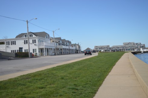
Connecticut’s largest public beach, Hammonasset Beach is split into different areas for camping and for people who want to visit the more than 2 miles of beach.
Meaning “where we dig holes in the ground”, Hammonasset is actually part of Long Island Sound.
The campground at Hammonasset has 556 campsites and 8 rustic cabins for reservation during camping season which runs from mid-May until October 8. Hammonasset also has a nature center at Meigs Point and acres of wetlands.
After paying the entrance fee, we asked the helpful woman at the booth where the best place to go for photography is and she suggested Meigs Point.
Meigs Point runs along the shoreline of the beach. There are lots of ducks, birds and lots of other wildlife on the beach and on the trails behind the beach.
This slideshow requires JavaScript.
The beach has some pretty views. There are also restrooms with showers and changing rooms at Meigs Point if you decide to go for a swim. During my visit it was overcast and chilly. The lack of sun didn’t take away from the beauty of the beach.
This slideshow requires JavaScript.
There is also a jetty. It went out quite a way. Since the rocks were pretty slippery, I made it about half way out before turning back.
Hammonasset is a beautiful beach, although it can get crowded as many beaches do during the summer months. If you live nearby it may be best to get a seasonal pass rather than paying the somewhat hefty fee each time you visit.
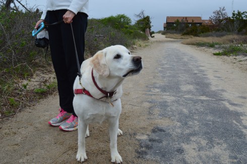
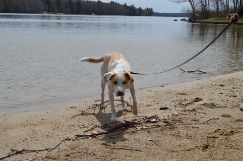
Leashed dogs are allowed on the beach during the off season (from November until April). They are still allowed on the trails but not on the beach from April until the end of October.
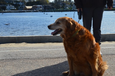
I met Summer, a golden retriever, on the trail Meigs Point. Especially after this unseasonably cold winter, we all could use a little more summer in our lives!
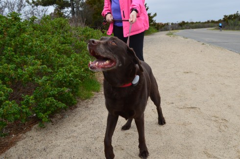
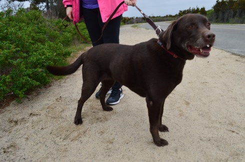
Jessie, a chocolate Labrador, had a great time on the trail.
Parking: There is not a designated parking lot for Wilcox Park. But, you should be able to find off street parking.
Wilcox Park is not your average park. In fact, it is unique in many different ways. One thing that makes Wilcox Park unique is that it is not part of the DCR or any other city or governmental body. Wilcox Park is privately operated by the Westerly Public Library’s Board of Trustees. The library, located on the grounds of the park, and a group of volunteers help keep the grounds clean and orderly. They rely on donations and fundraisers.
Westerly Library is attached to the park at the entrance. The library’s beautiful architecture of the building is both artful yet modest. It complements the beauty of the park and seems right in place. There are also benches for visitors to unwind and perhaps read a book from the library’s collection.
There are also a number of statues in the grounds of the library.
As you entered the park, one of the first statues you will see is the statue of Christopher Columbus sculpted by Ciriaco (or “Charles” as he was commonly known as) Pizzano in 1949. Originally from Avellino, Italy, Pizzano was living in Medford, Massachusetts, when he decided to sculpt this statue, appropriately, out of Westerly granite.
The inscription reads:
CRISTOFORO COLOMBO
INTREPID ITALIAN EXPLORER
WHO LINKED THE OLD WORLD OF
OUR FATHERS TO THE NEW WORLD
OF OUR SONS
On the back of the pedestal:
DEDICATED
BY
THE CITIZENS
OF
WESTERLY AND PAWCATUCK
A.D. 1949
Somewhere Leif Erikson is rolling around in his grave.
Down the staircase from the entrance to the park is a fountain (which was not running when I went to visit due to the still cold temperatures). The Wilcox Memorial Fountain was designed by John Francis Paramino in 1898 and was dedicated in honor of Harriet and Stephen Wilcox who had donated the land for the park.
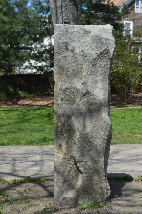
There are a variety of beautiful trees, plants, bridges and statues at Wilcox Park.
This slideshow requires JavaScript.
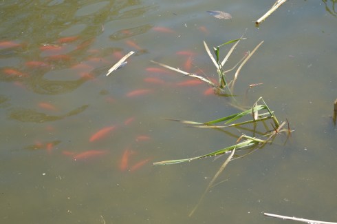
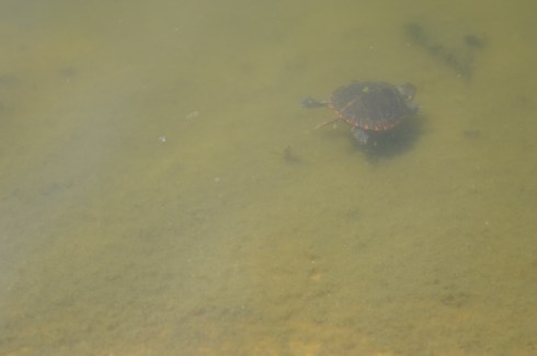
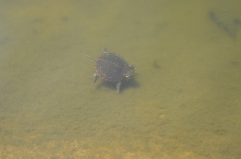
There is also a pond along the trails at Wilcox Park. It is populated with Koi fish
ducks
There’s room for two on this thing, right?
and baby turtles. I couldn’t find his mommy but I am sure she was nearby.
and rabbits
The bronze Runaway Bunny statue was dedicated in 1998 by Connecticut sculptor Joan Binney Ross. it is based on the book of the same name by Margaret Wise Brown. Unfortunately, the bunny has been the target of vandalism, predictably. But, it has been restored after each attack. Cameras are now installed liberally around the park to deter vandalism or catch the vandals.
This fella just wanted to play with the ducks
This sculpture sort of looked like a face to me. A very ugly face.
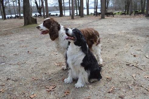
Dogs are allowed at Wilcox Park. Bandit, a Siberian Husky, had fun playing in the park. Apparently, Bandit earned his nickname because he “takes things”. What a beautiful dog. He caught my eye because of his handsome markings and his very cute smile. You can tell he’s a “bandit” based on his playful grin.
Parking: Vehicles are not allowed on Lighthouse Rd, unless you area senior citizen or if you have a physical impairment which may prevent you from walking or biking or running down.
The jewel of Westerly, Rhode island, Watch Hill Lighthouse is a stone’s throw away from Napatree Conservation Point. The walk down Lighthouse Rd is about half a mile and the views are worth the walk. Watch Hill is a swanky village in the town of Westerly that offers views of the southern most coast of the state (besides Block Island).
To get a sense of just how beautiful the area is, this is the view from someone’s driveway. Not a bad view to wake up to every morning.
There are more stunning views as you walk down the road.
This slideshow requires JavaScript.
There is also a “cliff walk” along the road which is basically a walkway along the sidewalk which allows you to walk on a “cliff” type access way next to the road. Besides being a fun way to travel, the cliff walk also offers some beautiful views.
Since it is somewhat isolated and not too active this time of the year, birds tend to congregate at Watch Hill. I found a few Double Crested Cormorants.
Watch Hill Lighthouse is the second oldest lighthouse in Rhode Island (Beavertail Light is the oldest lighthouse in RI). Originally built in 1808, Watch Hill Lighthouse has been destroyed or damaged by various storms over the years. The current lighthouse that stands there was built in 1856. It was automated in 1986 and it is still active today.
The best part of my trip to Watch Hill was watching the waves from the rocks. It is considered one of the more beautiful and romantic of Rhode Island (sans Newport). In fact, just before I arrived there I had missed a man proposing to a woman at the location. When I got there they were drinking champagne and cuddling as they watched the waves.
This slideshow requires JavaScript.
Cute little Louis (pronounced Louie) is a 3 year old toy poodle. I love how the wind blew his fur and ears back but he still wanted to see the lighthouse!
Below are two videos of the waves at Watch Hill to give a better sense of the power of the waves there (and this was just on a regular day)
Please connect with me and like my Facebook page to see extra photos and videos I don’t post on my blog!
Parking: Parking was a breeze in the early morning hours in April. I found off street parking with a 3 hour limit. There were several parking spaces available. This will change when the weather begins to warm up (at this rate, sometime in mid-August). One thing I found interesting and somewhat vexing is that according to signs, the parking lot next to Napatree is not supposed to be used for going to the beach. I assume the parking is meant for shoppers and people patronizing the restaurants in the area. For an area that has limited parking this seems highly unusual. If you go in the summer, be aware parking will be very limited.
First, I’d like to thank everyone for reading and being so supportive as I post my 100th blog post. One hundred posts in just under one year. What better place to write about than Napatree!
A peninsula-like shaped area, Napatree is actually a sandy spit. It has been shaped through a process called longshore drift which is basically a process by which sediments such as clay, silt, sand and shingle are transported along the coast creating its unique shape.
You wouldn’t know it by looking at it now but Napatree used to be densely wooded. Trees lined the area until the Great September Gale of 1815 hit the area and the trees were destroyed. In fact, the name Napatree comes from the term nap or nape of trees.
The views from the entrance of Napatree are beautiful. In some of the photos, you can see a brown tint to the otherwise deep blue water. In fact, the colors seemed to change depending on where and when I took the photos. The tides, shallowness of the water and other factors can affect the way the water looks. I had never noticed it as distinctly as I did at Napatree. The waves and movement of the water may have played a part as well. Despite how calm the water seems in these photos this was not the case everywhere at Napatree.
This slideshow requires JavaScript.
If you look close, you can see the Amtrak train in the distance that services the Westerly area in one of the photos.
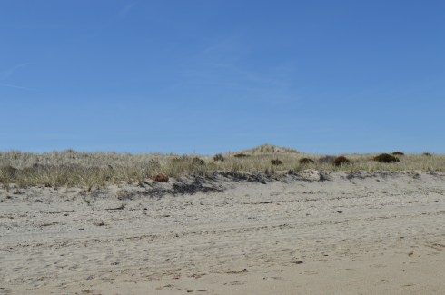
The dunes and the sand were also very pretty.
At first glance, Napatree seems like a long stretch of beach on only one side. But, I kept hearing noises over the dune. At first, I brushed it off as traffic or some other noise. Eventually, curiosity got the better of me and I decided to climb one of the dunes and check it out. What I found was pure paradise.
The calm waves and plain waterscape were replaced with crashing waves, foamy water, beautiful homes (the homes on both sides weren’t pretty shabby actually), the Watch Hill Lighthouse and marine activity.
This slideshow requires JavaScript.
When I arrived, the village was pretty desolate. This was partly due to the early time of the morning that I arrived and partly because the vacation season hasn’t began yet. Westerly did have a Cape Cod feel to it. From the quaint shops, the folksy, slowed down pace, the beautiful beaches and the mansions that dot the landscape (blog to follow soon about one of those lighthouses), I couldn’t help but think back to my childhood vacations at the Cape.
In due time, these empty streets will be bustling with activity. But, for now, it is a tourist/photographer’s dream having the area to one self!
There were several dogs at Napatree during my visit. Dogs are allowed on the beach but only until May 2nd. So, you’ll have to wait until next year to take Fido!
Daisy is a beautiful Golden Retriever. What a gorgeous smile.
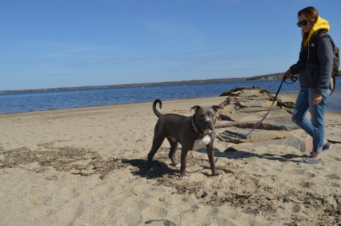
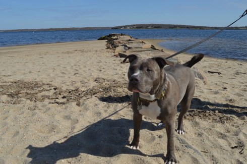
Caesar is an aquatic pitbull
Below are videos of the different sides of Napatree. The first video is of the more calm waters that I saw when I first arrived. The second video is from the other side over the dunes to the more active side of Napatree.
Parking: There are about a half dozen parking spots on the side of the road across from the bridge on Lilac Lane (a very busy road so be careful parking and crossing there). There is also additional parking on side streets and farther along the road on Lilac Lane.
There are many bridges in New England. But, only few have the name, reputation and appearance of a bridge that could collapse any moment. The Wiggly Bridge is a mini-suspension bridge built in the 1930’s which crosses over a tidal flow from Barrel Mill Pond to the York River. If you’re not careful, you may end up in the York River!
Ok, Wiggly Bridge really isn’t that dangerous. But, it can give you the willies as you walk across it. Even though it is safe to walk across, the bridge does wiggle and make noises as you traverse it. I made it across the bridge without much trouble and took some photos of the bridge as I made my way across.
The short walk across the bridge leads to Steedman Woods, a tiny peninsula with a mile long loop. Dogs are allowed on the beach and on Steedman Woods. The vieews from the island and bridge are stunning.
This slideshow requires JavaScript.
Wiggly Bridge is also within walking distance, or a short drive from York Harbor. So, you can take in both of these cool attractions in one day.
Cooper is a 7 year old rescue dog and a resident of Maine. He also likes the bridge.
The videos below shows how unstable the bridge seems when you’re walking on it.
Cost: Since I visited during the off season, it was free. The web site states it costs $9 for MA vehicles and $11 for out of state vehicles. Prices may vary if you bring your boat.
Location: 107 Wallum Lake Rd. Douglas, MA
Parking: Parking is limited at the main entrance. It probably fills up quickly during the summer weekends. There is also additional parking for boaters farther down the road to the entrance. There is also additional areas to park near the forest.
I wasn’t sure what to expect when I arrived at Douglas State Forest. It just happened to be in the area of another attraction I was visiting. But, I’m a firm believer in spontaneity, no I really am, so I decided to give it a whirl. I’m glad I did.
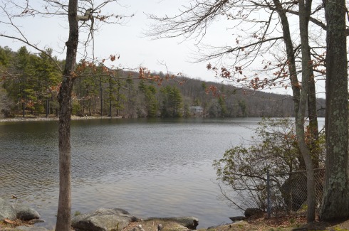
Douglas State Forest has a few different entrances besides the main entrance at Wallum Lake Drive. I passed some of them on the way to the main entrance. It may be a good option to try these entrances (off Webster and Wallis Streets respectively). After viewing the map for Douglas State Forest, I have determined I only walked a fraction of the 5,525 acres of the park.
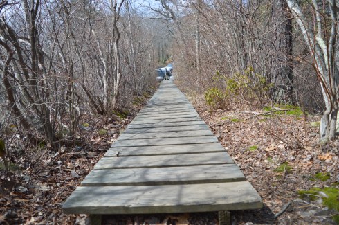
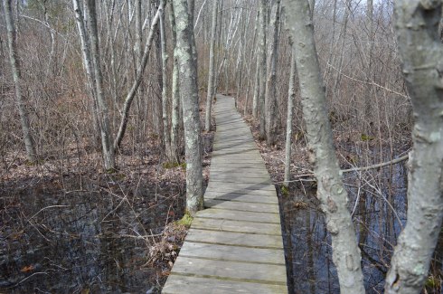
There are many hidden trails and long trails in the park. In fact, the Midstate Trail, a 95 mile hiking trail that extends through central Massachusetts to Mt. Watatic in the north, runs through the forest. I saw a group of walkers/hikers at one of the other entrances during my drive. I suspect they may have been gearing up to hike a section of this trail. There is also some rare Atlantic White Cedar swampland at Douglas State Forest. Boards are laid down to allow walking over these areas.
After arriving at Douglas State Forest, I walked the easy, half mile or so trail trail to Wallum Lake (the trail continues on much farther but I only walked to the boat launch and fishing area). A sure sign that spring is begrudgingly, well, springing was abundant. The trails are mainly like the one pictured below. I would describe the trails I took as being easy to moderate but the trail may get harder the farther you walk.
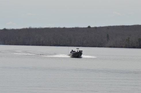
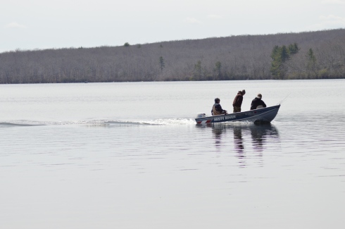
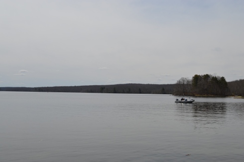
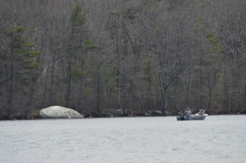
There were several people fishing and an assortment of boats in the lake. Boaters always seem to want to show off and speed around when they see someone with a camera!
Douglas Forest is a year-round attraction. Swimming, fishing and boating are allowed in the lake. In the winter snow shoeing and snowmobiling are popular activities at the forest. Horses and dogs are also allowed at the forest.
The views from the lake were beautiful.
This slideshow requires JavaScript.
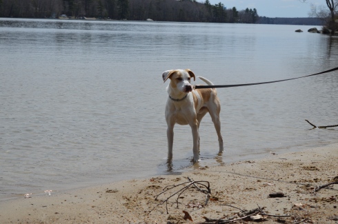
What started as a gloomy, chilly, overcast day, typical of a true New England spring day, turned into a sunny, warm day. It was the perfect day to take your pooch out for a walk and they were in abundance at Douglas Forest.
Lloyd is a 3 year old husky and lab mix. He was adopted by his pet parent from a shelter and he loves to play in the water.
Delilah is a 5 year old Staffy (Staffordshire Bull Terrier). She was rescued one day before she was slated to be put down. She is also from England and loves to play with sticks. Welcome to America, Delilah!
Dixie and Monty, Irish Spring Setters, posed perfectly for their dad.
Central Massachusetts (where Douglas is located) had always been a place to drive through to get to Western Massachusetts and its plethora of mountains, forests and waterfalls. But, I have been spending a lot of time in Central Massachusetts. After my last few visits I have fallen in love with the area. I will have many more posts coming from my travels in the Central Massachusetts area. Stay tuned and thank you for reading!
Please check out my Facebook Page and “like” it for additional photos, posts and videos. Thank you!
Driving home from Balance Rock State Park, I happened upon Lake Onota This is what is so great about New England, and really any area of the country. You can find the most beautiful places at the most unexpected moments.
A popular fishing spot, Lake Onota is a 617 acre pond located in Pittsfield, Massachusetts. It flows into the Housatonic River which eventually drains into Long Island Sound. Fishermen and women and boaters flock to Lake Onota for the bass, trout, walleye and crappie (yes they even fish for crappie fish).
A roadway bisects the lake. Of course, typical of New England weather, while it was very cloudy on one side, the other side had nary a cloud.
This slideshow requires JavaScript.
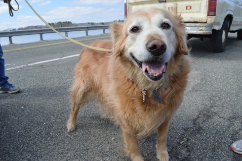
Dogs like Lake Onota as well. I met Becca, a happy 9 year old golden retriever,there.
How could you not want to visit an area with the name “by the sea” in its name? It sounds like the name of an idyllic setting from a novel. And the town lives up to that description. I passed by several fruit, vegetable and flower stands as well as signs to watch out for people riding horses. The houses and town also had a very Norman Rockwell feel.
I wasn’t sure how the footing and appearance of the park would be given the recent snowy weather and icy conditions on many of the trails at other parks. As it turned out, most of the ice and snow on the trails had melted and I only had to manage some small patches of ice and mud from the melted snow.
The trails are clearly marked and easy to walk. There are no steep inclines and the paths are wide enough to accommodate the throng of visitors.
There are a few trails that meander slightly off the trail. But one trail simply leads to the street and is behind a bunch of cattails so you really can’t view much of the pond. The other stupid trail goes to a thorny, rocky dead end.
As you walk on the main trail, you will pass Clarke Pond on your left. It was partially frozen and there were some ducks and geese milling around. I also got a few shots off them dunking for lunch. The gulls in the first photo looked like big blocks of snow at first glance. I especially like how the mom and dad duck kept the baby duckling close to them.
This slideshow requires JavaScript.
There were many breath taking views of the pond. I especially like how the frozen parts of the pond break with the unfrozen sections.
This slideshow requires JavaScript.
To the right of the main trail, I found a side road with a pond that channels into Clarke Pond. There were a variety of ducks and geese in this pond.
This slideshow requires JavaScript.
I met a lot of friendly and cool people at Coolidge. Shapoo was one of the cool and friendly folks I met (the name is a mix of shih tzu and poodle) .
Much to my consternation, I was unable to find the Ocean Lawn which offers views of the Boston skyline and Cape Cod as well as scenic views of the water. I totally missed the boat on that one as there are some great views and opportunities for some great shots from there. But, to the left of the trail, Magnolia Beach more than made up for it which I will post about very soon…click here to read about my visit to Magnolia Beach.
There are about a dozen parking spaces in the main parking lot. If needed, you can also park on the side of the road by the parking lot.
Cost: Free
Hours: open daily, sunrise to sunset
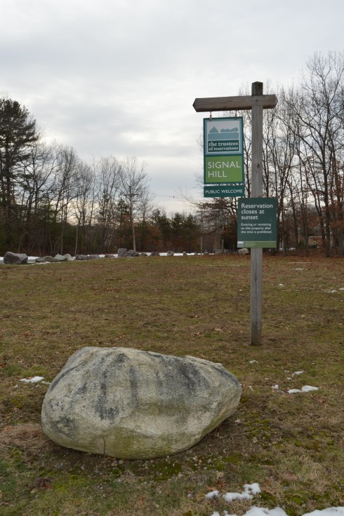
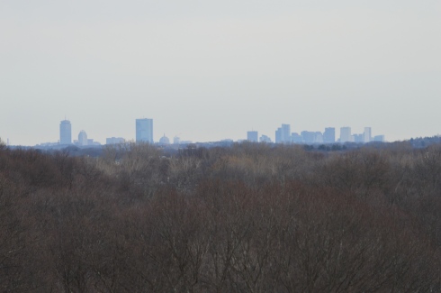
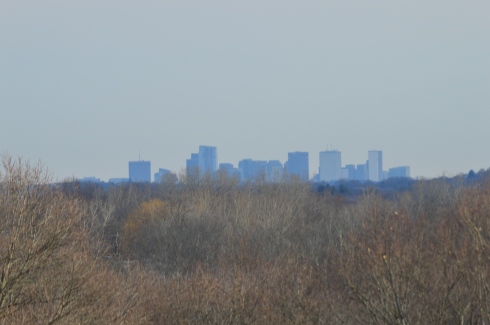
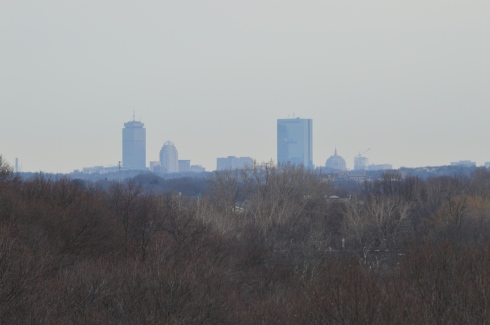
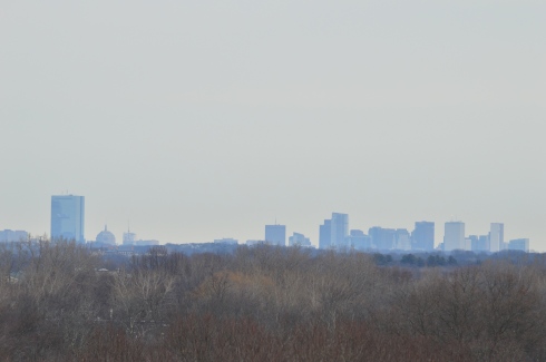
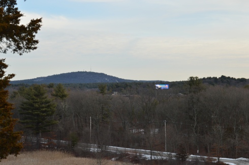
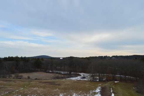
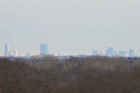
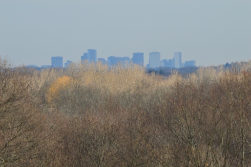
Before you even begin climbing the ascent to Signal Hill, the views from the parking lot are astounding.
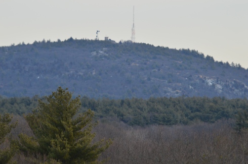
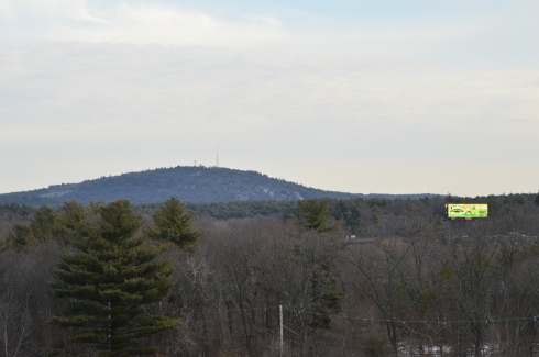
Besides the historical significance (it used to be the home to the Paleo-Americans who settled on what would become the Neponset River) and the active wildlife (hawks are said to nest there and many amphibians inhabit the area by the river), Signal Hill also offers grand views of the Boston Skyline, Blue Hills and the Neponset River Valley.
The hill to the scenic outlook at Signal Hill is modest at best. It should only take 10 minutes to go from the parking lot to the outlook.
The views are worth the short hike.
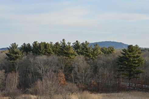
The scenic overlook has some pretty trees and rocks.
One of the charming features of Signal Hill is the short loop (1.6 miles) at the base of the hill. After climbing and trudging along so many long and steep hills, it’s refreshing to be able to take a leisurely stroll along the clearly defined trail. There are also trails that veer off a little.
Off the main trail there is a canoe launch site on the Neponset River. The upstream launch site goes to Norwood (MA) while the downstream site leads to Milton (MA).
Since there is little traffic on the road, the road to Signal Hill is popular with joggers and cyclists.
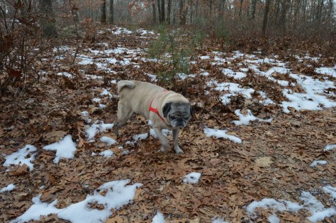
I met Charley during my visit. He was having fun playing in what remained of the snow on the trail.