Tag Archives: flowers

Chestnut Hill Reservation (Allston/Brighton, MA)

Date Visited: September 24, 2016

Location: Beacon St, Brighton, MA

Hours: open everyday dawn until dusk

Cost: Free

Parking: There is a free parking lot next to the reservation that accomodates about 100 vehicles, there is additional metered off street parking

Park Size:20 acres, 1.5 circular trail loop

Time To Allot For Visit: 1 to 2 hours

Trail Difficulty: Easy

Dog Friendly: Yes

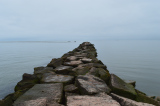
Highlights: nice views, reservoir, easy circular trail, popular with cyclists, joggers and dog walkers, lots of birds and other wildlife, shoreline fishing is permitted

Lowlights: trail can get congested

Web Site: Chestnut Hill Reservation

Trail Map: Chestnut Hill Reservation Trail Map

dsc_0413

Created in 1870 on marshes and meadowland to provide the city of Boston with an additional water supply, the Chestnut Reservior, the reservoir now acts as a pretty body of water encircled by a 1.5 mile circular trail loop.  The reservoir was taken off line in 1978 and is no longer needed for a water supply for the city of Boston.  But, it is still maintained as an emergency backup source for water.  Now, a plethora of birds and other aquatic animals thrive in the reservoir.

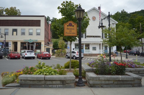
While the reservoir itself is only located in the Boston area, Chestnut Hill area of the park, which includes parts of Boston, Brookline and Newton, includes a swimming pool, skating rink.

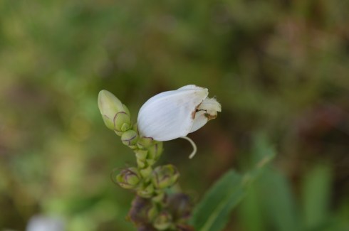
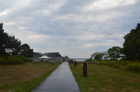
The reservation has some beautiful views of the Brighton/Allston, Chestnut Hill and surrounding areas.  The clouds provided a pretty, albeit threatening, touch.  There are pretty flowers along the trail and, as you can see from some of the photos, the circular loop around the reservoir is very easy with only subtle, if any, inclines.  You can see the two skyscrapers of Boston (the John Hancock Tower – the glassy blue colored building on the left – and the Prudential Tower – the brownish building with the long antenna on the right).  You can also see the stylish top of one of the buildings of the Boston College campus in the first few photos of this group.

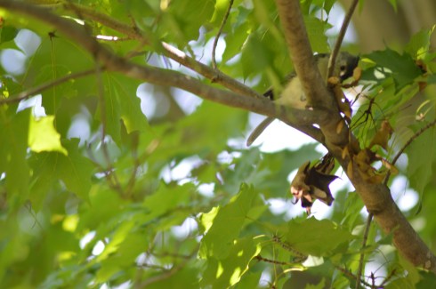
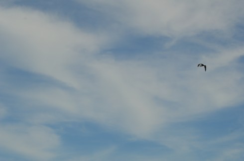
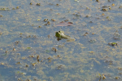
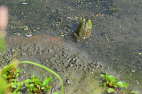
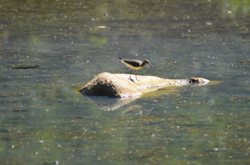
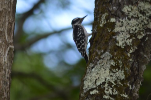
There is also an abundance of wildlife at the reservoir.  Mallards, Cormorants, Canadian Geese and a variety of other birds inhabit the reservoir.

This Cormorant had just got his or her lunch.  In the last photo the Coormorant had eith er lost the fish or just swallowed it (you can choose to believe whichever makes you sleep easier tonight).

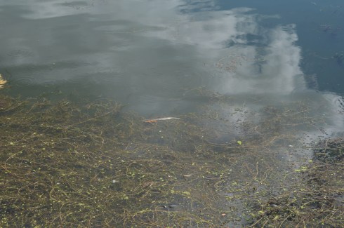
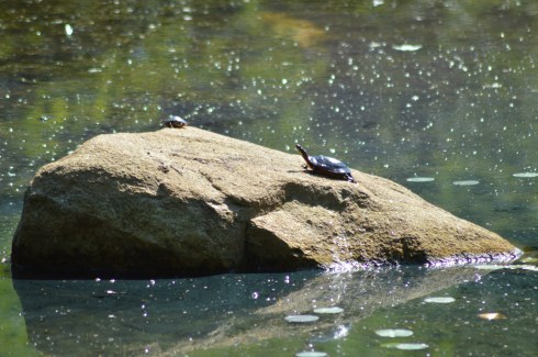
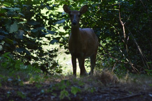
Birds aren’t the only inhabitants of the reservoir.  Turtles and other aquatic animals occupy the reservior as well.  It’s a little hard to see butt at the bottom of the second photo there is a huge turtle.

dsc_0629dsc_0626

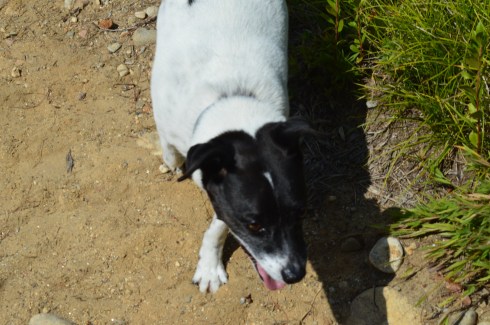
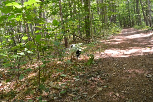
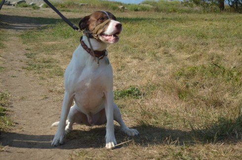
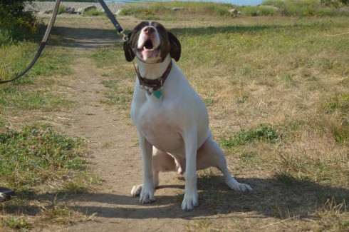
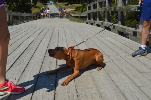
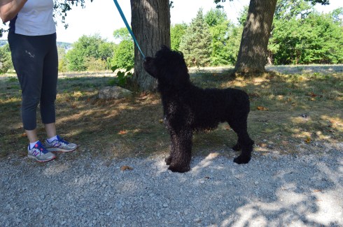
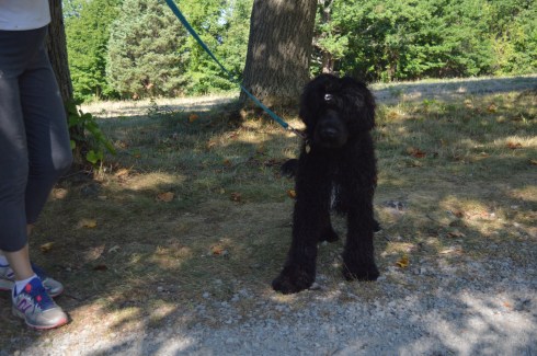
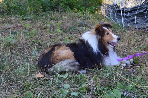
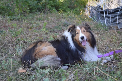
Since it was such a nice day outside, there were a variety of dogs at Chestnut Hill Reservation.

ViVi, a 4 year old Beagle and Cocker Spaniel mix, showed off her talents of doing a pirouette and playing patty cake to beg for treats.

This slideshow requires JavaScript.

This slideshow requires JavaScript.

Buster is a 9 year old English Lab and Retriever mix, or the best combination ever!

Bella is, appropriately enough, a 2 year old toy poodle.  Doesn’t she look like a toy?

Luke, a 2 year old Lab, was a little shy but warmed up to the camera nicely.

Please check out my Facebook page to see other photos, videos and other content that is not included in my blog

and look for me on my Instagram page @new.england.nomad_

Thank you!

Similar Places I Have Visited In New England:

dsc_0988

Dorrs Pond (Manchester, NH)

dsc_05372

Borderland State Park (North Easton, MA)

dsc_07681

The Nature Trail And Cranberry Bog At Patriot Place (Foxborough, MA)


Northwest Park (Windsor, CT)

Date Visited: September 10, 2016

Location: 145 Lang Rd, Windsor, CT (15 mins north of Hartford, CT and half an hour south of Springfield, MA)

Hours: Open everyday, sunrise to sunset

Parking: There is ample parking(about 100 parking spots) in the main parking area as you enter by the soccer and baseball fields.  There is also a smaller parking area by the dog park on your right as you enter the park that can accommodate about a dozen cars.

Cost: Free

Size: 473 acres, 12 miles of trails

Trail Difficulty: Easy to somewhat moderate in some areas

Time To Allot For Visit: 2 to 3 hours

Dog Friendly: Yes

Highlights: dog park, ponds, trails, flowers, reservoir, ball fields, wildlife, animals, tobacco museum, venue for events during the spring and summer

Web Site: Northwest Park

Trail Map: Northwest Park Trail Map

dsc_0305

Since summer is winding down, I decided to take in one last trip to one of New England’s more popular parks while the weather was still warm.

With over 12 miles of trails, a reservoir and miles of trails, Northwest Park is a scenic, family friendly park that is a great place to take your dog.

At the entrance of the park, there is a small, penned in dog park called the Windsor Dog Park.

In a way, it is odd to have a dog park in a park that is essentially a dog park.  I do suppose the penned in dog park would be good for dogs that may be too aggressive to be around other dogs or might be too shy or not yet socialized.

Along the trail past the main entrance, there is a pond with an overlook.  The pond is full of turtles, frogs and even Koi fish.  One of the visitors at the park threw some bread into the pond.  Who knew turtles liked to eat bread!

There is also an organic and community garden at the park.

There is also a barn with farm animals and other animals at the park.

One of the special parts of the park is the art scattered around the park.

The trails at the park are pretty much flat and easy to negotiate with some slight inclines.

There are several trails at Northwest Park.  We took the Brookside and Rainbow Reservoir trails.  The Brookside trail is heavily wooded without much to see except a few chipmunks.  The name Brookside seemed a bit misleading as there really wasn’t a brook to be found from the trail.

Eventually, we found ourselves by the Rainbow Reservoir.  The surface of the water was a strange shade of lime green.

There were some boats in the water and even a water skier.

The trails are full of pretty trees, colorful flowers and a few abandoned barns.

You ever notice what the inside of an abandoned barn looks like?  Then, wonder no longer.  It’s actually pretty boring. The video below gives a better look inside.

dsc_0652

There were also a lot of critters to see along the trails.  This chipmunk thought she could hide from me.

This squirrel wasn’t any better at hiding.

dsc_0662

This bird was a bit better at hiding.

dsc_0665

Finally, on our way out of the park, we decided to check out the tobacco museum.  The museum shows the history of the tobacco crop industry and the tools and machines they used.

Northwest Park is a great place to take your dog.  The trails are not very hard to walk and there are lots of open spaces for your dog to roam.  I found two very friendly dogs to photograph during my visit.

Tally is an 11 year old Shephherd mix.

Lada is a 1 year and 7 month old German Shepherd.

Below is a video of the water skier I saw at Rainbow Reservoir and a video of the inside of the abandoned barn I saw along the trails.

Please check out my Facebook Page and like it to see videos, photos and other content not included in this blog:

Facebook

and instagram:

@new.england.nomad_


Bridge Of Flowers (Shelburne Falls, MA)

Date Visited: September 6, 2016

Location: 22 Water St, Shelburne Falls, MA (1 hour west of Springfield, MA, 1.5 hours east of Hartford, CT and about 2 hours west of Boston)

Hours: Open April 1 – October 30, 24 hours a day

Cost: Free

Parking: There is available off street parking (the 2 hour unmetered parking limit on Bridge St is strictly enforced) and a free parking area off Baker Ave with about 30 -40 free spots (take care not to park in the spots reserved for businesses and other tenants in the area) and additional off street parking.  Parking is difficult during peak times.

Size: 400 feet long, 18 feet wide

Time To Allot For Visit: 30 minutes an hour.

Dog Friendly: No

Highlights: pretty flowers, scenic views, memorials, works of art, a master gardener is available on the bridge during peak weekends to ask questions about your own plants and gardens

Lowlights: bridge can get congested since it is narrow

Website: Bridge Of Flowers

dsc_0524

Built in 1908 for a measley $20,000 (roughly $500,000 in current day’s money) by the Shelburne Falls and Colrain Street Railway, the Bridge of Flowers is now home to a wide variety of flowers, trees and even some works of art.

Originally, the bridge was used as the main mode of transportation for the community.  However, once cars became more popular, the train was used less and the company went out of business.   Since the bridge could not be destroyed because it carried a water main between the towns of Colrain and Shelburne Falls, it was decided to do something with the bridge. Then, in 1929, the Shelburne Women’s Club sponsored Antoinette Burnham’s idea to transform the bridge into a garden.

More than 35,000 people visit the bridge ever year.  Yet, it is still something of an unknown attraction, even in New England.

Much to the consternation of my company, I can be very particular about my photos (although my guest on this day didn’t complain).  I tried my best to take photographs of the bridge without any visitors on the bridge or with as few people as possible on it and wow did it take a while to get those shots which just goes to show how much foot traffic it can get.  But, I did eventually get my shots of an empty or close to empty bridge.

This post is photo-heavy.  As much as I tried, it was very hard to choose flowers to include and which ones to not include.

The hardest part of this photo shoot was selecting the best photos to post.  The flowers are so pretty and the view nothing short of jaw dropping.  The flowers are also beautifully arranged.  I especially liked how the flowers complimented the landscape.


Birds and bees like the flowers, too.

Flowers and trees aren’t the only attractions at the Bridge Of Flowers.  Memorials and art are scattered throughout the bridge.

One of the works of art at the Bridge of Flowers is a stained glass window designed by Nancy Katz and created by Mark Liebowitz at the Garden House.  It is illuminated during the evening.


This water fountain is also at the area past the bridge.

I noticed this in one of the flower beds.  What is it?  A coded message?  A plan for a secret rendezvous?

dsc_0897

Also, and not least, there are war memorials on the bridge.  This memorial honors the veterans of World War I and World War II of the Buckland and Shelburne areas.  While it honors all of the veterans of these wars, the names of those made the supreme sacrifice from these areas are engraved on the plaque on the stone.

This memorial honors the veterans of Korean and Vietnam wars.  The names of the peolpe from the community who lost their lives in these wars are engraved on the plaque on the stone.

dsc_0962

Another great thing about the bridge is they plant flowers each month and it is “peak season” for different flowers at different times (their planting schedule is on their web site).  So you’re sure to see something new and pretty any time you go.  However, I would suggest going during the summer or, preferably, the fall.

Similar Places I Have Visited In New England:

dsc_03441

Glacial Potholes And Salmon Falls (Shelburne Falls, MA)

dsc_03261

Eindsor-Cornish Bridge (Windsor, VT and Cornish, NH)

dsc_0146

Wiggly Bridge (York, ME)


Glacial Potholes & Salmon Falls (Shelburne Falls, MA)

Date Visited: September 6, 2016

Location: Deerfield Ave, Shelburne Falls, MA

Hours: Open everyday, 24 hours a day

Cost: Free

Parking: There is off street parking with a 2 hour limit and police do take notice

Dog Friendly: Yes

Highlights: waterfall, glacial potholes, flowers, birds, shops, attractions

dsc_0344

The Salmon Falls and Glacial Potholes attraction in Shelburne Falls, MA, is a beautiful “two-fer.”  “Three-fer” if we include the bowling alley adjacent to the Salmon Falls and Glacial Potholes attractions.  IN fact, it is more accurately described as a “many-fer”s there are many attractions and beautiful attractions to the Salmon Falls area.

Although it may be best known for The Bridge Of Flowers (post to come shortly), beauty and grandeur abound Salmon Falls/Glacial Potholes area on Deerfield Ave.

The glacial potholes were ground out of granite during the high water of the Glacial Age.  The whirlpool action of the waves and the gyrating stones created the prominent holes in the stones.  It is said some of the grinding mills can still be seen in the smaller potholes.  Over 50 potholes exist in the confined area known as “Salmon Falls” when the the Native Americans resided here.  The potholes vary in size from 6 inches to 39 feet in diameter.  The 39 inch diameter pothole is considered the largest pothole on record.  And you thought the potholes on our roads were bad.


Salmon Falls, as it was dubbed by the Native Americans, was a common area for hunting and fishing.  The waterfall still gives some pretty views against a once industrialized scenery as the backdrop.

dsc_0248

What makes the Salmon Falls and Glacial Potholes area are the small shops and antiquated buildings that give the area a very old fashioned small town feel.  This is true for pretty much the entire community of Shelburne Falls.

There is a bench for sitting, feeding the birds and just taking in the beauty around you.

Almost as a prelude to the much heralded Bridge of Flowers (which is located only a short walk or drive from the Salmon Falls and Glacial Potholes area), flowers and trees bound the Salmon Falls area.

If you’re lucky you might even find a feathered friend to photograph.

dsc_0375

Deerfield Ave, the road that leads to Salmon Falls and the Glacial Potholes, still has the old town feel that adds tot he charm of the area.  In fact, the entire Shelburne Falls area still has many “mom and pop” shops and independent businesses rather than chain stores.  It was nice walking around without being bombarded by convenience stores and restaurant chains that seem to scar so many other towns.

The Shelburne Bowling Alley is one of the oldest bowling alleys in the country.  In operation since 1906 (and yes it is still open for business currently), the Shelburne Bowling Alley could easily be mistaken for a barn or some other structure from a different time.

dsc_0252

There is also a variety of art throughout the area.  Some of the art I noticed looked different from the art I have seen in previous visits.  So it appears they do change it up every so often.  The art honors the history of the area and gives information about the area.

Below is a video of the falls at Salmon Falls.  It was an overcast and somewhat windy day when we first arrived at the Falls so you may hear the wind in the video.  But, most of the sound is from the rushing waters of the Falls.

Similar Places In New England I have Visited:

dsc_0329

Wadsworth Falls State Park (Middletown, CT)


dsc_0913

Cascading Waters (Worcester, MA)

dsc_06561

Bash Bish Falls (Mount Washington, MA)


Canoe Meadows Wildlife Sanctuary (Pittsfield, MA)

Date Visited: September 3, 2016

Location: Holmes Rd, Pittsfield, MA (it is not clearly marked – it is about 2 miles down the road on the right hand side if you coming from the east)

Cost: Free but donations are appreciated

Parking:  There is room for about a dozen cars (see photo below)

dsc_0975

Trail difficulty: Easy

Park Size: 253 acres, 3 miles of trails

Time To Allot For Visit: 1 to 2 hours

Dog Friendly: No, dogs aren’t allowed on MA Audubon trails.

Highlights: pretty plants and flowers, a lot of wildlife, ponds, home to a community garden

Lowlights: Park is a little hard to find, some trails may be inaccessible or difficult to hike particularlywhen it rains

Web Site: Canoe Meadows Wildlife Sanctuary

Trail Map: Canoe Meadows Trail Map

I am always surprised at how some of the more beautiful areas to visit seem to be tucked away in the most unlikely places.  It’s almost as though they are meant to be kept a secret for just the few people who are adventurous enough to find it.  Such is the case with Canoe Meadows Wildlife Sanctuary.  Tucked away on a busy side street in the otherwise sleepy town of Pittsfield, MA, Canoe Meadows Wildlife Sanctuary (ironically, you can’t launch a canoe or any watercraft there) is a haven for birds, the occasional water faring mammal or amphibian and beautiful flowers.

The paths at Canoe Meadows are clearly defined and there are benches, bridges and boardwalks along the trail.

What stood out most to me about Canoe Meadows are the colorful plants and flowers and the trees.  The colors of the plants are so vibrant and the trees are nothing short of majestic.  I love the mix of pink, purple, white and yellow flowers as you can probably tell by my photos.

There are also a lot of bees at Canoe Meadows pollinating this time of the year.  There is a bee inside this flower.  You may be able to barely see the bees sticking outside of the flower.

dsc_0864


There are plenty of birds at Canoe Meadows.  They do like to hide.  So it is hard to get good photos of them.

I spotted this heron as he was flying away.  I just wish I saw the bird earlier.

dsc_0868dsc_0869

I also saw this chipmunk, one of the more common residents of the meadow.

dsc_0777

There were also lots of frogs at the meadow.

dsc_0882dsc_0879dsc_0878

Unfortunately, I did not see any of the otters, beavers and other critters that are said to inhabit this meadow (although I did see evidence of their existence there).  If you go early in the day or are very quiet, you may have better luck.  Good luck if you do try!

Similar Places I Have Visited In New England:

dsc_0005

Dorrs Pond (Manchester, NH)

dsc_07681

The Nature Trail And Cranberry Bog At Patriot Place (Foxborough, MA)

Please connect with me on one of my other social media sites to see videos, photos, links and other cool stuff not included in this blog!  Thank you.

Facebook (New England Nomad)

Instagram (@new.england.nomad_)

Twitter (New England Nomad)


Broadmoor Wildlife Sanctuary (Natick, MA)

Date Visited: August 13, 2016

Location: 280 Eliot Street Natick, MA

Hours: Tues-Fri, 9 am-5 pm
Sat, Sun, & Mon holidays, 10 am-5 pm
Closed Mondays

Trails:
Tues-Sun, & Mon holidays, dawn to dusk
Closed Mondays

Cost:

(MA Audubon) Members: Free
Nonmembers:
$5 Adults
$4 Children (2-12)
$4 Seniors (65+)

Parking:  There are about 50 0r so parking spaces in the parking lot

Trail Difficulty: Easy to moderate

Size: 9 miles of trails

Time To Allot For Visit: 2 to 3 hours

Highlights: abundant wildlife, clearly defined trails, lookouts and bridges, several pond areas

Lowlights: One of the ponds (Little Farm Pond) is only accessible via motor vehicle and is not accessible from the sanctuary, according to one of the staff workers at the sanctuary

Broadmoor Wildlife Sanctuary Web Site

Broadmoor Wildlife Sanctuary Trail Map

From the moment I drove into the parking lot for Broadmoor Wildlife Sanctuary (a MASS Audubon sanctuary), I could tell it was going to be a special place.   The pretty trees and stocks of grass reminded me of some rural, country farm.

The 10 trails at Broadmoor are fairly easy to negotiate (the Charles River Loop is probably the most challenging).  There are a few trails that cross over ponds and marsh land.

Overall, the trails are easy with a few moderately difficult trails such as The Charles River Loop.  The trail on the Charles River Loop is somewhat narrow in some places and it can be hard to follow the trail (look for the yellow and blue marked trees).

There was a lot of activity, such as turtles,  in the ponds.  Can you spot the turtles in this photo?  There are three.

DSC_0135


What if I get closer?

DSC_0132

How about now?

Broadmoor is teeming with wildlife.  I found these critters during my hike.

There is also a lookout area where you can sit and look out upon the pond where I found this heron hiding.

There is a lot to see at Broadmoor.  There are lots of turtles, butterflies, birds and evidence of other wildlife.

I found this beautiful swan as I was walking along the park.

All that swimming and looking for food can make you tired.  So, she decided to take a nap.

There are also beautiful views of the park.  The flowers, plants and trees make for a beautiful backdrop.

Broadmoor Wildlife Sanctuary is the perfect visitors of all ages (I even saw some visitors in strollers).  It can be buggy but, as lucky would have it, that won’t be a problem for much longer in New England as fall descends upon us.

Similar Places I Have Visited In New England:

dsc_03413


Ipswich River Wildlife Sanctuary (Topsfield, MA)

dsc_01462

Borderland State Park (North Easton, MA)


Bear Brook State Park (Allenstown, NH)

Date Visited: August 27, 2016

Location: 157 Deerfield Rd, Allenstown, NH

Cost: $4 for adults, $2 for children (ages 6-11), children 5 and under get in for free, NH residents 65 and older are also admitted free of charge

Hours: Open daily, sunrise to sunset, campground schedule: May 6 -Oct. 29 (2016), Sun-Thu 8 a.m. – 8 p.m., Fri 8 a.m. – 10 p.m.

Size: 10,000 acres

Time To Allot For Visit: 2 to 3 hours

Parking:  There are about 50-60 parking spaces in the main parking area (see photo below)

DSC_0640

Additional parking can be found at Hayes Field (see attached map)

Dog Friendly: Yes

Highlights: Very popular with cyclists, several large ponds and marshes, teeming with wildlife, campgrounds, archery target area, fishing (fly fishing only)

Lowlights: too big to hike or bike all in one day

Bear Brook State Park

Bear Brook State Park Trail Map


DSC_0502

A haven for cyclists and nature lovers, Bear Brook State Park in Allenstown, New Hampshire is the largest developed state park in New Hampshire.  Boasting 10,000 acres, over 40 miles of trails, several ponds and other bodies of water and marsh lands, Bear Brook is the biggest state park I have hiked.

Although there were many frogs and turtles visible at Bear Brook, birds, deer and other wildlife proved to be more elusive.

DSC_0259DSC_0294DSC_0311DSC_0299DSC_0360DSC_0393DSC_0560DSC_0418


DSC_0343

Bear Brook also has a fishing area, two of them actually.  There is the Archery Pond, which also has an archery target area.  Only fly fishing is allowed in the pond.

The archery target practice area is to the right of the pond.

Across the paved road from Archery is a kids fishing pond for children 12 years old and younger.  A fishing pond for children!  How cute is that?

What my visit to Bear Brook lacked in deer, birds and other more typically photographed wildlife, it made up for in smaller critters.

I did see a few runners and hikers but the overwhelming majority of the visitors at Bear Brook were cyclists.  The trails vary from flat and easy to steep, rocky and challenging.  I would consider some trails to be very challenging even for the advanced cyclist and I did not see any cyclists on some of the more steep and rocky trails.

You never know what you’ll find at Bear Brook State Park.  While walking along the main trail, I came across this grave site for an unknown soldier from the Civil War.  There is no marker for the Union or Confederacy.  The only flag or designation displayed is an American flag.

There is also a stream running under a bridge at the entrance

There are also several ponds, marshes and creeks.

There are also beautiful, vividly colored trees, plant life, spiderwebs (ok, maybe that’s not so beautiful) and a sign that summer is soon ending.

Speaking of beautiful trees and plants, one that thing is hate to see at parks is the cutting down of trees or, as the parks call it”sanitation timber harvest.”  However, in the case of Bear Brook, and most state parks, there was good reason for this sanitation.  Because of an infestation of red pine scale, many of the red pine plantations had to be cut down.  The sanitation began in 2013 and was completed in 2014.  For whatever reason, it’s always sort of sad to see so many open spaces and stumps.

The trail for Hayes Farm does not lead to a farm but rather what used to be a farm.  You can see remnants of the stones which surrounded the farm from the trail.

This is my only gripe about the park.  There are long swaths of land without much there.  It’s very pretty and largely untouched by humans.  In fact, it is such a big park that I was unable to get to one of the bigger attractions, Catamount Trail that is supposed to have pretty scenic views.  But, after 6 hours of hiking and photographing the park I didn’t have the energy for that hike.  But, keep it in mind if you do go.

There is also a campground with a place to park your camper or rent one of their own.  Check their website for fees and availability.

There were not many dogs at Bear Brook.  In fact, Jack, a 9 year old rat terrier from Rhode Island, is the only dog I saw during my trip.

DSC_0594DSC_0579DSC_0587

Similar Places I Have Visited In New England:

12345

Breakheart Reservation (Saugus, MA)

123456

Pawtuckaway State Park (Nottingham, NH)

Please Connect With me On Facebook:

Facebook


World’s End (Hingham, MA)

Date Visited: August 28, 2016

Location: 250 Martin’s Lane, Hingham, MA

Hours: open everyday, 8:00 a.m. until sunset

Cost: $6 for adults, annual memberships which include free admission are available for $47

Size: 4.5  miles of continuous trails, 251 acres

Parking: there are three parking areas with roughly 20 spots each.  When I left at 1:00 p.m. the lot was full and there was a line of about half a dozen cars waiting to get into the park.

Time To Allot For Visit: 2 hours

Dog Friendly: Yes

Trail Difficulty: Easy to Moderate

Highlights: scenic views of the Boston skyline and surrounding area, wildlife, occasionally they display exhibits at the park, benches to sit along the trail, pretty trees and flowers, perfect for walkers, joggers, runners, cyclists and even horseback riders and anowshoeing during the winter

Lowlights: limited parking (if you follow the reservation Twitter they post alerts when the lot is full)

Website: World’s End

World’s End Trail Map

DSC_0988

I “misunderestimated” World’s End.  I figured it would be an “easy” quick jaunt (I usually save my easier treks for Sundays).  So, I slipped on my Chuck Taylor All-Stars and figured I would be home in a few hours.  Not the best choice of footwear in retrospect.  The trails can be rocky (particularly if you go off trail) and deceivingly steep in some areas.

There are a lot of side trails and it’s easy to get confused and cover the same area twice (or more) which can add quite a bit of time to your journey.  In fact, for a while, I thought World’s End would never end. It’s a good idea to take a map of the trails with you.  But, the trails are clearly marked and easy to negotiate with some slight inclines.

Undoubtedly, the main attraction for many visitors at World’s End are the views of the Boston skyline.  World’s End affords several views of the skyline and surrounding areas.  From the shoreline views to the views atop the highest point on the top of one of the many views of the rolling, hilly trails, the views are majestic.

World’s End is teeming with wildlife, particularly birds.  They’re very good at camouflaging themselves so you might have to squint to see a few of them.

But, the real gem of my visit was this deer I spotted on my way to Rocky Neck, one of the more secluded areas.  We stood mere feet away from each other staring, until she finally took off.

There are not just an abundant of bird life in the water.  Being a picture perfect summer day with low humidity and a slight breeze and calm waters, it was ideal for many of the boaters, paddlers and other seafaring folks.

This boater wanted some privacy, apparently.

World’s End has many other charming features such as this huge rock and an elevated viewing area for bird watching.

Of course, sometimes the more simpler things can be the prettiest features of the park.  These flowers, tress and views off the water caught my eye.

Some people took advantage of the shore to skim some stones.

DSC_0508

DSC_0622


If there is one photo that sums up a trip to World’s End it is this photograph of a hammock with a bicycle next to it.  World’s End is the perfect place to lie out in a hammock with only the sounds of nature to keep you occupied and maybe a good book or your Itunes collection.

DSC_0999

There is also an art exhibit on display until Oct. 31, 2017.  The display was created by Jeppe Hein, an artist based out of Copenhagen and Berlin.  He is known worldwide for his interactive exhibits.  The exhibit is called, “A New End”.  According to the website for the exhibit, Hein wants to invite visitors to reflect and to transform how we view a familiar place like World’s End.

There were dogs-a-plenty at World’s End during my visit.  World’s End is a great place for dogs to play around in since there are many open, grassy areas and, of course, water to frolic around in.

DSC_0474DSC_0483DSC_0488DSC_0478

Casey is a happy, 8 year old English Pointer mix.  He is a rescue.

DSC_0949DSC_0950

Gus is a 2 year old Ridgeback mix.  He was very excited to be at the park!

DSC_0651DSC_0650DSC_0643DSC_0647

Tande is an 8 month old Portuguese Water Dog.  If Tande looks familiar, you may have seen a similarly looking dog on the news.  The President also has the same breed of dog. Tande came all the way from the Odysea Portuguese Water Dogs breeder in Colorado.

DSC_0701DSC_0702DSC_0706

One of my easiest subjects to photograph ever, Bella is a gentle 7 year old Shetland Sheepdog.

I also saw a variety of other dogs playing in the water and running around.

viewsofanemergencyrn was kind enough to nominate me for the One Lovely Blog Award.  Thank you!  I usually don’t post about these awards but I figured I would play along since she was so nice to mention me and I wanted to acknowledge her.  She is a sweet, strong person and a survivor (read her post to see what I mean).

So, the rues are I have to mention 7 random things about me.

  1. I didn’t take up photography seriously until last year
  2. I  love dogs and all animals (big surprise there) but they also seem to love me – the key is to not show fear and be confident and friendly around them (they can sense fear)
  3. I am a pescatarian (I only eat seafood and do not eat meat, primarily)
  4. People often say I bear a strong resemblance to Donnie Wahlberg (but I can’t sing like him)
  5. Although I love dogs, I don’t have one (I have a cat instead)
  6. Until my work schedule got too busy, I had been an active literacy tutor at my local library
  7. I run (and/or walk) 3 miles (at least) a day everyday

The rules say to nominate other bloggers to participate.  But, I’m going to skip that part.  In my experience, people have usually already posted a blog like this in the past and don’t want to do it again, or they don’t participate or they seem to be too busy.  But, thank you, once again for the mention, viewsofanemergencyrn!  I do appreciate you and I look forward to reading more of your posts.  You all should also!

Similar Places I have Visited In New England:

111

Webb Memorial State Park (Weymouth, MA)

222

Blue Hills Reservation (Milton, MA)


Odiorne Point State Park (Rye, NH)

Date Visited: August 6, 2016

Location: 570 Ocean Blvd, Rye, NH 603-436-7406

Hours: Open everyday 8 a.m. to 8 p.m. (I got there well before 8 and the gates were already open).  Open but unstaffed after 10/11

Cost: $4 for adults $2 for children (ages 6-11), NH residents who are seniors (over 65) or younger than 6 get in free

Parking: There are about 50 parking spots in the main parking area.  There are additional parking lots along the beach

Time To Allot For Visit: 1 to 2 hours

Trails: Easy

Dog Friendly: No

Highlights: abundant wildlife (mostly birds), pretty flowers and trees, lighthouse (Whaleback Light), scenic views, play area for children, “sunken forest”, science center, historical site

Lowlights: Parking can be tough (especially during the summer), since it is considered a beach dogs are not allowed at the park

Odiorne Point State Park Trail Map

Odiorne Point State Park Website

DSC_0024

The location of the first English settlement in New Hampshire, Odiorne Point has a very storied past.

Named after the Odiorne family who settled there during the 1660’s, Odiorne Point is probably best known for being a military installation during World War 2.  Known as Fort Dearborn at the time, Odiorne Point was part of the military’s attempt to modernize the U.S. coast defenses.  Part of the military installation served as a radar station by the United States Air Force beginning in 1949, and in 1955 this became the Rye Air Force Station.  None of the Air Force’s installation remains there.  Looking at the historical remnants of the fort it is obvious how far we have come as a military power.  Real shells, a bunker entrance, a battery and other historical structures are scattered throughout the entrance to the park.

The park also has a science center located at the end of one of the main paths where people can learn about nature and the various wildlife that inhabit the park.

DSC_0020

The trails at the park were easy to negotiate.  However, if you do go off trail to get a closer view of the surroundings and wildlife you have to be careful and be mindful of the water level.  I will touch on this later in the post.

As you can see from the photos above, the plants and trees at Odiorne are beautiful even if they are directly next to a dumpster.

Only about an hour’s drive north of Boston, Odiorne Point has something for people of all ages to enjoy. There is a play area for children as well as picnic tables and benches for people to sit and eat while they take in all of the beautiful views.

This particular family had a hungry visitor eyeing them as they ate lunch.

DSC_0653

The birds are one of the main attractions of the park.  A wide variety of gulls, egrets and other birds frequent the park.

This slideshow requires JavaScript.

The views at Odiorne State Park are pretty all year round.  The lighthouse, Whaleback Light, provides a majestic backdrop for any photo.  The weather was very erratic when I made my visit.  It was rainy and raw when I first arrived at the park in the early morning hours.  After waiting out the rain, the clouds gave way to the sun.  Then, the wind picked up and drove the waves against the rocks.  Basically, I experienced just about all the weather New England has in one day.  In other words, it was a typical New England day.

Perhaps the biggest attraction of Odiorne Point State Park is the “sunken forest”.  If you arrive during low tide, you can see what used to be a forest or some other land.  What appears to be tree stumps, rocks and other land based structures appear on the floor of what will rapidly become the bottom of the body of water.

So, during low tide you can easily traverse these rocks (make sure to not try this with sandals on or barefoot) and get closer to the birds, ocean and other rocks.  One important thing to keep in mind is the tide comes in pretty quickly.  I made it out to the rocky area where the birds were all hanging out.  Then, suddenly, I realized just how much water had accumulated around me.  I quickly ran/sloshed through ankle deep water along the pebbles to make it back to land before it got too late.  If I waited half an hour longer I would have been swimming back to shore.  Below are some side side examples of just how quickly the water rises.  The time lapse is only about an hour.

Below are two videos of the waves and scenery at Odiorne Point.

Similar Places In New England I Have Visited:

dsc_05202

Colt State Park (Bristol, RI)

dsc_00902

Moswetuset Hummock (Quincy, MA)

dsc_08381

Hammonasset Beach State Park (Madison, CT)

Please Follow Me On:

Facebook

Instagram

Twitter


Green Animals Topiary Garden (Portsmouth, RI)

Date Visited: June 25, 2016

Location: 380 Corys Ln, Portsmouth, RI (about 15 minutes north of Newport, RI and 1 hour south of Boston, MA)  (401) 683-1267 

Hours: Open everyday  10-5 seasonally (May 21 – Oct. 10 this year but the dates may change each year)

Cost: $15.99 for adults, $6.99 for youth (ages 6-17).  There are discounts available if you provide an AARP card (I’m not quite that old yet) and if you have AAA and possibly if you’re in the military.  Take note that the Green Gardens is considered part of the Newport Mansions and their prices are based on how many houses you visit.  In this case, the price was based on a one house tour because there is only one mansion on the premises (the Brayton House)

Parking: Free parking for 24 vehicles

Dog Friendly: No (service dogs may be allowed)

Highlights: shrubs and bushes cut into shapes of animals and other shapes, pretty flowers and gardens, mansion (Brayton House)

DSC_0506

If you think the grass is always greener on the other side, you’ve never been to the Green Animals Topiary Garden in Portsmouth, Rhode Island.

Located adjacent to the Brayton house, the Green Animals display is the brainchild of gardener Joseph Carreiro.  Carreiro began the topiary in 1905 and the 80 pieces of topiary have been in place at the garden ever since.

The topiary may be the main  attraction.  But the flowers and plants are also very pretty.  In fact, as much as I loved the different shapes at the topiary, I found the flowers and the garden near the side of the topiary to be just as appealing.

The website states there are 80 different shapes sculpted into the greenery (although I don’t remember seeing that many).  I have included the most interesting of these 80.

The Damask Rose Garden is featured at the entrance of the topiary.

DSC_0245

The topiary has shapes of all kinds of animals. Like this giraffe.

DSC_0306DSC_0303with her/his baby giraffe (the black dot in this and some other photo is dirt on my sensor which I didn’t notice until after I got home unfortunately)

DSC_0314

And this duck.

DSC_0311

This is a growly bear (it is standing on its hind quarters)

DSC_0291

Not all of the shapes are made in the image of creatures that are presently with us.  This dinosaur was one of the scarier shapes in the garden.

DSC_0373

This colorful shape is of a yew rooster

DSC_0355

I don’t usually get this close to lions.

DSC_0347

This swan peaked her head out among the other green animals.

DSC_0351

This appears to be a bird

DSC_0460DSC_0462

It was a little warm for a polar bear

DSC_0464

Reindeers aren’t just in the North Pole.

DSC_0470

There are even human shapes cut into the greenery.  This human is riding a horse.

DSC_0360

This police officer helped direct traffic around the green garden.  I am not sure if he is affiliated with the Portsmouth department.

DSC_0246

There’s even a mythical unicorn

DSC_0295

This baby bear just wants a hug

DSC_0349

There are even inanimate objects cut into the greenery.  For instance, you can take a seat in this chair if you get tired (I am just kidding, you’re not allowed to climb and/or touch the greenery)

One of the few birds who actually sits still long enough for me to photograph him

DSC_0358

I looked like this elephant was going to charge!

DSC_0301

I don’t mean to boar you with this piece from the topiary.

DSC_0353

The handout I received did not have a description for this shape.  it appears to be a train.

DSC_0467

This mommy and baby bear were sitting outside the Brayton mansion.

DSC_0502

There is also a pet cemetery located at the topiary.  Four pets of the owners are buried there.  This section is very peaceful and decorative.  The cemetery has a bench for sitting and reflecting and gravestones with the names of the deceased friends.  It is very tranquil.

The flowers and garden are well kept and have some very vivid colors. I thought it was cute how they had “scarepeople” instead of scarecrows.  I also liked the different chairs and wind vane and other decor around the grounds.

This slideshow requires JavaScript.

There is also a fish pond with goldfish in it.

DSC_0328

I also liked the Brayton House.  They do not allow flash photography in the house (although you can take photos with your cellphone).  I don’t like how photos look on my cellphone so I didn’t take any photos in the house but it is a must see on the tour.