Tag Archives: boats

World’s End (Hingham, MA)

Date Visited: August 28, 2016

Location: 250 Martin’s Lane, Hingham, MA

Hours: open everyday, 8:00 a.m. until sunset

Cost: $6 for adults, annual memberships which include free admission are available for $47

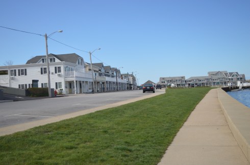
Size: 4.5  miles of continuous trails, 251 acres

Parking: there are three parking areas with roughly 20 spots each.  When I left at 1:00 p.m. the lot was full and there was a line of about half a dozen cars waiting to get into the park.

Time To Allot For Visit: 2 hours
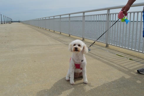
Dog Friendly: Yes

Trail Difficulty: Easy to Moderate

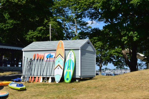
Highlights: scenic views of the Boston skyline and surrounding area, wildlife, occasionally they display exhibits at the park, benches to sit along the trail, pretty trees and flowers, perfect for walkers, joggers, runners, cyclists and even horseback riders and anowshoeing during the winter

Lowlights: limited parking (if you follow the reservation Twitter they post alerts when the lot is full)

Website: World’s End

World’s End Trail Map

DSC_0988

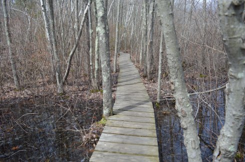
I “misunderestimated” World’s End.  I figured it would be an “easy” quick jaunt (I usually save my easier treks for Sundays).  So, I slipped on my Chuck Taylor All-Stars and figured I would be home in a few hours.  Not the best choice of footwear in retrospect.  The trails can be rocky (particularly if you go off trail) and deceivingly steep in some areas.

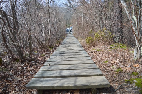
There are a lot of side trails and it’s easy to get confused and cover the same area twice (or more) which can add quite a bit of time to your journey.  In fact, for a while, I thought World’s End would never end. It’s a good idea to take a map of the trails with you.  But, the trails are clearly marked and easy to negotiate with some slight inclines.

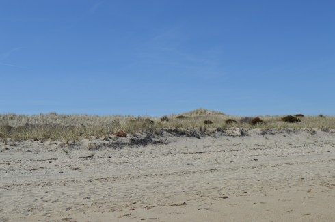
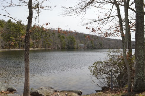
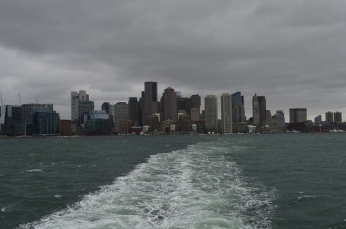
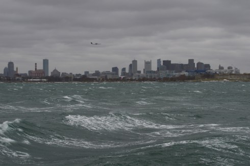
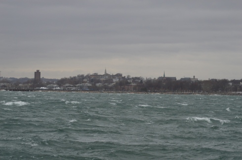
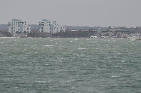
Undoubtedly, the main attraction for many visitors at World’s End are the views of the Boston skyline.  World’s End affords several views of the skyline and surrounding areas.  From the shoreline views to the views atop the highest point on the top of one of the many views of the rolling, hilly trails, the views are majestic.

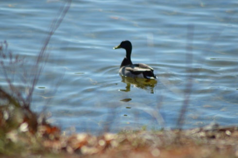
World’s End is teeming with wildlife, particularly birds.  They’re very good at camouflaging themselves so you might have to squint to see a few of them.

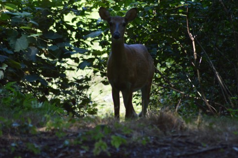
But, the real gem of my visit was this deer I spotted on my way to Rocky Neck, one of the more secluded areas.  We stood mere feet away from each other staring, until she finally took off.

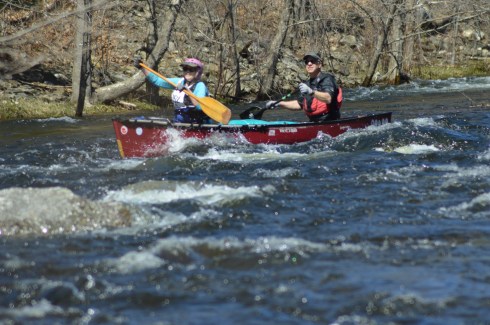
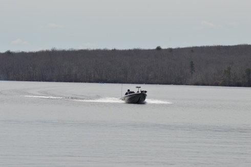
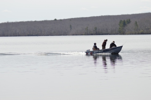
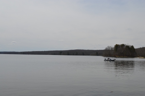
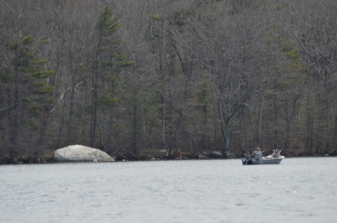
There are not just an abundant of bird life in the water.  Being a picture perfect summer day with low humidity and a slight breeze and calm waters, it was ideal for many of the boaters, paddlers and other seafaring folks.

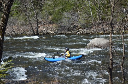
This boater wanted some privacy, apparently.

World’s End has many other charming features such as this huge rock and an elevated viewing area for bird watching.

Of course, sometimes the more simpler things can be the prettiest features of the park.  These flowers, tress and views off the water caught my eye.

Some people took advantage of the shore to skim some stones.

DSC_0508

DSC_0622


If there is one photo that sums up a trip to World’s End it is this photograph of a hammock with a bicycle next to it.  World’s End is the perfect place to lie out in a hammock with only the sounds of nature to keep you occupied and maybe a good book or your Itunes collection.

DSC_0999

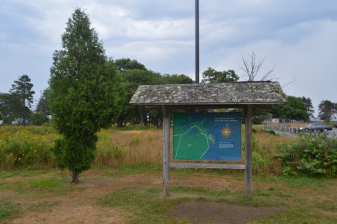
There is also an art exhibit on display until Oct. 31, 2017.  The display was created by Jeppe Hein, an artist based out of Copenhagen and Berlin.  He is known worldwide for his interactive exhibits.  The exhibit is called, “A New End”.  According to the website for the exhibit, Hein wants to invite visitors to reflect and to transform how we view a familiar place like World’s End.

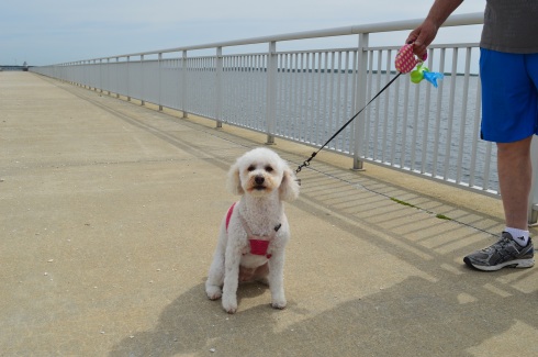
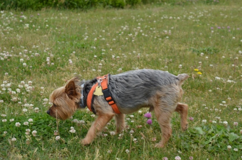
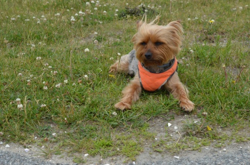
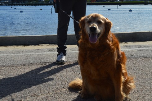
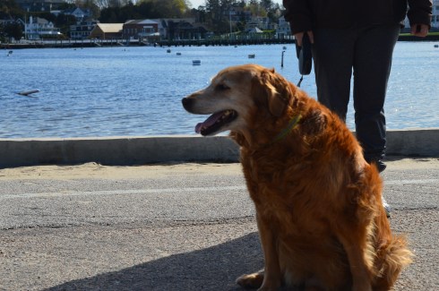
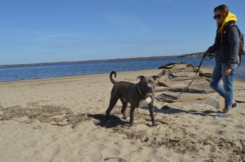
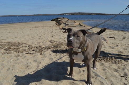
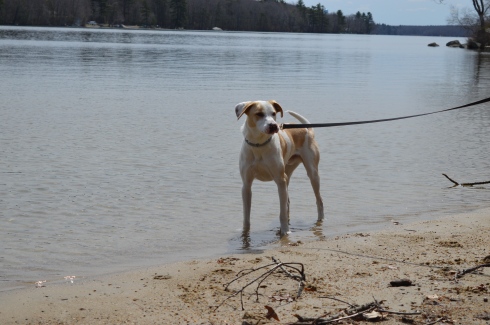
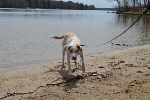
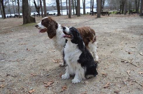
There were dogs-a-plenty at World’s End during my visit.  World’s End is a great place for dogs to play around in since there are many open, grassy areas and, of course, water to frolic around in.

DSC_0474DSC_0483DSC_0488DSC_0478

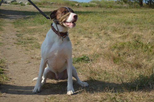
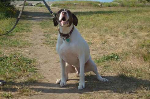
Casey is a happy, 8 year old English Pointer mix.  He is a rescue.

DSC_0949DSC_0950

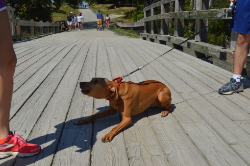
Gus is a 2 year old Ridgeback mix.  He was very excited to be at the park!

DSC_0651DSC_0650DSC_0643DSC_0647

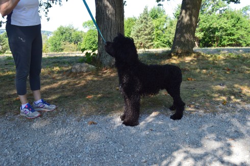
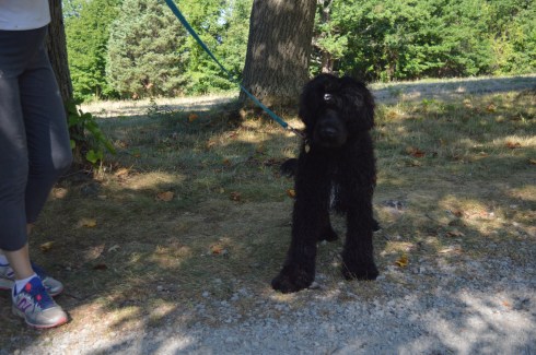
Tande is an 8 month old Portuguese Water Dog.  If Tande looks familiar, you may have seen a similarly looking dog on the news.  The President also has the same breed of dog. Tande came all the way from the Odysea Portuguese Water Dogs breeder in Colorado.

DSC_0701DSC_0702DSC_0706

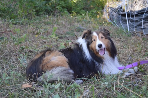
One of my easiest subjects to photograph ever, Bella is a gentle 7 year old Shetland Sheepdog.

I also saw a variety of other dogs playing in the water and running around.

viewsofanemergencyrn was kind enough to nominate me for the One Lovely Blog Award.  Thank you!  I usually don’t post about these awards but I figured I would play along since she was so nice to mention me and I wanted to acknowledge her.  She is a sweet, strong person and a survivor (read her post to see what I mean).

So, the rues are I have to mention 7 random things about me.

  1. I didn’t take up photography seriously until last year
  2. I  love dogs and all animals (big surprise there) but they also seem to love me – the key is to not show fear and be confident and friendly around them (they can sense fear)
  3. I am a pescatarian (I only eat seafood and do not eat meat, primarily)
  4. People often say I bear a strong resemblance to Donnie Wahlberg (but I can’t sing like him)
  5. Although I love dogs, I don’t have one (I have a cat instead)
  6. Until my work schedule got too busy, I had been an active literacy tutor at my local library
  7. I run (and/or walk) 3 miles (at least) a day everyday

The rules say to nominate other bloggers to participate.  But, I’m going to skip that part.  In my experience, people have usually already posted a blog like this in the past and don’t want to do it again, or they don’t participate or they seem to be too busy.  But, thank you, once again for the mention, viewsofanemergencyrn!  I do appreciate you and I look forward to reading more of your posts.  You all should also!

Similar Places I have Visited In New England:

111

Webb Memorial State Park (Weymouth, MA)

222

Blue Hills Reservation (Milton, MA)


Odiorne Point State Park (Rye, NH)

Date Visited: August 6, 2016

Location: 570 Ocean Blvd, Rye, NH 603-436-7406

Hours: Open everyday 8 a.m. to 8 p.m. (I got there well before 8 and the gates were already open).  Open but unstaffed after 10/11

Cost: $4 for adults $2 for children (ages 6-11), NH residents who are seniors (over 65) or younger than 6 get in free

Parking: There are about 50 parking spots in the main parking area.  There are additional parking lots along the beach

Time To Allot For Visit: 1 to 2 hours

Trails: Easy

Dog Friendly: No

Highlights: abundant wildlife (mostly birds), pretty flowers and trees, lighthouse (Whaleback Light), scenic views, play area for children, “sunken forest”, science center, historical site

Lowlights: Parking can be tough (especially during the summer), since it is considered a beach dogs are not allowed at the park

Odiorne Point State Park Trail Map

Odiorne Point State Park Website

DSC_0024

The location of the first English settlement in New Hampshire, Odiorne Point has a very storied past.

Named after the Odiorne family who settled there during the 1660’s, Odiorne Point is probably best known for being a military installation during World War 2.  Known as Fort Dearborn at the time, Odiorne Point was part of the military’s attempt to modernize the U.S. coast defenses.  Part of the military installation served as a radar station by the United States Air Force beginning in 1949, and in 1955 this became the Rye Air Force Station.  None of the Air Force’s installation remains there.  Looking at the historical remnants of the fort it is obvious how far we have come as a military power.  Real shells, a bunker entrance, a battery and other historical structures are scattered throughout the entrance to the park.

The park also has a science center located at the end of one of the main paths where people can learn about nature and the various wildlife that inhabit the park.

DSC_0020

The trails at the park were easy to negotiate.  However, if you do go off trail to get a closer view of the surroundings and wildlife you have to be careful and be mindful of the water level.  I will touch on this later in the post.

As you can see from the photos above, the plants and trees at Odiorne are beautiful even if they are directly next to a dumpster.

Only about an hour’s drive north of Boston, Odiorne Point has something for people of all ages to enjoy. There is a play area for children as well as picnic tables and benches for people to sit and eat while they take in all of the beautiful views.

This particular family had a hungry visitor eyeing them as they ate lunch.

DSC_0653

The birds are one of the main attractions of the park.  A wide variety of gulls, egrets and other birds frequent the park.

This slideshow requires JavaScript.

The views at Odiorne State Park are pretty all year round.  The lighthouse, Whaleback Light, provides a majestic backdrop for any photo.  The weather was very erratic when I made my visit.  It was rainy and raw when I first arrived at the park in the early morning hours.  After waiting out the rain, the clouds gave way to the sun.  Then, the wind picked up and drove the waves against the rocks.  Basically, I experienced just about all the weather New England has in one day.  In other words, it was a typical New England day.

Perhaps the biggest attraction of Odiorne Point State Park is the “sunken forest”.  If you arrive during low tide, you can see what used to be a forest or some other land.  What appears to be tree stumps, rocks and other land based structures appear on the floor of what will rapidly become the bottom of the body of water.

So, during low tide you can easily traverse these rocks (make sure to not try this with sandals on or barefoot) and get closer to the birds, ocean and other rocks.  One important thing to keep in mind is the tide comes in pretty quickly.  I made it out to the rocky area where the birds were all hanging out.  Then, suddenly, I realized just how much water had accumulated around me.  I quickly ran/sloshed through ankle deep water along the pebbles to make it back to land before it got too late.  If I waited half an hour longer I would have been swimming back to shore.  Below are some side side examples of just how quickly the water rises.  The time lapse is only about an hour.

Below are two videos of the waves and scenery at Odiorne Point.

Similar Places In New England I Have Visited:

dsc_05202

Colt State Park (Bristol, RI)

dsc_00902

Moswetuset Hummock (Quincy, MA)

dsc_08381

Hammonasset Beach State Park (Madison, CT)

Please Follow Me On:

Facebook

Instagram

Twitter


Salem Willows (Salem, MA)

DSC_0180

Date Visited: July 23, 2016

Location: 167 Fort Ave, Salem, MA

Hours: The website for Salem Willows shows their hours as being daily from 11 a.m. to 11 p.m. but you can get in to the park before 11.  We got their just before 10 and there was already some people there.  I think the hours are the hours of operation for the restaurants and other businesses in that area.

Cost: Free

Parking:  There are about 60 metered parking spots.  The meters cost 25 cents an hour.  There is also about 50 additional free parking spots in a nearby lot and off street parking is available.

Dog Friendly: Yes

Highlights: Family friendly, arcades, restaurants, willow trees, harbor, scenic walking path, grassy areas to grill, relax and for kids to play, jetty, place to rent surfboards and other aquatic sporting goods

As I entered Salem Willows I couldn’t help but think of my childhood of carnivals and traveling shows.  My friends and I would be so excited when the fair came to town.  Now, the fair is always in town.  In these days of sit down eateries and chain restaurants, it was refreshing.  If you d go, try the slushies or get a cone at Cappy’s!

Salem Willows has changed so much since its original opening in 1880.  Willows Pavilion which featured a skating rink and restaurant dominated the landscape.    Now, the area where the takeout food vendors are located still keeps the name of “on the line”.  But, the restaurants are much different.  In place of the sit down, grand restaurants stand take out vendors and ice cream shops.

There is also a stage for bands and other entertainers to perform.  Named after former  Salem resident and veteran, the Robert F Hayes Band Stand holds a summer concert series every year as well as holding other events.

DSC_0035

But, there is so much more to Salem Willows than nostalgic stroll past the smell of flour dough and the buzzing and ringing from the vendors and arcades.  Salem Willows is also, as the name would suggest, known for all of the willow trees planted to offer shade and beauty to the area.

The mostly shady loop around the bay and back too the parking area is an easy half mile walk.  Along the way there are benches to sit on and a jetty to fish off or just enjoy the views. The views from the bay were very pretty.  A variety of flowers and scenic views frame the busy blue waterway.

There was a lot of activity on and in the water at Salem Willows.  That is a man swimming in the last photos

There is also a place to rent surf/paddle/body boards and other watercraft and flotation devices.

DSC_0141

Salem’s love of art is evident even in the most unlikely places.  These trash cans and rocks displayed some of the street art of Salem.  I especially like the art on the rocks.  Each block has a different symbol of the area painted on them.

This slideshow requires JavaScript.

Salem Willows is a great place to bring your dog for a short walk.  Dixie, a 4 year old Maltese, was enjoying the seasonal weather and cool breeze when she stopped to pose for photos for me.

DSC_0244DSC_0236

DSC_0240

Video of “on the line” from Salem Willows


Fort Taber/Fort Rodman Park (New Bedford, MA)

Date Visited: June 11, 2016

Location: 1000 Rodney French Blvd, New Bedford, MA

Parking: There are about 70-100 spots or so in the park itself but plenty of off street parking as well.

Cost: Free

Hours: Dawn until dusk
Dog Friendly: It sure is!

Highlights: forts, lighthouse, jetty, beach, war memorials, walking trails, playground with slides and swings for children (or adults if you’re so inclined), military museum, war reenactments, pretty views

DSC_0696

The highlight of the park for most visitors has to be the jetty.  Fishing off the jetty, or anywhere else at the park is allowed.  But, they have a strict “catch and release” policy because most of the fish are contaminated with PCB (poly-chlorinated bipenyls).  So, they would not be safe to eat.  PCB’s are known cancer causing toxins.  The New Bedford Harbor is lined with these cancer-causing toxins that were released into the harbor between 1938 and 1973 by factories such as the electrical component manufacturer Aerovox.  The harbor is in the process of being cleaned.  But, it could take many more years before the job is complete.

Seashells and seaweed were scattered along the bridge, evidence of some recent stormy seas.

There are so many beautiful views and interesting things at Fort Taber Park.  The lighthouse in the photos is the

Since New Bedford has been known for its whaling and seafaring history, the park (and all of New Bedford) is also known for its lighthouses.  In the background of  the fort in the photo below you can see Clarks Point Lighthouse, first originally built in 1797 (it was replaced with a stone tower in 1804).

DSC_0819

The lighthouse below is the Butler Flats Lighthouse, originally built in 1898.

DSC_0699

There are several war memorials dedicated to the men and women of Fall River who have served their country, with a specific emphasis on those who were killed in action.

The memorial below is a Vietnam War Memorial that really stood out to me.  If you look closely at the board in the final photo, you can see photos of the service people from New Bedford who were killed in the war.   Everything about this memorial has meaning.  The 43 stars on the memorial represent all of the 43 people from New Bedford who died in Vietnam.  The outline of Vietnam is in orange as a reference to Agent Orange who died from Agent Orange.  Even the service ribbons on the memorial have meaning.  The blue ribbon represents the National Defense Ribbon which is representative of everyone who served in Vietnam.  The other two ribbons represent in country veterans.  The two plants at the memorial signify life.

This slideshow requires JavaScript.

There are also several memorials to all of the 20th century wars America has been in, although I did not notice any memorials for the Iraq and Afghanistan wars.  I am assuming this may be because those actions are still not officially over even if we have pulled out most of our military presence in those places.

A tribute does stand for Army Staff Sargent Joseph Camara of New Bedford, MA, who was killed in action on September 1, 2003 while serving during Operation Iraqi Freedom  when the humvee he was traveling in hit a land mine.  He was serving with the 115th Military Police Company as a member of the Rhode Island National Guard in the Iraq War.  He was 40 years old when he died.  He was also a member of the New Bedford Police Department.  His memorial is located at the bottom of the gallery below.

There is also a replica of a Sherman tank stands as a tribute to the LST amphibious force T-4 who lost their lives in training for the invasion on D-Day.  During the training exercises, sadly, many men lost their lives training for the invasion.

While I was visiting it was 17th century drill day.  Reenactors from the Dartmouth militia, in full 17th century garb, showed how weapons were used, described the different types of warfare of the day and answered any questions the public had.

The staff also allowed visitors inside Fort Taber.  The guide explained they stopped using this Civil War fort once the ballistics that were used became too effective against the barricades of the fort.

Grass and rust had overtaken what was once a formidable fortification.

One of the best parts of my visit – on the way to my car, I saw this man and woman playing their instruments.


One of the great things I noticed about the New Bedford area as I walked around taking photos and from the crowd at Fort Taber is the diversity of the cultures and people of the area.  The photographs above illustrate this.  The music sounded like it had an up tempo flamenco influence.  It sounded beautiful.  And I love their attire.

Fort Taber/Fort Rodman is a dog friendly park.  The park is a great place for dogs.  There are miles of trails for your dog to wander.

DSC_0787DSC_0786

Sadie is a miniature poodle.  She will be 5 in August!  Early happy birthday wishes, Sadie!

DSC_0906DSC_0918DSC_0911

I also met Yoda, a 10 year old Yorkie.

Below is a video of the inside of one of the forts at Fort Taber.   It’s kind of spooky!

This video is a video of the military reenactors firing their weapons.

Please connect with me on Facebook!

New England Nomad


Napatree Point Conservation Area (Westerly, RI)

DSC_0599

Date Visited: April 30, 2016

Location: Fort Rd, Westerly, RI

Parking: Parking was a breeze in the early morning hours in April.  I found off street parking with a 3 hour limit.  There were several parking spaces available.  This will change when the weather begins to warm up (at this rate, sometime  in mid-August).  One thing I found interesting and somewhat vexing is that according to signs, the parking lot next to Napatree is not supposed to be used for going to the beach.  I assume the parking is meant for shoppers and people patronizing the restaurants in the area.  For an area that has limited parking this seems highly unusual.  If you go in the summer, be aware parking will be very limited.

First, I’d like to thank everyone for reading and being so supportive as I post my 100th blog post.   One hundred posts in just under one year.   What better place to write about than Napatree!

A peninsula-like shaped area, Napatree is actually a sandy spit.  It has been shaped through a process called longshore drift which is basically a process by which sediments such as clay, silt, sand and shingle are transported along the coast creating its unique shape.

You wouldn’t know it by looking at it now but Napatree used to be densely wooded.  Trees lined the area until the Great September Gale of 1815 hit the area and the trees were destroyed.  In fact, the name Napatree comes from the term nap or nape of trees.

The views from the entrance of Napatree are beautiful.  In some of the photos, you can see a brown tint to the otherwise deep blue water.  In fact, the colors seemed to change depending on where and when I took the photos.  The tides, shallowness of the water and other factors can affect the way the water looks.  I had never noticed it as distinctly as I did at Napatree.  The waves and movement of the water may have played a part as well.  Despite how calm the water seems in these photos this was not the case everywhere at Napatree.

This slideshow requires JavaScript.

If you look close, you can see the Amtrak train in the distance that services the Westerly area in one of the photos.

The dunes and the sand were also very pretty.

DSC_0719

DSC_0878

DSC_0860

At first glance, Napatree seems like a long stretch of beach on only one side.  But, I kept hearing noises over the dune.  At first, I brushed it off as traffic or some other noise.  Eventually, curiosity got the better of me and I decided to climb one of the dunes and check it out.  What I found was pure paradise.

The calm waves and plain waterscape were replaced with crashing waves, foamy water, beautiful homes (the homes on both sides weren’t pretty shabby actually), the Watch Hill Lighthouse and marine activity.

This slideshow requires JavaScript.

When I arrived, the village was pretty desolate.  This was partly due to the early time of the morning that I arrived and partly because the vacation season hasn’t began yet.  Westerly did have a Cape Cod feel to it.  From the quaint shops, the folksy, slowed down pace, the beautiful beaches and the mansions that dot the landscape (blog to follow soon about one of those lighthouses), I couldn’t help but think back to my childhood vacations at the Cape.

DSC_0572

In due time, these empty streets will be bustling with activity.  But, for now, it is a tourist/photographer’s dream having the area to one self!

There were several dogs at Napatree during my visit.  Dogs are allowed on the beach but only until May 2nd.  So, you’ll have to wait until next year to take Fido!

DSC_0659

DSC_0657

Daisy is a beautiful Golden Retriever.  What a gorgeous smile.

DSC_0796DSC_0797

DSC_0822DSC_0819

Caesar is an aquatic pitbull

Below are videos of the different sides of Napatree.  The first video is of the more calm waters that I saw when I first arrived.  The second video is from the other side over the dunes to the more active side of Napatree.


Wiggly Bridge (York, ME)

Date Visited: April 23, 2016

Location: Lilac Lane, York, ME

Cost: Free

Hours: Open 24 hours a day, 365 days a year.

Parking: There are about a half dozen parking spots on the side of the road across from the bridge on Lilac Lane (a very busy road so be careful parking and crossing there).  There is also additional parking on side streets and farther along the road on Lilac Lane.


There are many bridges in New England.  But, only few have the name, reputation and appearance of a bridge that could collapse any moment.  The Wiggly Bridge is a mini-suspension bridge built in the 1930’s which crosses over a tidal flow from Barrel Mill Pond to the York River.  If you’re not careful, you may end up in the York River!

Ok, Wiggly Bridge really isn’t that dangerous.  But, it can give you the willies as you walk across it.  Even though it is safe to walk across, the bridge does wiggle and make noises as you traverse it. I made it across the bridge without much trouble and took some photos of the bridge as I made my way across.

The short walk across the bridge leads to Steedman Woods, a tiny peninsula with a mile long loop.  Dogs are allowed on the beach and on Steedman Woods.  The vieews from the island and bridge are stunning.

This slideshow requires JavaScript.

Wiggly Bridge is also within walking distance, or a short drive from York Harbor.  So, you can take in both of these cool attractions in one day.

Cooper is a 7 year old rescue dog and a resident of Maine.  He also likes the bridge.

The videos below shows how unstable the bridge seems when you’re walking on it.

Please connect with me on Facebook here


Westfield River Whitewater Races (Huntington, MA)

Date Of Event: April 16, 2016

Location: Knightville Dam, Huntington, MA

DSC_0373

Each year hundreds of kayak and canoe racers come to the Western Massachusetts to test their mettle against the rapids of the Westfield River.

The Westfield River, one of the longer rivers in Western Massachusetts, runs 78.1 miles and has a 497 square miles drainage area consisting of several tributaries.  It attracts enthusiasts, recreational competitors and people who just like to challenge themselves.  It also attracts an array of boating fans.

The Westfield River Whitewater Races, which have been held every year since 1953, are the oldest consecutively run canoe races in the US.  People come from all over New England and farther to participate in the races.  The races consist of novice and expert divisions.  The novices race lasts 8 miles and the experts race for 12 miles.  The participants race in two person canoes or one person kayaks. As if the rapids weren’t challenging enough, the race officials have the water behind the dam held for three days before the race to give more momentum to the current.

I never knew how popular kayaking, canoeing and boating was in Western Massachusetts.  It was hard enough to find a good place to pull over or park along the route of the race.   I was able to find a place on the side of the road to catch some of the novices who had already started.

Since the river wasn’t very active here, we drove to the Knightville Dam, the launch point for the race.  The area was very pretty and the river was more active here.  I even caught some enthusiasts who weren’t participating in the race.

DSC_0252DSC_0263DSC_0272DSC_0250


At the main parking area, one of the racers let me photograph his boat.

Still not happy with my location, I found a better spot along the side of the river past a precarious rocky decline.  Watching the racers expressions was fascinating.  Some were determined.  Others looked focused and even a bit bewildered.  Others just looked like they were having a grand time.  Then, there were others who didn’t seem to be having fun at all.

This slideshow requires JavaScript.

Not every racer made it to the end.

Eventually, they were able to wade across the river to the other side, no easy task given the strength of the rapids.

Monty, an 8 year old Siberian Husky, came along to watch the race.

Below is a video of a canoe racing tandem fighting the rapids.  You can hear the strength of the tide.  Rumor has it that it gets even rougher farther down the river.

Please stop by my Facebook page, say hi and like it: New England Nomad On Facebook


Lake Char­gogg­a­gogg­man­chaugg­a­gogg­chau­bun­a­gung­a­maugg (Webster, MA)

Date Visited: April 9, 2016

Location: Webster, MA

Parking:  Parking is available at the entrance, before the gate and there is a big parking lot where you can also launch your watercraft at the head of the beach.

Cost: There are a variety of different fees established for visitors to Lake Char­gogg­a­gogg­man­chaugg­a­gogg­chau­bun­a­gung­a­maugg.  For instance, if you walk in or ride your bicycle to the lake and you are 17 or younger it is free.  If you walk to the lake or ride your bike and you are 18 or older it is $1 to get in.  A resident (of Webster) motor vehicle costs $5 for entry.  A resident motor vehicle with a water craft is $25, etc.  See the link below for all of the fees and regulations.

Lake Webster Rules and Fees

DSC_0086

Lake Char­gogg­a­gogg­man­chaugg­a­gogg­chau­bun­a­gung­a­maugg.  Try saying that 5 times fast.  I dare you!

Originally named Lake Chaubunagungamaugg or “Fishing Place at the Boundary”, Lake Char­gogg­a­gogg­man­chaugg­a­gogg­chau­bun­a­gung­a­maugg (meaning, “Englishmen at Manchaug at the Fishing Place at the Boundary”) is actually broken into two parts; a lake (Lake Char­gogg­a­gogg­man­chaugg­a­gogg­chau­bun­a­gung­a­maugg) and beach (Memorial Beach).

For the purposes of this post, I will call Lake Char­gogg­a­gogg­man­chaugg­a­gogg­chau­bun­a­gung­a­maugg Lake Webster as it is now more commonly called.

At the main entrance ofWebster Lake, there is a memorial to our veterans.  It is a fitting tribute for those who have gave so much.

Upon arriving at Webster Lake, you will see the lake.

Memorial Beach is dedicated to the veterans of all of our wars.

As beautiful as the lake is, I found the beach, located just beyond the lake to be even more beautiful.  To me, it’s basically one large body of water and I am not sure why they have separate names.

This slideshow requires JavaScript.

Webster Lake and Memorial Beach are a boaters/kayakers/fisher person’s dream.

Lake Webster also has a variety of bird life.

DSC_0455DSC_0450DSC_0336DSC_0354DSC_0360DSC_0208DSC_0194DSC_0223

Dogs are not allowed at the lake or beach.

There is also a basketball court and play area.

The beauty of the beach and the sound of the water could only be captured in a video

Please check out my Facebook Page and like my page by clicking on the link below!

New England Nomad


Douglas State Forest (Douglas, MA)

Date Visited: April 9, 2016

Cost:  Since I visited during the off season, it was free.  The web site states it costs $9 for MA vehicles and $11 for out of state vehicles.  Prices may vary if you bring your boat.

Location: 107 Wallum Lake Rd. Douglas, MA

Parking:  Parking is limited at the main entrance.  It probably fills up quickly during the summer weekends.  There is also additional parking for boaters farther down the road to the entrance.  There is also additional areas to park near the forest.

Douglas State Forest

DSC_0544

I wasn’t sure what to expect when I arrived at Douglas State Forest.  It just happened to be in the area of another attraction I was visiting.  But, I’m a firm believer in spontaneity, no I really am, so I decided to give it a whirl.  I’m glad I did.

Douglas State Forest has a few different entrances besides the main entrance at Wallum Lake Drive.  I passed some of them on the way to the main entrance.  It may be a good option to try these entrances (off Webster and Wallis Streets respectively).  After viewing the map for Douglas State Forest, I have determined I only walked a fraction of the  5,525 acres of the park.

There are many hidden trails and long trails in the park. In fact,  the Midstate Trail, a 95 mile hiking trail that extends through central Massachusetts to Mt. Watatic in the north, runs through the forest.  I saw a group of walkers/hikers at one of the other entrances during my drive.  I suspect they may have been gearing up to hike a section of this trail.  There is also some rare Atlantic White Cedar swampland at Douglas State Forest.  Boards are laid down to allow walking over these areas.

DSC_0538DSC_0614DSC_0615

After arriving at Douglas State Forest, I walked the easy, half mile or so trail trail to Wallum Lake (the trail continues on much farther but I only walked to the boat launch and fishing area).  A sure sign that spring is begrudgingly, well, springing was abundant.  The trails are mainly like the one pictured below.  I would describe the trails I took as being easy to moderate but the trail may get harder the farther you walk.

There were several people fishing and an assortment of boats in the lake.  Boaters always seem to want to show off and speed around when they see someone with a camera!

DSC_0518DSC_0514DSC_0516DSC_0524DSC_0593

Douglas Forest is a year-round attraction.  Swimming, fishing and boating are allowed in the lake.  In the winter snow shoeing and snowmobiling are popular activities at the forest.  Horses and dogs are also allowed at the forest.

The views from the lake were beautiful.

This slideshow requires JavaScript.

What started as a gloomy, chilly, overcast day, typical of a true New England spring day, turned into a sunny, warm day.  It was the perfect day to take your pooch out for a walk and they were in abundance at Douglas Forest.

DSC_0568DSC_0565

Lloyd is a 3 year old husky and lab mix.  He was adopted by his pet parent from a shelter and he loves to play in the water.

DSC_0639

Delilah is a 5 year old Staffy (Staffordshire Bull Terrier).  She was rescued one day before she was slated to be put down.  She is also from England and loves to play with sticks.  Welcome to America, Delilah!

DSC_0642

Dixie and Monty, Irish Spring Setters, posed perfectly for their dad.

Central Massachusetts (where Douglas is located) had always been a place to drive through to get to Western Massachusetts and its plethora of mountains, forests and waterfalls.  But, I have been spending a lot of time in Central Massachusetts. After my last few visits I have fallen in love with the area.  I will have many more posts coming from my travels in the Central Massachusetts area.  Stay tuned and thank you for reading!

Please check out my Facebook Page and “like” it for additional photos, posts and videos.  Thank you!

New England Nomad on Facebook


Winter Wildlife Cruise (Boston Harbor, MA)

Date visited: January 23, 20016

Price: $20 for adults, $10 for children (ages 3-11) and seniors (over 65)

This was a special cruise and is not something they do regularly in the winter.  During the spring, summer and fall they have cruises scheduled regularly.

Twenty degree weather and an impending winter storm; what better conditions for a harbor cruise.  Ironically, that statement could not be more accurate.

We were greeted by gulls and rough seas when we arrived at the wharf.

DSC_0084

As we made our way on to the boat for and they announced the cruise would be a three hour tour (in retrospect, that Gilligan’s Island reference should have been a bad omen), I was surprised by how roomy, comfortable and modern it was.  The three story boat had booths on the sides of the cabin area and ample seating.

Even before we left the wharf I took some shots of the bay.  You can see Logan Airport in the distance in some of the photos.

This slideshow requires JavaScript.

As the boat left the bay, I took some obligatory photos of the skyline.

DSC_0197DSC_0189DSC_0231DSC_0227DSC_0249

I had to bundle up (and hold on tight to the railing) for the shoot.  I was surprised at how well I handled the overly active ocean.  I’ve never been particularly fond of roller coasters, wavy oceans or anything that moves to and fro quickly.  But, I did fine.  The only time I felt a tinge of sickness was when a fellow traveler described his own feelings of sea sickness (gee, thanks random stranger).  But, that quickly passed.

DSC_0277

There was a variety of sea life, although the choppy waters made it difficult to photograph all of them.  DCR (Department of Conservation and Recreation) officials were on the boat with binoculars on the lookout for wildlife and other points of interest and announcements were made whenever a bird or other animal was sighted.

I did photograph this Eider as he swam with friends.

DSC_0328

and a few other elusive birds.

This slideshow requires JavaScript.

Even though it was a cruise for wildlife viewing some of the best views were of the harbor and the islands.

This is Spectacle Island.  Spectacle Island was made entirely from the dirt from the huge construction project known as the “Big Dig”.   it is much prettier during the summer.

These are some photos of Boston Light.  Boston Light is the first Lighthouse in America.  It is still working today.

This slideshow requires JavaScript.

The Deer Island Waste Water Treatment Plant began operations in 1995.  It is clearly the jewel of Boston Harbor.  Prior to the construction of the sewage plant, sewage from Boston’s treatment facilities had contaminated shellfish after the sewage had been released.  Lunch, anyone?

DSC_0466

These structures are what is left of the bridge to Long Island (not the one in NY – we didn’t go out that far).  It was dismantled recently.  Personally, I think they should keep them.  They make for a good background for photography.

Below is a slideshow of some of the other shots from my cruise.  It was very windy and the sea was pretty choppy.  I tried to capture this in the photos.

This slideshow requires JavaScript.

Finally, I found a cute furry animal named Bailey to photograph when I disembarked from the boat.

DSC_0630

See below for videos of the cruise to get a better idea of just how windy it was.

Winter Wildlife Cruise – Long Wharf

Winter Wildlife Cruise

Winter Wildlife Cruise II