Cost: Since I visited during the off season, it was free. The web site states it costs $9 for MA vehicles and $11 for out of state vehicles. Prices may vary if you bring your boat.
Location: 107 Wallum Lake Rd. Douglas, MA
Parking: Parking is limited at the main entrance. It probably fills up quickly during the summer weekends. There is also additional parking for boaters farther down the road to the entrance. There is also additional areas to park near the forest.
I wasn’t sure what to expect when I arrived at Douglas State Forest. It just happened to be in the area of another attraction I was visiting. But, I’m a firm believer in spontaneity, no I really am, so I decided to give it a whirl. I’m glad I did.
Douglas State Forest has a few different entrances besides the main entrance at Wallum Lake Drive. I passed some of them on the way to the main entrance. It may be a good option to try these entrances (off Webster and Wallis Streets respectively). After viewing the map for Douglas State Forest, I have determined I only walked a fraction of the 5,525 acres of the park.
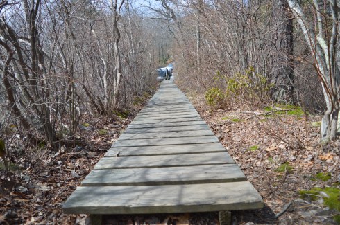
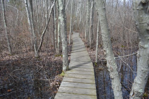
There are many hidden trails and long trails in the park. In fact, the Midstate Trail, a 95 mile hiking trail that extends through central Massachusetts to Mt. Watatic in the north, runs through the forest. I saw a group of walkers/hikers at one of the other entrances during my drive. I suspect they may have been gearing up to hike a section of this trail. There is also some rare Atlantic White Cedar swampland at Douglas State Forest. Boards are laid down to allow walking over these areas.
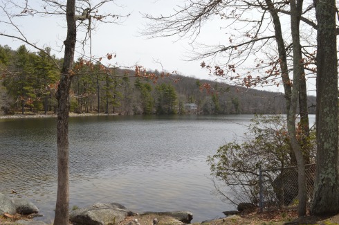
After arriving at Douglas State Forest, I walked the easy, half mile or so trail trail to Wallum Lake (the trail continues on much farther but I only walked to the boat launch and fishing area). A sure sign that spring is begrudgingly, well, springing was abundant. The trails are mainly like the one pictured below. I would describe the trails I took as being easy to moderate but the trail may get harder the farther you walk.
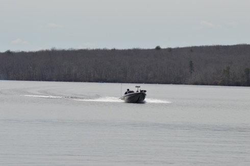
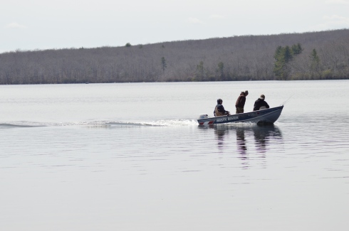
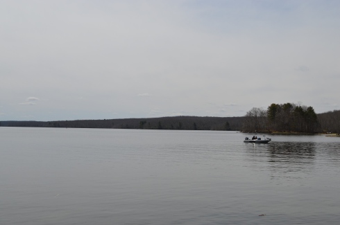
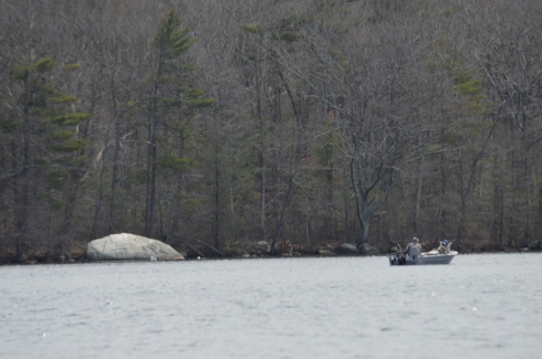
There were several people fishing and an assortment of boats in the lake. Boaters always seem to want to show off and speed around when they see someone with a camera!
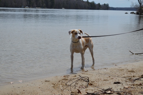
Douglas Forest is a year-round attraction. Swimming, fishing and boating are allowed in the lake. In the winter snow shoeing and snowmobiling are popular activities at the forest. Horses and dogs are also allowed at the forest.
The views from the lake were beautiful.
This slideshow requires JavaScript.
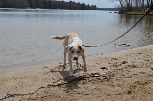
What started as a gloomy, chilly, overcast day, typical of a true New England spring day, turned into a sunny, warm day. It was the perfect day to take your pooch out for a walk and they were in abundance at Douglas Forest.
Lloyd is a 3 year old husky and lab mix. He was adopted by his pet parent from a shelter and he loves to play in the water.
Delilah is a 5 year old Staffy (Staffordshire Bull Terrier). She was rescued one day before she was slated to be put down. She is also from England and loves to play with sticks. Welcome to America, Delilah!
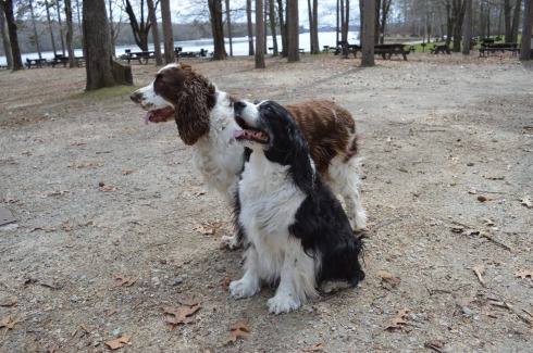
Dixie and Monty, Irish Spring Setters, posed perfectly for their dad.
Central Massachusetts (where Douglas is located) had always been a place to drive through to get to Western Massachusetts and its plethora of mountains, forests and waterfalls. But, I have been spending a lot of time in Central Massachusetts. After my last few visits I have fallen in love with the area. I will have many more posts coming from my travels in the Central Massachusetts area. Stay tuned and thank you for reading!
Please check out my Facebook Page and “like” it for additional photos, posts and videos. Thank you!
In 1900, Stephen Salisbury II built a tower on what is now known as Salisbury Park as a tribute to his friend, historian and jack of all trades, George Bancroft. And to think, my friends only usually give me gift cards, wine and books for my birthday.
The park is has a wide variety of bird life.
As I was reviewing the photos, I couldn’t help feeling the tower was purposefully constructed to look as though it was incomplete. The sides are not rounded and seem almost as though they were cut off from the facade or the builder gave up half way through. But, as the photos show it was indeed constructed this way by design.
This slideshow requires JavaScript.
My favorite view from the tower was at the arched entrance.
The 56 foot tower is made of natural stone and granite. It was designed by Stephen C. Earle and Clellann W. Fisher.
The plaque at the memorial states:
BANCROFT TOWER
THIS TOWER WAS BUILT IN 1900
TO HONOR THE MEMORY OF
GEORGE BANCROFT
1800-1891
BORN AT THE FOOT OF THIS HILL
HE ROSE TO THE POSTS OF
SECRETARY OF THE NAVY
FOUNDER OF THE U.S. NAVAL ACADEMY
ANNAPOLIS, MARYLAND
U.S. MINISTER TO GREAT BRITAIN
AND GERMANY
THIS MEMORIAL WAS BUILT BY HIS
FRIEND AND ADMIRER
STEPHEN SALISBURY III
Jacks wasn’t impressed by the tower.
There were some views of the city from the parking lot.
During my visit and in my research after the shoot, I found out they let visitors inside the tower during October of each year. The views at the top are said to give 360 degree views of the area. The sorority and fraternity at the local college also holds a Halloween party for the kids in the area at the tower with mild scares. So, it looks like a visit in October is on my list!
A walking tour of the Bancroft Tower:
Please stop by my Facebook page and like my page for extra photos, videos and other fun stuff!
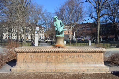
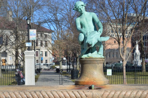
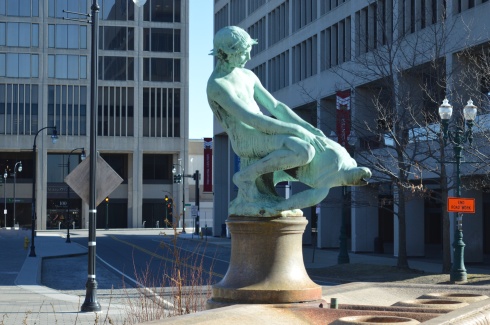
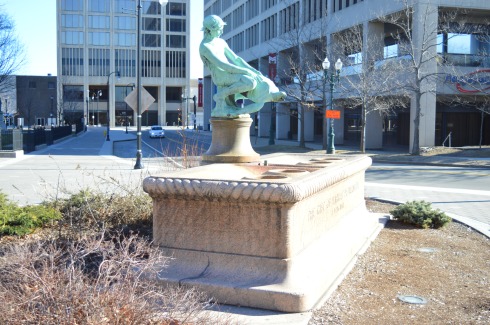
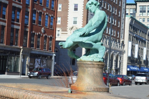
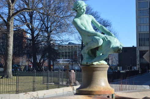
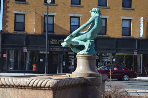
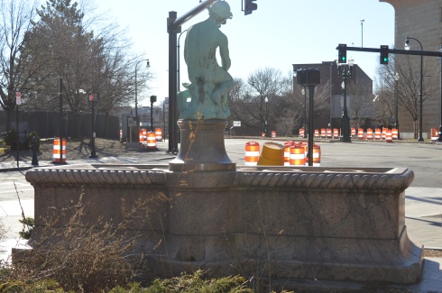
Just outside of Worcester Common, at 455 Main St, sits an unusual monument. Also known as “Turtle Boy”, the Burnside Fountain looks like a cross between a Roman sculpture and a high school prank gone wrong. But, this statue is no prank. It is a very real monument. In fact, it is a gift from Harriet Burnside, a philanthropist and the daughter of a prominent lawyer in Worcester; Samuel Burnside. In her will, Harriet donated $5,000 to the city to build a fountain in memory of her father. Harriet Burnside specifically requested the fountain be used as a drinking trough for horses and dogs.
Enter Charles Y. Harvey. Harvey was given the task of designing the fountain. For some reason that is still unknown, he chose a design called “boy with turtle”. Henry Bacon, who also worked on the Lincoln Memorial, designed the basin.
In an interesting turn of events, Harvey would take his own life, claiming before doing so that the half finished sculpture was telling him to do so. Sherry Frye finished the sculpture. The statue was completed in 1912.
The bronze statue sits on a pink rectangular basin. The basin has four bowls, two on each side of the statue.
Despite the various interpretations, the statue is not meant to be as controversial. It was just meant to be a statue about a boy and his turtle. It was a simpler time.
Driving home from Balance Rock State Park, I happened upon Lake Onota This is what is so great about New England, and really any area of the country. You can find the most beautiful places at the most unexpected moments.
A popular fishing spot, Lake Onota is a 617 acre pond located in Pittsfield, Massachusetts. It flows into the Housatonic River which eventually drains into Long Island Sound. Fishermen and women and boaters flock to Lake Onota for the bass, trout, walleye and crappie (yes they even fish for crappie fish).
A roadway bisects the lake. Of course, typical of New England weather, while it was very cloudy on one side, the other side had nary a cloud.
This slideshow requires JavaScript.
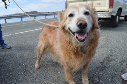
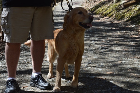
Dogs like Lake Onota as well. I met Becca, a happy 9 year old golden retriever,there.
Location: Balance Rock, Rd, Pittsfield, MA (about 2.5 hours west of Boston, MA or 1 hour east of Albany, NY)
Hours: Sunrise until 6 p.m.
Parking: There is parking for about up to 50 cars or so at the Balance Rock entrance.
During the last ice age, some 12,000 to 100,000 years ago, rocks were haphazardly pushed to and fro, creating this unusual formation. Or, someone put one rock on top of another. Either the product of glacial movement or an elaborate hoax, the namesake of Balance Rock State Park is a huge attraction.
But, before you view the impressive rock, there are rocks and beauty aplenty at the entrance to Balance Rock Park.
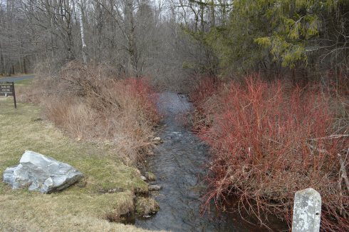
By the entrance, there is a stream that runs along the side of the park
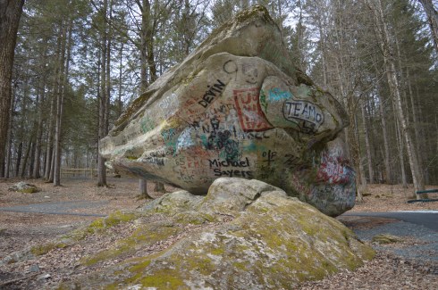
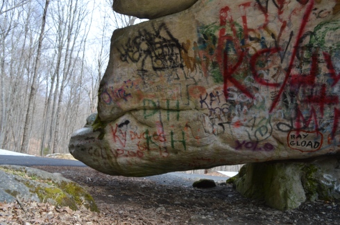
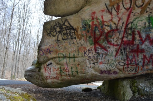
After a short drive up the main entrance road (about half a mile), you will reach Balance State Park’s main attraction; the rock. We were a bit disappointed to find the rock right there next to the parking lot. While it is convenient and easy for visitors to find, it would have been nice to have to hike to it. It would have built up the anticipation. Despite the journey being anticlimactic, the rock was impressive. As you can tell from the photos and attached video, the rock never touches the ground. Unfortunately, it has been vandalized which was very disappointing to see.
The rock is 30 feet long and 15 feet wide. It is resting on another much smaller rock. This, the story goes, is the product of the last glacial age. It also goes to show that no matter how big and seemingly powerful someone or something may be, the rock and we wouldn’t be the same without the help of a little friend.
I noticed how some of the rocks seem to have eyes and lips. I am not sure if this was due to nature, erosion or the work of mankind.
It turns out, there are many rocks in the area
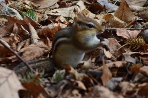
The residents of Balance Rock State Park are very photogenic. He was shy at first. But, eventually, he came out and I was able to get some close ups of him.
Video of the stream at the entrance to Balance Rock State Park
Location: Rotary Common Park , 315 Main Street , Nashua, NH
Hours: Open every day, 24 hours day
Parking: Parking is limited. There are about half a dozen spots in the lot for the memorial. There is ample parking across the street at the strip mall.
Dedicated on June 1, 2014, the New Hampshire Holocaust Memorial is a thought provoking exhibit located off busy Main St in Nashua, New Hampshire, next to the Rotary Common Park.
Designed by John Weidman, the memorial is a somber reminder to never forget. The memorial does not have any religious symbols nor does it represent one particular race, nation or religion. This was done purposefully. The intent is for everyone of any background to be able to empathize with the victims, regardless of your own beliefs or lack thereof. According to the website for the memorial, the design was inspired “by the belief that to empathize with those who endured the horrors of the Holocaust, one must – on some small level – experience a concentration camp itself.” The memorial accomplishes this.
The railroad track used for the memorial is an actual railroad track that was donated by PanAm Railway.
There are several benches and monuments scattered around the area with quotes, phrases and names of those who sacrificed so that others may live as well as reminders of the war on children and homosexuals. You may notice the rocks on top of some of the memorials.
It was early in the morning and there were a lot of shadows as it was a cloudless, sunny day. I did my best to avoid casting shadows.
This slideshow requires JavaScript.
The main part of the memorial are the six engraved granite walls that encircle a brick column with a black granite cube. Each of the walls has a name for the six concentration camps (Auschwitz, Sobibor, Treblinka, Majdanek, Belzec and Chelmno). Each of the granite walls have barbed wire and steel on them.
The black granite cube is meant to show that we are all connected through space and time while making us pause and reflect.
This is an important memorial and reminder, especially during these difficult times.
Parking: There are several parking lots at the Greater Worcester Land Trust which the Cascading Waters is part of. The closest lot to the Cascading Waters is small with only room for about half a dozen cars. You can also drive up to Cascading Waters via Cataract St and park on the dirt road there.
One of the great things about Worcester (pronounced “Woo-stah”) is its diversity of people and places. One moment you could be in the heart of the city and only ten minutes later you could be at a grand waterfall. It remind me a lot of Boston in this regard.
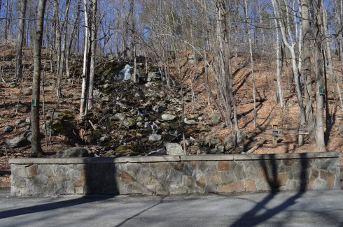
I found myself at one of the natural wonders of Worcester, Cascading Falls, Saturday.
Located about an hour west of Boston, Cascading Falls is known for its beauty and trails. There are both hiking and biking trails at the main parking area. I chose the most direct hiking route to the falls. The trail is pretty flat and straight with some pretty views. I also noticed some greenery sprouting on the eve of the first day of Spring. it’s about half a mile to the Cascading Waters from the parking area.
There is a trail to the right of the falls with a fairly steep incline. The trail leads to the top of the falls. You can go to the top of the waters. The views are pretty sweet.
This slideshow requires JavaScript.
There are also interesting rocks, pools of water and streams at the top of Cascading Waters.
This slideshow requires JavaScript.
Although the sun was out and the temperatures did increase, it was still relatively cold as this branch shows.
The waterfall leads to a stream just under and behind the trail.
Cascading Waters is a great place to take your dog for a walk. I met two golden retrievers; Wilson (on the left ) and Tucker, while I was there.
Below are two videos of Cascading Waters from the trail view and view from the top of the falls.
Location: Beech St, Manchester, New Hampshire (with access points on Union, St, Amherst St and Hanover St)
Cost: Free to the public
Although a statue that is dedicated to the veterans of the Spanish American War, the Boxer Rebellion and the Phillipine-American War, Bronstein Park celebrates a hero from another war.
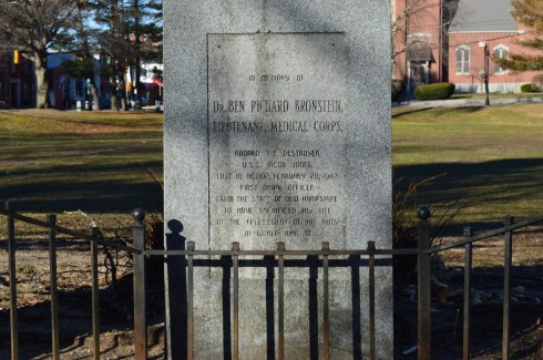
Although “The Hiker” stands prominently at the street entrance to the park, Bronstein Park (formerly known as Hanover Square) is actually named after a corpsman who died in World War II; Dr. Ben Richard Bronstein, the first Manchester, New Hampshire, resident to die during the war. Dr Bronstein’s brother, Maurice Bronstein, donated the memorial to the park in 1990.
The inscription on the memorial is hard to read in some parts. It states:
“in memory of Dr. BEN RICHARD BRONSTEIN, LIEUTENANT, MEDICAL CORPS, aboard the destroyer U.S.S. Jacob Jones Lost in Action, February 28, 1942 First Naval Officer From the State of New Hampshire To have Sacrificed his life in the fulfillment of his duty in World War II.”
Another memorial pays tribute to Dr. Bronstein’s brother, Stephen Max Bronstein, who also served during the war.
“The Hiker” was originally sculpted by Theo Alice Ruggles Kitson in 1906. The original statue was made for the University of Minnesota. However, 50 copies were made of her statue and were distributed all over America. Manchester, New Hampshire was the recipient of one of the copies of her statue. The statue is made of bronze on a base of granite, of course.
The name “hiker” was a moniker the American soldiers in the Spanish American War and Philippine-American War gave themselves because of the long hikes they took in the jungle. Kitson said the hiker, “depicts a hero stripped of his parade uniform and shown as a soldier reacting to the challenges of the battlefield.”
Leonard Sefing, Jr., a Spanish-American War veteran, was the model for the statue.
A close inspection of the statue shows a weary soldier clad in civilian type apparel.
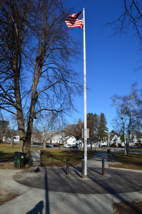
An American flag stands in front of the memorial for Dr. Ben Bronstein.
One strange thing I noticed is a warning posted that prohibits people from hanging out at the park during school hours. So that is something to bear in mind if you do visit. I’m not sure why this restriction is in place. I can only imagine you would be the talk of the town in prison if you ever got convicted of it “Don’t mess with that guy. He’s in here for loitering.” (I know it’s probably just a fine)
Below are some additional photos of the park from different angles.
Arms Park is a unique kind of park. In fact it’s not really a park at all. A stream, fed by the Amoskeag Fishways, runs parallel to the park. It is the perfect place for people who love the sound of water and watching waves (and based on my previous posts I know you’re out there). There’s not much to Arms Park. A parking lot takes up most of the area (which has led some to call it “Arms Parking”) and a few office buildings dot the landscape. It’s certainly not one of the most picturesque landscapes but the stream and walkway does have a certain charm. It is often used for observing important important days such as the annual Pearl Harbor Day observance event and the Fourth of July fireworks display.
The river is usually pretty rough and could consequently be dangerous if anyone got caught up it in.
This slideshow requires JavaScript.
It was still fairly cold when I went to visit, so the water which did splash on the railing quickly turned to ice.
A variety of birds like to seek refuge at Arms Park. I saw a bunch of gulls there during my visit.
Arms Park has a short walkway along the river with benches along the way.
The video below gives a better representation of the choppy water at Arms Park.
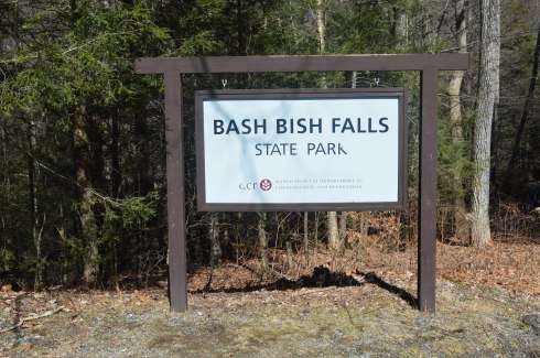
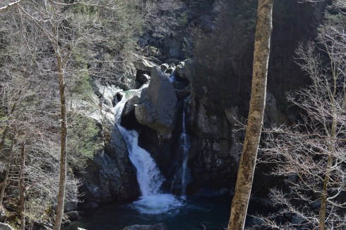
Located in the most southwestern part of Massachusetts, Bash Bish Falls is considered one of the most dangerous waterfalls in not only Massachusetts but the entire United States. It is also one of the most beautiful.
According to legend, Bash Bish was the name of a Mohican Native American woman who was accused of adultery which was punishable by death.. Bash Bish was pushed over the falls while tied up in a canoe.
The shape of the falls is said to resemble a woman falling to her death. Another theory claims the segmented characteristic of the falls resembled the reuniting of Bash Bish and her daughter White Swan who had also disappeared over the falls according to the Mohican legend. If the rapids of the stream leading from the waterfall and the speed of the water falling from the waterfall are any indication, the restless spirits may still be there. It is also a good reason why swimming is not allowed as the rapids can be very strong and it is easy to hit a rock.
This slideshow requires JavaScript.
Bash Bish Falls is located in Massachusetts, just past New York/Massachusetts border.
There are several entrances for Bash Bish. One of the entrances, at the top of the hill from the Massachusetts entrance on Falls Rd, gives ample evidence as to why Bash Bish may be considered such a dangerous waterfall. The stairs, which are a generous description, and walkway, also a generous description, are rocky and treacherous. There is a railing to hold on to. But, it’s still a tricky path.
I would recommend using the first parking spot on Falls Rd, if you’re traveling from Massachusetts. The trails are easy to moderate with a few slight inclines from the first parking lot. It is a 3/4 mile walk to the waterfall from the parking area.
There are many interesting rock formations along the trail. Little known factoid: I learned a new word recently for the strange piles of rocks stacked creatively that we often see along trails and at beaches like the rocks in the first two photos in the top row of photos below. They are called cairns, unless you ask a conservationist or geologist in which case they will condescendingly call them just rock piles since real cairns are nature made and not man made.
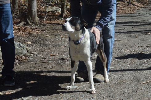
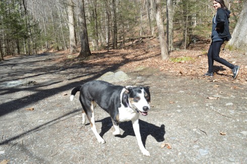
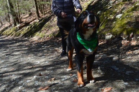
Bash Bish Falls is a popular spot for dog walkers. I met the following dogs during my hike.
Charlie
Juno, a Rottweiler and Shepherd mix
Cassie, a Bernese Mountain Dog.
Murphy, a beautiful Golden retriever
To get a better perspective of the waterfall and the stream leading from the waterfall, I have attached the following videos.