Parking: There are about half a dozen parking spots next to the tower and they fill up quickly.(and they were all filled at 8 o’clock on a Friday morning). There is also parking at the gate of the entrance on Mountain Road for about another half a dozen vehicles. The walk to the tower from the main entrance is about a mile.
Cost: Free
Hours: Open 365 days a year from sunrise to sunset
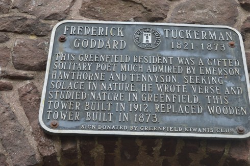
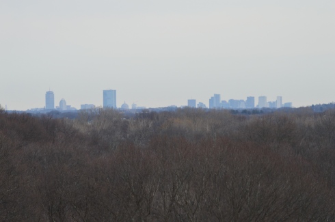
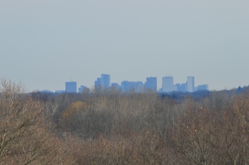
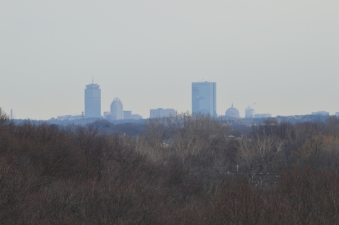
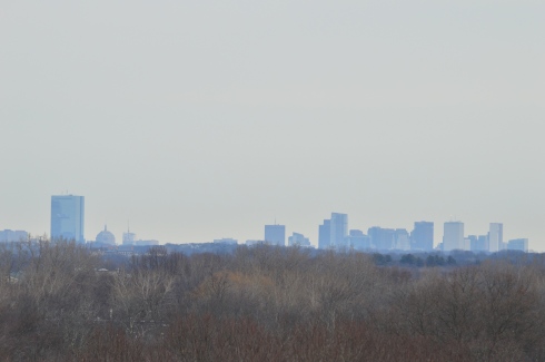
Perhaps it’s the unobstructed, sweeping views of the landscapes or maybe it’s the solitude of being in such an isolated tall structure. Whatever the reason, poets seemed to flock to this observation tower. It has since been known as the “poets seat tower” because of the long tradition of poets that have been attracted to the location. Frederick Goddard Tuckerman, a local poet at the time, is credited with bestowing this name on the structure in 1850. The tower, which was built in 1912, now attracts people of all walks of life, not just poets. Prior to the construction of the sandstone tower, a wooden observation tower had been built on the edge of the lookout in 1879. A plaque at the tower acknowledges Tuckerman’s role in the history of the tower.
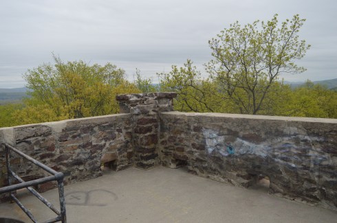
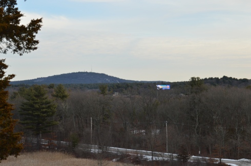
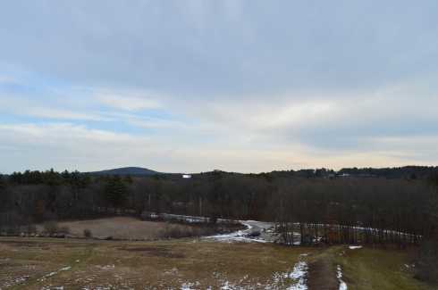
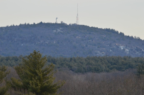
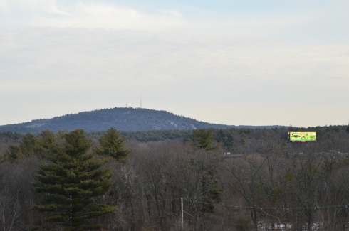
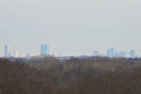
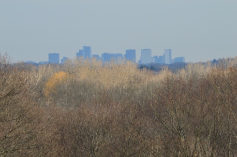
Even before you reach the top of the tower, if you dare, there are some impressive views of the Greenfield (MA), Connecticut, Deerfield (MA) and Green River valleys. The ledge of the road where the tower is bult has a rocky ledge from where you can get some views of the Greenfield area below. It’s a long way down!
The highest point of Greenfield, the tower is 4 floors (counting the ground floor and top floor). The views from each floor are pretty stunning. After all the rain in the area, the greens were very vivid.
This slideshow requires JavaScript.
As I stood looking over the land below I couldn’t help but think of how the landscape has changed over the years. Many years ago people looked over farmlands and valleys. Now, we look over schools, houses, parks and businesses. I also thought about all of the people who came here to rid their mind and soul of their worries by taking in the beautiful views. It really can make you take a step back (and hopefully not forward) when you’re up so high and appreciating the nature around us.
The journey to the top is not difficult. A trip up one stairwell and one spiral staircase take you to the top.
The arches and architecture of the tower rival the beauty of the views from the top of the tower.
This slideshow requires JavaScript.
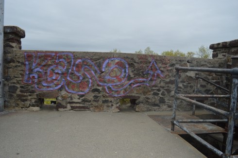
And what would a historic structure be without graffiti? As seems to be customary, particularly in Western Mass, there was graffiti on the walls of the sandstone structure. It did seem fitting that poetry lined the walls of “Poet’s Seat Tower”
“Jump off the cliff and build your wings on the way down”
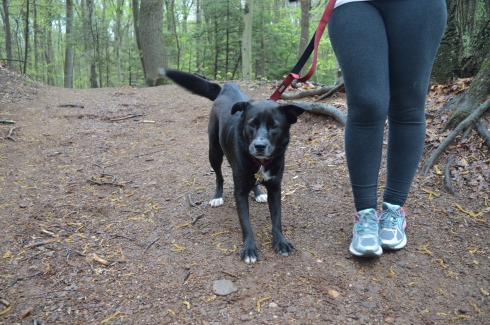
The are also benches along the road to the tower which offer views of the area. There are also hiking trails that branch off from the road to the tower. The trails look easy to moderate but I could not walk on them because of time constraints. I did hear a lot of presumably animal activity in the woods.
Below is a video of the view from the top of Poet’s Seat Tower
Parking: There is not a designated parking lot for Wilcox Park. But, you should be able to find off street parking.
Wilcox Park is not your average park. In fact, it is unique in many different ways. One thing that makes Wilcox Park unique is that it is not part of the DCR or any other city or governmental body. Wilcox Park is privately operated by the Westerly Public Library’s Board of Trustees. The library, located on the grounds of the park, and a group of volunteers help keep the grounds clean and orderly. They rely on donations and fundraisers.
Westerly Library is attached to the park at the entrance. The library’s beautiful architecture of the building is both artful yet modest. It complements the beauty of the park and seems right in place. There are also benches for visitors to unwind and perhaps read a book from the library’s collection.
There are also a number of statues in the grounds of the library.
As you entered the park, one of the first statues you will see is the statue of Christopher Columbus sculpted by Ciriaco (or “Charles” as he was commonly known as) Pizzano in 1949. Originally from Avellino, Italy, Pizzano was living in Medford, Massachusetts, when he decided to sculpt this statue, appropriately, out of Westerly granite.
The inscription reads:
CRISTOFORO COLOMBO
INTREPID ITALIAN EXPLORER
WHO LINKED THE OLD WORLD OF
OUR FATHERS TO THE NEW WORLD
OF OUR SONS
On the back of the pedestal:
DEDICATED
BY
THE CITIZENS
OF
WESTERLY AND PAWCATUCK
A.D. 1949
Somewhere Leif Erikson is rolling around in his grave.
Down the staircase from the entrance to the park is a fountain (which was not running when I went to visit due to the still cold temperatures). The Wilcox Memorial Fountain was designed by John Francis Paramino in 1898 and was dedicated in honor of Harriet and Stephen Wilcox who had donated the land for the park.
There are a variety of beautiful trees, plants, bridges and statues at Wilcox Park.
This slideshow requires JavaScript.
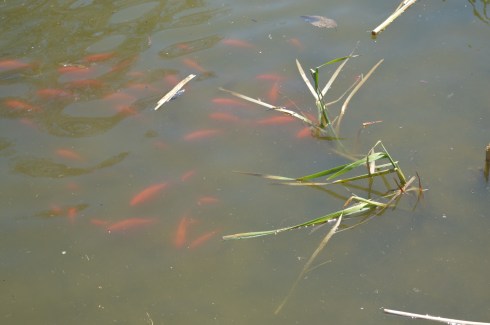
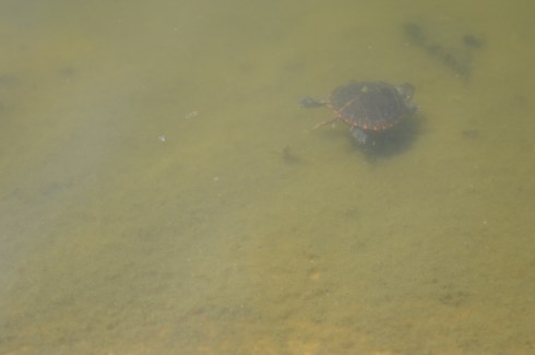
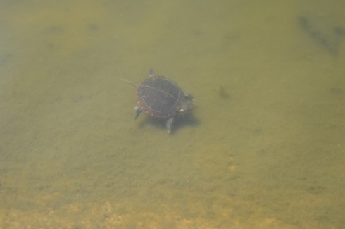
There is also a pond along the trails at Wilcox Park. It is populated with Koi fish
ducks
There’s room for two on this thing, right?
and baby turtles. I couldn’t find his mommy but I am sure she was nearby.
and rabbits
The bronze Runaway Bunny statue was dedicated in 1998 by Connecticut sculptor Joan Binney Ross. it is based on the book of the same name by Margaret Wise Brown. Unfortunately, the bunny has been the target of vandalism, predictably. But, it has been restored after each attack. Cameras are now installed liberally around the park to deter vandalism or catch the vandals.
This fella just wanted to play with the ducks
This sculpture sort of looked like a face to me. A very ugly face.
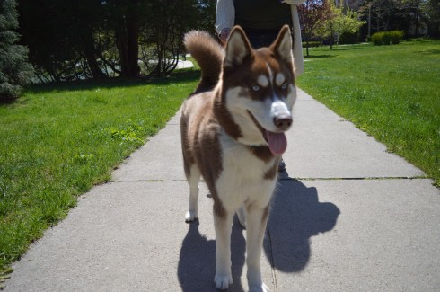
Dogs are allowed at Wilcox Park. Bandit, a Siberian Husky, had fun playing in the park. Apparently, Bandit earned his nickname because he “takes things”. What a beautiful dog. He caught my eye because of his handsome markings and his very cute smile. You can tell he’s a “bandit” based on his playful grin.
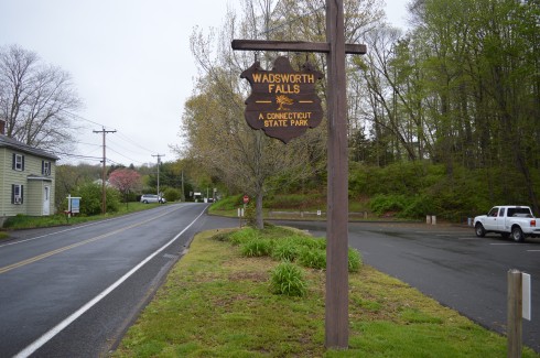
Location: 701 Wadsworth St, Middletown, CT or Cherry Hill Rd, Middlefield, CT
Cost: When I went to visit, it was free. I think they begin charging a fee starting Memorial Day weekend. There is no fee entrance fee during the weekdays. It costs CT residents $9 and it costs non Connecticut residents $15 to get in to the park during the weekend. You also may be able to access the park for free at the Cherry Hill Rd entrance.
Hours: Open everyday from sunrise until night time.
Parking: There are about 30 parking spots at the main entrance at Wadsworth St and another 20 or so at the Cherry Hill Rd entrance in Middlefield (pictured below)
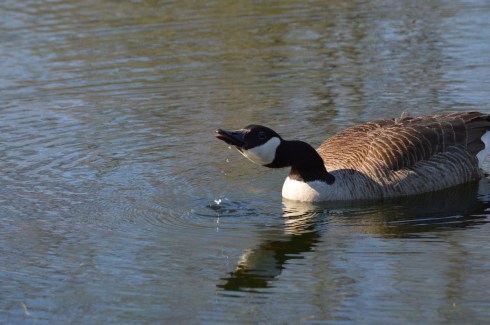
We entered at the main entrance on Wadsworth St. There is a sandy beach area (there is a lifeguard on duty during the summer season). Since it was an overcast and chilly day, there weren’t any people swimming but there were a lot of birds congregating near the water.
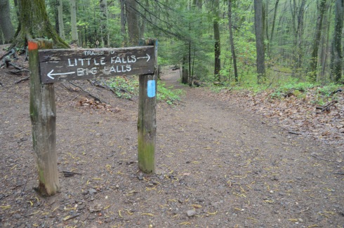
The highlight of the park, of course, are the falls. The two waterfalls at Wadsworth Falls are creatively named “Little Falls” and “Big Falls.”
Once you get on the main trail, you will eventually see the sign for the falls (after about a 3/4 to one mile hike). From this sign, it is about a half mile hike to the Little Falls and a mile hike to Big Falls if you enter from the entrance on Wadsworth St. There are also lots of trails that branched off the main trail and would be fun to explore if you have the time.
You can avoid the longer hike by parking on Cherry Hill Rd. Big Falls is accessible from a short walk down a well defined path from the lot on Cherry Hill Rd. But, the parking lot at Cherry Hill Rd is smaller than the lot on Wadsworth St.
Little Falls is actually a pretty big fall, even if it isn’t the biggest one at the park. But, the height of this waterfall may actually surpass the height of Big Falls. The last few shots in the slideshow are from our trek back to the main parking lot. The falls seemed much less rapid on our way back and you can see the ledges of the falls better.
This slideshow requires JavaScript.
There are a few different ways to get to Big Falls, the main attraction. The safest, but longest way, is to follow the trail until you reach the edge of the park which filters onto Cherry Hill Rd. The park is a short walk on a sidewalk to the right. Or, you can cross the railroad tracks and follow trail along the tracks for quicker access. There really isn’t a defined trail but there is space to walk a safe distance from the tracks. The railroad is still in operation but we didn’t see any trains while we were there.
There are two places I photographed the waterfalls from but there are probably even more places to view the waterfalls. The first place is a little tricky to get to and potentially dangerous. There is a path that goes off the trail across the tracks and up to ta cliff that offers some decent views of the waterfall. I did take some photographs from there but I would bypass it and go to the parking area of the entrance on Cherry Hill Rd to get a safer, closer and less obstructed view of the waterfalls. The first two photos are from the cliff area the rest are views from the entrance to the park.
This slideshow requires JavaScript.
From the main entrance on Wadsworth St it is about 1.5 mile hike to the falls and it is a 3.4 mile trail loop to walk the entire park. There were bicyclists, walkers and other photographers along the trail. Because of the inclines and, in some areas, rocky terrain, it would be a challenging place to go for a run. I would describe the trails as being easy to slightly moderate because of the inclines and rocky trails.
There are also pretty trees, bridges, plants, brooks and streams along the trails.
This slideshow requires JavaScript.
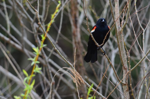
There was a lot of bird activity at Wadsworth Falls such as this male red-winged blackbird.
There are a variety of bird life at Wadsworth including bats. This is a bat house. It was built and maintained as part of an Eagle Scout project to help restore the bat population. It was good to see that it’s not only the cute animals that are being helped.
Toads and other amphibious life is also abundant at Wadsworth State Park. It was still pretty cold out so these toads seemed out of sorts. We gently picked them up and tried to find a warmer place for them under some leaves.
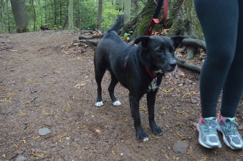
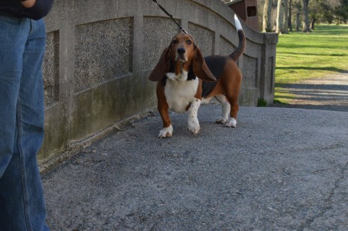
Leashed dogs are allowed at Wadsworth State Park. It is a great place for dogs to play and roam around. Caesaris (pronounced Kay-sar-is), a friendly 1 year old female Labrador and Australian Sheep Dog, enjoyed the unseasonably cool weather with his mom.
Below are some videos I took of the falls. The power, crispness and sound is much more evident in the videos.
As the name suggests, there are lots of birds to watch at Francis William Bird Park. Either there are lots of robins at the park or I photographed the same one over and over.
There are more than birds at the park to catch your attention.
Such as trees and flowers
This slideshow requires JavaScript.
the ponds and streams
and the bridges (each bridge is made slightly differently)
The trails are easy and branch off to side trails. But, since it is all concentrated in one area it is hard to get lost there.
The tree below was planted in memory of Charles Sumner Bird, a paper manufacturer, candidate for governor of Massachusetts, resident of Walpole MA and the son of William Francis Bird.
Tip of the day; don’t get too close to a goose and his or her Cheetos.
You’re not supposed to feed the birds at William Francis (and you’re especially not supposed to feed them Cheetos). It’s not good for them physically and it creates more messes on the trail. But, of course, people still do.
Along the trails, there are benches and places to enjoy the outdoors. Or, you can just chill on a rock or log. There is also a restroom (open seasonly)
Charlot (pronounced Char-lo) is a local (local to Walpole) artist, storyteller and cultural and historical expert. He specializes in Haitian art and culture. He likes to go to the park to paint and relax. He was kind enough to let me photograph him painting. He calls the first painting Silhouette Of The Drum. he was also touching up a painting he had finished previously.
Charlot is very talented. You can find out more about him here.
There are also a variety of attractions for sportsmen and sportswomen. The trails make for great running surfaces. There are four tennis courts as well as a basketball backboard (but not a court) . There are also musical and other types of events during the summer by the main field.
Birds aren’t the only animals you will find at Francis William Bird Park. The park is also popular spot for dogs. The trails and open spaces make it a great place to take your pooch.
Henry is a 3 year old Basset Hound. Cute freckles on his left front paw!
Sophia is a 5 year old Newfoundland. Sophia reminded me of a Newfoundland we had. Beautiful dog.
Buddha is a 3 month old Hound mix. I love the eyebrows!
Cost: Free since I visited during the off season. It costs $8 for MA vehicles and $10 for out of state vehicles once the main season begins (around early May)
Parking is limited. Since it was not the peak of the season, I found a spot without any trouble. But, there are only 20 or so spots in the main parking areas. There are some additional parking areas off the main trail to the lake.
Boats are not allowed in the water, although fishing is allowed. Trout and bass are the most common fish in the water.
I had been interested in visitng Rutland State ever since I heard about the remnants of the state prison camp and the views of the water.
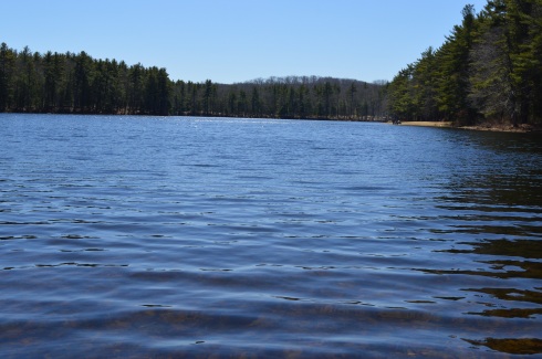
There was a strong wind, evident by the ripples in the water.
This slideshow requires JavaScript.
The gates at the entrances to some of the trails prevented some vehicles from entering the trails. This is because during this time of the year it rains a lot and bikes and other vehicles can get stuck on the trails. So, it was a pretty empty trail when I went. Which was just fine by me. Miles of near solitude in nature with a cloudless, cold blue sky on a bright New England morning….yes please!
The main trail I stayed on was easy with some moderate includes. The only thing you may find annoying is the long stretches of nothing but trees and water on each side of the trail. This was heaven for me, though. I was also pleased to see a dirt trail rather than gravel or, gasp, paved road.
As I continued on the main trail, I began to see signs of ruins of structures frozen in time. A stairwell and frame of a building, now adorned with graffiti (get used to it as it is a constant theme), stood on the outskirts of the trail.
At around the 2 mile mark of the trail there are remnants of a prison camp. The camp was constructed in 1903 for housing petty criminals. It would later be converted into a farm. The first structure, again riddled with graffiti, was used for solitary confinement.
When you consider just how small and confining the spaces in the building are you can only imagine the distress it caused some of the prisoners.
Something happened when I visited the remnants of the prison camp. What I had once considered “cool” and interesting, seemed dank and sad. In fact, it wasn’t until after I left the structure and cave that it really sunk in. It seems like a grim existence at the least. When you realize people lived in these conditions and suffered, largely for committing petty crimes (such as drunkeness), it makes you think we should be more cognizant of the history of the building and area. If it wasn’t so tragic it would be more interesting. Rather than being “cool”, it just made me depressed.
Farther along the trail is an arch that appears to be a root-like cellar. I am not sure what it was used for but my gut tells me nothing good.
There are also some interesting tunnels and holes in the ground at the old prison site. I decided to investigate.
Given the architecture of the structures and the history of the area, it is easy to see why the park is considered haunted. Disembodied voices and apparitions are said to have been witnessed by visitors. There are even claims the area was once used for satanic worship. The area was the subject of the book The Soul Collector, written by Joni Mayhan.
On a brighter note, I saw lots of four legged friends at Rutland State Park.
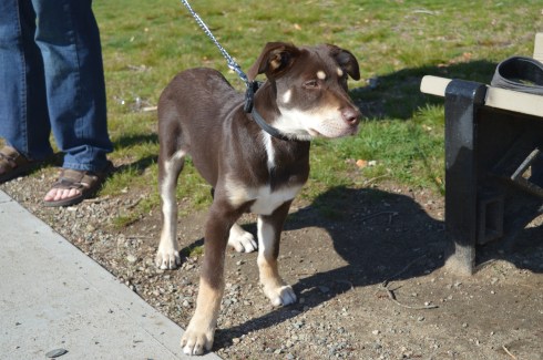
(left to right) Grayson, 7, an American Pit Bull Terrier and Gamble, 6, a Pit Bull and Boxer mix.
Blackie, 4 years old, a part husky.
I also saw some other four legged friends.
Panda, in front, is a training horse. Calvin is the horse on the right and the horse in the back left (who is difficult to see) is Jack.
There were also a few kids playing on their motor bikes and ATV’s.
The videos below are some videos from my visit. Thank you for reading!
How could you not want to visit an area with the name “by the sea” in its name? It sounds like the name of an idyllic setting from a novel. And the town lives up to that description. I passed by several fruit, vegetable and flower stands as well as signs to watch out for people riding horses. The houses and town also had a very Norman Rockwell feel.
I wasn’t sure how the footing and appearance of the park would be given the recent snowy weather and icy conditions on many of the trails at other parks. As it turned out, most of the ice and snow on the trails had melted and I only had to manage some small patches of ice and mud from the melted snow.
The trails are clearly marked and easy to walk. There are no steep inclines and the paths are wide enough to accommodate the throng of visitors.
There are a few trails that meander slightly off the trail. But one trail simply leads to the street and is behind a bunch of cattails so you really can’t view much of the pond. The other stupid trail goes to a thorny, rocky dead end.
As you walk on the main trail, you will pass Clarke Pond on your left. It was partially frozen and there were some ducks and geese milling around. I also got a few shots off them dunking for lunch. The gulls in the first photo looked like big blocks of snow at first glance. I especially like how the mom and dad duck kept the baby duckling close to them.
This slideshow requires JavaScript.
There were many breath taking views of the pond. I especially like how the frozen parts of the pond break with the unfrozen sections.
This slideshow requires JavaScript.
To the right of the main trail, I found a side road with a pond that channels into Clarke Pond. There were a variety of ducks and geese in this pond.
This slideshow requires JavaScript.
I met a lot of friendly and cool people at Coolidge. Shapoo was one of the cool and friendly folks I met (the name is a mix of shih tzu and poodle) .
Much to my consternation, I was unable to find the Ocean Lawn which offers views of the Boston skyline and Cape Cod as well as scenic views of the water. I totally missed the boat on that one as there are some great views and opportunities for some great shots from there. But, to the left of the trail, Magnolia Beach more than made up for it which I will post about very soon…click here to read about my visit to Magnolia Beach.
Parking: there is a parking lot located next to the memorial with over a dozen or so parking spaces. There are also parking lots and off street parking nearby.
Although she is known more for her success as a teacher and most notably working with Hellen Keller in Tuscumbia, Alabama, and Boston, Massachusetts, Anne Sullivan is actually a product of Feeding Hills (a sub section of Agawam), Massachusetts.
I especially like how the trees still have leaves and the flowers are in bloom since I originally took these photos in the summer of last year. It makes me yearn for the long spring and summer days.
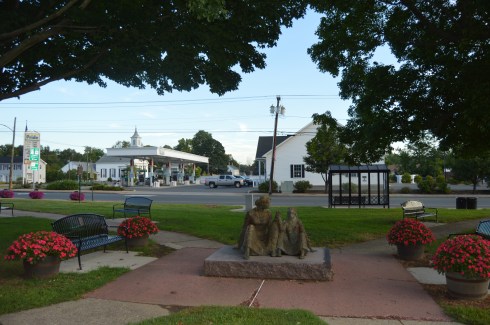
I am never completely satisfied with my photos. So, I made two trips to this memorial. My biggest gripe with the first set of photos was there were too many cars and people in the background. But, even when I went back another day earlier in the daytime there was still a lot of activity. It is located by a busy intersection so it was unavoidable. You can see the difference in the shadowing and angle of the sun from my two visits.
Sullivan lost her vision at an early age due to an infectious eye disease. She would receive a series of treatments which considerably improved her vision while she was a student at Perkins School for the Blind in Boston. This undoubtedly inspired her to work with other people who were visually impaired and challenged in other ways.
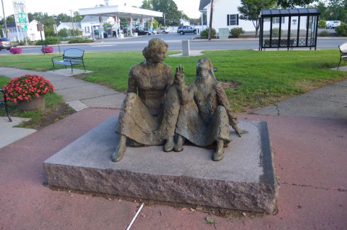
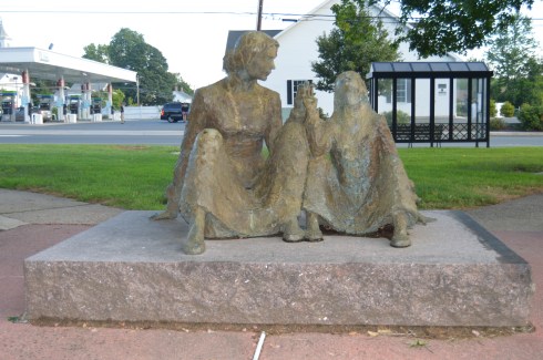
The centerpiece of the park is the monument of Anne Sullivan sitting with Helen Keller. The intensity in her stare is palpable. The sculpture, created by the Romanian-American sculptor Mico Kaufman, captures the moment Anne Sullivan successfully teaches Helen Keller her first word – “water.” The statue was dedicated on June 28, 1992.
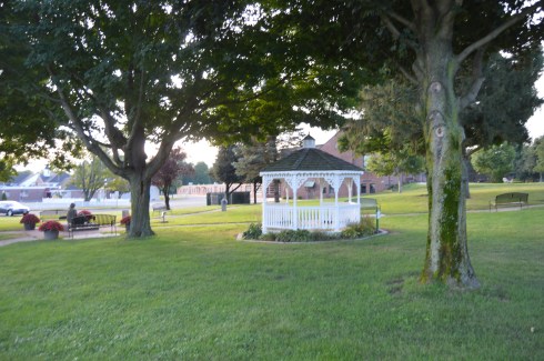
The park is well kept and there are many places to sit. A gazebo stands off to the side as well. It would be a peaceful place to relax and unwind, except the fact it is located at a busy intersection.
There are additional monuments in the park.
This memorial is another tribute to Anne Sullivan’s work with Helen Keller. The inscription reads, “Anne Sullivan…Teacher of Helen Keller. Heroic friend of the deaf and blind. Native of Feeding Hills.”
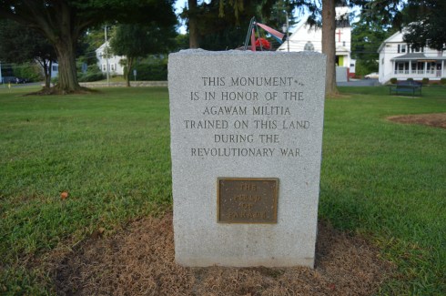
This memorial is a tribute to the Agawam Militia who trained on this land during the revolutionary War. I am always fascinated at how seemingly ordinary places like a busy intersection has so much history and significance. In fact, the land you are standng on, or the land your house or apartment building was built upon most certainly has a hidden history you are not privy to.
The trees at the Anne Sullivan memorial Park are very impressive, particularly when they still have their leaves.
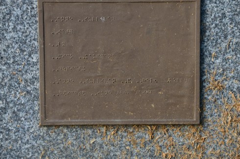
The last monument I photographed at the park names the people on the memorial committee. If you look closely, you may notice the inscription is also written in braille.
There are about a dozen parking spaces in the main parking lot. If needed, you can also park on the side of the road by the parking lot.
Cost: Free
Hours: open daily, sunrise to sunset
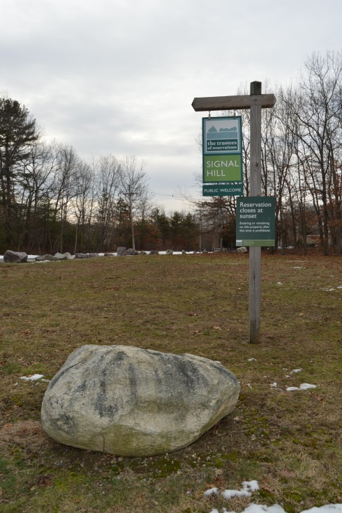
Before you even begin climbing the ascent to Signal Hill, the views from the parking lot are astounding.
Besides the historical significance (it used to be the home to the Paleo-Americans who settled on what would become the Neponset River) and the active wildlife (hawks are said to nest there and many amphibians inhabit the area by the river), Signal Hill also offers grand views of the Boston Skyline, Blue Hills and the Neponset River Valley.
The hill to the scenic outlook at Signal Hill is modest at best. It should only take 10 minutes to go from the parking lot to the outlook.
The views are worth the short hike.
The scenic overlook has some pretty trees and rocks.
One of the charming features of Signal Hill is the short loop (1.6 miles) at the base of the hill. After climbing and trudging along so many long and steep hills, it’s refreshing to be able to take a leisurely stroll along the clearly defined trail. There are also trails that veer off a little.
Off the main trail there is a canoe launch site on the Neponset River. The upstream launch site goes to Norwood (MA) while the downstream site leads to Milton (MA).
Since there is little traffic on the road, the road to Signal Hill is popular with joggers and cyclists.
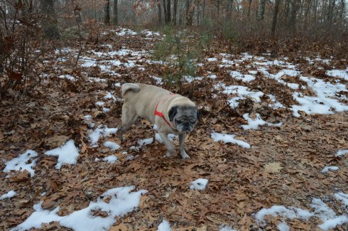
I met Charley during my visit. He was having fun playing in what remained of the snow on the trail.
Although the area is mostly known for being the home of the New England Patriots and its adjacent marketplace, Patriot Place has another impressive attraction – The Nature Trail and Cranberry Bog. Admission to the trail and bog is free and the parking is ample evident by the photo below. You can also park in the lots in front of the store and walk down to the trail.
From the entrance the Nature Trail and Cranberry Bog greets you with a charming sitting area and pretty trees.
This slideshow requires JavaScript.
Although most of the vegetation is dead (save for a few stubborn blueberries and cranberries), a thin layer of ice covered most of the pond and the trees are bare this time of the year, the Nature Trail and Cranberry Bog at Patriot Place in Foxboro, MA, is just as beautiful in the winter as it is during the summertime.
This slideshow requires JavaScript.
Located directly behind the expansive Bass Pro Shop, the Nature Trail and Cranberry Bog is a .5 mile loop with a 3 percent grade and some inclines as much as 12 percent.
It is a mostly dirty trail with a few boardwalks and bridges. There are two benches in the middle of the first walking bridge. Overall, it is an easy to semi-moderate trail. I saw people of all age groups handle the trail, inclines and all, with little difficulty.
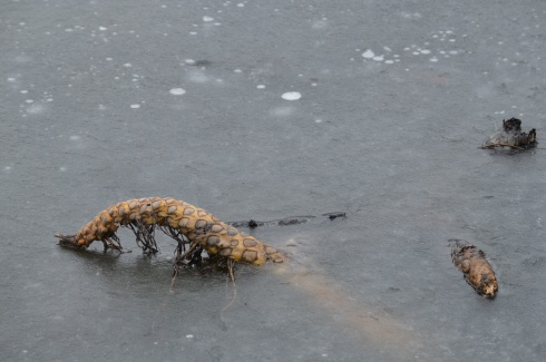
I found this strange, creepy looking branch or alien arm protruding from the ice.
An extra bonus for any Patriots fan is you can see Gillette Stadium (the stadium the Patriots play in) from the main road on the way to the Nature Trail and Cranberry Bog. You can also catch a quick glimpse of some of the stadium from the entrance to trail and bog.
After finishing the loop, I met Chandler, a beautiful 6 year old tri-colored English Setter (thank you for the clarification, Adam).
Thank you for reading and please like my Facebook page to view videos, photos and more that I do not post on this blog:
As the year draws to an end I thought I would share some of the photos taken from my mother’s house throughout the year. Since she lives in an area that used to be farmland there are a lot of wooded areas that attract a variety of wildlife. She also has a couple of bird feeders that attract birds of all types. There are many other animals in the area over the years that I have heard or seen but not photographed such as deer, a horse, cows, mountain lions and reportedly even bears.
Check out the slideshow below to see some of the friends that have visited us this past year. My cat, Bailey, is included in the slideshow. I always bring her when I visit.
This slideshow requires JavaScript.
I always like investigating the area when I visit for the holidays and long weekends. I’ve always thought it would be a great place to retire. The storms and sunsets can be jaw dropping.
This slideshow requires JavaScript.
There are also a variety of plants, flowers and trees in her yard.


 Blackie, 4 years old, a part husky.


 Thank you for reading and please like my Facebook page to view videos, photos and more that I do not post on this blog:


