Located next to the New Hampshire Holocaust Memorial on Main Street across from a strip mall and busy roadway, the Rotary Common Park is a most unlikely place to find an art display. But, the Rotary Common Park is just that; an outdoor art museum. And this isn’t just some tourist attraction. The art here is very thought-provoking and amazingly crafted.
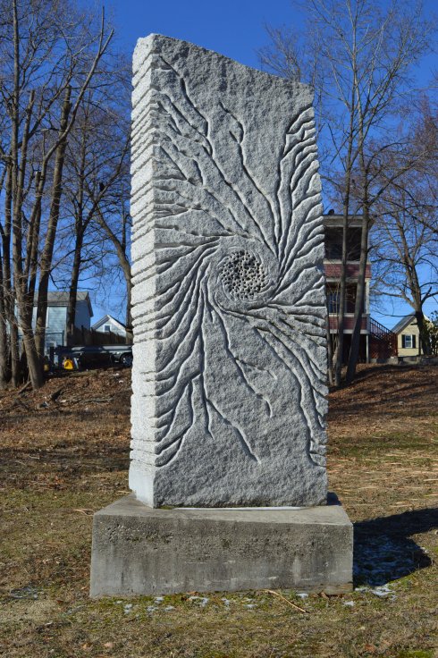
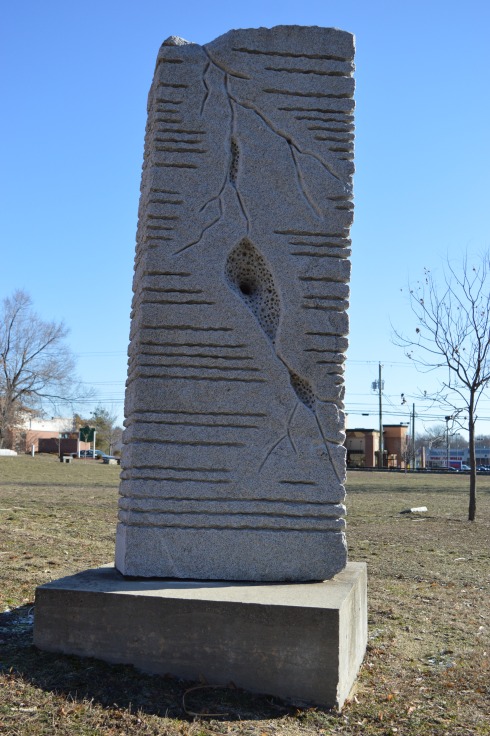
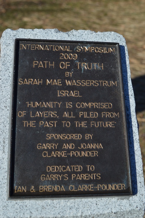
The “Path Of Truth” is a memorial to the “layers of humanity”. Or, as Sarah Mae Wasserstrum said;
“From the Origin layers of Humanity, we are connected by a common denominator.”
She imagines humanity as like layers, some thicker and some modest, all plied from the past to the future. The stone signifies the immense power of people and our ability to grow and change.
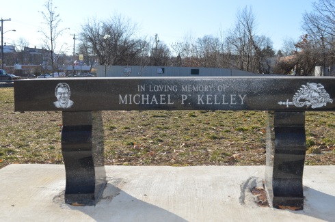
A bench dedicated to Michael Kelley. Who was Michael? What was he like?
Since it is located directly across from the Holocaust Memorial, the Reflection Garden & Labyrinth is the most popular spots at the park. Benches, sculptures, tiles with words of inspiration and works of art dot the circular reflection area.
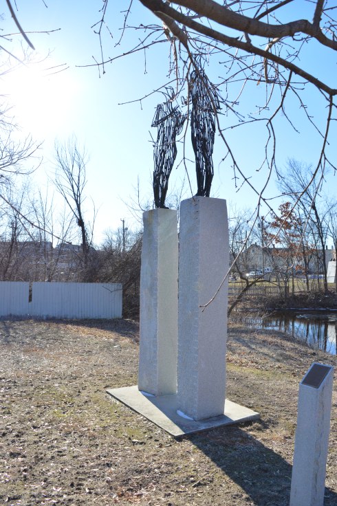
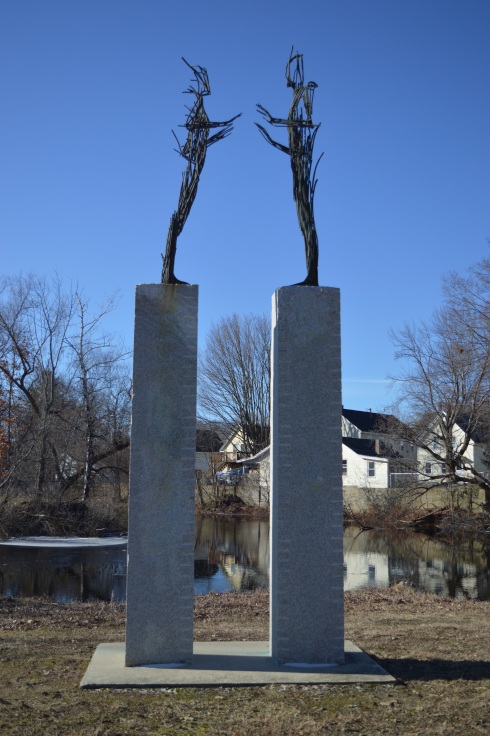
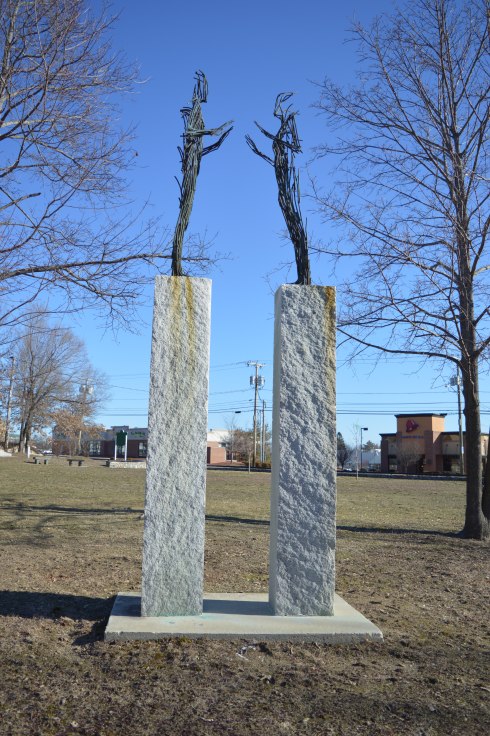
The “Encounter” sculpture by Luben Boykov,
Boykov described it as, “The present moment of meeting becoming a place in the future.”
Boykov explains the sculpture as a moment just before people meet that are so quick but also last forever. It represents an encounter that can begin a lasting relationship.
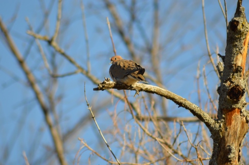
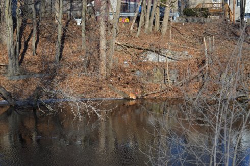
There was also a surprising amount of animal activity in the area like this bird and a thirsty cat.
The displays at the Rotary Park change on a regular basis so keep an eye out if you’re in the area!
Cost: Free since I visited during the off season. It costs $8 for MA vehicles and $10 for out of state vehicles once the main season begins (around early May)
Parking is limited. Since it was not the peak of the season, I found a spot without any trouble. But, there are only 20 or so spots in the main parking areas. There are some additional parking areas off the main trail to the lake.
Boats are not allowed in the water, although fishing is allowed. Trout and bass are the most common fish in the water.
I had been interested in visitng Rutland State ever since I heard about the remnants of the state prison camp and the views of the water.
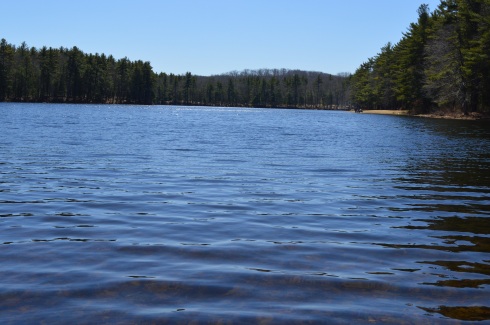
There was a strong wind, evident by the ripples in the water.
This slideshow requires JavaScript.
The gates at the entrances to some of the trails prevented some vehicles from entering the trails. This is because during this time of the year it rains a lot and bikes and other vehicles can get stuck on the trails. So, it was a pretty empty trail when I went. Which was just fine by me. Miles of near solitude in nature with a cloudless, cold blue sky on a bright New England morning….yes please!
The main trail I stayed on was easy with some moderate includes. The only thing you may find annoying is the long stretches of nothing but trees and water on each side of the trail. This was heaven for me, though. I was also pleased to see a dirt trail rather than gravel or, gasp, paved road.
As I continued on the main trail, I began to see signs of ruins of structures frozen in time. A stairwell and frame of a building, now adorned with graffiti (get used to it as it is a constant theme), stood on the outskirts of the trail.
At around the 2 mile mark of the trail there are remnants of a prison camp. The camp was constructed in 1903 for housing petty criminals. It would later be converted into a farm. The first structure, again riddled with graffiti, was used for solitary confinement.
When you consider just how small and confining the spaces in the building are you can only imagine the distress it caused some of the prisoners.
Something happened when I visited the remnants of the prison camp. What I had once considered “cool” and interesting, seemed dank and sad. In fact, it wasn’t until after I left the structure and cave that it really sunk in. It seems like a grim existence at the least. When you realize people lived in these conditions and suffered, largely for committing petty crimes (such as drunkeness), it makes you think we should be more cognizant of the history of the building and area. If it wasn’t so tragic it would be more interesting. Rather than being “cool”, it just made me depressed.
Farther along the trail is an arch that appears to be a root-like cellar. I am not sure what it was used for but my gut tells me nothing good.
There are also some interesting tunnels and holes in the ground at the old prison site. I decided to investigate.
Given the architecture of the structures and the history of the area, it is easy to see why the park is considered haunted. Disembodied voices and apparitions are said to have been witnessed by visitors. There are even claims the area was once used for satanic worship. The area was the subject of the book The Soul Collector, written by Joni Mayhan.
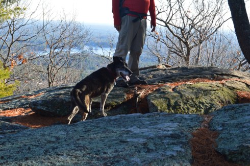
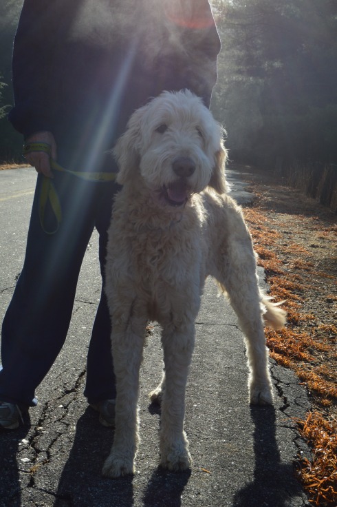
On a brighter note, I saw lots of four legged friends at Rutland State Park.
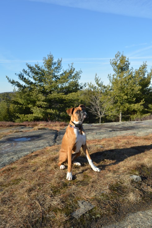
(left to right) Grayson, 7, an American Pit Bull Terrier and Gamble, 6, a Pit Bull and Boxer mix.
Blackie, 4 years old, a part husky.
I also saw some other four legged friends.
Panda, in front, is a training horse. Calvin is the horse on the right and the horse in the back left (who is difficult to see) is Jack.
There were also a few kids playing on their motor bikes and ATV’s.
The videos below are some videos from my visit. Thank you for reading!
Location: Beech St, Manchester, New Hampshire (with access points on Union, St, Amherst St and Hanover St)
Cost: Free to the public
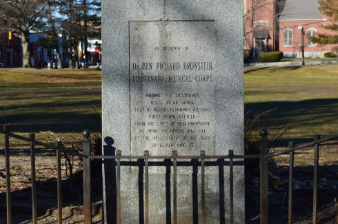
Although a statue that is dedicated to the veterans of the Spanish American War, the Boxer Rebellion and the Phillipine-American War, Bronstein Park celebrates a hero from another war.
Although “The Hiker” stands prominently at the street entrance to the park, Bronstein Park (formerly known as Hanover Square) is actually named after a corpsman who died in World War II; Dr. Ben Richard Bronstein, the first Manchester, New Hampshire, resident to die during the war. Dr Bronstein’s brother, Maurice Bronstein, donated the memorial to the park in 1990.
The inscription on the memorial is hard to read in some parts. It states:
“in memory of Dr. BEN RICHARD BRONSTEIN, LIEUTENANT, MEDICAL CORPS, aboard the destroyer U.S.S. Jacob Jones Lost in Action, February 28, 1942 First Naval Officer From the State of New Hampshire To have Sacrificed his life in the fulfillment of his duty in World War II.”
Another memorial pays tribute to Dr. Bronstein’s brother, Stephen Max Bronstein, who also served during the war.
“The Hiker” was originally sculpted by Theo Alice Ruggles Kitson in 1906. The original statue was made for the University of Minnesota. However, 50 copies were made of her statue and were distributed all over America. Manchester, New Hampshire was the recipient of one of the copies of her statue. The statue is made of bronze on a base of granite, of course.
The name “hiker” was a moniker the American soldiers in the Spanish American War and Philippine-American War gave themselves because of the long hikes they took in the jungle. Kitson said the hiker, “depicts a hero stripped of his parade uniform and shown as a soldier reacting to the challenges of the battlefield.”
Leonard Sefing, Jr., a Spanish-American War veteran, was the model for the statue.
A close inspection of the statue shows a weary soldier clad in civilian type apparel.
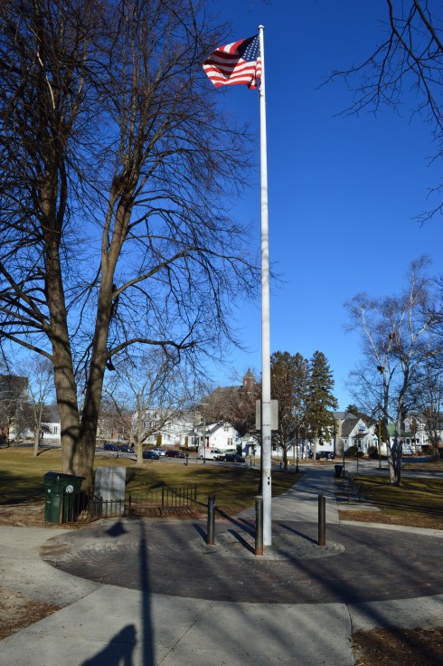
An American flag stands in front of the memorial for Dr. Ben Bronstein.
One strange thing I noticed is a warning posted that prohibits people from hanging out at the park during school hours. So that is something to bear in mind if you do visit. I’m not sure why this restriction is in place. I can only imagine you would be the talk of the town in prison if you ever got convicted of it “Don’t mess with that guy. He’s in here for loitering.” (I know it’s probably just a fine)
Below are some additional photos of the park from different angles.
Arms Park is a unique kind of park. In fact it’s not really a park at all. A stream, fed by the Amoskeag Fishways, runs parallel to the park. It is the perfect place for people who love the sound of water and watching waves (and based on my previous posts I know you’re out there). There’s not much to Arms Park. A parking lot takes up most of the area (which has led some to call it “Arms Parking”) and a few office buildings dot the landscape. It’s certainly not one of the most picturesque landscapes but the stream and walkway does have a certain charm. It is often used for observing important important days such as the annual Pearl Harbor Day observance event and the Fourth of July fireworks display.
The river is usually pretty rough and could consequently be dangerous if anyone got caught up it in.
This slideshow requires JavaScript.
It was still fairly cold when I went to visit, so the water which did splash on the railing quickly turned to ice.
A variety of birds like to seek refuge at Arms Park. I saw a bunch of gulls there during my visit.
Arms Park has a short walkway along the river with benches along the way.
The video below gives a better representation of the choppy water at Arms Park.
New Hampshire isn’t known as the “Live Free Or Die” state for no reason. The quote, which is said to have French origins and adorns license plates and other kitschy souvenirs, is directly attributed to General, and former New Hampshire resident, John Stark. It was at John Stark Park in Manchester, NH, that I found this historical tribute to the revolutionary warrior.
The remaining of the “live free or die…”quote is lesser known, yet just as poignant.
For someone who is so heroic and brave, General Stark is not someone who many of us are familiar with. But, heroic he is. As the plaque in front of his statue explains, after being kidnapped by a Native American tribe and eventually ransomed, Stark joined the American Revolution and became a general. His most notable achievement was in 1777 when he commanded his troops to prevent British troops and supplies from connecting with the main army in Saratoga, New York, which was considered a key point which led to the American victory in the war.
Crisp blue skies awaited me at the park. It almost felt fall-like. What struck me most about the park was how peaceful it was. The gazebo is a nice touch also. The statue of General Stark was sculpted by Richard Recchia in 1948. The park is one of the older parks in New Hampshire, dating back to 1893 (it is the second oldest park in Manchester).
This slideshow requires JavaScript.
General Stark his, wife and a few of their children are buried at the bottom of the hill from the entrance.
One of the interesting things about Stark Park is the loop behind the park. It’s only about a quarter of mile and it is a great place to take your dog for a walk. But, there is a trail that branches off to a bridge and some other trails which eventually lead to the Heritage Trail. But, apart from some interesting trees and some wildlife, there isn’t much on the trails. Most of them lead to residential areas. I walked most of the narrow trails as far as I could go before they ended, rather disappointingly, at roadways and residential areas.
The big payoff to walking the loop behind the park was meeting Bennie. Bennie is a Chinook which is the state dog of New Hampshire.
As fall made one more last gasp, I took advantage of the unseasonably warm (50 degrees) weather and made my way up north to the picturesque Pawtuckaway State Park in Nottingham, New Hampshire.
Located about an hour and a half north of Boston, MA, Pawtuckaway is a 5,000 acre preserve with a camp site, lakes, a beach, a spectacular view of the Pawtuckaway Mountains and 15 miles of trails. The parking lot is pretty big so parking shouldn’t be a problem if you get there early in the day during the spring and summer. There were only 4 cars there when I went in December. It costs $5 for adults and $2 for children ages 6-11. It is free when it is not staffed (from 11/2 until 5/1). The park hours are 8 am-7 pm.
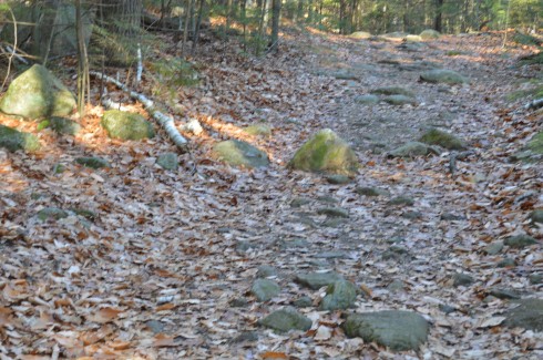
The trails can be challenging not so much because of their inclines, which can be tricky at parts, but because of the rocks which are randomly placed throughout the trails. They can come in handy, though, when you have to cross the puddles along the trails.
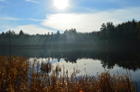
I arrived at Pawtuckaway early in the morning. Mist and frost was still visible on the way to the lake.
Looking into the pond was like looking into a mirror.
This slideshow requires JavaScript.
The views from the rocks trail on the Fire Tower make the long ascent (about 3 miles from the entrance) worthwhile.
This slideshow requires JavaScript.
The fire tower is located a short distance (about a quarter of a mile) from the rocky ledge with all of the beautiful views.
While I preferred the views from the ledge, the fire tower offered views from every angle and both sides of the vista.
This slideshow requires JavaScript.
There were also many pretty trees at Pawtuckaway.
There is also a beach at Pawtuckaway. I got there just in time for the sunset.
This slideshow requires JavaScript.
Pawtuckaway is said to have been derived from a Native American word meaning, “big buck.” I didn’t see any bucks but I did some dogs! From top to bottom Artie, Lulu (on the left), Rooster (on the right), Tucker and Duke.
Video from the fire tower at Pawtuckaway. As you can tell by the audio it was quite a windy day.
Video from the rocky ledge it was less windy there)
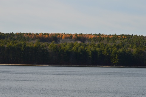
Spending a crisp autumn day at Myles Standish State Park makes you long for summer days.
Since it is so big, Myles Standish has several parking areas. I parked at the main parking area where the ranger headquarters is located on Cranberry Rd. There were about 30 or 40 parking spots at this parking area. It wasn’t a problem finding a spot when I went but I bet it fills up quickly if you don’t go early during the spring and summer. Myles Standish also has camp sites for tents and some for RV’s. It costs $8 for MA residents and $10 for non MA residents to visit for the day when the park is open for the season. It is free off during the off season.
As beautiful as the forest is in late fall, it must be even so much prettier when all the flowers are in bloom or during foliage season. The wind was just strong enough to give the water a little ripple effect.
This slideshow requires JavaScript.
There were birds a plenty at Myles Standish. The woodpecker in the second photo was too busy pecking to be scared away.
Myles Standish is a huge forest and it extends into several towns. There are 16 ponds, 13 miles of hiking trails and 15 miles of biking trails in Myles Standish. I stopped by Fearing Pond.
This slideshow requires JavaScript.
There was also quite a few pretty trees and vegetation at the forest.
My one gripe about Myles Standish is the amount of trees they had cut down. It wasn’t clear why they had the trees down. But, it was unsettling nonetheless.
Named after Frank Winsor, the chief engineer of the construction project, the Winsor Dam section of the Quabbin Reservoir is a mecca for nature lovers, outdoors people and anyone who just wants to get out for a walk along the largest inland body of water in the Commonwealth of Massachusetts.
If there is one word that best describes the Winsor Dam it would be peaceful.
The easy to moderate walking trails are surrounded by rolling hills and crystal blue water
I missed the foliage season. But, you can still see the colors peaking from the tree tops.
The staff at the Quabbin Reservoir use these boats as part of their gull harassment program to limit the pollutants from the birds.
Located about a half an hour from Springfield, MA and an hour and a half west of Boston, MA, Quabbin Reservoir supplies water to three towns west of the reservoir and acts as the backup supply for three other towns. There was a seasonal fall breeze during my visit which created pretty ripples on the water.
Quabbin Reservoir is expansive (it has an area more than 38 and a half miles). It is separated by different dams and sections. There is a pretty walking bridge that you can use to visit some of the other areas. There are some great views from the bridge.
The distance between dams are more than a mile. So, it is often a good idea to drive to the different parts of the reservoir.
One of the many great things about the area is that after you cross the bridge there are trails and a creek which people use to fish. I got my first two ticks of the season taking these photos, so you’re welcome!
The water is green in some places and it is so clear you can see the trout and other fish that inhabit the water.
There are also a variety of bird life at Quabbin Reservoir. I caught these titmouse on the trail (ok I laughed a little when I wrote that)
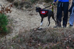
Dogs aren’t allowed at Quabbin reservoir. I did see one dog that was “in training”, though.
Bear Hole is not just a name give to the much traveled reservoir in West Springfield.
Tales of bear, deer and other animals have been told from many visitors at the park.
I didn’t see any bear, though. I only met the occasional dog (from top left to right Figueroa, Lily, Jyp, bottom from left to right Oreo and Connor)
and owl
The main attraction at Bear Hole is the waterfall.
and the pond it flows to
The trails are clearly defined (unless you go off trail to get a closer look at the waterfall and pond as I did from time to time). And runners and cyclists use the trails frequently.
Click below to view the video of the waterfall in all its splendor.
Once a seasonal campsite for Native Americans as well as the site for a fertilizer factory and a missile launcher warehouse, Webb Memorial State Park has gone through many changes over the years. It has since been cleaned up and developed into one of the lesser known jewels of the South Shore of Massachusetts.
Named after William K. Webb, a World War II and police officer from Weymouth, Webb Park is a popular spot for joggers and other outdoor enthusiasts. There are many different paths that offer various pretty views of the skyline of Boston and the surrounding cities.
You can see planes flying to and from Boston’s Logan International Airport. They are so loud you can hear them clear across the harbor.
There are also several monuments at Webb State Park.
This memorial is named after John Cole, a former resident of Weymouth, MA.
This memorial is dedicated to Chief Engineer Donald F. Haviland. Haviland was on the Henry Bacon which took heavy damage from enemy bombers. He refused to take a seat on one of the lifeboats because the lifeboats were running out of room and not everyone could fir on the lifeboats. Haviland gave up his seat on the lifeboat to a younger person and he died when the ship sunk. He is certainly worthy of our admiration and this token of our appreciation. This memorial certainly makes you think.
Another monument memorializes the Grape Island Alarm which was a Revolutionary War battle where a Weymouth militia fought back the British Navy.
This slideshow requires JavaScript.
There is also a memorial dedicated to Domenic J. Sansone.
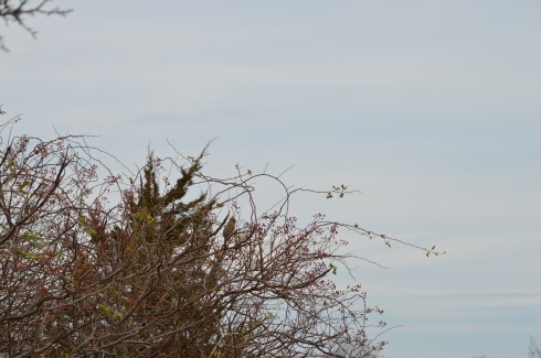
There are a variety of birds in the area. I was lucky enough to photograph this woodpecker
a sparrow
and this female cardinal. You might have to enlarge the photo at the top of one of the branches toward the right side of the tree.
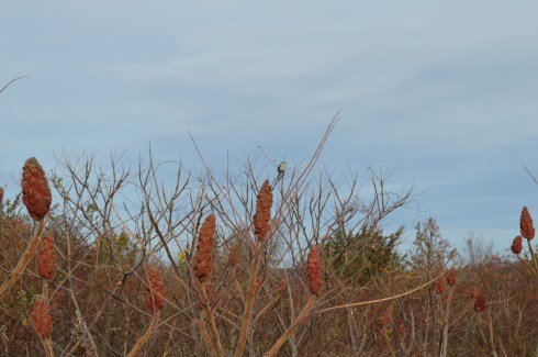
I also spotted this bird. Another one that might be a little hard to see unless you zoom in.
There were many additional land animals at the park during my visit. (top left to right – Nandi, Molly and Ziggy, bottom left to right – Ellsbury, Louie and Olly)
There were so many beautiful spots at Webb Memorial Park. I have included a few more miscellaneous images in the slideshow below.


 Blackie, 4 years old, a part husky.