Tag Archives: scenic

Purgatory Chasm State Reservation (Sutton, MA)

Date Visited: September 4, 2016

Location: 198 Purgatory Rd., Sutton, MA

Hours: Open everyday, sunrise to sunset

Parking: There are about 50 parking spots in the main lot and several additional parking areas farther down the road in the park.

Cost:  $5 MA Vehicle, $6 non-MA Vehicle

Time To Allot For Visit: 1 hour to 3 hours

Trail Difficulty: Ranges from Difficult (The Chasm) to easy (The Charley Loop)

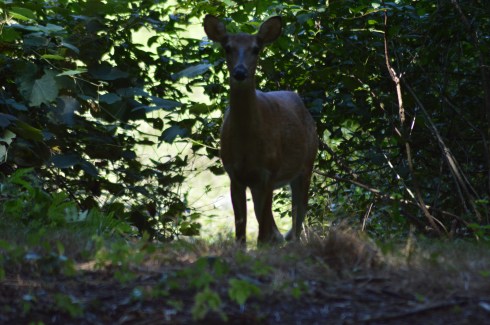
Highlights: interesting rock structures, jagged, rocky trails and wildlife

Lowlights: some of the trails can be dangerous, especially if there has been rain or snow in the area or if you do not wear proper footwear (hiking shoes are recommended)

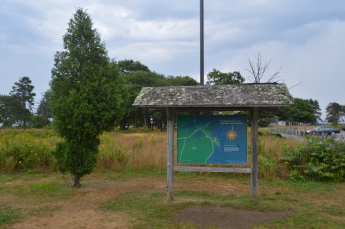
Web Site: Purgatory Chasm State Reservation

Trail Map: Purgatory Chasm Trail Map

dsc_0261

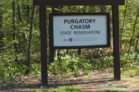
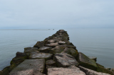
Purgatory Chasm might evoke images of the afterlife or the apocalypse.  But, no, it’s actually in Sutton, MA.

The trail of jagged stones is only .25 miles but they are difficult to cross in some parts and particularly dangerous when you’re carrying a camera.

The Chasm is believed to have originated because of the sudden release of dammed-up glacial meltwater near the end of the last Ice Age, approximately 14,000 years ago.

Almost as difficult is the incline next to the Chasm with such areas as as The Corn Crib, The Coffin, The Pulpit, Lovers’ Leap and Fat Man’s Misery.  The inclines are very steep in some areas on this route.  There are areas that have a smoother, less sharp incline (look for the rocks on the right side of the incline for these smoother declines).  I had to take the more steeper inclines and declines, of course.  Some of the views from the ledges are a little scary if you don’t like heights.  Some of the heights are as high as 70 feet in some areas and the rocky terrain below would not make for a very safe landing.

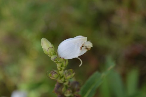
There are several trails you can take after tackling the Chasm.  We took the Charley Loop – an easy, mostly smooth trail with pretty flowers and rocky structures that is just over a mile long.

While walking along the Charley Loop, we found a rock with a strange crystal-like powder on it.

These crystals are Granite Pegmatite which is made up of clusters or clumps of minerals.  They generally contain mica, feldspar, beryl and quartz.

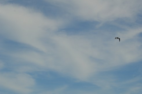
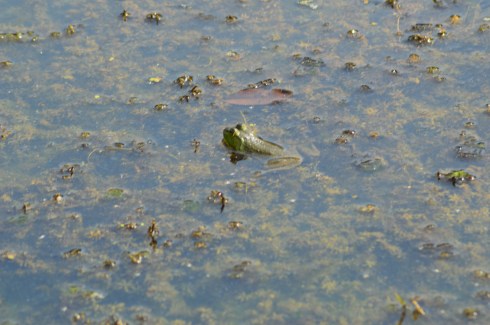
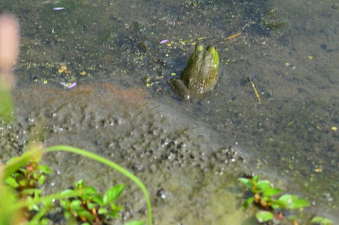
Beyond the chasm there is a pond with frogs, birds, possibly some turtles, flowers, and, of course, rocks.

There is also a large rock with a steep decline that has a slippery surface.  We found some children (and a few adults) sliding down it.

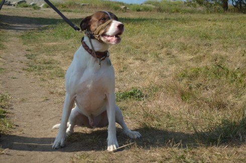
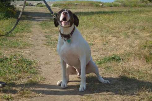
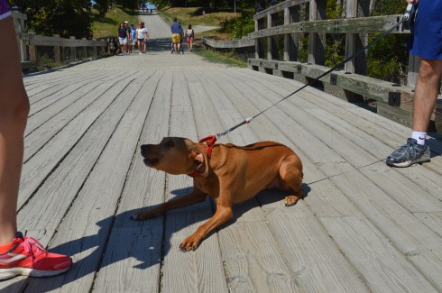
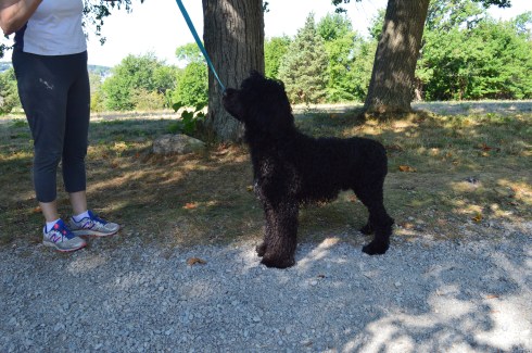
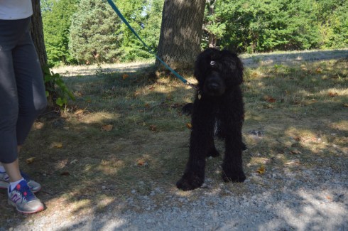
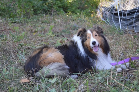
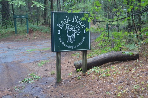
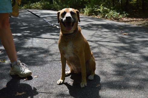
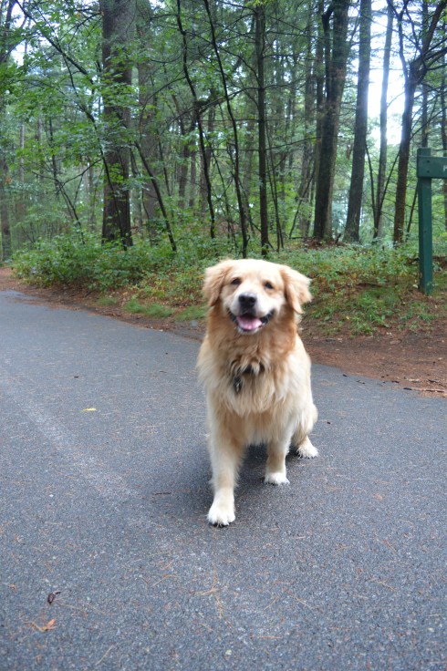
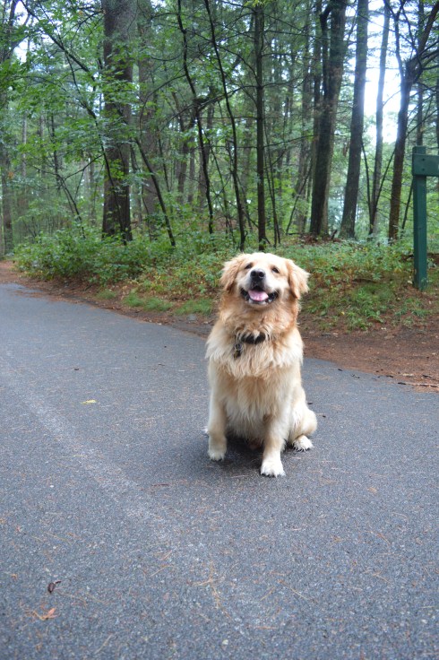
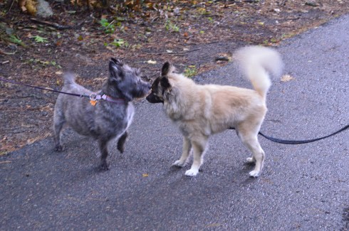
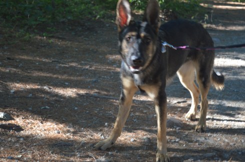
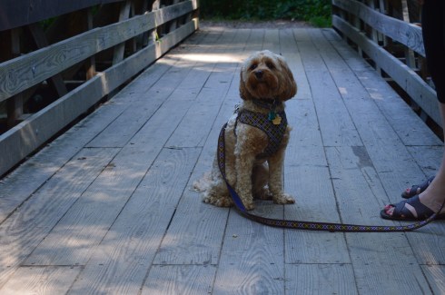
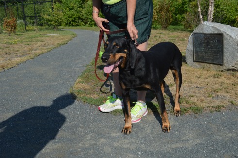
Purgatory Chasm is a great place to bring dogs for a walk (I would avoid taking them on the Chasm trail).  We saw a few dogs during our visit.

Gisele (not Tom’s Gisele, at least I don’t think so) is a 8 year old Yorkie.

Sawyer is a friendly 3 and a half year old Golden Retriever.

Charlie is a rescue dog who was being fostered.  Since he was a rescue, his foster family didn’t know his exact breed or his age.  He was taken in from the Lighthouse Animal Shelter in New Bedford, MA. Hopefully, he has a happy new permanent home now.

Below is a video looking over one of the many edges of the rocky incline next to the Chasm.

Please check out my facebook page and like it to see videos, photos and other content not posted on my blog.  Thank you!

Facebook


Glacial Potholes & Salmon Falls (Shelburne Falls, MA)

Date Visited: September 6, 2016

Location: Deerfield Ave, Shelburne Falls, MA

Hours: Open everyday, 24 hours a day

Cost: Free

Parking: There is off street parking with a 2 hour limit and police do take notice

Dog Friendly: Yes

Highlights: waterfall, glacial potholes, flowers, birds, shops, attractions

dsc_0344

The Salmon Falls and Glacial Potholes attraction in Shelburne Falls, MA, is a beautiful “two-fer.”  “Three-fer” if we include the bowling alley adjacent to the Salmon Falls and Glacial Potholes attractions.  IN fact, it is more accurately described as a “many-fer”s there are many attractions and beautiful attractions to the Salmon Falls area.

Although it may be best known for The Bridge Of Flowers (post to come shortly), beauty and grandeur abound Salmon Falls/Glacial Potholes area on Deerfield Ave.

The glacial potholes were ground out of granite during the high water of the Glacial Age.  The whirlpool action of the waves and the gyrating stones created the prominent holes in the stones.  It is said some of the grinding mills can still be seen in the smaller potholes.  Over 50 potholes exist in the confined area known as “Salmon Falls” when the the Native Americans resided here.  The potholes vary in size from 6 inches to 39 feet in diameter.  The 39 inch diameter pothole is considered the largest pothole on record.  And you thought the potholes on our roads were bad.


Salmon Falls, as it was dubbed by the Native Americans, was a common area for hunting and fishing.  The waterfall still gives some pretty views against a once industrialized scenery as the backdrop.

dsc_0248

What makes the Salmon Falls and Glacial Potholes area are the small shops and antiquated buildings that give the area a very old fashioned small town feel.  This is true for pretty much the entire community of Shelburne Falls.

There is a bench for sitting, feeding the birds and just taking in the beauty around you.

Almost as a prelude to the much heralded Bridge of Flowers (which is located only a short walk or drive from the Salmon Falls and Glacial Potholes area), flowers and trees bound the Salmon Falls area.

If you’re lucky you might even find a feathered friend to photograph.

dsc_0375

Deerfield Ave, the road that leads to Salmon Falls and the Glacial Potholes, still has the old town feel that adds tot he charm of the area.  In fact, the entire Shelburne Falls area still has many “mom and pop” shops and independent businesses rather than chain stores.  It was nice walking around without being bombarded by convenience stores and restaurant chains that seem to scar so many other towns.

The Shelburne Bowling Alley is one of the oldest bowling alleys in the country.  In operation since 1906 (and yes it is still open for business currently), the Shelburne Bowling Alley could easily be mistaken for a barn or some other structure from a different time.

dsc_0252

There is also a variety of art throughout the area.  Some of the art I noticed looked different from the art I have seen in previous visits.  So it appears they do change it up every so often.  The art honors the history of the area and gives information about the area.

Below is a video of the falls at Salmon Falls.  It was an overcast and somewhat windy day when we first arrived at the Falls so you may hear the wind in the video.  But, most of the sound is from the rushing waters of the Falls.

Similar Places In New England I have Visited:

dsc_0329

Wadsworth Falls State Park (Middletown, CT)


dsc_0913

Cascading Waters (Worcester, MA)

dsc_06561

Bash Bish Falls (Mount Washington, MA)


Canoe Meadows Wildlife Sanctuary (Pittsfield, MA)

Date Visited: September 3, 2016

Location: Holmes Rd, Pittsfield, MA (it is not clearly marked – it is about 2 miles down the road on the right hand side if you coming from the east)

Cost: Free but donations are appreciated

Parking:  There is room for about a dozen cars (see photo below)

dsc_0975

Trail difficulty: Easy

Park Size: 253 acres, 3 miles of trails

Time To Allot For Visit: 1 to 2 hours

Dog Friendly: No, dogs aren’t allowed on MA Audubon trails.

Highlights: pretty plants and flowers, a lot of wildlife, ponds, home to a community garden

Lowlights: Park is a little hard to find, some trails may be inaccessible or difficult to hike particularlywhen it rains

Web Site: Canoe Meadows Wildlife Sanctuary

Trail Map: Canoe Meadows Trail Map

I am always surprised at how some of the more beautiful areas to visit seem to be tucked away in the most unlikely places.  It’s almost as though they are meant to be kept a secret for just the few people who are adventurous enough to find it.  Such is the case with Canoe Meadows Wildlife Sanctuary.  Tucked away on a busy side street in the otherwise sleepy town of Pittsfield, MA, Canoe Meadows Wildlife Sanctuary (ironically, you can’t launch a canoe or any watercraft there) is a haven for birds, the occasional water faring mammal or amphibian and beautiful flowers.

The paths at Canoe Meadows are clearly defined and there are benches, bridges and boardwalks along the trail.

What stood out most to me about Canoe Meadows are the colorful plants and flowers and the trees.  The colors of the plants are so vibrant and the trees are nothing short of majestic.  I love the mix of pink, purple, white and yellow flowers as you can probably tell by my photos.

There are also a lot of bees at Canoe Meadows pollinating this time of the year.  There is a bee inside this flower.  You may be able to barely see the bees sticking outside of the flower.

dsc_0864


There are plenty of birds at Canoe Meadows.  They do like to hide.  So it is hard to get good photos of them.

I spotted this heron as he was flying away.  I just wish I saw the bird earlier.

dsc_0868dsc_0869

I also saw this chipmunk, one of the more common residents of the meadow.

dsc_0777

There were also lots of frogs at the meadow.

dsc_0882dsc_0879dsc_0878

Unfortunately, I did not see any of the otters, beavers and other critters that are said to inhabit this meadow (although I did see evidence of their existence there).  If you go early in the day or are very quiet, you may have better luck.  Good luck if you do try!

Similar Places I Have Visited In New England:

dsc_0005

Dorrs Pond (Manchester, NH)

dsc_07681

The Nature Trail And Cranberry Bog At Patriot Place (Foxborough, MA)

Please connect with me on one of my other social media sites to see videos, photos, links and other cool stuff not included in this blog!  Thank you.

Facebook (New England Nomad)

Instagram (@new.england.nomad_)

Twitter (New England Nomad)


World’s End (Hingham, MA)

Date Visited: August 28, 2016

Location: 250 Martin’s Lane, Hingham, MA

Hours: open everyday, 8:00 a.m. until sunset

Cost: $6 for adults, annual memberships which include free admission are available for $47

Size: 4.5  miles of continuous trails, 251 acres

Parking: there are three parking areas with roughly 20 spots each.  When I left at 1:00 p.m. the lot was full and there was a line of about half a dozen cars waiting to get into the park.

Time To Allot For Visit: 2 hours

Dog Friendly: Yes

Trail Difficulty: Easy to Moderate

Highlights: scenic views of the Boston skyline and surrounding area, wildlife, occasionally they display exhibits at the park, benches to sit along the trail, pretty trees and flowers, perfect for walkers, joggers, runners, cyclists and even horseback riders and anowshoeing during the winter

Lowlights: limited parking (if you follow the reservation Twitter they post alerts when the lot is full)

Website: World’s End

World’s End Trail Map

DSC_0988

I “misunderestimated” World’s End.  I figured it would be an “easy” quick jaunt (I usually save my easier treks for Sundays).  So, I slipped on my Chuck Taylor All-Stars and figured I would be home in a few hours.  Not the best choice of footwear in retrospect.  The trails can be rocky (particularly if you go off trail) and deceivingly steep in some areas.

There are a lot of side trails and it’s easy to get confused and cover the same area twice (or more) which can add quite a bit of time to your journey.  In fact, for a while, I thought World’s End would never end. It’s a good idea to take a map of the trails with you.  But, the trails are clearly marked and easy to negotiate with some slight inclines.

Undoubtedly, the main attraction for many visitors at World’s End are the views of the Boston skyline.  World’s End affords several views of the skyline and surrounding areas.  From the shoreline views to the views atop the highest point on the top of one of the many views of the rolling, hilly trails, the views are majestic.

World’s End is teeming with wildlife, particularly birds.  They’re very good at camouflaging themselves so you might have to squint to see a few of them.

But, the real gem of my visit was this deer I spotted on my way to Rocky Neck, one of the more secluded areas.  We stood mere feet away from each other staring, until she finally took off.

There are not just an abundant of bird life in the water.  Being a picture perfect summer day with low humidity and a slight breeze and calm waters, it was ideal for many of the boaters, paddlers and other seafaring folks.

This boater wanted some privacy, apparently.

World’s End has many other charming features such as this huge rock and an elevated viewing area for bird watching.

Of course, sometimes the more simpler things can be the prettiest features of the park.  These flowers, tress and views off the water caught my eye.

Some people took advantage of the shore to skim some stones.

DSC_0508

DSC_0622


If there is one photo that sums up a trip to World’s End it is this photograph of a hammock with a bicycle next to it.  World’s End is the perfect place to lie out in a hammock with only the sounds of nature to keep you occupied and maybe a good book or your Itunes collection.

DSC_0999

There is also an art exhibit on display until Oct. 31, 2017.  The display was created by Jeppe Hein, an artist based out of Copenhagen and Berlin.  He is known worldwide for his interactive exhibits.  The exhibit is called, “A New End”.  According to the website for the exhibit, Hein wants to invite visitors to reflect and to transform how we view a familiar place like World’s End.

There were dogs-a-plenty at World’s End during my visit.  World’s End is a great place for dogs to play around in since there are many open, grassy areas and, of course, water to frolic around in.

DSC_0474DSC_0483DSC_0488DSC_0478

Casey is a happy, 8 year old English Pointer mix.  He is a rescue.

DSC_0949DSC_0950

Gus is a 2 year old Ridgeback mix.  He was very excited to be at the park!

DSC_0651DSC_0650DSC_0643DSC_0647

Tande is an 8 month old Portuguese Water Dog.  If Tande looks familiar, you may have seen a similarly looking dog on the news.  The President also has the same breed of dog. Tande came all the way from the Odysea Portuguese Water Dogs breeder in Colorado.

DSC_0701DSC_0702DSC_0706

One of my easiest subjects to photograph ever, Bella is a gentle 7 year old Shetland Sheepdog.

I also saw a variety of other dogs playing in the water and running around.

viewsofanemergencyrn was kind enough to nominate me for the One Lovely Blog Award.  Thank you!  I usually don’t post about these awards but I figured I would play along since she was so nice to mention me and I wanted to acknowledge her.  She is a sweet, strong person and a survivor (read her post to see what I mean).

So, the rues are I have to mention 7 random things about me.

  1. I didn’t take up photography seriously until last year
  2. I  love dogs and all animals (big surprise there) but they also seem to love me – the key is to not show fear and be confident and friendly around them (they can sense fear)
  3. I am a pescatarian (I only eat seafood and do not eat meat, primarily)
  4. People often say I bear a strong resemblance to Donnie Wahlberg (but I can’t sing like him)
  5. Although I love dogs, I don’t have one (I have a cat instead)
  6. Until my work schedule got too busy, I had been an active literacy tutor at my local library
  7. I run (and/or walk) 3 miles (at least) a day everyday

The rules say to nominate other bloggers to participate.  But, I’m going to skip that part.  In my experience, people have usually already posted a blog like this in the past and don’t want to do it again, or they don’t participate or they seem to be too busy.  But, thank you, once again for the mention, viewsofanemergencyrn!  I do appreciate you and I look forward to reading more of your posts.  You all should also!

Similar Places I have Visited In New England:

111

Webb Memorial State Park (Weymouth, MA)

222

Blue Hills Reservation (Milton, MA)


Odiorne Point State Park (Rye, NH)

Date Visited: August 6, 2016

Location: 570 Ocean Blvd, Rye, NH 603-436-7406

Hours: Open everyday 8 a.m. to 8 p.m. (I got there well before 8 and the gates were already open).  Open but unstaffed after 10/11

Cost: $4 for adults $2 for children (ages 6-11), NH residents who are seniors (over 65) or younger than 6 get in free

Parking: There are about 50 parking spots in the main parking area.  There are additional parking lots along the beach

Time To Allot For Visit: 1 to 2 hours

Trails: Easy

Dog Friendly: No

Highlights: abundant wildlife (mostly birds), pretty flowers and trees, lighthouse (Whaleback Light), scenic views, play area for children, “sunken forest”, science center, historical site

Lowlights: Parking can be tough (especially during the summer), since it is considered a beach dogs are not allowed at the park

Odiorne Point State Park Trail Map

Odiorne Point State Park Website

DSC_0024

The location of the first English settlement in New Hampshire, Odiorne Point has a very storied past.

Named after the Odiorne family who settled there during the 1660’s, Odiorne Point is probably best known for being a military installation during World War 2.  Known as Fort Dearborn at the time, Odiorne Point was part of the military’s attempt to modernize the U.S. coast defenses.  Part of the military installation served as a radar station by the United States Air Force beginning in 1949, and in 1955 this became the Rye Air Force Station.  None of the Air Force’s installation remains there.  Looking at the historical remnants of the fort it is obvious how far we have come as a military power.  Real shells, a bunker entrance, a battery and other historical structures are scattered throughout the entrance to the park.

The park also has a science center located at the end of one of the main paths where people can learn about nature and the various wildlife that inhabit the park.

DSC_0020

The trails at the park were easy to negotiate.  However, if you do go off trail to get a closer view of the surroundings and wildlife you have to be careful and be mindful of the water level.  I will touch on this later in the post.

As you can see from the photos above, the plants and trees at Odiorne are beautiful even if they are directly next to a dumpster.

Only about an hour’s drive north of Boston, Odiorne Point has something for people of all ages to enjoy. There is a play area for children as well as picnic tables and benches for people to sit and eat while they take in all of the beautiful views.

This particular family had a hungry visitor eyeing them as they ate lunch.

DSC_0653

The birds are one of the main attractions of the park.  A wide variety of gulls, egrets and other birds frequent the park.

This slideshow requires JavaScript.

The views at Odiorne State Park are pretty all year round.  The lighthouse, Whaleback Light, provides a majestic backdrop for any photo.  The weather was very erratic when I made my visit.  It was rainy and raw when I first arrived at the park in the early morning hours.  After waiting out the rain, the clouds gave way to the sun.  Then, the wind picked up and drove the waves against the rocks.  Basically, I experienced just about all the weather New England has in one day.  In other words, it was a typical New England day.

Perhaps the biggest attraction of Odiorne Point State Park is the “sunken forest”.  If you arrive during low tide, you can see what used to be a forest or some other land.  What appears to be tree stumps, rocks and other land based structures appear on the floor of what will rapidly become the bottom of the body of water.

So, during low tide you can easily traverse these rocks (make sure to not try this with sandals on or barefoot) and get closer to the birds, ocean and other rocks.  One important thing to keep in mind is the tide comes in pretty quickly.  I made it out to the rocky area where the birds were all hanging out.  Then, suddenly, I realized just how much water had accumulated around me.  I quickly ran/sloshed through ankle deep water along the pebbles to make it back to land before it got too late.  If I waited half an hour longer I would have been swimming back to shore.  Below are some side side examples of just how quickly the water rises.  The time lapse is only about an hour.

Below are two videos of the waves and scenery at Odiorne Point.

Similar Places In New England I Have Visited:

dsc_05202

Colt State Park (Bristol, RI)

dsc_00902

Moswetuset Hummock (Quincy, MA)

dsc_08381

Hammonasset Beach State Park (Madison, CT)

Please Follow Me On:

Facebook

Instagram

Twitter


Breakheart Reservation (Saugus, MA)

Date Of Visit: August 14, 2016

Location: 177 Forest St, Saugus, MA 781-223-0834

Parking:  There are about 30 parking spots at the entrance to the park.  There is also off street parking and parking available down the street at Kasabuski Arena (201 Forest St).

Cost: Free

Hours: Open everyday sunrise to sunset

Size: 640 acres

Time To Allot For Visit: At least 1 to 3 hours

Trail difficulty: Easy to Moderate in some areas

Dog Friendly: Yes

Fun For One: Yes

Highlights: scenic views – especially from Eagle Rock, beach, play area for children, trails for cycling and running, fishing is allowed

Lowlights: side trails end without warning, some rocky terrain

Trail Map: Breakheart Reservation Trail Map

Website: Breakheart Reservation

DSC_0200

Once a hunting ground and camp area for Paleo Indians as far back as the Archaic and Woodland eras (roughly 1000 – 2000 BCE),  Breakheart Reservation boasts two grand lakes, scenic vistas, a beach, a play area for children and miles of trails.

The trails are mostly easy with some moderately difficult trails and inclines.  The side trails can be challenging more because of the rocky and narrow terrain rather than the inclines.  The one downside to taking the side trails is that some of the side trails end without warning, such was the case with the Saugus River Trail which is one of the first side trails you will see when you enter the park.  The Cedar Glen Golf Course abuts the park.  So, you’ll hear and see golfers whacking their golf balls around.  Also, one side trail leads to the children’s camping site which you’re not supposed to access and yet another trail just ends near a store’s parking lot.  So, you end up walking long distances only to have to turn around.  If you want to avoid walking on trails that end suddenly, it’s best to stay on the main trail and the trails that loop around the lake.

The two lakes at Breakheart Reservation, Pearce Lake and Silver Lake, have trails that loop around the bodies of water.

Pearce Lake (considered the lower pond) has a beach and some very pretty views.  It runs along the main trail and along some of the side trails.  It is the larger of the two lakes and it is where the beach is loacted.

Although Lake Pearce is the larger of the two lakes, I found Lake Silver (the upper pond) to be more intriguing than Lake Pearce.

Lake Pearce has two smaller islands in the lake.  One of the islands is accessible via a makeshift walking bridge of branches, sticks and anything else that you can walk on to get to the island.  Except for some pretty views there wasn’t much on the island.

At an elevation of 206 feet, Eagle Rock offers scenic views of the Boston skyline and surrounding areas.  One suggestion I would make if you do try to climb up to Eagle Rock (it’s a moderate climb) is to use the “back” way to the vista (aptly names Eagle Rock Trail).  I went straight up along the rocky edge along the Pearce Lake Trail and it was more challenging than it would have been if I had gone up via the trail on Eagle Rock Trail.  There are other points of higher elevation on other trails such as Castle Rock and Crow Hill.

There are many other beautiful and interesting things along the trails at Breakheart Reservation.

This slideshow requires JavaScript.

Breakheart has a paved main trail which is usually packed with runner, cyclists and people walking their dogs, especially at the Bark Place where dogs are allowed off leash for a section of the trail.

DSC_0327

Breakheart Reservation stopped allowing vehicles on the trails some time ago.  It was great not having to look over your shoulder or carefully turn a corner worrying if a car or other vehicle might be coming your way.  It also allows lots of room for all the walkers, runners and, of course, the dogs that frequent the park.

These dogs had a great time at Breakheart Reservation during my visit…

DSC_0707DSC_0702DSC_0704DSC_0705

Bailey is a 6 year old Black Mouth Cur

DSC_0337DSC_0336DSC_0335DSC_0334

Cooper is a 7 year old Golden Retriever.

DSC_0217DSC_0235DSC_0250

DSC_0211

Free is an 8 year old Bichon and Shih Tzu mix.

Follow Me on Twitter:

New England Nomad – Twitter

and like me on Facebook:

New England Nomad – Facebook

or follow me on Instagram:

New England Nomad – Instagram

Similar Places In New England I Have Visited:

dsc_0237 (2)

Dorrs Pond, Manchester, NH

dsc_03413

Ipswich River Wildlife Sanctuary

rutland

Rutland State Park

Below is a video of the view from Eagle Rock.


Dorrs Pond (Manchester, NH)

Date Visited: August 7, 2016

Location: Dorrs Pond is part of Livingston Park which is located at 244 Hookset Rd, Manchester, NH (off Daniel Webster Highway)

Hours: Open 24 hours (use your best judgment if you go at nighttime)

Cost: Free

Parking:  There are about 70 or so parking spots by Dorrs Pond.  There is also additional parking by the play area and field by Livingston Park.

Dog Friendly: Yes

Size: 1.2 mile loop with some short side trails.

Time To Allot For Visit: 1 or 2 hours

Fun For One: Yes

Highlights: abundant wildlife, popular trails for runner, cyclists and walkers, pretty views, very well maintained, benches for sitting, skating on the pond during the winter

Lowlights: short loop (only 1.2 mile) so many runners have to complete the loop several times to get a good workout, some side trails end abruptly at parking lots or just stop without going anywhere

DSC_0338

Once an artificial pond to serve the people of Manchester, Dorrs Pond now serves a scenic retreat for cyclists, runners, nature lovers and dogs.

“hidden gem” is a phrase that gets thrown around a lot.  But, the photos below will show how this description is apt for Dorrs Pond.  In fact, I, and many people I talked to about it, had never been to this pond or ever even heard about before I went there.

One of the great things about Dorrs Pond is it is not a particularly difficult trail.  The trails are Dorrs Pond are pretty level with a few small inclines

The views at Dorrs Pond are beautiful.  Vivid greens and a variety of green, purple and other vibrant colors dot the landscape.

One of the best parts of Dorrs Pond is the wildlife.  There is a variety of birds, amphibians and other animals at the pond.

I also found this interesting shelter.  Unfortunately, no one was home.

During the winter, skating is allowed on the pond.  Also, there is a play area, playing field, restrooms and pool for children (and some adults) in addition to Dorrs Pond at Livingston Park.

Doors Pond is a great place to bring your dog.  The trail is not too long and the inclines are not very steep.  And it was a perfect day for taking your pooch out for a stroll.  I saw lots of dogs at Dorrs Pond.  Here are a few of the cute dogs at the park Sunday:

Katie, a 9 month old German Shepherd.

DSC_1000DSC_1001

Finley, a Cavachon who will be 2 in September

DSC_0114DSC_0113DSC_0116

Reagan, a 4 month old Golden Retriever

DSC_0149DSC_0152DSC_0160

and Jackson, a 2 year old Basenji Greyhound.

DSC_0279DSC_0278

Please follow me on Facebook: New England Nomad

Similar Places In New England I Have Visited:

ames

Ames Nowell State Park

cutler1

Cutler Park


Scott Tower (Holyoke, MA)

Date Visited: July 30, 2016

Location: 8 Scott Tower Rd, Holyoke, MA, behind the Community Field Park at 51 Community Field Park, Holyoke, MA

Hours: Open everyday, no hours listed but it can be dangerous at night

Cost: Free

Parking: Roughly a couple of dozen parking spots are available at Community Field

Dog Friendly: Yes

Time To Allot For Visit: Between half and hour and an hour

Highlights: the tower, pretty views of West Springfield and the surrounding area, wildlife, plant life, easy mile hike

Lowlights: Graffiti all over the tower (all. over), a lot of broken bottles and other litter on the premises, some stairs to the top of the tower have holes in them or are missing, tower not accessible by car

Fun For One: Yes

DSC_0200

The walk to the tower is an easy mile walk with a few moderate inclines.  An easy way to locate the trail to Scott Tower is to look for the overpass.  Walk directly under the overpass and stay on the asphalt trail.  There are a lot of side trails and trees, plants, graffiti and remnants of what looks like used to be a waterfall or wall.  Now, the party days are way behind the Nomad but zig zags and 4:20?  Well, I guess things don’t change that much after all.  You crazy Holyoke kids.

Below is a side by side comparison of what the tower reportedly looked like in its heyday (July 16, 1972), a photo of what it looked like in May 31, 2004 and what it looks like now (July 30, 2016).  Yes, it’s pretty cringe worthy.

As a footnote, the tower was originally built in 1942.  Also, there used to be a fence around the tower which you can see at the bottom of the second photo taken in 2004.  The fence seemed to work as there is very little if any graffiti on the tower in the second photo.  Of course, the fence was torn down (presumably by visitors) and the graffiti and vandalism escalated.

There was also a lot of rustling in the brush from squirrels, chipmunks and other types of wildlife.  The vulture on the pole we saw on the way to the tower seemed like a bad harbinger.

Once the main attraction of Craft Hill at Anniversary Hill Park, Scott Tower is now a shell of what it once was.  Graffiti and litter cover the tower and it appears to be in disrepair.  In fact, you can see some remnants of what look like what used to be tables or shelters.  Even with all of the graffiti and litter, the tower is still impressive.

Not all of the graffiti was just messy chicken scratch.  Whenever I go to a landmark in MA, especially Western MA, there is bound to be some artistic renderings.  There wasn’t anything too artsy there but these images did catch my eye.


Scott Tower has two areas for observation.  There is an observation deck on the second floor and there is an enclosed area at the top of the tower.  The tower offers views of nearby Mount Tom and the Holyoke area.  The views are pretty sweet.  Just be careful if you  do go to the top.  Some of the stairs are missing or have holes in them.

It’s pretty far down from the second floor of the tower.

DSC_0083

The tricky thing about accessing Scott Tower is you have to park at Community Field Park (use the entrance off Cherry St).  The entrance is behind the park.  There is usually a gate up that you can easily navigate around.  You will have to pass under an overpass on your way to the tower.  It is about a mile walk to the tower.  You will see many side trails on your way to the tower but stay on the main trail for the easiest, most direct route.

While I was at Community Field Park before we began the walk to Scott Tower, we saw this beautiful dog.  Remy is a 4 year old Black and Tan Coonhound

DSC_0019DSC_0036DSC_0035

Below are some videos of a walking tour of the tower.  I really had to watch my step in the first video.  So, it’s mostly a video of the stairs and me wheezing.

I had to stop the second video so I could take some photos of the openings in the tower and the walls.

Just as an aside, I am regularly updating my categories at the top and bottom of my posts.  The “fun for one” category at the top simply means it can be fun to do by yourself.  Being a single person, I often take this into account before I decide to photograph or visit places.  I went with my mom this time so it was a lot of fun but it was something you could do by yourself or, better yet, with a dog!

Similar places in New England I have visited:

poets1


Poet’s Tower, Greenfield, MA

bancroft

Bancroft Tower, Worcester, MA

Similar places in New England I have not visited (yet):

scargo

Scargo Tower, Dennis (Cape Cod), MA

newport

Newport Tower, Newport, Rhode Island


Salem Willows (Salem, MA)

DSC_0180

Date Visited: July 23, 2016

Location: 167 Fort Ave, Salem, MA

Hours: The website for Salem Willows shows their hours as being daily from 11 a.m. to 11 p.m. but you can get in to the park before 11.  We got their just before 10 and there was already some people there.  I think the hours are the hours of operation for the restaurants and other businesses in that area.

Cost: Free

Parking:  There are about 60 metered parking spots.  The meters cost 25 cents an hour.  There is also about 50 additional free parking spots in a nearby lot and off street parking is available.

Dog Friendly: Yes

Highlights: Family friendly, arcades, restaurants, willow trees, harbor, scenic walking path, grassy areas to grill, relax and for kids to play, jetty, place to rent surfboards and other aquatic sporting goods

As I entered Salem Willows I couldn’t help but think of my childhood of carnivals and traveling shows.  My friends and I would be so excited when the fair came to town.  Now, the fair is always in town.  In these days of sit down eateries and chain restaurants, it was refreshing.  If you d go, try the slushies or get a cone at Cappy’s!

Salem Willows has changed so much since its original opening in 1880.  Willows Pavilion which featured a skating rink and restaurant dominated the landscape.    Now, the area where the takeout food vendors are located still keeps the name of “on the line”.  But, the restaurants are much different.  In place of the sit down, grand restaurants stand take out vendors and ice cream shops.

There is also a stage for bands and other entertainers to perform.  Named after former  Salem resident and veteran, the Robert F Hayes Band Stand holds a summer concert series every year as well as holding other events.

DSC_0035

But, there is so much more to Salem Willows than nostalgic stroll past the smell of flour dough and the buzzing and ringing from the vendors and arcades.  Salem Willows is also, as the name would suggest, known for all of the willow trees planted to offer shade and beauty to the area.

The mostly shady loop around the bay and back too the parking area is an easy half mile walk.  Along the way there are benches to sit on and a jetty to fish off or just enjoy the views. The views from the bay were very pretty.  A variety of flowers and scenic views frame the busy blue waterway.

There was a lot of activity on and in the water at Salem Willows.  That is a man swimming in the last photos

There is also a place to rent surf/paddle/body boards and other watercraft and flotation devices.

DSC_0141

Salem’s love of art is evident even in the most unlikely places.  These trash cans and rocks displayed some of the street art of Salem.  I especially like the art on the rocks.  Each block has a different symbol of the area painted on them.

This slideshow requires JavaScript.

Salem Willows is a great place to bring your dog for a short walk.  Dixie, a 4 year old Maltese, was enjoying the seasonal weather and cool breeze when she stopped to pose for photos for me.

DSC_0244DSC_0236

DSC_0240

Video of “on the line” from Salem Willows


Ipswich River Wildlife Sanctuary (Topsfield, MA)

Date Visited: July 16, 2016

Location: Mass Audubon, 87 Perkins Row, Topsfield, MA (about half an hour north of Boston, MA and an hour southeast of Manchester, NH) 978-887-9264

Hours: presently,  Tues–Fri, 9 am–4 pm
weekends & Mon holidays, 9 am–5 pm

November-April
Tues-Sun & Mon holidays, 9 am-4 pm

May-October
Tues–Fri, 9 am–4 pm
weekends & Mon holidays, 9 am–5 pm

Trails
Tues-Sun, & Mon holidays, dawn to dusk

Cost:

Members: Free
Nonmembers:
$4 Adults
$3 Children (2-12)
$3 Seniors (65+)

Parking: There are about 50 parking spots.  You shouldn’t have too much of a hard time finding parking unless there is an event or summer camp is in session

Size: 12 square miles

Time To Allot For Visit: I was there 5 hours and I still didn’t see everything but you can take in most of the best parts of the park in 2 to 3 hours

Dog Friendly: No, most Audubon parks are not dog friendly

Highlights: bodies of water, plentiful wildlife, pretty flowers and plants, observation tower, canoe rentals (if you’re a Mass Audubon member)

From the moment I walked to the visitor center at the Mass Audubon Ipswich River Wildlife Sanctuary, I encountered wildlife.  In fact, I found this rabbit chewing on some greenery in the shrub by the office.

DSC_0763

That is the great thing about Ipswich River Sanctuary.  If you’re an animal lover, or even if you just like them a little, then you will love this place.

Not only are the animals abundant, they are also relatively friendly and not all that shy.  Well, most of them weren’t too shy.

This slideshow requires JavaScript.

The well-fed red squirrel let me get very close to him or her, so long as I didn’t affect his or her food supply.  A lady who had been sitting there on the bridge wall before I arrived has been intentionally leaving seeds or some other type of food the squirrel was enjoying which allowed me to get some great shots.  Thanks, random lady!

There are also a wide variety of bugs and other insects at the park.  Bug spray and covering up are a must (I especially suggest a hat since one particular bug kept landing in my hair).  And most bug sprays don’t stop all bugs.  The black insect below was particularly menacing.  Also, I never saw so many dragon flies in one spot as I did at Ipswich River Sanctuary but they were pretty harmless.

There are some beautiful views and plant life at Ipswich River Wildlife Sanctuary.  The colors of the flowers really pop out and the trails are well defined.  Many of these pretty features of the landscape were created 15,000 years ago by a glacier.

This slideshow requires JavaScript.

You can also rent canoes, if you are a member, for $10/hour for a minimum of 2 hours.  So, the cost is $20 or more.  You pay for the canoes at the front office and then you have to lug the paddles and life vests along with a key to the where the canoes are locked up (about a half a mile or so away) at the canoe launch.  The canoe launch is right next to where the canoes are locked up.

One thing I have seen at other parks that is present at Ipswich are bat boxes.  These bat boxes are designed to give daytime roots for little brown bats.  Bats are important because they eat lots of mosquitoes and other insects, the plaque next to the boxes explains (then get more bats there please).  Little brown bats have been the victims of white nose syndrome,an illness which has been affecting brown bats while they hibernate during the winter.  The cause is not yet known.  So, the boxes are meant to give them a safe and convenient way for them to rest.  The boxes were constructed by Eagle Scout Sean Enos and Boy Scout Troop 48 of Lynnfield, MA.  The lumber was donate by a local business.

There is also an observation tower at Ipswich Wildlife Sanctuary.  The three story tower built of wood is a little shaky but safe.  The tower overlooks a swamp and meadow.  There wasn’t much wildlife except for the very occasional bird  (I included photos of the egret and other bird who landed in the water in the earlier slideshow).  I think that is you had unlimited time and a lot of patience as well as a good set of binoculars (I didn’t have any of those things) you could see a few grand birds.

This slideshow requires JavaScript.

One of the things I noticed and I had not seen before my trip to Ipswich are pink water lilies.  I have seen white water lilies but never saw the pink water lilies until my visit there.

Like most Mass Audubon sanctuaries, the Ipswich River Wildlife Sanctuary is well kept and family friendly.  The grounds are well manicured and there is even a play area for children.  They also have a summer camp program where they teach children about nature in a fun and exciting way.  All in all, the Ipswich River Wildlife Sanctuary is a fun and exciting place for people of all ages.

Please connect with me on Facebook: New England Nomad’s Facebook Page