Tag Archives: Nature

Feeding Birds (Mass Audubon Ipswich River Wildlife Sanctuary, Topsfield, MA)

Date Of Visit: Nov. 8, 2025

Location: Mass Audubon Ipswich River Wildlife Sanctuary. 87 Perkins Row, Topsfield, MA (30 minutes northeast of Boston, MA)

Cost: $7 for adults, $4 for children seniors. Memberships are also available.

Hours: Trails are open dawn until dusk

Parking: There are about 50 free parking spots for visitors

Dog Friendly: No

Universally Accessible: Yes, while some trails may be challenging, the Audubon has an ADA-compliant, universally accessible All Persons Trail. Also, a rollator is available for loan upon request

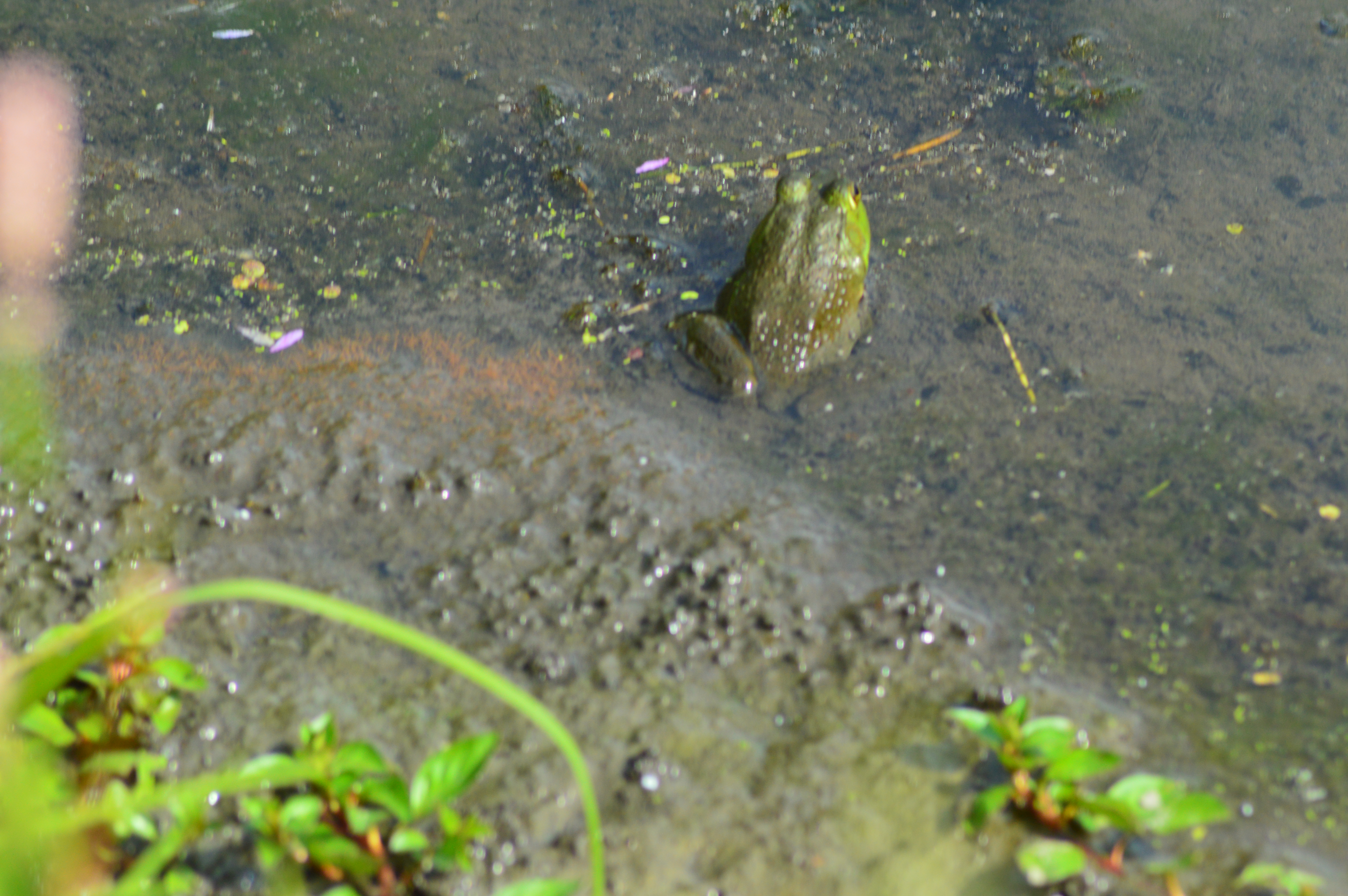
Summary: The Mass Audubon Ipswich River Wildlife Sanctuary in Topsfield, MA, has many features and natural beauty. But, it’s an especially magical this time of the year when they\ hungry birds enjoy hand fed treats.

As the temperatures dip and food becomes less available, you may be surprised by how friendly the wildlife can be. Especially our feathered friends.

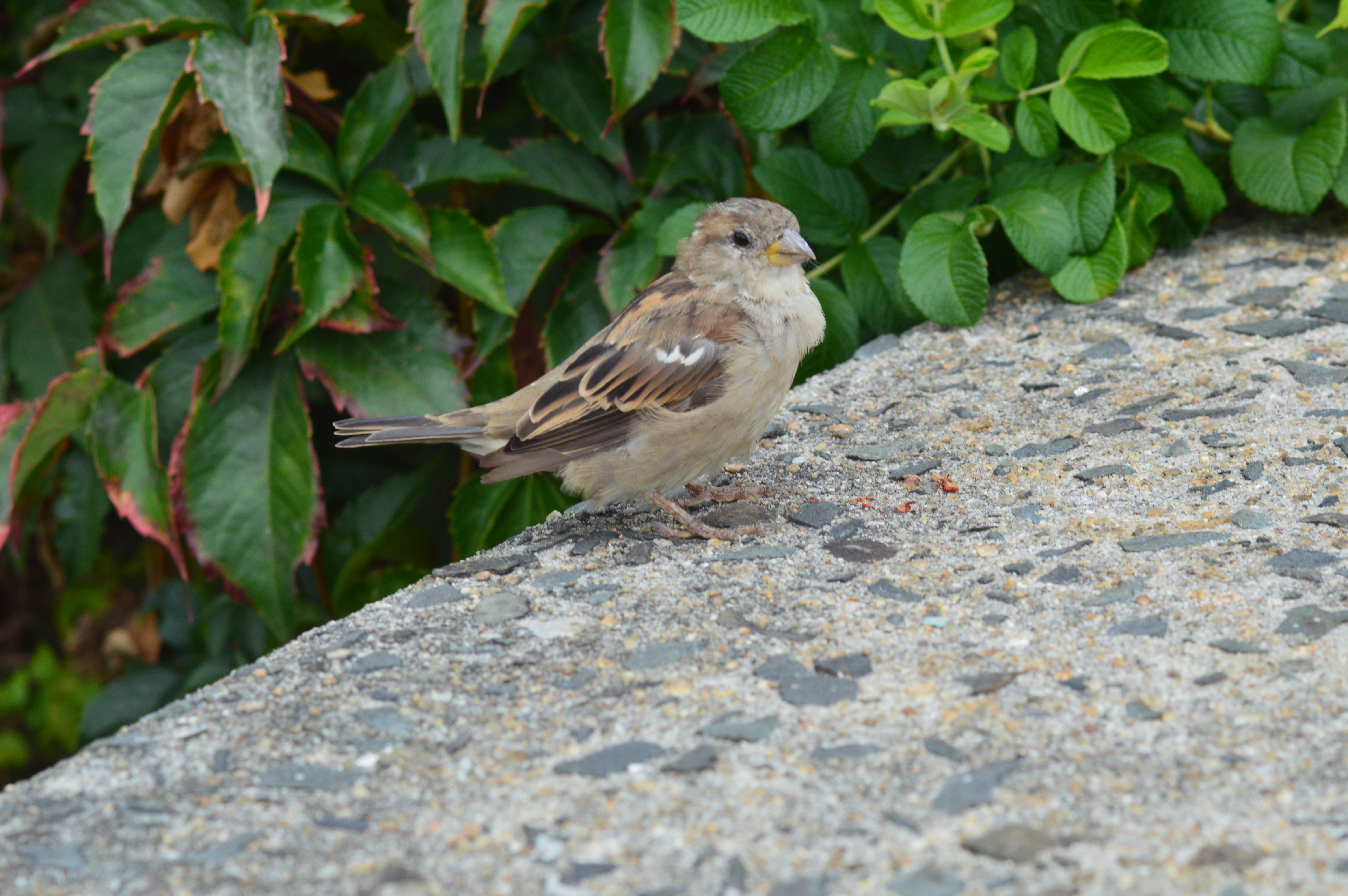
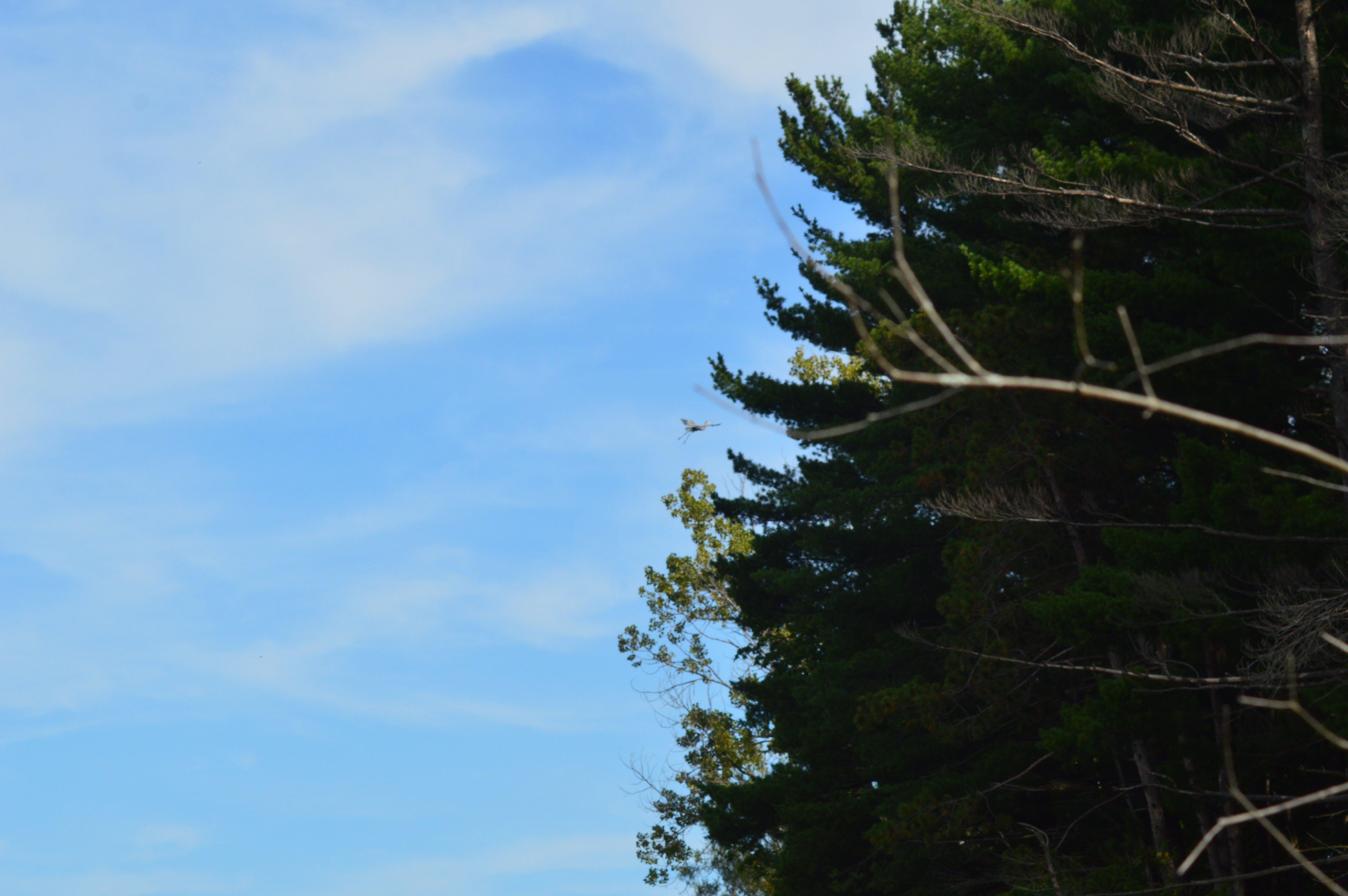
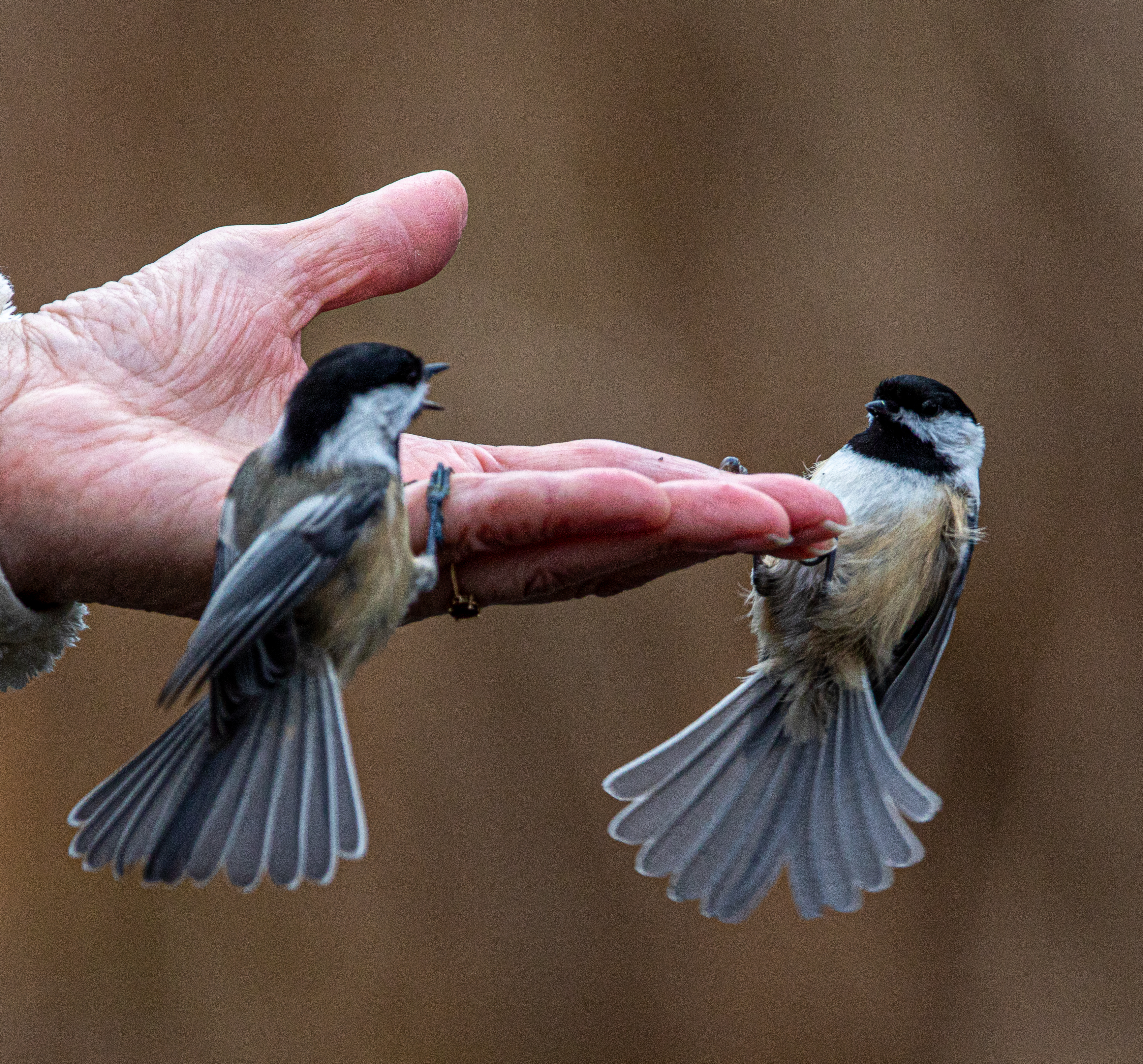
There are only a few spots in Massachusetts where birds will eat of your hand. And, only a few birds that will be bold and trusting, or hungry, enough to do so. In fact, some of the birds are so bold it almost feels like you’re in a Alfred Hitchcock movie (I’m looking at you, Black-Capped chickadee).

The Nuthatch, like the one featured above, is one of these birds that will eat right out of your hand. I especially like how they show you the seed before they begin their takeoff from your hand. As if to say, “Look what I have!” or “Thank you!”

If you enlarge the photo below, you can see the tongue of the Nuthatch picking up and bringing the seed into their mouth,

The Black-Capped Chickadees at the sanctuary are very friendly and not very shy. In fact, one of them landed on my cellphone as I tried to photograph the bird. This one had to tell a fellow Chickadee, “I was here first!”

But, my favorite and at times the most elusive bird there is the Tufted Titmouse.

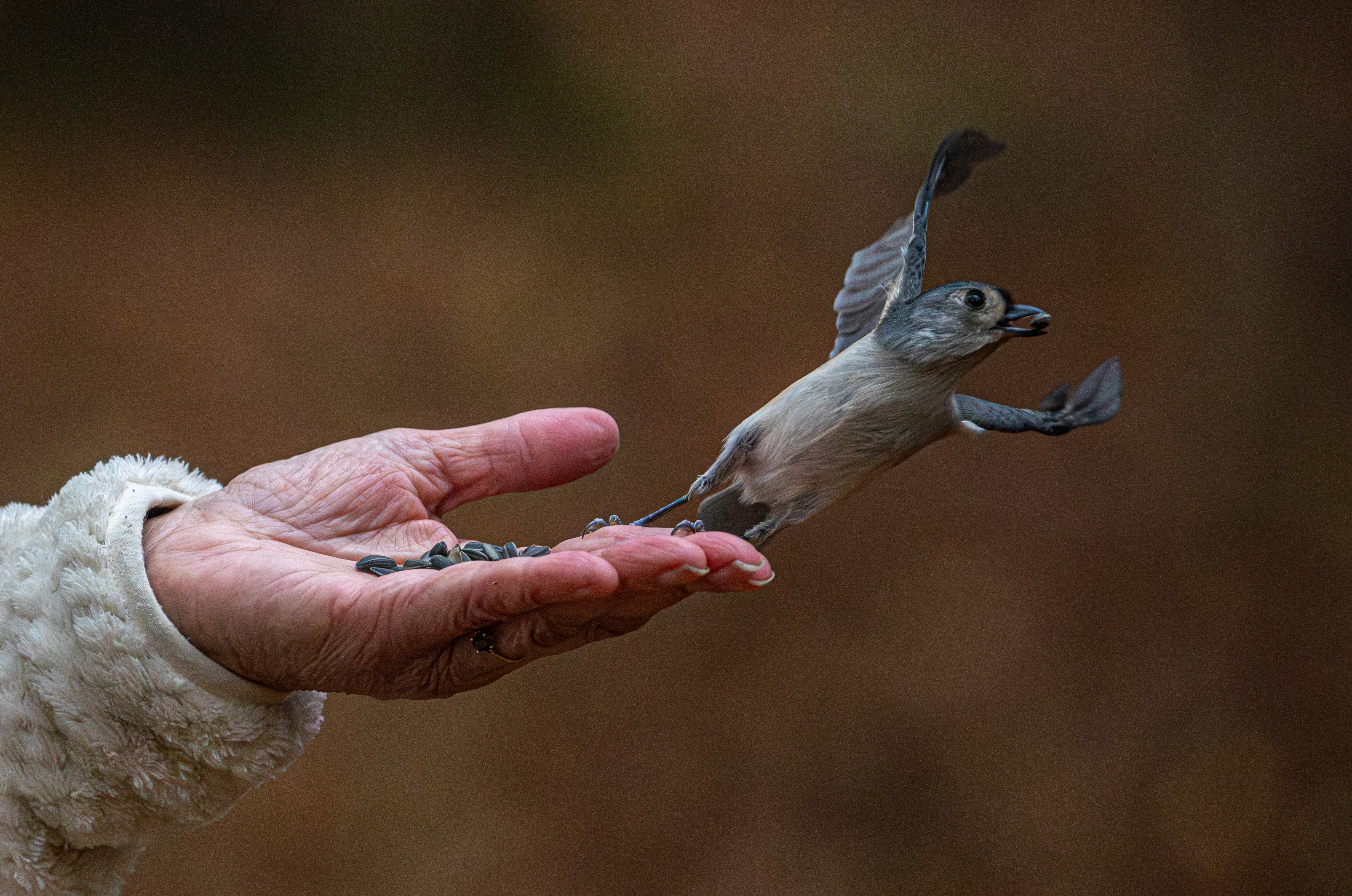
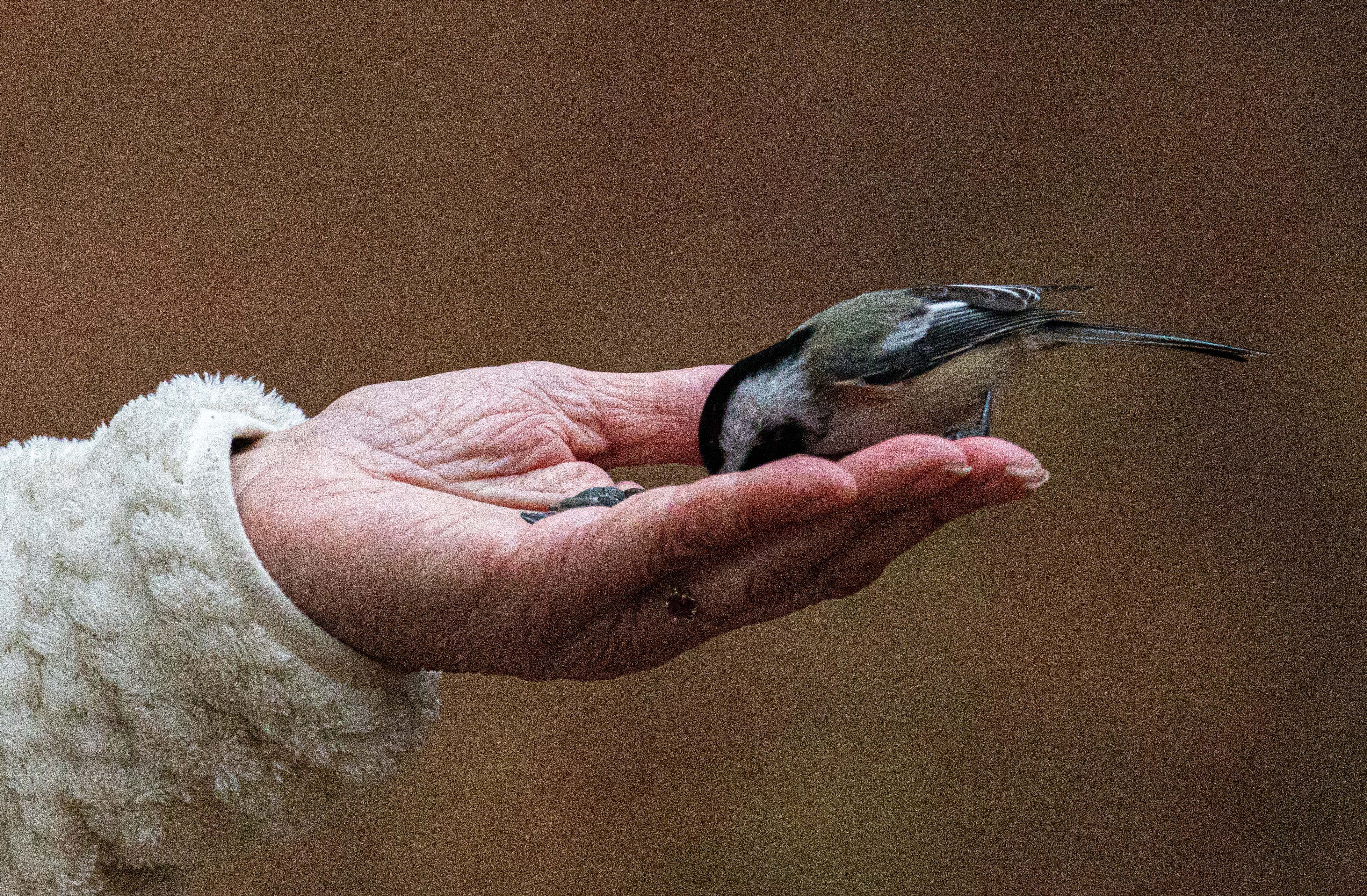
While their claws may look sharp, and they can be, the birds don’t hurt the people feeding them. At least not usually. The person I photographed feeding the birds said they felt soft and light and you could barely feel the claws. And don’t bring just any seeds. The birds seed of choice is the Black-oil Sunflower seed which provides significant energy for the birds due to their high oil content. They won’t even touch some of the other types of seeds. In fact it can’t be just any Black-oil Sunflower seed. Some of the Black-Capped Chickadees would pick through the Black oil Sunflower seeds just to find the right one.

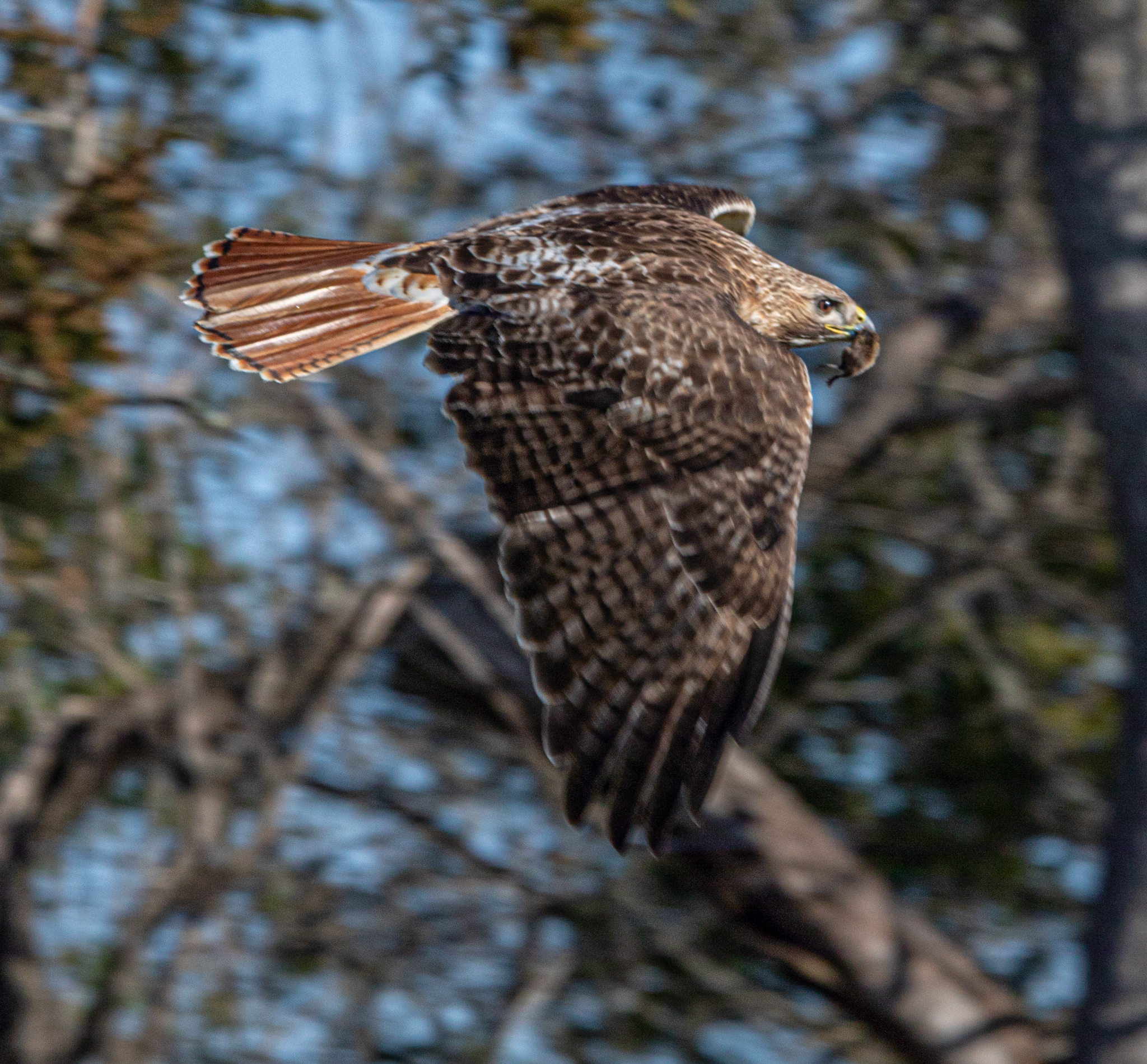
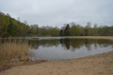
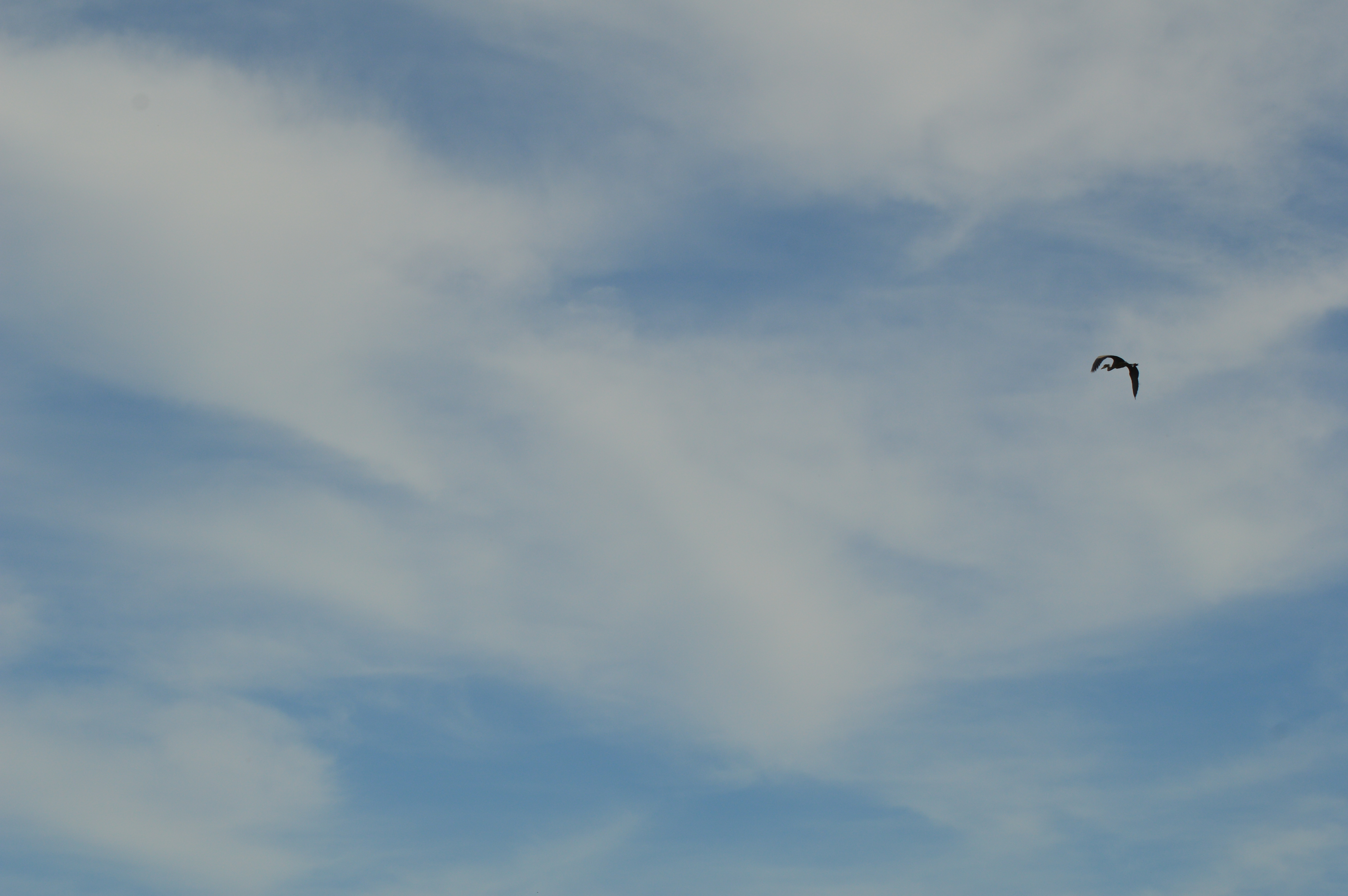
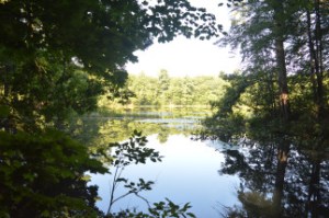
This sanctuary, which I may not be able to photograph much longer (more on this later in the post), has been my go to sanctuary for the past few years. In fact, there always seem to be something interesting to photograph there, like this Red Tailed Hawk I saw during my visit.

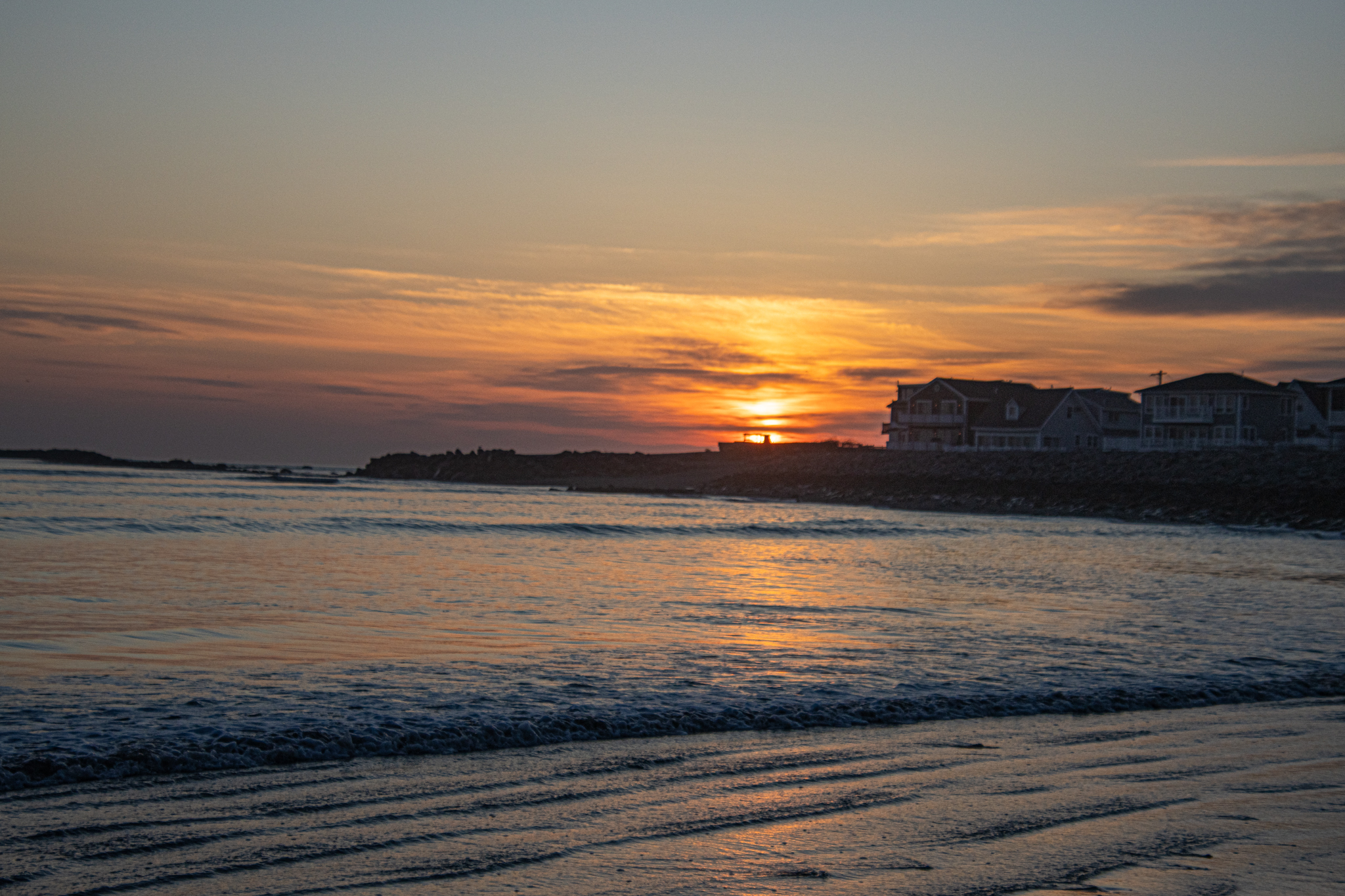
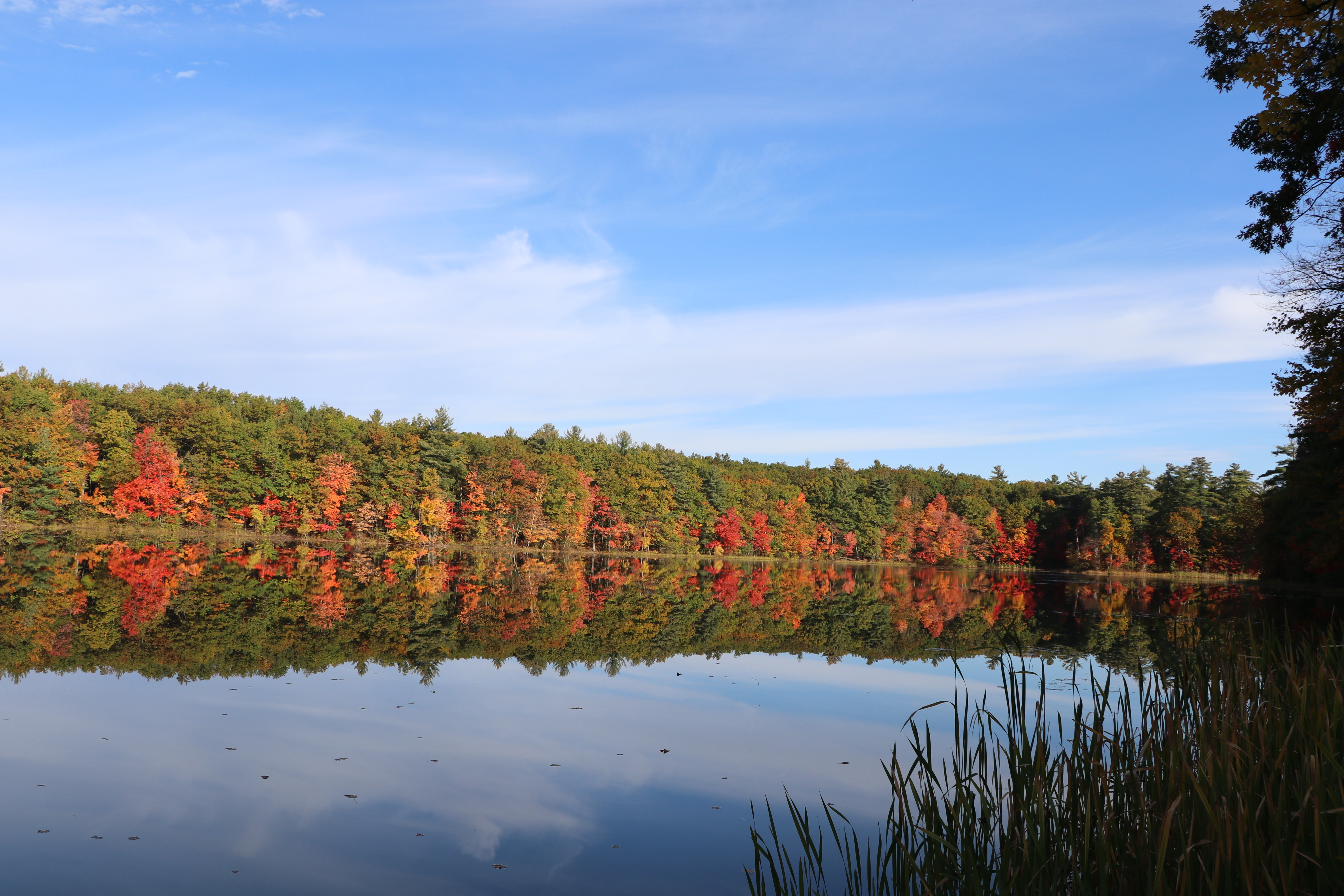
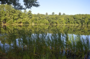
Also there was a little mist on the water during my photo shoot.

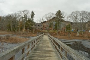
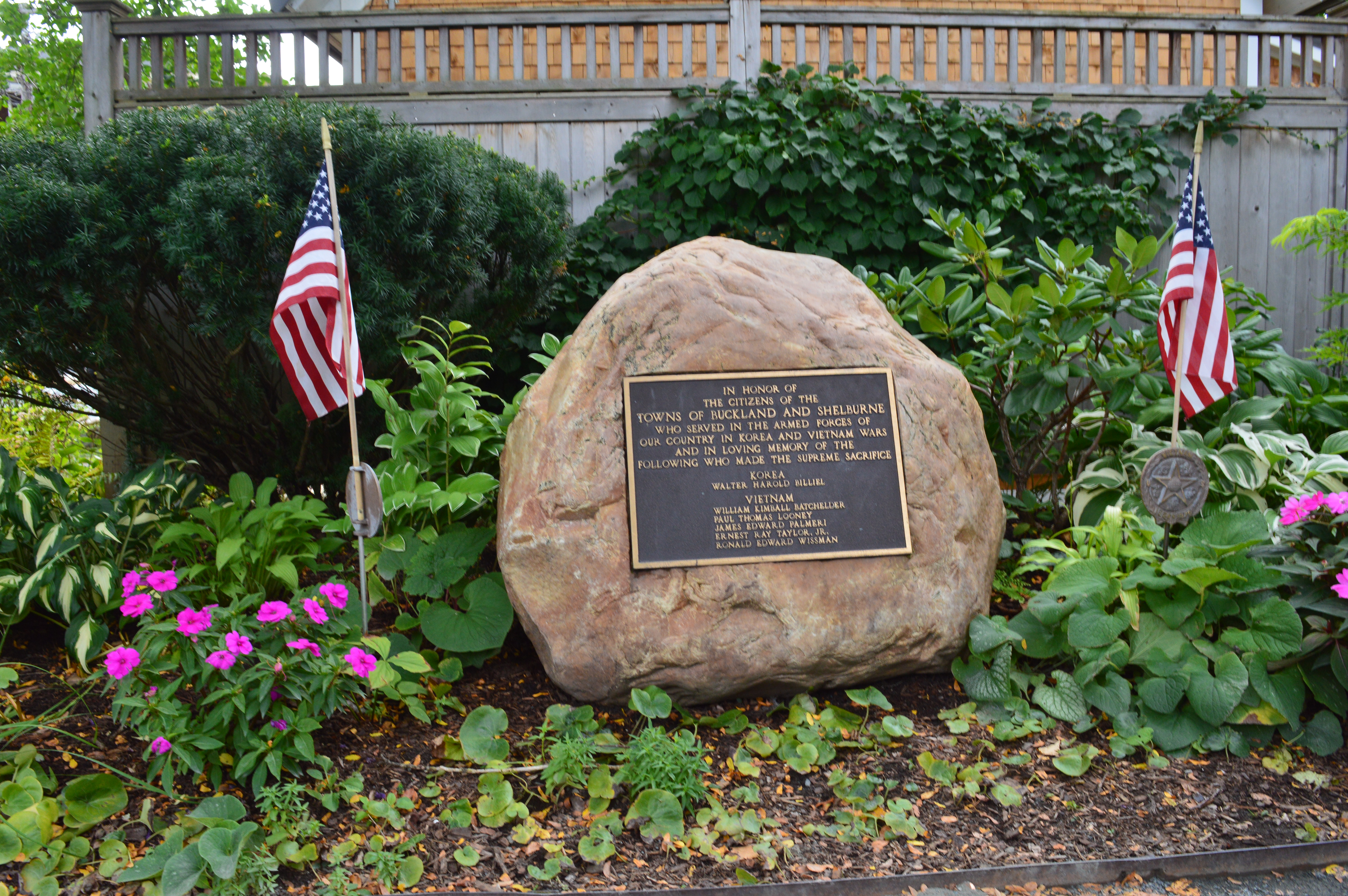
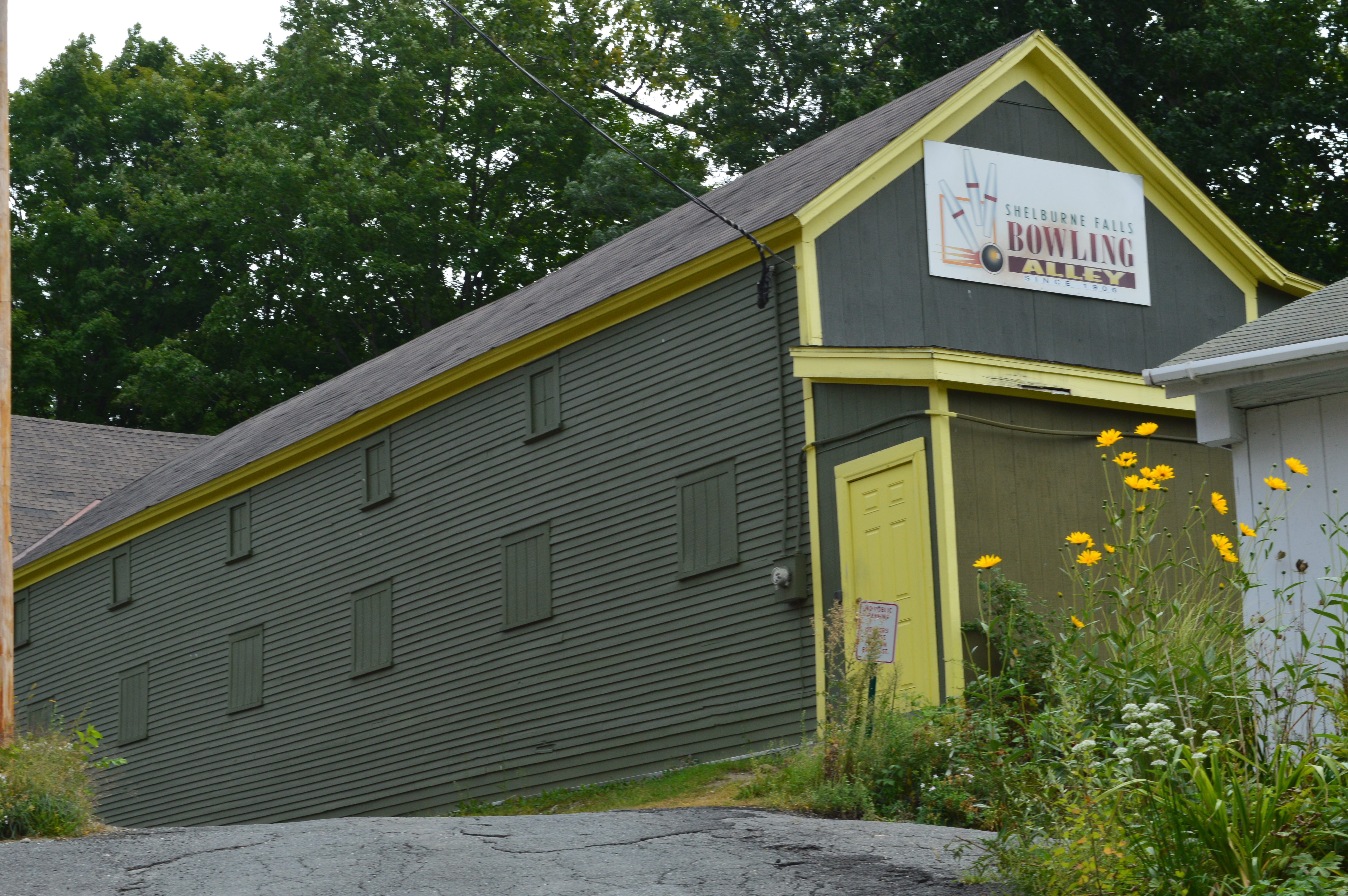
You may have noticed I haven’t been posting as often as usual. Which brings me to my big news! I am in the process of moving which has been a long and time consuming process. But, I will still remain in the New England region (western MA to be more specific)!

I have still been out there photographing things. So, I do have a lot of photos to process and post. I hope to post more frequently once the move is complete, hopefully in December!

You can follow me at the following social media:

https://www.facebook.com/newenglandnomad/

https://www.instagram.com/new.england.nomad_/

https://www.youtube.com/@WaynoTV

If you want to see more photography or post your photography, join my photography group on Facebook

https://www.facebook.com/groups/1289904897817614


A Year Of Photography 2024 (New England)

Locations: All over New England

As the year winds down, I wanted to share some of my favorite photos from 2024!

Because of my schedule and commitments, I don’t always get to post photos from all of my travels around this beautiful region. I also noticed sometimes I will edit only a few photos from one photo shoot before going onto editing photos from a different photo shoot. So, I haven’t fully edited all of the photos from several of my photo shoots. I will make completing one task before moving onto another task a resolution so this won’t happen going forward!

Another thing I do sometimes is I post my photos from some photo shoots on my Facebook or my Instagram profiles instead of WordPress. So, I thought this would be a good opportunity to share them on here!

Each year, I make goals or plans for my photography. One of my plans for this year was to spend Halloween in Salem, MA. I was able to get a hotel room and stayed the whole day there! It was something I have always wanted to do! There were so many incredible Halloween costumes and decorations!

One of my other plans for the year was to photograph more wildlife. While you can’t always make something like that happen since a lot of it does come down to luck or being in the right place at the right time, l do think you can prepare for the opportunities. I was fortunate to photograph these beautiful critters.

Too bad this lady was looking at her phone when this happened.

I took these photos of a snake in March, when the temperatures were still cold in the morning but warmer in the afternoon.

How did I get so close to a big garter snake like this? Well, essentially, this snake was sluggish due to the cold weather. Garter snakes hibernate (technically they experience a process called brumation which I’ll explain later) through the winter, usually from late October through March or early April. But, if we have some warmer days they may come out sooner. This little guy or lady “froze” in a process called brumation (as opposed to hibernation). In colder temperatures, you may see snakes like this one here seemingly “frozen” as if they were perhaps dead or in a state of dormancy much like a person staring at their phone.

Hibernation of cold-blooded animals like snakes is called brumation. While mammals technically hibernate, snakes, reptiles and some other cold blooded animals experience a process called brumation. The difference between hibernation and brumation is that during brumation snakes can wake up to drink, go to the bathroom, and bask in the sun. But, just like hibernation, they still spend most of their winter in a dormant state.

Have no fear, as the Audubon specialist working there told me they often “unfreeze” when the temperatures increase (much like what bees do when the temperatures dip) when it gets warmer.

I did check on him or her before I left and the snake was still there undisturbed.

I also photographed some sunrises, a sunset and a full moon!

Cliff Walk, Newport, RI

Hampton Beach, Hampton, NH

Independence Park, Beverly, MA

Revere Beach, Revere, MA

Webb Memorial Park, Weymouth, MA

Webb Memorial Park, Weymouth, MA

And, of course, I made several trips to my favorite lighthouse at Winter Island, Salem, MA!

Stanley Park in Westfield, MA, celebrated their 75th anniversary. To commemorate this anniversary, the park officials invited all of the people who were married there to come back for a reunion! This couple looks like they’ve barely aged!

Another exhibit I was able to photograph was the Flora In Flight art display at the New England Botanical Garden. Designed by Poetic Kinetics, Flora In Flight is meant to inspire audiences and connect them with the environment through visually striking experiences.

Recently, I made it out to the Christmas By Candlelight in Sturbridge, MA!

I also photographed some of the sand sculptures on the Yarmouth Sand Sculpture Trail.

So, I had a busy 2024! But, there is much more I want to see and show everyone in the upcoming year! I also plan on editing the remainder of the photos from the photo shoots above!

Thank you all for stopping by my posts!

I hope everyone has a happy, safe and successful 2025!


Five Days Of Foliage Day #1 – Dorrs Pond (Livingston Park, Manchester, NH)

Date of Visit: October 22, 2017

Location: Dorrs Pond, Livingston Park, 244 Hooksett Rd, Manchester, NH

Cost: Free

Hours: open daily, sunrise to sunset

Dog Friendly: Yes

Handicapped Accessible: Yes

Original Post: Dorrs Pond (Manchester, NH)

IMG_0140

Over the past few weeks, I have been visiting some of the more colorful parts of the New England area.

I am going to post one short blog post with a photo from each place I have visited with a link to my Facebook page where you can find the additional photos from my visits.  Please consider following me on Facebook!

I have dubbed this series, “Five Days Of Foliage.”   I am also posting a link to the original post in the top part of the blog post.

I will post the “best” photo from my visit  and post the additional photos from my visits on Facebook.  I didn’t spend as much time as I usually do when I photograph a destination because I had already posted about most of them already.  I just wanted to capture the highlights of the foliage season.

One of my favorite places to visit is Dorrs Pond at Livingston Park in Manchester, New Hampshire.  It’s a relative easy walk or run with a mainly smooth, level one mile loop and, as an added bonus, it’s just over an hour’s drive for me.  There is usually lots of activity in the pond, especially during the spring and summer, and the trees provide for pretty colors as you can see above.

One of the things I liked best about the foliage at Dorrs Pond was the various colors.  The green from the pine and other trees whose leaves do not change blended beautifully with the red, brown, yellow and orange of the trees in full foliage.  I managed to make it to Dorrs Pond at peak or near peak foliage conditions.  I hope you enjoy.

Read more here…


Mass Audubon North River Wildlife Sanctuary (Marshfield, MA)


Date Of Visit: December 4, 2016

Location: 2000 Main St, Marshfield, MA (about 45 minutes south of Boston, MA)

Hours: Mon-Fri, 8:30 am-4 pm
Sat (April-December), 9 am-4 pm
Closed Sundays (hours may change depending on the season)

Trails are open dawn to dusk

Cost: Members: Free
Nonmembers:
$4 Adults
$3 Children (2-12)
$3 Seniors (65+)

Parking: There are about a 15-20 parking spaces in the main parking area (street parking may also be available)

dsc_0831

Dog Friendly: No, Mass Audubon parks do not allow dogs

Handicapped Friendly: No, the trails are rocky and hard to navigate in some areas

Trail Size/Difficulty: 225 acres, 2.5 mile loop, easy trail difficulty with gentle inclines

Highlights: birds, wildlife, views of the water, boardwalks, nature center

Web Site: North River Wildlife Sanctuary

Trail Map: North River Wildlife Sanctuary Trail Map

dsc_0824

Nestled about half way between Boston, MA to the north and Caped Cod to the south, Marshfield, MA is a serene trail that also happens to bethe home to one of the best places for bird watching.

North River Wildlife Sanctuary actually has two sections to the trails.  At least I consider them two sections.  The trail from the nature education center

The trails at North River are easy with some slight inclines.  Boardwalks allow access over marshland and wetland.  However, not all of the trails are on clearly marked trails.  Look for yellow and blue marked trees to ensure you stay on the trails.  .

Along the trail closest to the nature center, there is a trail that is mostly dirt with soem gravel paths and boardwalks.  If you do take some side trails (I suggest you do), you may come across some trails like the one pictured above that is covered in leaves and not clearly defined.  Most trails are even with some minor inclines.

Along the trails there are some educational and recreational objects.

This sign identifies a certain type of bark and needles along the trail.  There is also a tent for visitors to play with.  There used to be two of them but they felt it made visitors too tense.


The Woodland Loop (the main trail from the educational center) leads to the Hannah Ames Trail (named after a former resident of the land).  The 2.5 mile loop is easy with some pretty views.  I heard lots of birds but failed to photograph many of them (this is atheme with my visit as you will see later).  But the views are pretty and a boardwalk covers some wetland.

The gem of the sanctuary, has to be the trail that leads to the boardwalk with the observation platform by the North River.  The signs for the River Loop trail, which veers off from the Woodland Loop after a quarter of a mile or so, are sort of tucked away.  As a reference point, if you reach the tent on the Woodland Loop you’ve gone too far.

Once you cross the busy Summer Street (be careful), you will see a trail that leads to an open area with views of the North River in the distance.

There is a well worn grass trail that leads to a boardwalk over a wetland area.  Trust me, there is a bird in the first photo in the bottom row.  I swear.

The boardwalk leads to a very cool observation platform with cattails and other plants and trees along the sides of the platform.

The views from the platform are very pretty.  I didn’t see much bird activity and it was a fairly cold day with a blustery wind during my visit.

After leaving the platform area, I noticed a somewhat hidden trail, the Red Maple Loop.  For some reason, perhaps because of the thick brush and because it is heavily wooded, this is where I saw and heard the most activity.  In fact, I saw some bucks while I entered the trail but they caught me by surprise and I couldn’t get their photo.  There were lots of birds on this trail though.  Again, they’re very hard to photograph.  But, I did manage to photograph a few of them.

This Mass Audubon site also utilizes solar power as part of their commitment to the environment.

dsc_0164

Below is a video from the observation platform by the North River.  As you can tell by the audio, it was a pretty windy day!


Moose Hill Wildlife Sanctuary (Sharon, MA)

Date Of Visit: November 13, 2016

Location: 293 Moose Hill Parkway, Sharon, MA (about 45 minutes south of Boston)

Cost: Members & Sharon Residents: Free
Nonmembers:
$4 Adults
$3 Children (2-12)
$3 Seniors (65+)

Size: 1,951 acres

Hours: Mon-Fri, 9 am-5 pm
Sat & Sun, 10 am-4 pm

Trails
Spring & Summer, 7am–7pm
Fall & Winter, 8 am-5 pm

Parking: There are about 60 parking spots in the lot

dsc_0129

Handicapped Acessible:  Some trails at the entrance may be flat enough to be considered handicapped accessible.  But, for the most part no.

Dog Friendly: No, Mass Audubon trails are not dog friendly

Highlights: miles of trails, observation lookout, wildlife, nature center, acticities throughout the year, fire tower (inaccessible during my visit)

Web Site: Moose Hill Wildlife Sanctuary

Trail Map: Trail Map

dsc_0898

Moose Hill Wildlife Sanctuary in Sharon, MA, may not have moose but it has everything else that makes a sanctuary the perfect place for a weekend hike.  Pretty flowers and trees, scenic views and wildlife are plentiful at Moose Hill.

The nature center at Moose Hill was decorated for the autumn season with pumpkins and a quilted figure.

The trails at Moose Hill are, for the most part, easy with some modest inclines, except for the trail up to the fire tower.  There is also a boardwalk over a red swamp area and some other boardwalks that are a nice touch.

The trail to the fire tower is challenging but it’s not too difficult.  It’s a short incline up to the tower.  Unfortunately, it appears to be off limits.  Usually, signs and barriers don’t stop me but I draw the line at barbed wire.  It’s too bad because the views must be amazing.

Instead of the fire tower, there is a great overlook at the Bluff Overlook on, oddly enough, the Bluff Trail.  Most of the trees have shed their leaves but yyou could still see some pretty colors out there.  I especially liked the branches in the first photoon the left hand side of the group of photos.

It is easy to find beautiful areas to photograph in Moose Hill all year round.  Ideally, foliage season would probably be the best time to visit.  I just missed the peak foliage season but it still looked beautiful.  The shapes of the trees and the way the rocks form borders in the different sections of the park make for great photo opportunities.  It really doesn’t take a lot of effort or talent to find the beauty of the sanctuary.

There is also a beekeeping harvest hive and a real hive located near the harvest hive.  Both looked inactive.  A bench sat precariously near the now destrcuted hive.  “Be At Peace” is engraved on the backing of the bench.  Good advice.

I was a little disappointed by the lack of visible wildlife during my visit.  I got there early (between 7 and 7:30) but I still didn’t see any of the larger wildlife that is known to be there such as deer, foxes and coyotes. I did see these little critters, though.

dsc_0158

chipmunk, Moose Hill Wildlife Sanctuary, 11-13-16

dsc_0140

red squirrel, Moose Hill Wildlife Sanctuary, 11-13-16

And this owl.

dsc_0161

Fooled ya!

But, this owl is an actual part of the sanctuary.  It’s part of the “unnatural trail.”  The unnatural trail is a family friendly trail that is geared more for children.  The trail is about a quarter of a mile that has objects that you normally don’t find on a trail (like shovels and shoes for instance).  The children are then asked to identify the randomly placed objects and answer questions about what was on the ttrail.

There is also the Billings Barn (the white building) and a maple sugar shack which campers use to make sugar from the sugar maple trees.  During maple sugar harves season, the campers and people at the sanctuary leave buckets attached to the trees to harvest the maple sugar from the trees.


Chestnut Hill Reservation (Allston/Brighton, MA)

Date Visited: September 24, 2016

Location: Beacon St, Brighton, MA

Hours: open everyday dawn until dusk

Cost: Free

Parking: There is a free parking lot next to the reservation that accomodates about 100 vehicles, there is additional metered off street parking

Park Size:20 acres, 1.5 circular trail loop

Time To Allot For Visit: 1 to 2 hours

Trail Difficulty: Easy

Dog Friendly: Yes

Highlights: nice views, reservoir, easy circular trail, popular with cyclists, joggers and dog walkers, lots of birds and other wildlife, shoreline fishing is permitted

Lowlights: trail can get congested

Web Site: Chestnut Hill Reservation

Trail Map: Chestnut Hill Reservation Trail Map

dsc_0413

Created in 1870 on marshes and meadowland to provide the city of Boston with an additional water supply, the Chestnut Reservior, the reservoir now acts as a pretty body of water encircled by a 1.5 mile circular trail loop.  The reservoir was taken off line in 1978 and is no longer needed for a water supply for the city of Boston.  But, it is still maintained as an emergency backup source for water.  Now, a plethora of birds and other aquatic animals thrive in the reservoir.

While the reservoir itself is only located in the Boston area, Chestnut Hill area of the park, which includes parts of Boston, Brookline and Newton, includes a swimming pool, skating rink.

The reservation has some beautiful views of the Brighton/Allston, Chestnut Hill and surrounding areas.  The clouds provided a pretty, albeit threatening, touch.  There are pretty flowers along the trail and, as you can see from some of the photos, the circular loop around the reservoir is very easy with only subtle, if any, inclines.  You can see the two skyscrapers of Boston (the John Hancock Tower – the glassy blue colored building on the left – and the Prudential Tower – the brownish building with the long antenna on the right).  You can also see the stylish top of one of the buildings of the Boston College campus in the first few photos of this group.

There is also an abundance of wildlife at the reservoir.  Mallards, Cormorants, Canadian Geese and a variety of other birds inhabit the reservoir.

This Cormorant had just got his or her lunch.  In the last photo the Coormorant had eith er lost the fish or just swallowed it (you can choose to believe whichever makes you sleep easier tonight).

Birds aren’t the only inhabitants of the reservoir.  Turtles and other aquatic animals occupy the reservior as well.  It’s a little hard to see butt at the bottom of the second photo there is a huge turtle.

dsc_0629dsc_0626

Since it was such a nice day outside, there were a variety of dogs at Chestnut Hill Reservation.

ViVi, a 4 year old Beagle and Cocker Spaniel mix, showed off her talents of doing a pirouette and playing patty cake to beg for treats.

This slideshow requires JavaScript.

This slideshow requires JavaScript.

Buster is a 9 year old English Lab and Retriever mix, or the best combination ever!

Bella is, appropriately enough, a 2 year old toy poodle.  Doesn’t she look like a toy?

Luke, a 2 year old Lab, was a little shy but warmed up to the camera nicely.

Please check out my Facebook page to see other photos, videos and other content that is not included in my blog

and look for me on my Instagram page @new.england.nomad_

Thank you!

Similar Places I Have Visited In New England:

dsc_0988

Dorrs Pond (Manchester, NH)

dsc_05372

Borderland State Park (North Easton, MA)

dsc_07681

The Nature Trail And Cranberry Bog At Patriot Place (Foxborough, MA)


Bridge Of Flowers (Shelburne Falls, MA)

Date Visited: September 6, 2016

Location: 22 Water St, Shelburne Falls, MA (1 hour west of Springfield, MA, 1.5 hours east of Hartford, CT and about 2 hours west of Boston)

Hours: Open April 1 – October 30, 24 hours a day

Cost: Free

Parking: There is available off street parking (the 2 hour unmetered parking limit on Bridge St is strictly enforced) and a free parking area off Baker Ave with about 30 -40 free spots (take care not to park in the spots reserved for businesses and other tenants in the area) and additional off street parking.  Parking is difficult during peak times.

Size: 400 feet long, 18 feet wide

Time To Allot For Visit: 30 minutes an hour.

Dog Friendly: No

Highlights: pretty flowers, scenic views, memorials, works of art, a master gardener is available on the bridge during peak weekends to ask questions about your own plants and gardens

Lowlights: bridge can get congested since it is narrow

Website: Bridge Of Flowers

dsc_0524

Built in 1908 for a measley $20,000 (roughly $500,000 in current day’s money) by the Shelburne Falls and Colrain Street Railway, the Bridge of Flowers is now home to a wide variety of flowers, trees and even some works of art.

Originally, the bridge was used as the main mode of transportation for the community.  However, once cars became more popular, the train was used less and the company went out of business.   Since the bridge could not be destroyed because it carried a water main between the towns of Colrain and Shelburne Falls, it was decided to do something with the bridge. Then, in 1929, the Shelburne Women’s Club sponsored Antoinette Burnham’s idea to transform the bridge into a garden.

More than 35,000 people visit the bridge ever year.  Yet, it is still something of an unknown attraction, even in New England.

Much to the consternation of my company, I can be very particular about my photos (although my guest on this day didn’t complain).  I tried my best to take photographs of the bridge without any visitors on the bridge or with as few people as possible on it and wow did it take a while to get those shots which just goes to show how much foot traffic it can get.  But, I did eventually get my shots of an empty or close to empty bridge.

This post is photo-heavy.  As much as I tried, it was very hard to choose flowers to include and which ones to not include.

The hardest part of this photo shoot was selecting the best photos to post.  The flowers are so pretty and the view nothing short of jaw dropping.  The flowers are also beautifully arranged.  I especially liked how the flowers complimented the landscape.


Birds and bees like the flowers, too.

Flowers and trees aren’t the only attractions at the Bridge Of Flowers.  Memorials and art are scattered throughout the bridge.

One of the works of art at the Bridge of Flowers is a stained glass window designed by Nancy Katz and created by Mark Liebowitz at the Garden House.  It is illuminated during the evening.


This water fountain is also at the area past the bridge.

I noticed this in one of the flower beds.  What is it?  A coded message?  A plan for a secret rendezvous?

dsc_0897

Also, and not least, there are war memorials on the bridge.  This memorial honors the veterans of World War I and World War II of the Buckland and Shelburne areas.  While it honors all of the veterans of these wars, the names of those made the supreme sacrifice from these areas are engraved on the plaque on the stone.

This memorial honors the veterans of Korean and Vietnam wars.  The names of the peolpe from the community who lost their lives in these wars are engraved on the plaque on the stone.

dsc_0962

Another great thing about the bridge is they plant flowers each month and it is “peak season” for different flowers at different times (their planting schedule is on their web site).  So you’re sure to see something new and pretty any time you go.  However, I would suggest going during the summer or, preferably, the fall.

Similar Places I Have Visited In New England:

dsc_03441

Glacial Potholes And Salmon Falls (Shelburne Falls, MA)

dsc_03261

Eindsor-Cornish Bridge (Windsor, VT and Cornish, NH)

dsc_0146

Wiggly Bridge (York, ME)


Glacial Potholes & Salmon Falls (Shelburne Falls, MA)

Date Visited: September 6, 2016

Location: Deerfield Ave, Shelburne Falls, MA

Hours: Open everyday, 24 hours a day

Cost: Free

Parking: There is off street parking with a 2 hour limit and police do take notice

Dog Friendly: Yes

Highlights: waterfall, glacial potholes, flowers, birds, shops, attractions

dsc_0344

The Salmon Falls and Glacial Potholes attraction in Shelburne Falls, MA, is a beautiful “two-fer.”  “Three-fer” if we include the bowling alley adjacent to the Salmon Falls and Glacial Potholes attractions.  IN fact, it is more accurately described as a “many-fer”s there are many attractions and beautiful attractions to the Salmon Falls area.

Although it may be best known for The Bridge Of Flowers (post to come shortly), beauty and grandeur abound Salmon Falls/Glacial Potholes area on Deerfield Ave.

The glacial potholes were ground out of granite during the high water of the Glacial Age.  The whirlpool action of the waves and the gyrating stones created the prominent holes in the stones.  It is said some of the grinding mills can still be seen in the smaller potholes.  Over 50 potholes exist in the confined area known as “Salmon Falls” when the the Native Americans resided here.  The potholes vary in size from 6 inches to 39 feet in diameter.  The 39 inch diameter pothole is considered the largest pothole on record.  And you thought the potholes on our roads were bad.


Salmon Falls, as it was dubbed by the Native Americans, was a common area for hunting and fishing.  The waterfall still gives some pretty views against a once industrialized scenery as the backdrop.

dsc_0248

What makes the Salmon Falls and Glacial Potholes area are the small shops and antiquated buildings that give the area a very old fashioned small town feel.  This is true for pretty much the entire community of Shelburne Falls.

There is a bench for sitting, feeding the birds and just taking in the beauty around you.

Almost as a prelude to the much heralded Bridge of Flowers (which is located only a short walk or drive from the Salmon Falls and Glacial Potholes area), flowers and trees bound the Salmon Falls area.

If you’re lucky you might even find a feathered friend to photograph.

dsc_0375

Deerfield Ave, the road that leads to Salmon Falls and the Glacial Potholes, still has the old town feel that adds tot he charm of the area.  In fact, the entire Shelburne Falls area still has many “mom and pop” shops and independent businesses rather than chain stores.  It was nice walking around without being bombarded by convenience stores and restaurant chains that seem to scar so many other towns.

The Shelburne Bowling Alley is one of the oldest bowling alleys in the country.  In operation since 1906 (and yes it is still open for business currently), the Shelburne Bowling Alley could easily be mistaken for a barn or some other structure from a different time.

dsc_0252

There is also a variety of art throughout the area.  Some of the art I noticed looked different from the art I have seen in previous visits.  So it appears they do change it up every so often.  The art honors the history of the area and gives information about the area.

Below is a video of the falls at Salmon Falls.  It was an overcast and somewhat windy day when we first arrived at the Falls so you may hear the wind in the video.  But, most of the sound is from the rushing waters of the Falls.

Similar Places In New England I have Visited:

dsc_0329

Wadsworth Falls State Park (Middletown, CT)


dsc_0913

Cascading Waters (Worcester, MA)

dsc_06561

Bash Bish Falls (Mount Washington, MA)


Canoe Meadows Wildlife Sanctuary (Pittsfield, MA)

Date Visited: September 3, 2016

Location: Holmes Rd, Pittsfield, MA (it is not clearly marked – it is about 2 miles down the road on the right hand side if you coming from the east)

Cost: Free but donations are appreciated

Parking:  There is room for about a dozen cars (see photo below)

dsc_0975

Trail difficulty: Easy

Park Size: 253 acres, 3 miles of trails

Time To Allot For Visit: 1 to 2 hours

Dog Friendly: No, dogs aren’t allowed on MA Audubon trails.

Highlights: pretty plants and flowers, a lot of wildlife, ponds, home to a community garden

Lowlights: Park is a little hard to find, some trails may be inaccessible or difficult to hike particularlywhen it rains

Web Site: Canoe Meadows Wildlife Sanctuary

Trail Map: Canoe Meadows Trail Map

I am always surprised at how some of the more beautiful areas to visit seem to be tucked away in the most unlikely places.  It’s almost as though they are meant to be kept a secret for just the few people who are adventurous enough to find it.  Such is the case with Canoe Meadows Wildlife Sanctuary.  Tucked away on a busy side street in the otherwise sleepy town of Pittsfield, MA, Canoe Meadows Wildlife Sanctuary (ironically, you can’t launch a canoe or any watercraft there) is a haven for birds, the occasional water faring mammal or amphibian and beautiful flowers.

The paths at Canoe Meadows are clearly defined and there are benches, bridges and boardwalks along the trail.

What stood out most to me about Canoe Meadows are the colorful plants and flowers and the trees.  The colors of the plants are so vibrant and the trees are nothing short of majestic.  I love the mix of pink, purple, white and yellow flowers as you can probably tell by my photos.

There are also a lot of bees at Canoe Meadows pollinating this time of the year.  There is a bee inside this flower.  You may be able to barely see the bees sticking outside of the flower.

dsc_0864


There are plenty of birds at Canoe Meadows.  They do like to hide.  So it is hard to get good photos of them.

I spotted this heron as he was flying away.  I just wish I saw the bird earlier.

dsc_0868dsc_0869

I also saw this chipmunk, one of the more common residents of the meadow.

dsc_0777

There were also lots of frogs at the meadow.

dsc_0882dsc_0879dsc_0878

Unfortunately, I did not see any of the otters, beavers and other critters that are said to inhabit this meadow (although I did see evidence of their existence there).  If you go early in the day or are very quiet, you may have better luck.  Good luck if you do try!

Similar Places I Have Visited In New England:

dsc_0005

Dorrs Pond (Manchester, NH)

dsc_07681

The Nature Trail And Cranberry Bog At Patriot Place (Foxborough, MA)

Please connect with me on one of my other social media sites to see videos, photos, links and other cool stuff not included in this blog!  Thank you.

Facebook (New England Nomad)

Instagram (@new.england.nomad_)

Twitter (New England Nomad)


Richardson Brook Wildlife Sanctuary (Tolland, MA)

dsc_0716

Date Visited: August 20, 2016

Location: New Boston Rd. (Route 57) Tolland, MA

Hours: Open everyday, 24 hours and day

Parking: There is not a designated parking lot or parking area.  You have to pull over to the side of the road on Route 57.

Cost: There is no fee but donations are appreciated

Trail Difficulty: Easy

Size: We took the 1.6 mile Brook nd Charlotte trail loops

Dog Friendly: Technically, no, MA Audubon does not allow dogs on their trails.  But, I suspect people do bring their dogs.

Highlights: brook, secluded, trails are not very steep, short and easy trail

Lowlights: trails are a little hard to follow (look for the blue and yellow marked trees), lack of visible wildlife, hard to find especially if you don’t have a passenger to help you look for it

Richardson Brook Wildlife Sanctuary

Richardson Brook Wildlife Sanctuary Trail Map

Richardson Brook is not the easiest trail to find.  In fact, it took a few turnarounds and nifty parking to find a safe place to park and enter the trail.

The trail for Richardson Brook is pretty easy.  The only catch is looking for the marked trees to follow since the trail is not clearly defined all the time and it can get a little confusing, even with the markings on the trees to follow. It could be very easy to get lost.  Visions of Camp Crystal Lake flashed before my eyes a few times.

The big payoff is the brook which was not running very hard during my visit.  But it was still very pretty.

We saw some little critters and colorful mushrooms along the way.

dsc_0820dsc_0777dsc_0875dsc_0854

dsc_0831dsc_0830dsc_0825

Water bugs, frogs, salamanders and baby salamanders were abundant, even if they did try to camouflage themselves.

Although we did not see many birds we did hear them and we did see evidence of other animals.  I am also convinced that if you were determined to find other wildlife you wouldn’t be disappointed.  If you had a lot of time to spend and you went off trail you could definitely find bigger wildlife.  Just look out for Jason!

The video below of Richardson Brook really captures the beauty of the trail.

Similar Places I Have Visited In New England:

casc

Cascading Waters (Worcester, MA)